We will be traveling into the wilderness again today… We will be dry camping at the North Rim of the Grand Canyon, and we will have little electricity and little internet access…
Stay tuned! You should hear from us again when we are at Lake Powell…
We will be traveling into the wilderness again today… We will be dry camping at the North Rim of the Grand Canyon, and we will have little electricity and little internet access…
Stay tuned! You should hear from us again when we are at Lake Powell…
Slow, quiet day today. We need one of these every now and then…
We slept in, caught up on the blog, and read the newspaper; we walked around a bit…
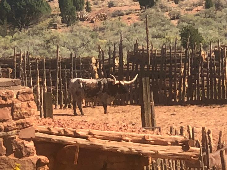
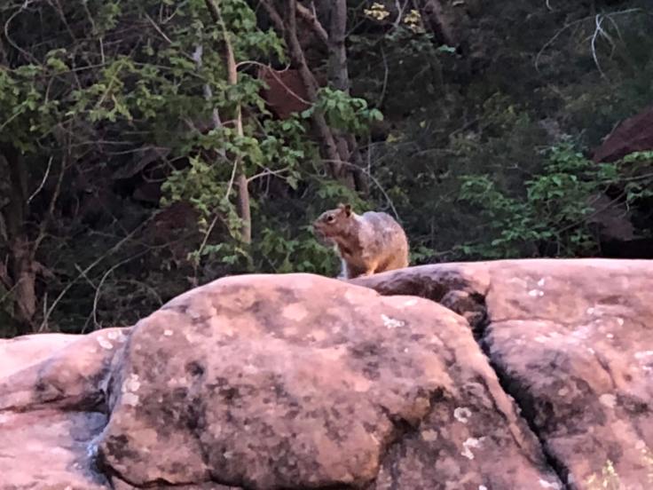
We did walk across the street to the Pipe Springs National Monument… It is an historic site documenting the life and times of the Mormons in this area. The irony is that these 40 acres are in the middle of the Kaibab Paiute Reservation…
The Indians, of course, have been in this area forever.
The water of Pipe Spring has made it possible for plants, animals, and people to live in this dry desert region. Ancestral Puebloans and Kaibab Paiute Indians gathered grass seeds, hunted animals, and raised crops near the springs for at least 1,000 years. The land at that time was rich is grasses, not desert sand as it is today…
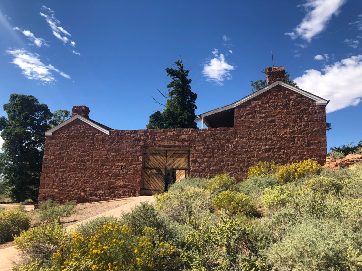
In the 1860s Mormon pioneers from St. George, Utah, led by James M. Whitmore brought cattle to the area, and a large cattle ranching operation was established. In 1866 the Apache, Navajo and Paiute tribes of the region joined the Utes for the Black Hawk War, and they raided Pipe Spring and killed Mr. Whitmore and his ranch foreman. The ranch was later purchased by Brigham Young for The Church of Jesus Christ of Latter-day Saints (Mormon Church), and a fort was built over the top of Pipe Spring. The LDS Bishop of nearby Grafton, Utah, Anson Perry Winsor, was hired to operate the ranch and maintain the fort, soon called “Winsor Castle”. This isolated outpost served as a way station for people traveling across the Arizona Strip, that part of Arizona separated from the rest of the state by the Grand Canyon.
The main function of the ranch was to accept tithes from the local Mormons, in the form of cows, chickens, etc. The ranch fed the animals, and milked the cows and made cheese, and shipped it all off on weekly trips to St. George, Utah.
The Pipe Spring area also served as a refuge for polygamist wives during the 1880s and 1890s. The LDS Church lost ownership of the property through penalties involved in the federal Edmunds-Tucker (Anti-Polygamy) Act of 1887.
In the mean time, overgrazing from as many as 100,000 cattle decimated the grasslands; the topsoil soon blew away, and the land was left with the desert sand and sagebrush we see today. There are attempts in the area, through better grazing practices, to bring back the grasslands.
As the Mormons took over the ranch lands, the local Indians were deprived of their main water source, and times were hard on the Paiute. However, they continued to live in the area and by 1907 the Kaibab Paiute Indian Reservation was established, surrounding the privately owned Pipe Spring ranch. In 1923, the Pipe Spring ranch was purchased and set aside as a national monument to be a memorial to western pioneer life.
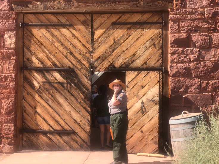
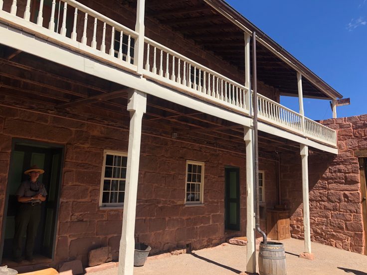
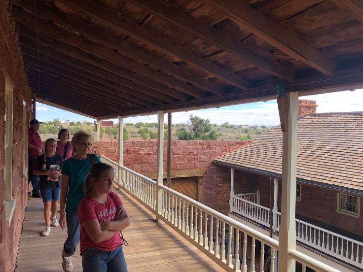
The Winsor Castle has been restored, as well as several smaller cabins. The tours are very informative, and “living history” is on view in the form of a lady demonstrating the use of a spinning wheel, and a blacksmith using a primitive forge.
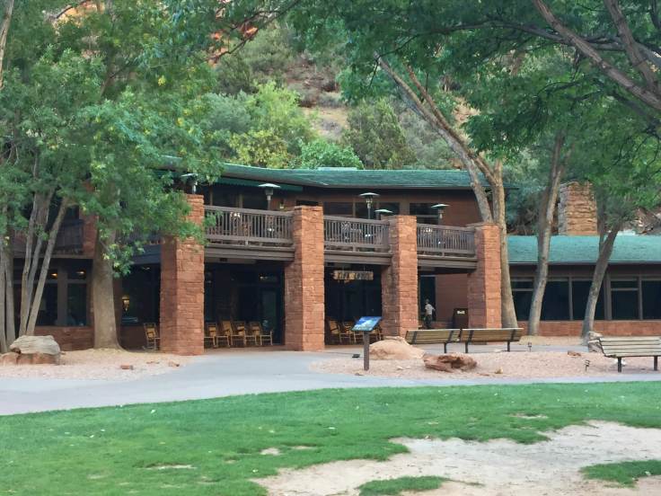
This is Winsor Castle… We were met at the entrance by the NPS tour guide…

The interior of the castle are typical of a well-made outpost such as this…


This is the entrance to the Spring Room. The spring water ran through here, keeping the room at about 55 degrees (perfect for wine, but these were Mormons living here…).

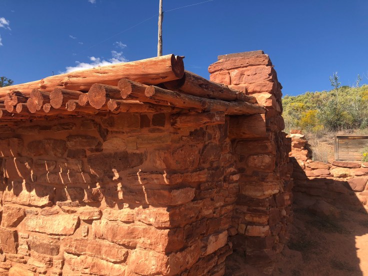
We saw some of the out-buildings and cabins for visitors… Interesting earthen roof…


We watched the spinning wheel lady doing her thing…


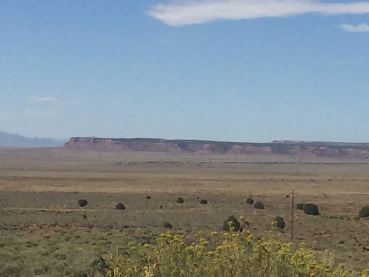
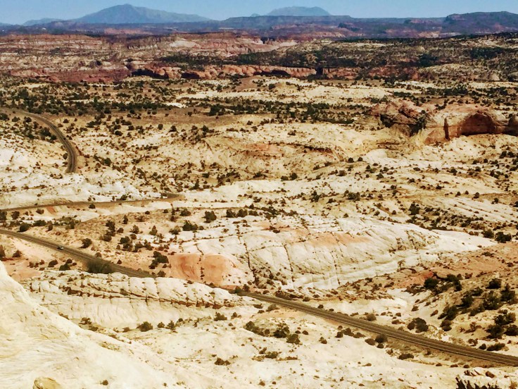
The view of the area known as the Arizona Strip… More on this tomorrow…
After a few hours we walked back to the RV Park and relaxed and did laundry…
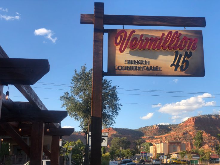
We drove to Kanab for dinner at a very nice, and very busy, French Restaurant. It has only been open for 6 weeks. We wished we could have spoken with the proprietor and learn more, but as I said, it was packed – on a Wednesday evening…!
And an enjoyable time was had by all…
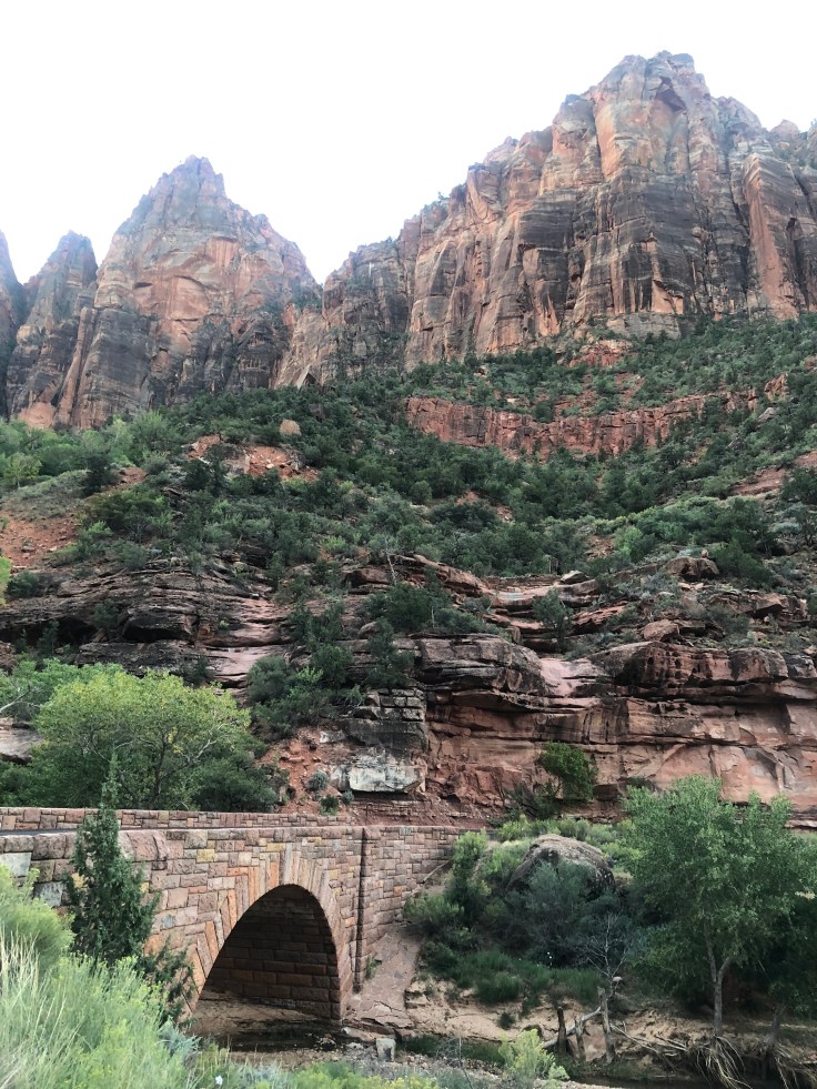
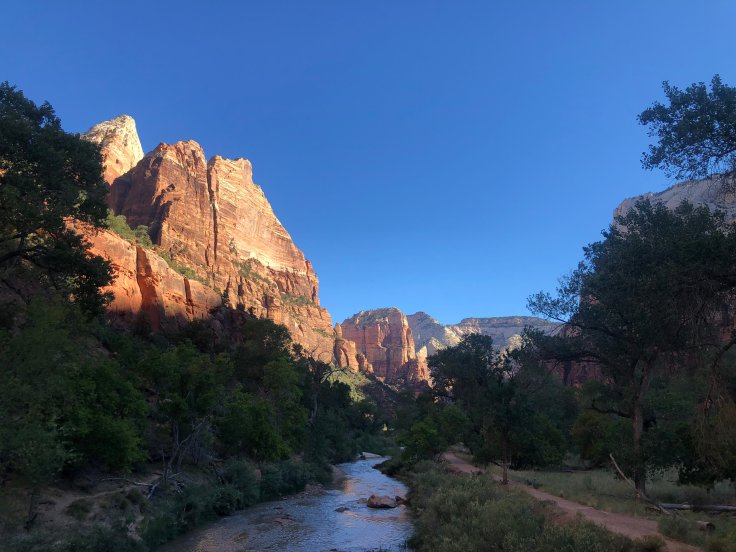
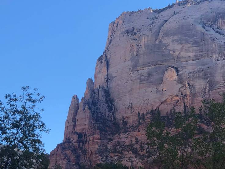
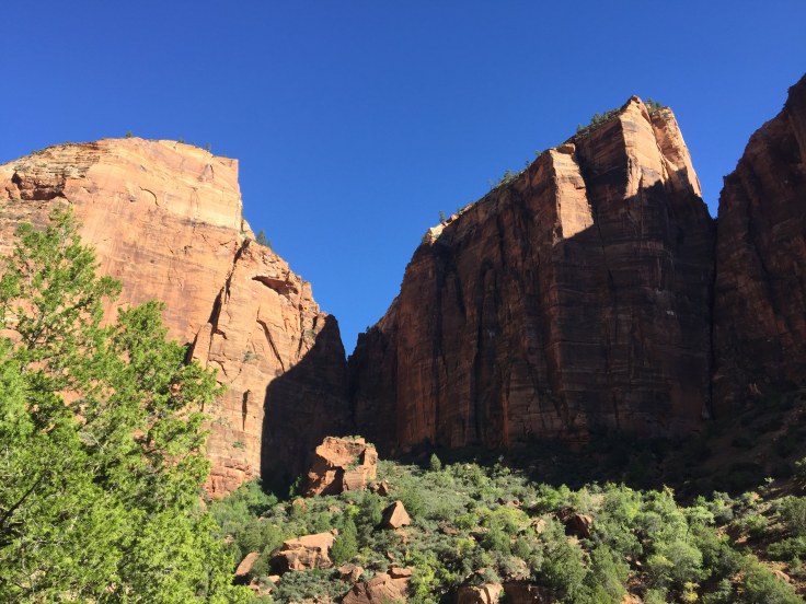
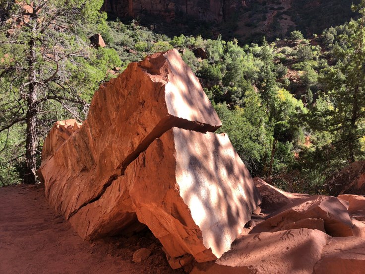
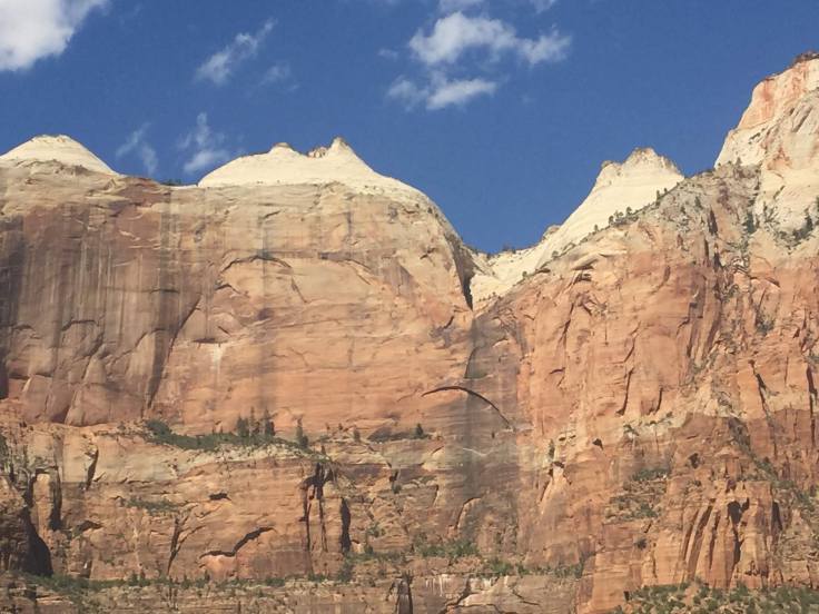
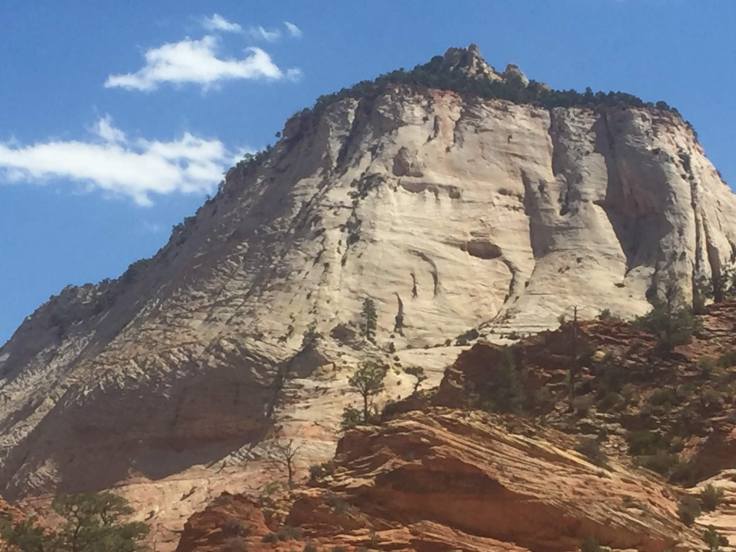
Today we explored Zion National Park…

Yes, more rocks… But different rocks, and different colored rocks…
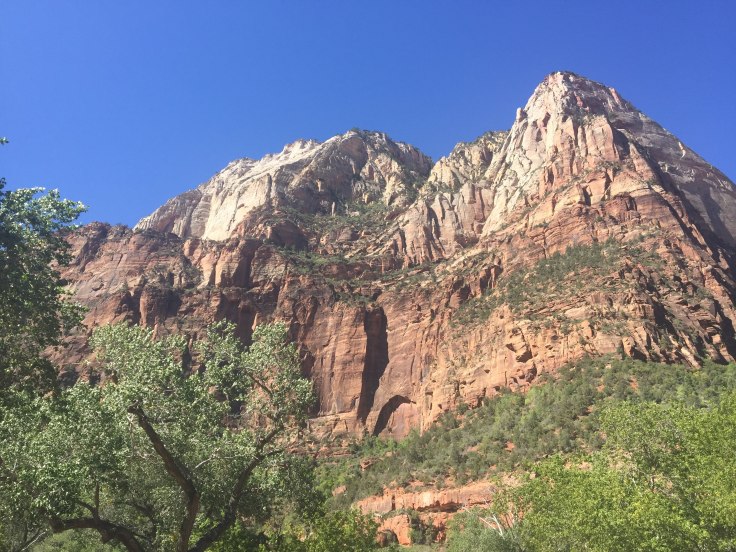
Zion National Park is an national park located in Southwestern Utah near the city of Springdale. A prominent feature of the 229-square-mile park is Zion Canyon, which stretches 15 miles long and spans up to half a mile deep. It cuts through the reddish and tan-colored Navajo Sandstone by the North Fork of the Virgin River. The lowest point in the park is 3,666 ft at Coalpits Wash and the highest peak is 8,726 ft at Horse Ranch Mountain. Located at the junction of the Colorado Plateau, Great Basin, and Mojave Desert regions, the park has a unique geography and a variety of life zones that allow for unusual plant and animal diversity.
Zion National Park includes mountains, canyons, buttes, mesas, monoliths, rivers, slot canyons, and natural arches. Human habitation of the area started about 8,000 years ago with small family groups of Native Americans; however, these Indians moved away by 1300 and were replaced by other Southern Paiute subtribes. Mormons came into the area in 1858 and settled there in the early 1860s. In 1909, President William Howard Taft named the area Mukuntuweap National Monument in order to protect the canyon. In 1918, the acting director of the newly created National Park Service, Horace Albright, drafted a proposal to enlarge the existing monument and change the park’s name to Zion National Monument, a name used by the Mormons. According to historian Hal Rothman: “The name change played to a prevalent bias of the time. Many believed that Spanish and Indian names would deter visitors who, if they could not pronounce the name of a place, might not bother to visit it. The new name, Zion, had greater appeal to an ethnocentric audience.” On November 20, 1919, the United States Congress established the monument as Zion National Park, and it was signed by President Woodrow Wilson. The Kolob section was proclaimed a separate Zion National Monument in 1937, but was incorporated into the park in 1956.
We left the RV park at just before 6:00 am, Utah time… Wow! It is really dark out here!
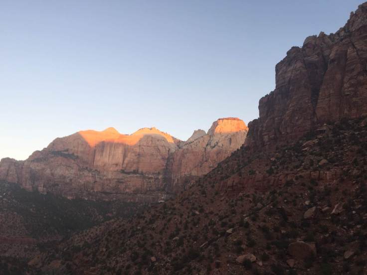
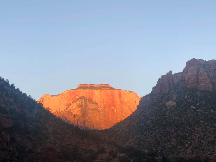
Light finally came just as we arrived at Zion, just after 7:00 am.
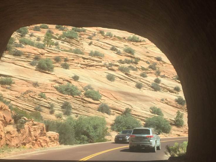
The entrance station was still closed. We entered the tunnel (1.1 mile long, took 3 years to complete in the 1930s…) and emerged to the sun rising over the valley below…

Maybe I should have cleaned my windshield…


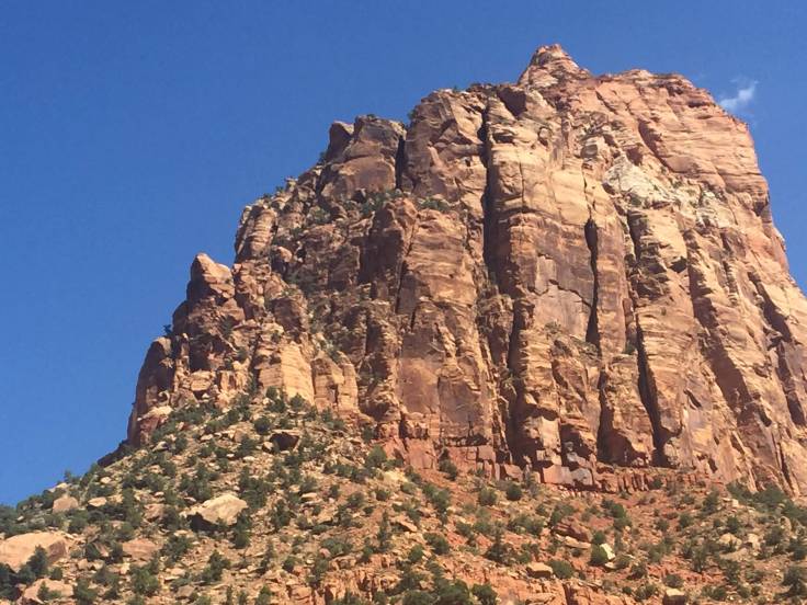
As we drove through the almost deserted park we recalled that we had been told that Zion is the 3rd most visited national park in the USA, yet it is one of the smaller parks. We were arriving early precisely to avoid these expected crowds.
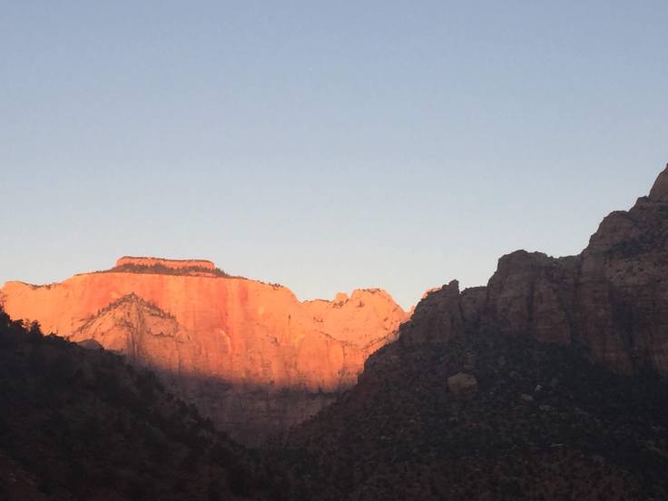
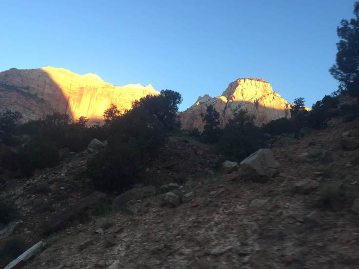
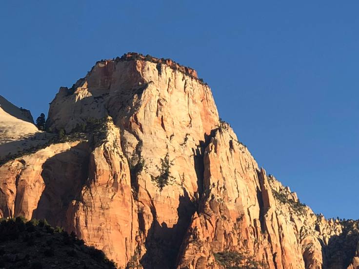
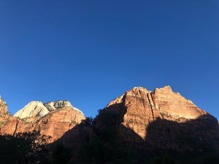
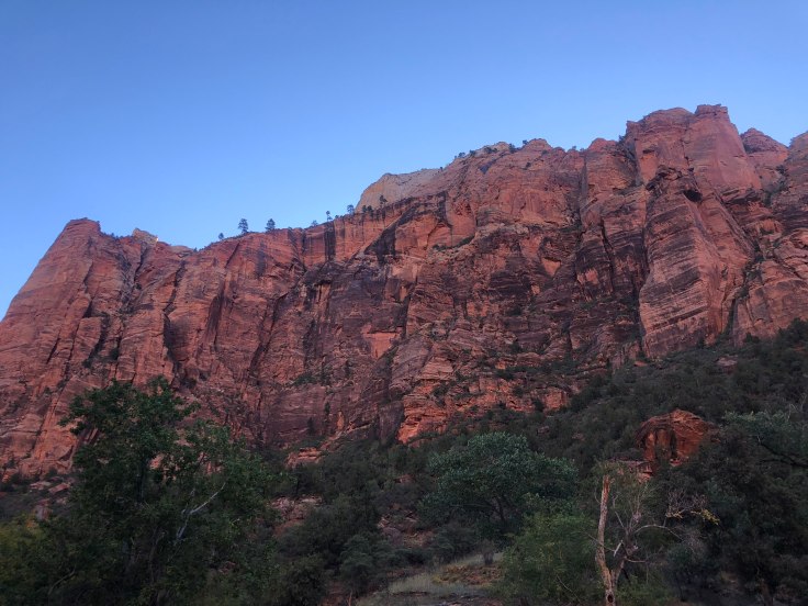
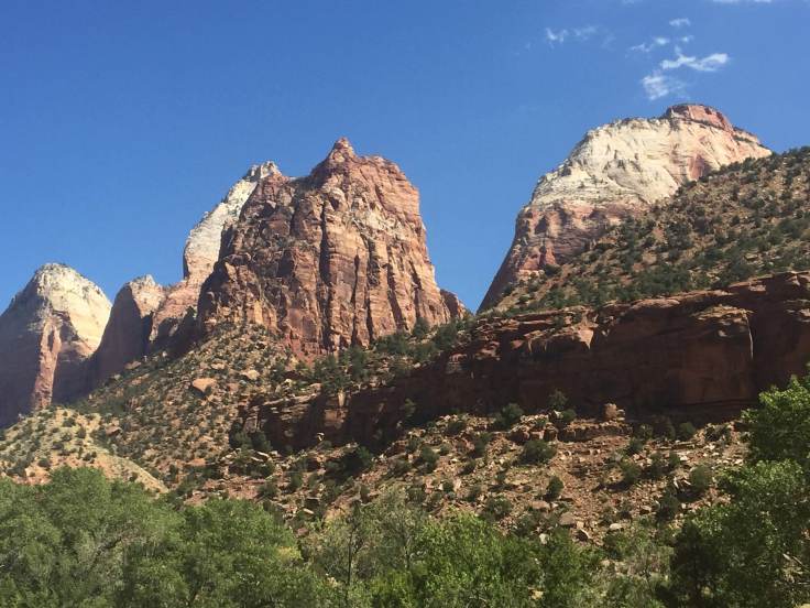
As we drove to the visitor center we found many interesting sights as the rising sun began to hit the higher peaks…


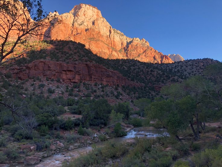
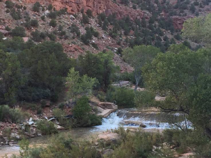
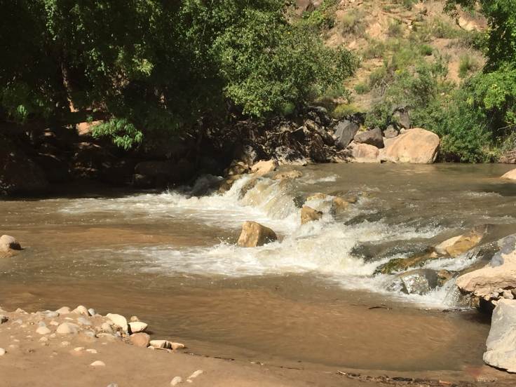
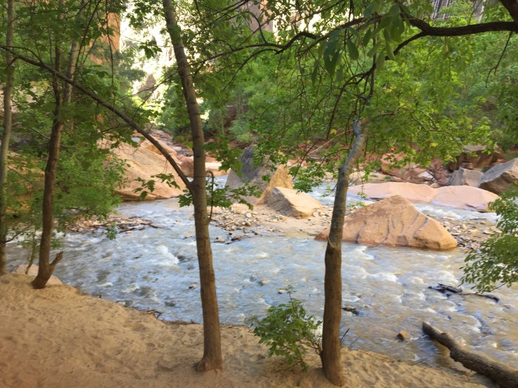
We arrived at the visitors center (which was not yet open) and parked. We then walked the Pa’rus Trail, along the Virgin River for about 1 1/2 miles…


Lynda went off-road to get a picture of the rapids…


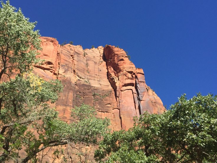
The sun continued to reveal move sights…


We arrived at Canyon Junction, where we caught the shuttle to the Lodge…

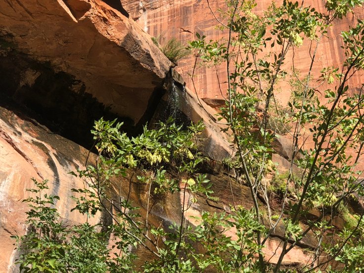
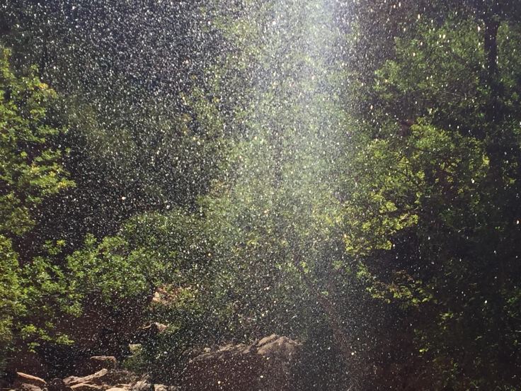
We had a nice late breakfast in the second floor dining room, then set out to walk the Lower Emerald Pool Trail… Only one mile, round trip…


Finally we arrived at the “waterfall”… More of a “wet wall”…

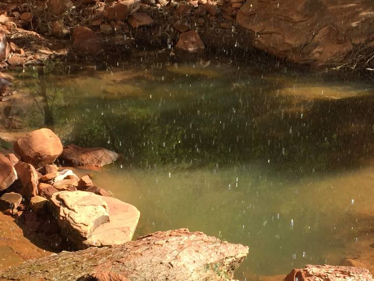
The pool was a little bit emerald…

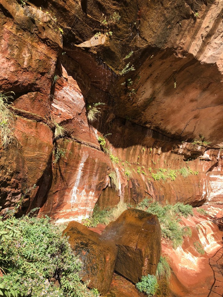
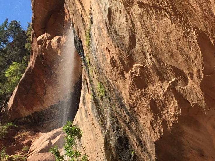
Now we see falling water…
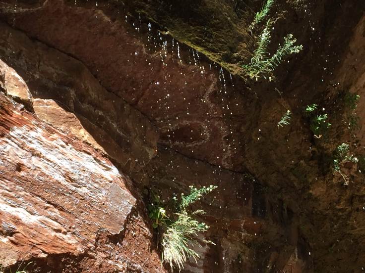


Falling into the Emerald Pool…


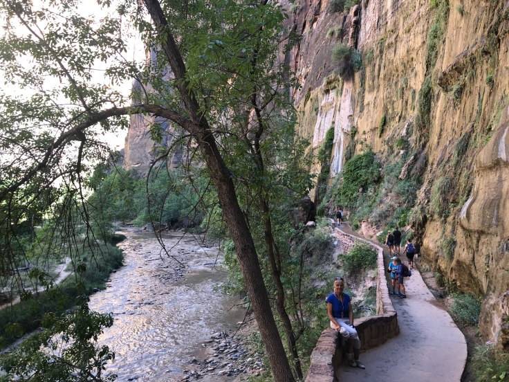
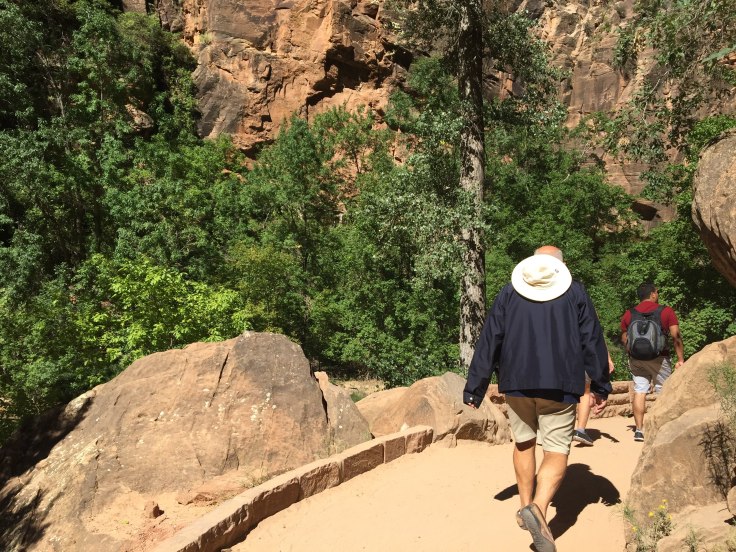
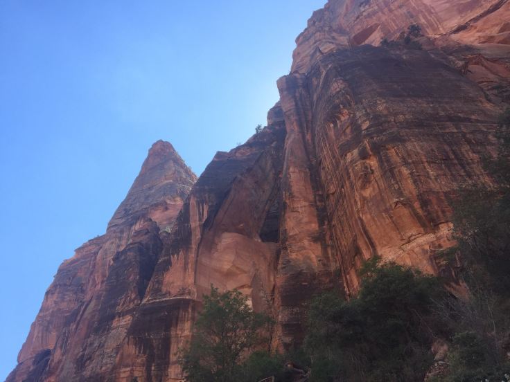
We back-tracked to the lodge and caught the shuttle to Temple of Sinawava… They tried to explain which rocks looked like a temple, but I didn’t see it…
We are following the Virgin River, once again, about two miles round trip. At the top of the canyon is “The Narrows”. In the mean time, we see the flora and fauna…


If you squint, and imagine it 100 times as big, it almost looks like a bear… Lynda says she wants to see a bear…
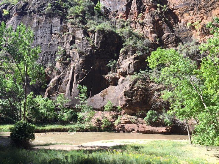
Finally we reach the end of the trail. No, this is not a throng of Mormons being baptized… This is where “The Narrows” begins. To see the narrows up close, where the canyon walls are only 20′ apart, you need to hike upstream through the water for about a mile… We didn’t…


We were not about to walk in the river, so we returned along the path, seeing the canyon from the other direction…

At the trail head we caught the shuttle back to the visitors center, and thus to the Big Red Truck. As we headed out of the park we saw the sights that we missed by arriving when it was still dark…


 We emerged from the tunnel… and we were on our way…

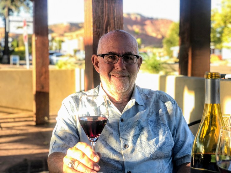
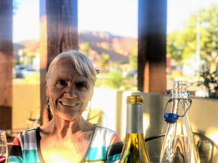
We returned to Kanab, where we enjoyed a late lunch at the Wild Thyme Cafe. We returned to The Villa, where the AC was running strong (it is 93 degrees today…), took a nap, and had Happy Hours…
And an enjoyable time was had by all…
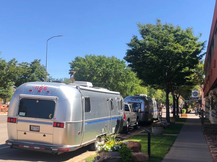
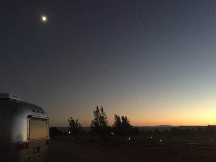
Today we traveled to Zion National Park. Except, not exactly… We are camping 13 miles outside Fredonia, AZ, at the Kaibab Paiute Band Tribal RV Park. The RV park is across the street from the Pipe Springs National Monument, and is about 50 miles from Zion…
I took this picture because… Not Rocks!

It was an easy drive. After about 1 1/2 hours we arrived at the town of Kanab, UT, a nice little town…
We stopped for lunch at the Rocking V Cafe… Interesting place in this very remote town…


Other Airstreamers were in town, too, having lunch, shopping for groceries…
We also shopped for groceries – finally found half-&-half. The last four grocery stores didn’t have any… What’s up with Southern Utah and their lack of half-&-half?
As we left the grocery store and headed to the RV park, we noticed a strange thing: It is 1:34 pm, and we will arrive at our destination, 20 miles away, at 1:06 pm…

Obviously we are in Utah, and our destination is in Arizona. They are in the same time zone, but Arizona does not believe in Daylight Saving Time… However, as we approached the RV park, rather than changing the actual time to Arizona time, it changed the destination time to Utah time! Apparently the RV Park is quite close to cellular towers in Utah. Our Apple devices and our computer similarly kept switching back and forth such that we never able to know what time it was… To avoid the confusion we set a real clock on Utah time, and the Caravan all agreed that we would operate on Utah time… Of course, Zion is on Utah time…
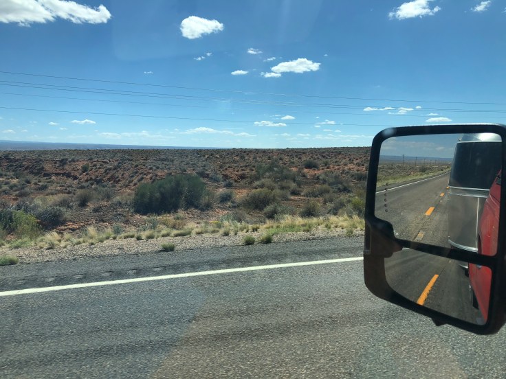
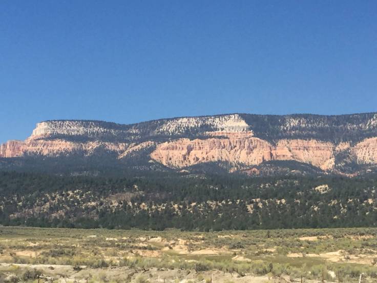
As we approached the RV park, this was the landscape surrounding us… Arizona looks a lot like Wyoming around here…
Zion National Park is an national park located in Southwestern Utah near the city of Springdale. A prominent feature of the 229-square-mile park is Zion Canyon, which stretches 15 miles long and spans up to half a mile deep. It cuts through the reddish and tan-colored Navajo Sandstone by the North Fork of the Virgin River. The lowest point in the park is 3,666 ft at Coalpits Wash and the highest peak is 8,726 ft at Horse Ranch Mountain. Located at the junction of the Colorado Plateau, Great Basin, and Mojave Desert regions, the park has a unique geography and a variety of life zones that allow for unusual plant and animal diversity.
Zion National Park includes mountains, canyons, buttes, mesas, monoliths, rivers, slot canyons, and natural arches. Human habitation of the area started about 8,000 years ago with small family groups of Native Americans; however, these Indians moved away by 1300 and were replaced by other Southern Paiute subtribes. Mormons came into the area in 1858 and settled there in the early 1860s. In 1909, President William Howard Taft named the area Mukuntuweap National Monument in order to protect the canyon. In 1918, the acting director of the newly created National Park Service, Horace Albright, drafted a proposal to enlarge the existing monument and change the park’s name to Zion National Monument, a name used by the Mormons. According to historian Hal Rothman: “The name change played to a prevalent bias of the time. Many believed that Spanish and Indian names would deter visitors who, if they could not pronounce the name of a place, might not bother to visit it. The new name, Zion, had greater appeal to an ethnocentric audience.” On November 20, 1919, the United States Congress established the monument as Zion National Park, and it was signed by President Woodrow Wilson. The Kolob section was proclaimed a separate Zion National Monument in 1937, but was incorporated into the park in 1956.
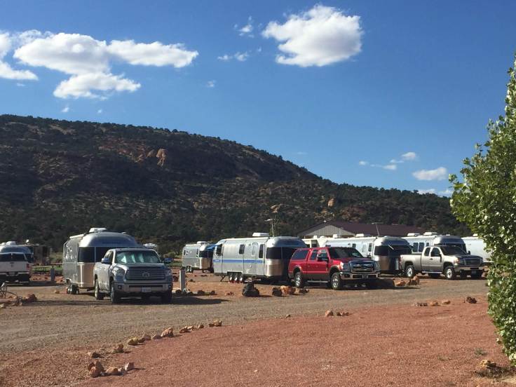
We parked The Villa and set up camp… As did all the others…

As we settled in at the RV park we learned that one of the Caravaner couples, who live in coastal North Carolina, had learned that their property (not their house) had sustained damage due to debris and flooding from Hurricane Florence, so they decided to leave the caravan and return home… We held an impromptu gathering to wish them well…


After the gathering, as we headed back to The Villa. The sunset was striking…
Another momentous event occurred 39 years ago today … Our daughter, Erin, was born… She celebrated today by letting her not-quite-three-year-old capture her on film:

I think he has caught her essence…
And an enjoyable time was had by all…
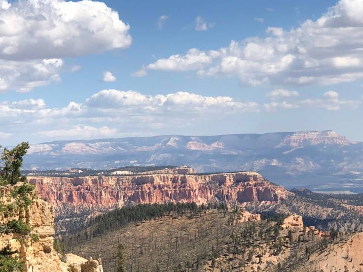
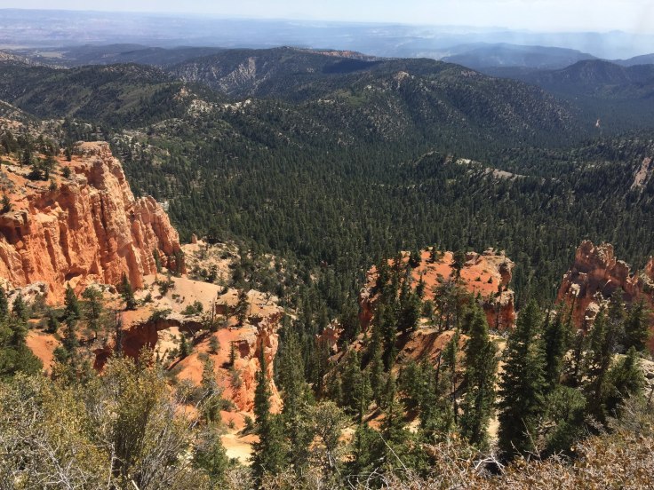
This is our last day in Bryce. We took advantage of the free time and drove through the park on our own…
We visited the Natural Bridge, at elevation 8,627’…


Of course, as we know, this is not a bridge at all, but an arch…
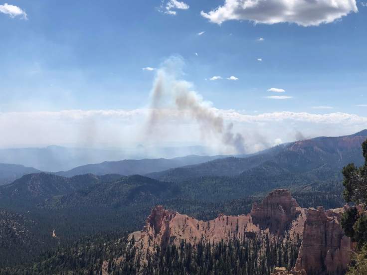
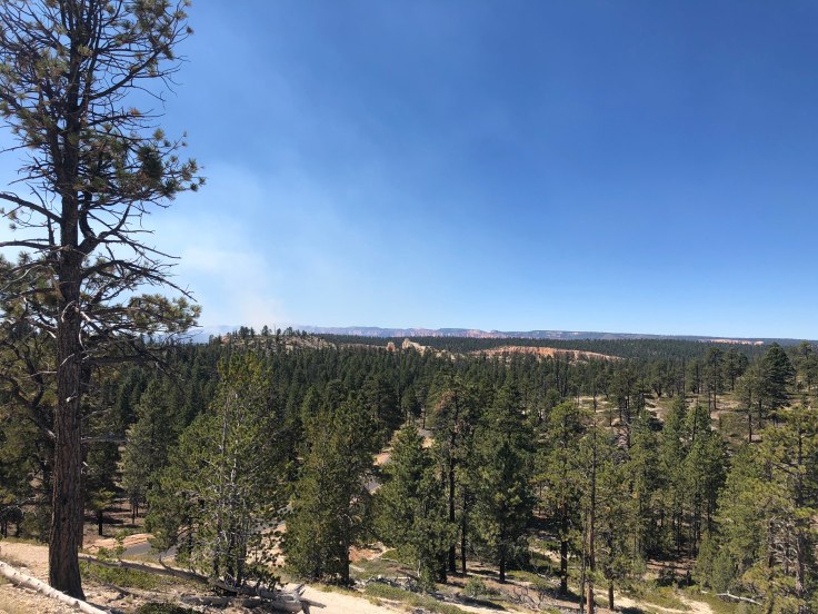
We would have gone on further to see other sights, but the road was closed due to a controlled burn in the park…
We visited the Farview Overlook, at elevation 8,819’…


We visited the Swamp Canyon overlook…
We visited Fairyland Canyon, at elevation 7,758’…
We saw marvelous rock formations that looked like they were copying something from Disney…


We had a shared dessert of assorted pies, then we had our usual Drivers Meeting to review our move tomorrow to Fredonia, AZ, staging area for our visit to Zion National Park and Pipe Springs National Monument…


And an enjoyable time was had by all…


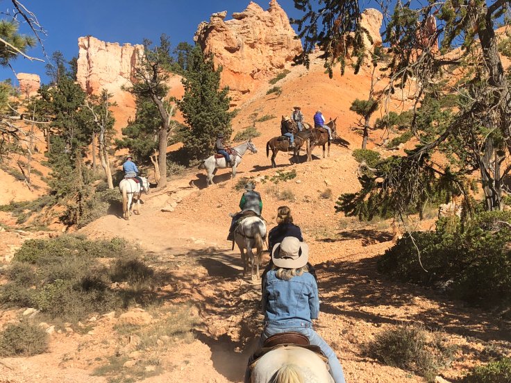
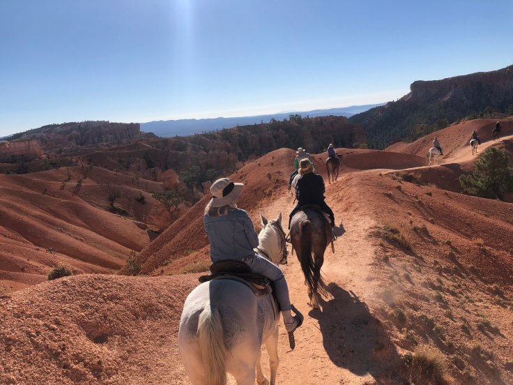
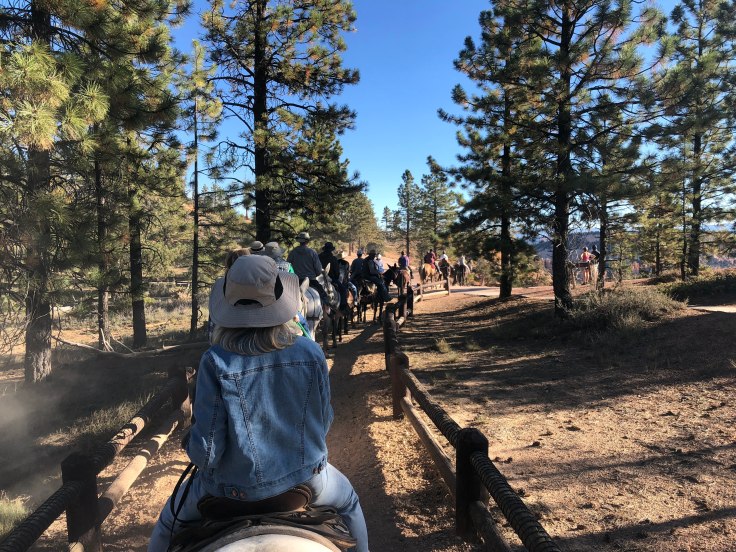
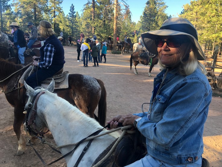
Today we enjoyed the famous Mule-Horse Trail Ride down into the amphitheater of Bryce Canyon National Park…
I had heard from previous caravaners that this ride was terrifying – that the mules walk along the outer edge of the trail above vertical cliffs, that the mules make turns at the last minute, when their heads are cantilevered over the vast emptiness below. Frankly, I found that the ride was more like the kiddie pony rides offered at Griffith Park…
We began our adventure at the corral, where, after an excruciatingly long wait, we were shown to our trusty steeds…


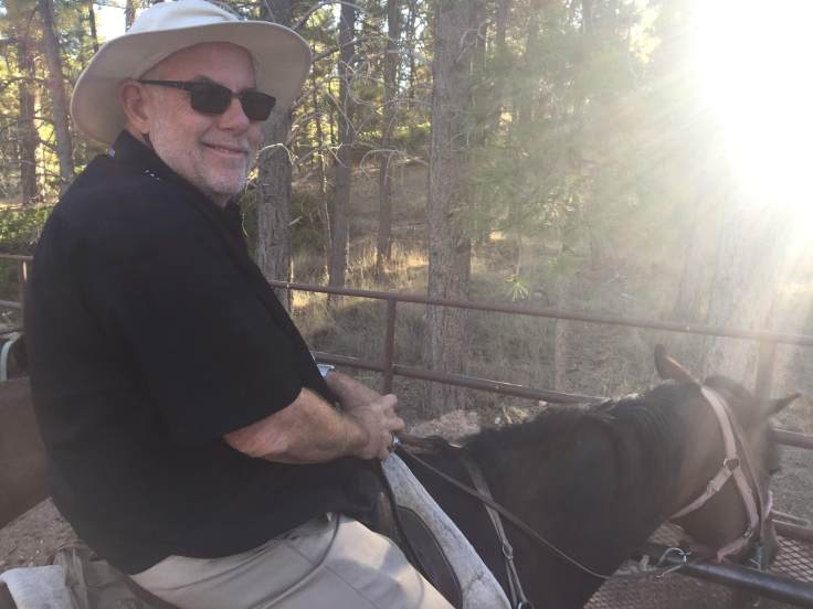
Finally we set out down the trail… at a plodding pace…

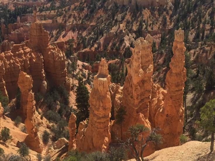
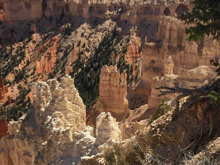
The first thing we enjoyed along the trail was to be up close with the hoodoos and pinnacles and other rock formations here…


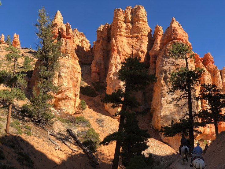


All along the trails, up, and down, these mules and horses walked at their plodding pace. They walk these trails twice a day, and they have been doing it for years. They are sure footed and very responsive, plodding along, following the animal in front of them. Very little drama…

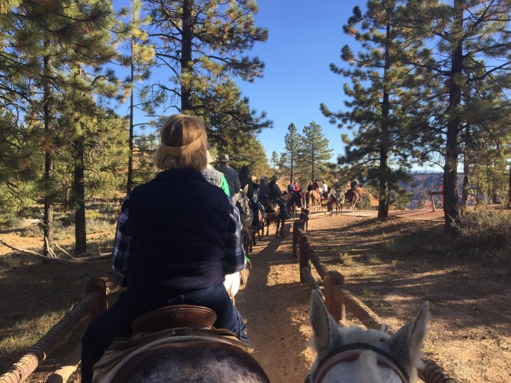
After an hour and a half we returned to the corral…

Upon dismounting, we learned that our limbs had been stretched into an unusual position for the last two hours. Getting them back to their normal positions took a little time… We were not alone – everyone was walking funny…
All in all, it was interesting. I wouldn’t exactly call it fun. Interesting to see these animals do there jobs, interesting to see how other people react to the animals… It was great to see the rocks up close… And it was not terrifying or dangerous…
We returned to the RV park, stopping along the way for fuel and groceries. We relaxed in The Villa, watching football… After all, it is Saturday…! Too bad, Auburn, UCLA, Florida State, USC…
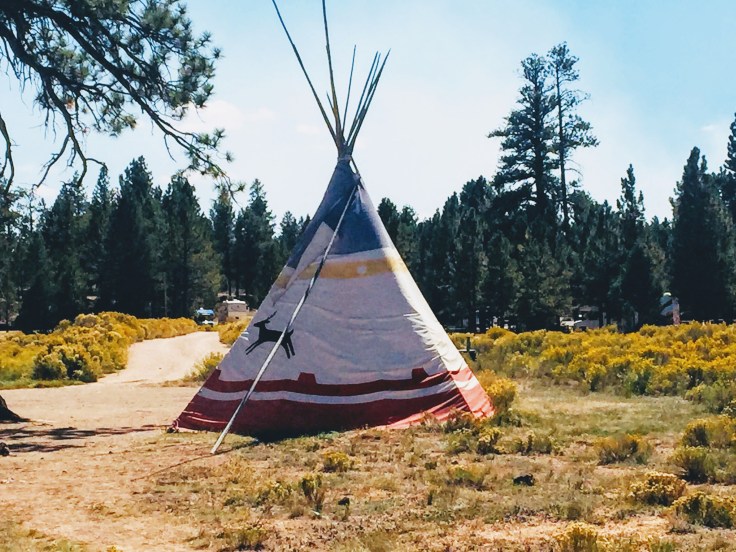
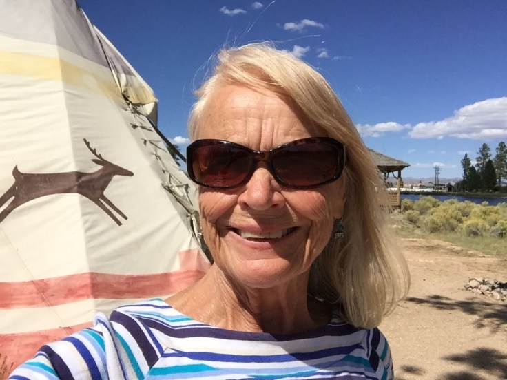
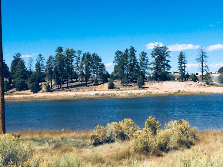
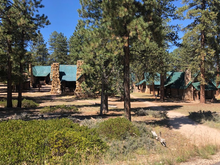
We walked about a bit. We found a lake nearby, and we found teepees that you can rent if you want to camp this way…
We shared happy hours from 5:00 to 9:30 with several other caravaners…
And an enjoyable time was had by all…
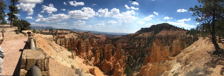
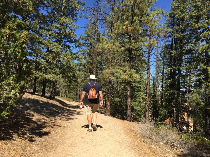
We slept in a bit today, then caught the shuttle into Bryce Canyon National Park…

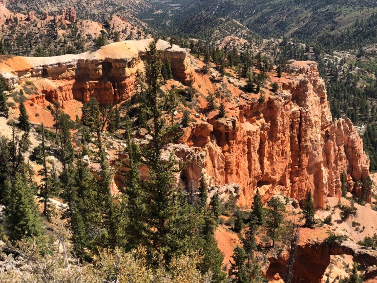
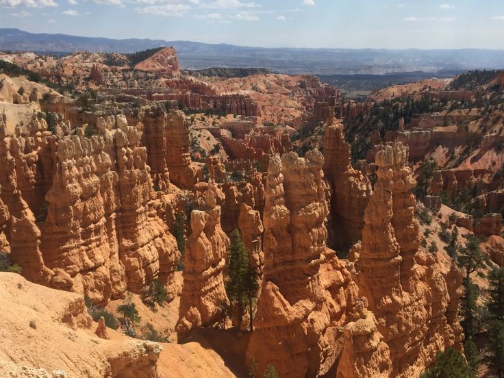
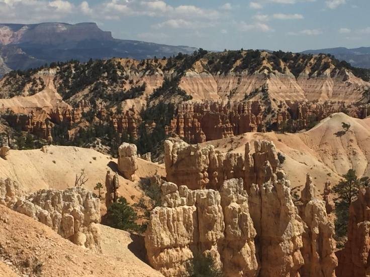
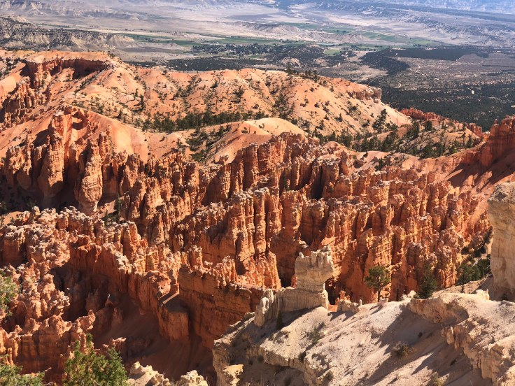
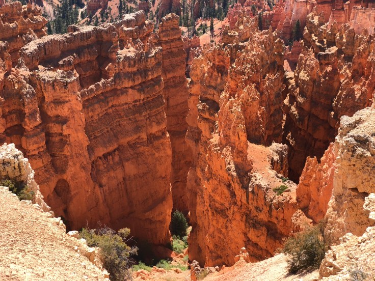
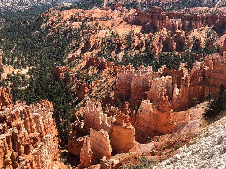
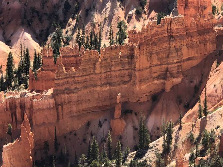
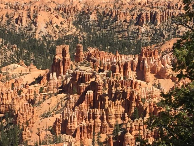
Bryce Canyon National Park is an national park located in southwestern Utah. The major feature of the park is Bryce Canyon, which despite its name, is not a canyon, but a collection of giant natural amphitheaters along the eastern side of the Paunsaugunt Plateau. Bryce is distinctive due to geological structures called hoodoos, formed by frost weathering and stream erosion of the river and lake bed sedimentary rocks. The red, orange, and white colors of the rocks provide spectacular views for park visitors. The rim at Bryce varies from 8,000 to 9,000 feet.
The Bryce Canyon area was settled by Mormon pioneers in the 1850s and was named after Ebenezer Bryce, who homesteaded in the area in 1874. The area around Bryce Canyon was originally designated as a national monument by President Warren G. Harding in 1923 and was redesignated as a national park by Congress in 1928. The park covers 35,835 acres…
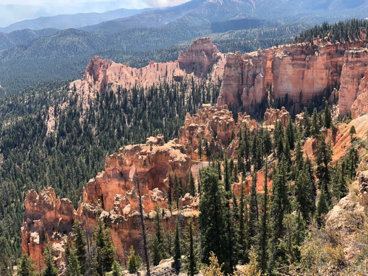
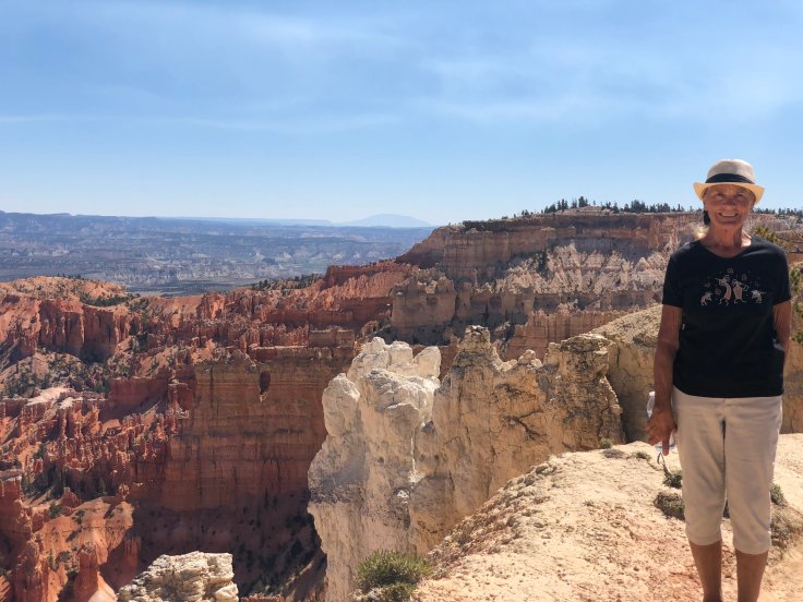
We took the shuttle around the main amphitheater to Bryce Point, elev. 8,300′. We walked the Rim Trail, overlooking the amphitheater. Along the way we passed Inspiration Point, Sunset Point, and Sunrise Point, elev. 8,000′. Along the way were several ups and downs, so we had our fair share of elevation change.
Needless to say, the views were spectacular. All along the way we saw, well, rocks…


We found a spot to rest from time to time…

And, in the event we need a picture of me for my funeral, we have this…
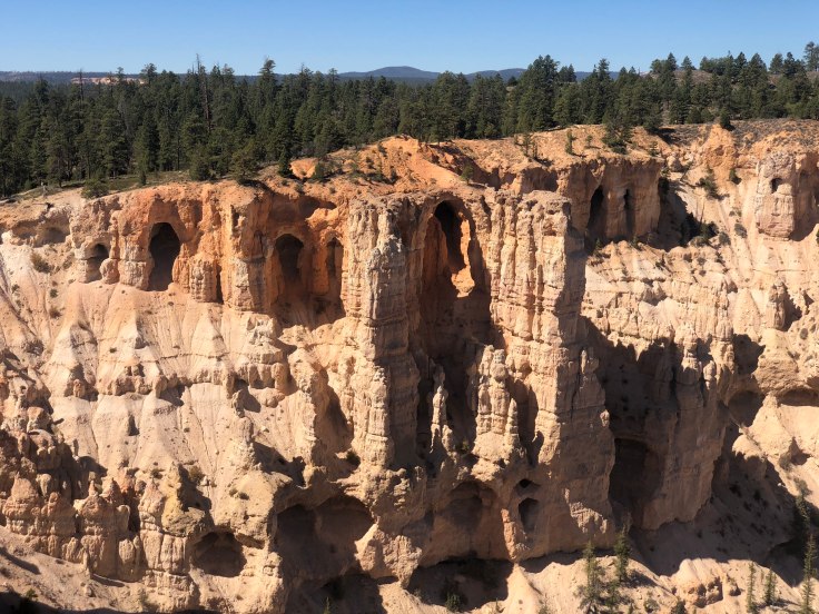
We kept walking and saw amazing things…


See the hands…
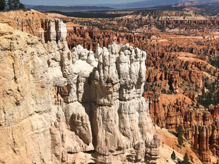
See the cathedral with flying buttresses…


This was the viewpoint at Bryce Point, where we started…

Single photos don’t do it justice, so I was forced to use the panorama mode…

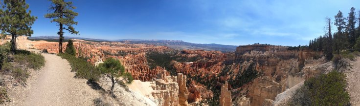
This is where the path is on the ridge, with the amphitheater on one side and forest on the other…


We arrived at the end of today’s trail…

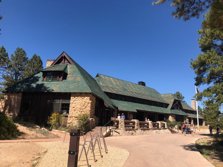
We found our way to the Lodge – typical National Park Lodge, only smaller.
The Bryce Canyon Lodge was built by the Utah Parks Company, a subsidiary of the Union Pacific Railroad, as part of the railroad’s project to develop tourist traffic to Bryce, Zion and the Grand Canyon by providing noteworthy destination hotels at each park. The Union Pacific was following in the footsteps of other railroads’ efforts to promote the western parks of the United States and Canada. Architect Gilbert Stanley Underwood was in charge of the design work for the Union Pacific hotels. Construction at the Bryce Lodge started in 1924 and was completed in the early summer of 1925. The guest wings were added in 1926 and the auditorium in 1927. Tourists were brought by train to Cedar City, Utah, where they were taken by custom 11 passenger bus-limousines to the various national park lodges.
We had a nice lunch to refresh ourselves after the ordeal of our “hike”…

After lunch we peaked around the lodge to see what we could see…


We returned to the RV Park, via the shuttle, and rested up for our evening out.
Tonight we go to Ebeneezers Cowboy Barn and Grill, for dinner and a show. This has been a tradition of the Southwest Caravan for many years. Remember that Ebeneezer Bryce settled this land, so the name is an homage to him… It is a very large dining room (approximately 300-400 people), not exactly a barn, but certainly as ugly as one…
Even though it is less than a mile from the RV park, everyone has to drive their truck… Because, Utah…

We waited outside until they opened the doors…

We did get a table up front. I wasn’t sure if this was a good idea, or not…

We shared the table with three other Airstream couples…

The food was quite good for a mass buffet, and the “band” (three guitar players/singers) was very talented. They made the show seem very casual and improvised and addressed directly to us, the audience. However, I would hazard a guess that if we returned tomorrow night we would see the EXACT same casual and improvised show…
We returned to The Villa and turned in…
And an enjoyable time was had by all…
Today we travel to Bryce Canyon National Park. But first, we had duties as assigned… We were “Deparkers”. This meant that we, along with another couple, were to stand at the exit to the RV park, and, as each Airstream rig pulled out, we were to check to see that their mirrors, hitch, lights, vents, etc. were in proper order for safe travels… It took about one hour for 25 Airstreams to depart. We then finished hitching up and headed on our way…
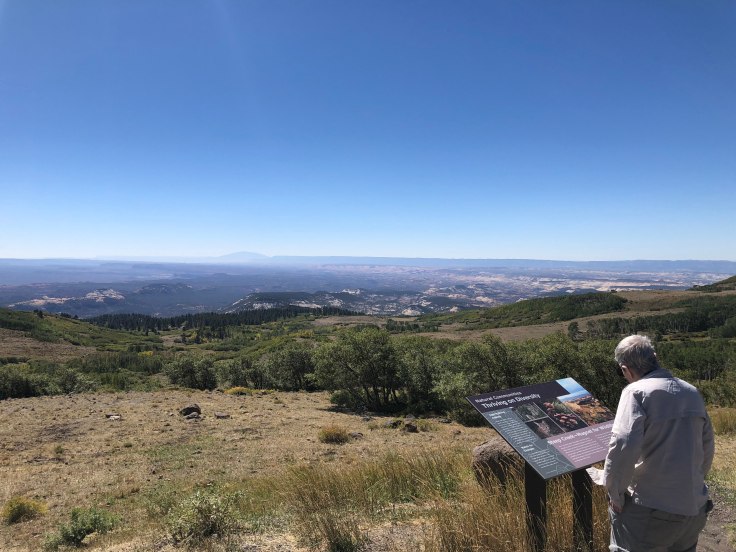
We drove along the “Highway Through Time”, so named for its geologic formations… We stopped along the way, at about elevation 9,300 ft., and viewed the scenery…


The Aspens are starting to turn into fall colors…

After about two hours we were at Bryce Canyon City. The town seems to consist of two motels, several restaurants, a “Barn and Grill” dinner show place (more on this tomorrow…), a state-run liquor store, a post office, a giant gift shop, and a gas station, all apparently owned by the same family…
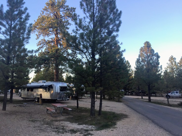
We were shown to our campsite by the “Parkers”, who had arrived early…

We walked to the bus/shuttle stop and signed up for a bus tour on Sunday and learned about the shuttle service offered through the park…
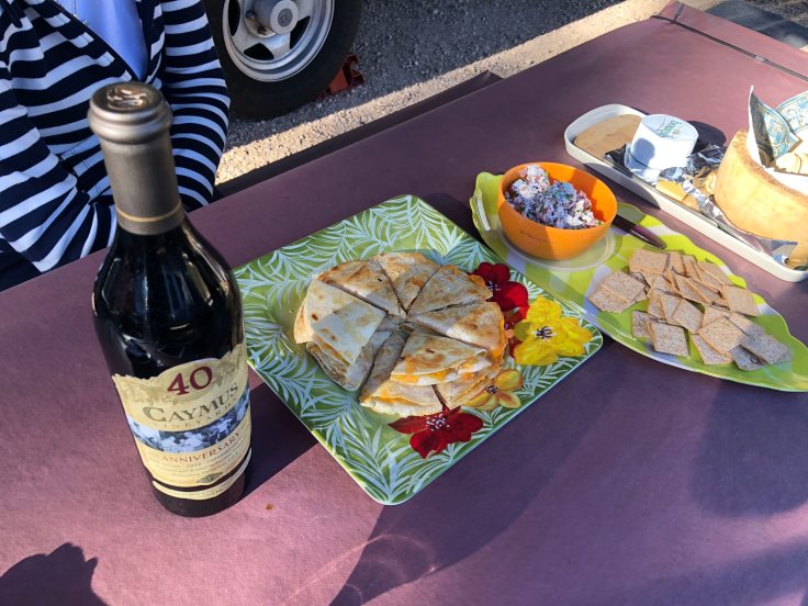
We enjoyed happy hours with other caravaners from New Jersey…
Tomorrow we begin to explore Bryce…
And an enjoyable time was had by all…
