After an uneventful night we headed out. From Arizona, back into Nevada, then up the 15 into Utah…
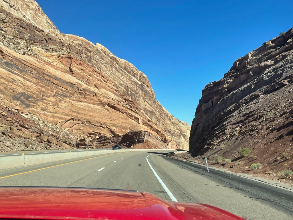
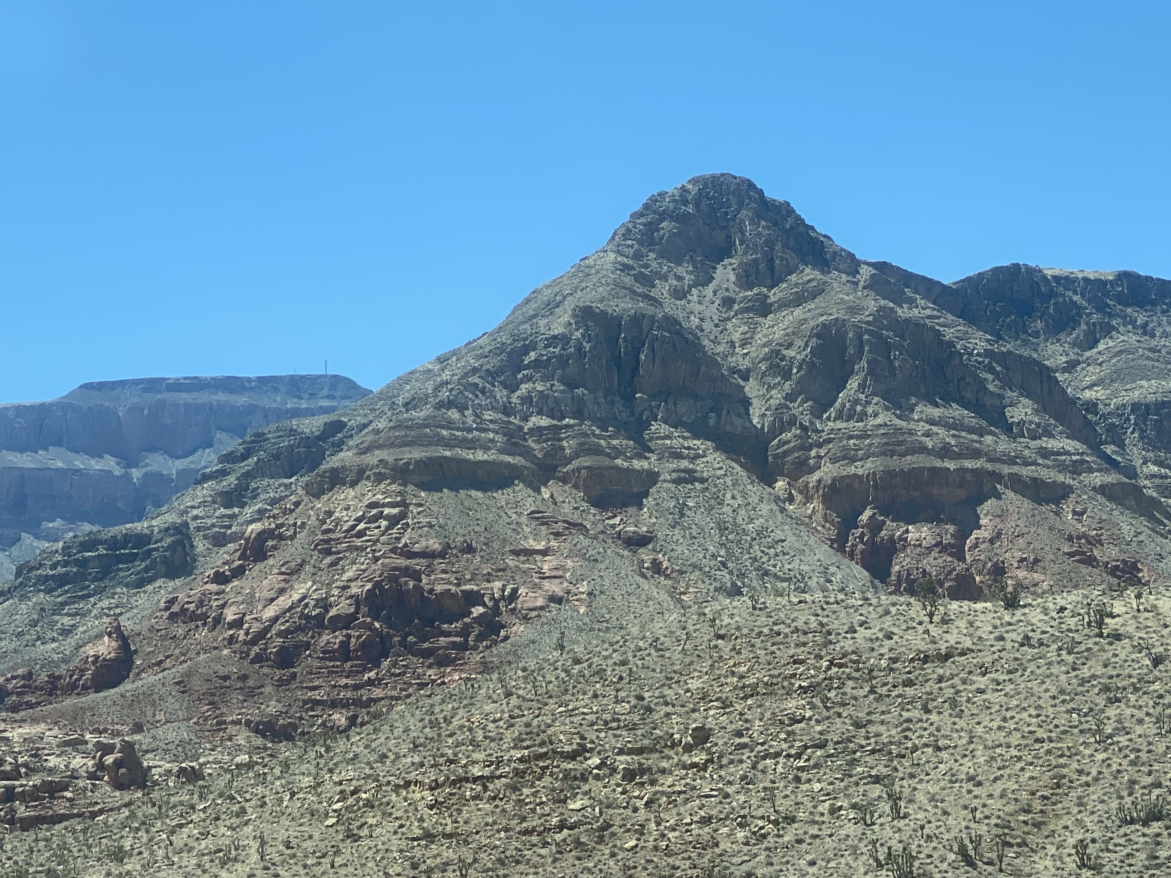
Utah has magnificent geological formations. We took a few photos, but we are on a tight schedule, so we did not stop often or spend too much time being touristy…
We stopped in a little town called Hurricane, UT, to stretch our legs again…These next photos are the amazing mountains all through Utah…We soon headed east on the 70. More great mountains!
We continued East…
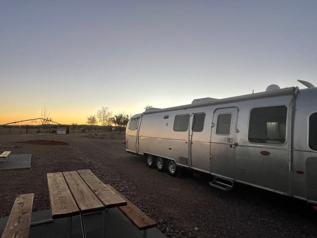
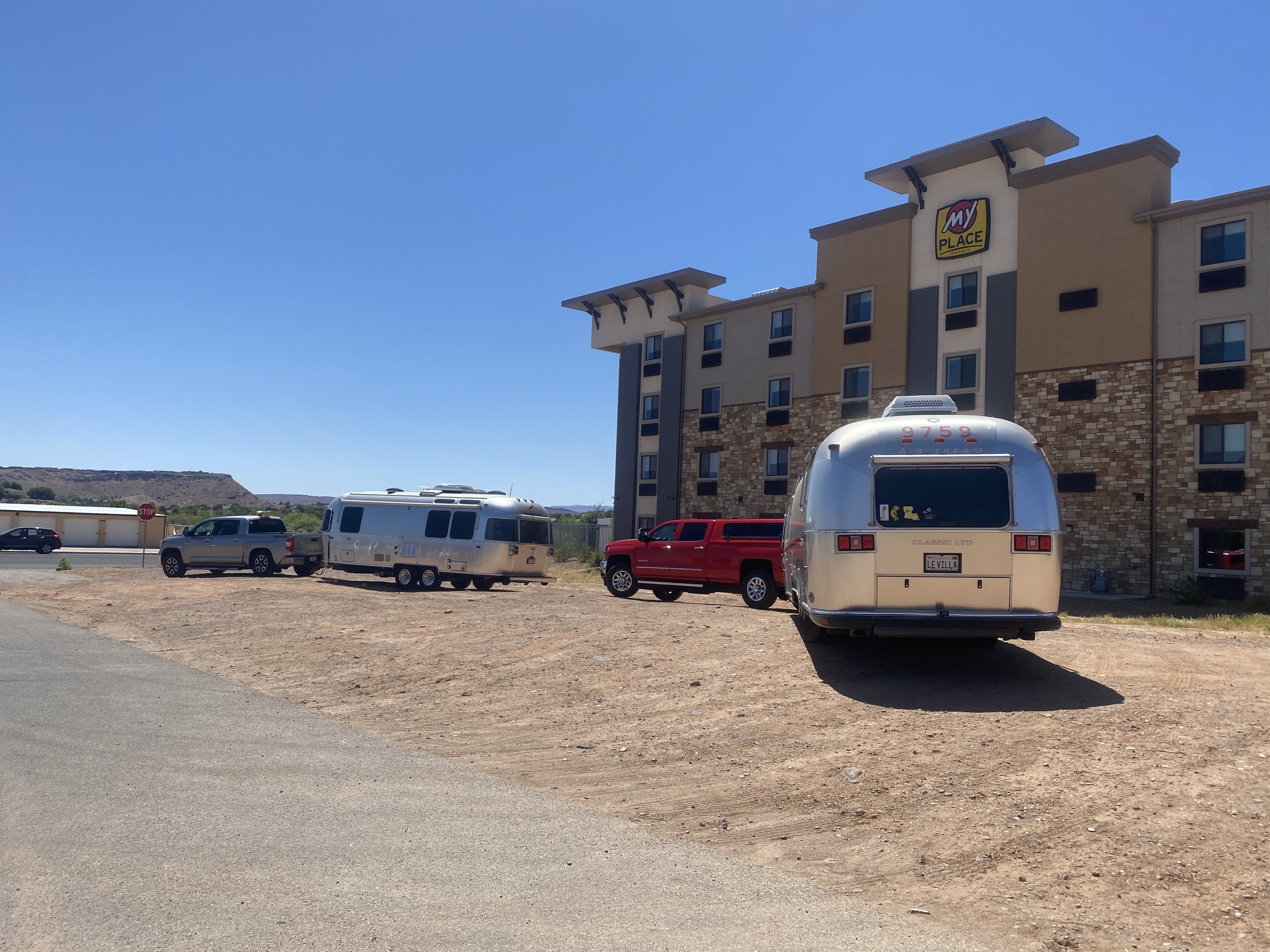
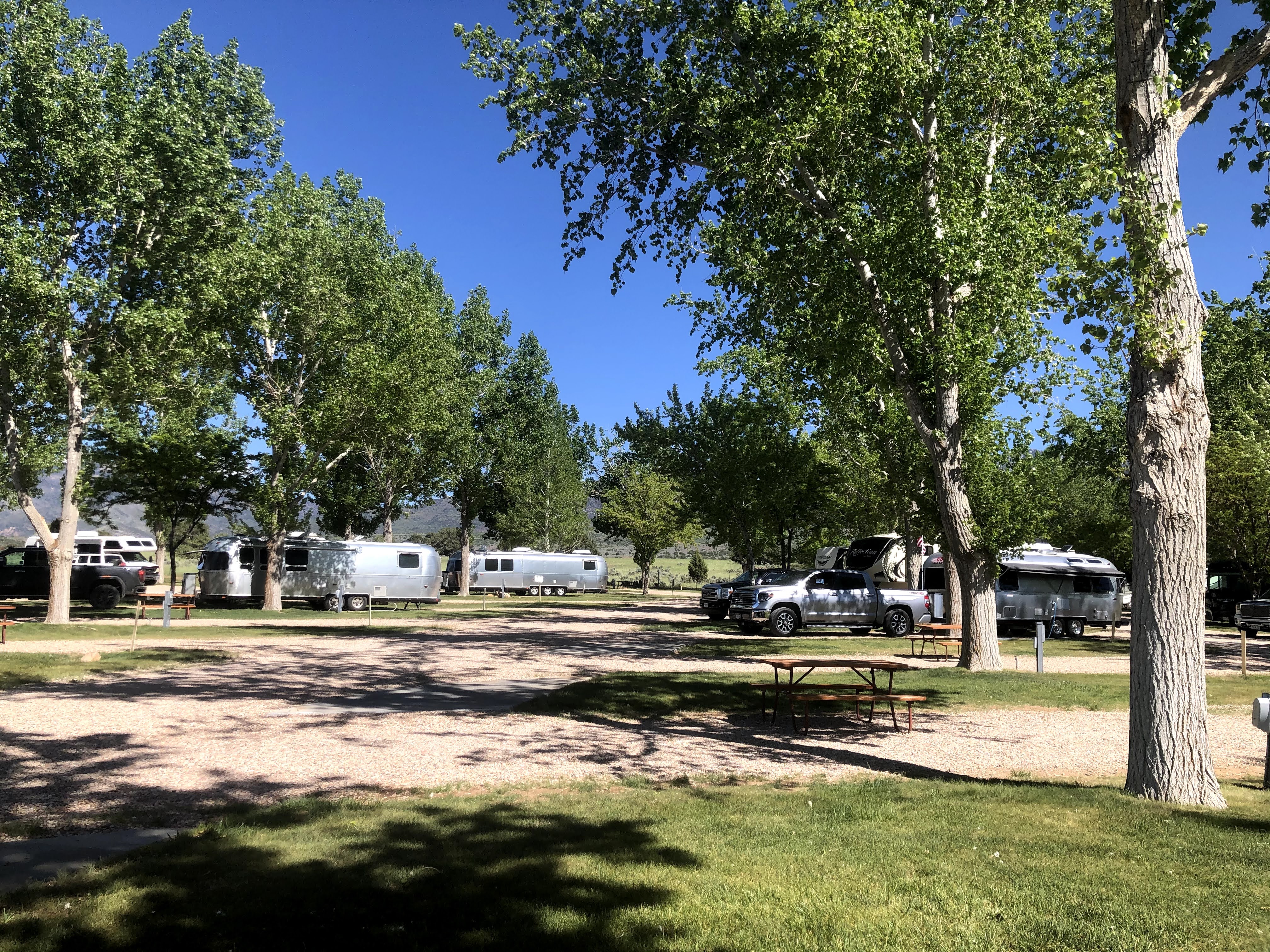
We arrived in Green River, Utah, and checked into the RV park. It was still hot…
We had been to Green River before, in 2018, on the Southwest Adventure Caravan. We had arrived from the south, and we spent hours at the Historic Museum telling the story of John Wesley Powell. Powell left from here on the Green River, which joins the Colorado River a few miles south of here. He continued on and explored the Colorado through the Grand Canyon…
We are not heading south – we did that in 2018. Tomorrow we continue East. We will drive over the Rocky Mountains, continue through Colorado, Kansas, and into Missouri. In Kansas City we will tour a Frank Lloyd Wright building. We continue east through Missouri and into Illinois to Springfield, where we will see more Frank Lloyd Wright, and all things Abraham Lincoln. Finally we will head south to meet up with the caravan in northern Arkansas…
Today is a travel day, as we leave Colorado and enter the far northeast corner of Utah, just a few miles south of Wyoming. We left about 9:00 am and traveled north. At first the roads were small, straight, and well paved…
The views are very stark, very moon-like…
Mountains are rocky and very distinct…
We climbed the mountains, as usual. The road got windier, and the pavement got rougher. In fact, it was terrible!
We turned west, and entered the town of Rangley. We parked the Villa and walked the length of the town. We ate lunch at Dottie’s Diner. Best French fries we’ve had on this trip! But the chili had absolutely no spice or heat to it – I suspect there wasn’t even salt and pepper… But we easily put these things aside, and we enjoyed our meal…
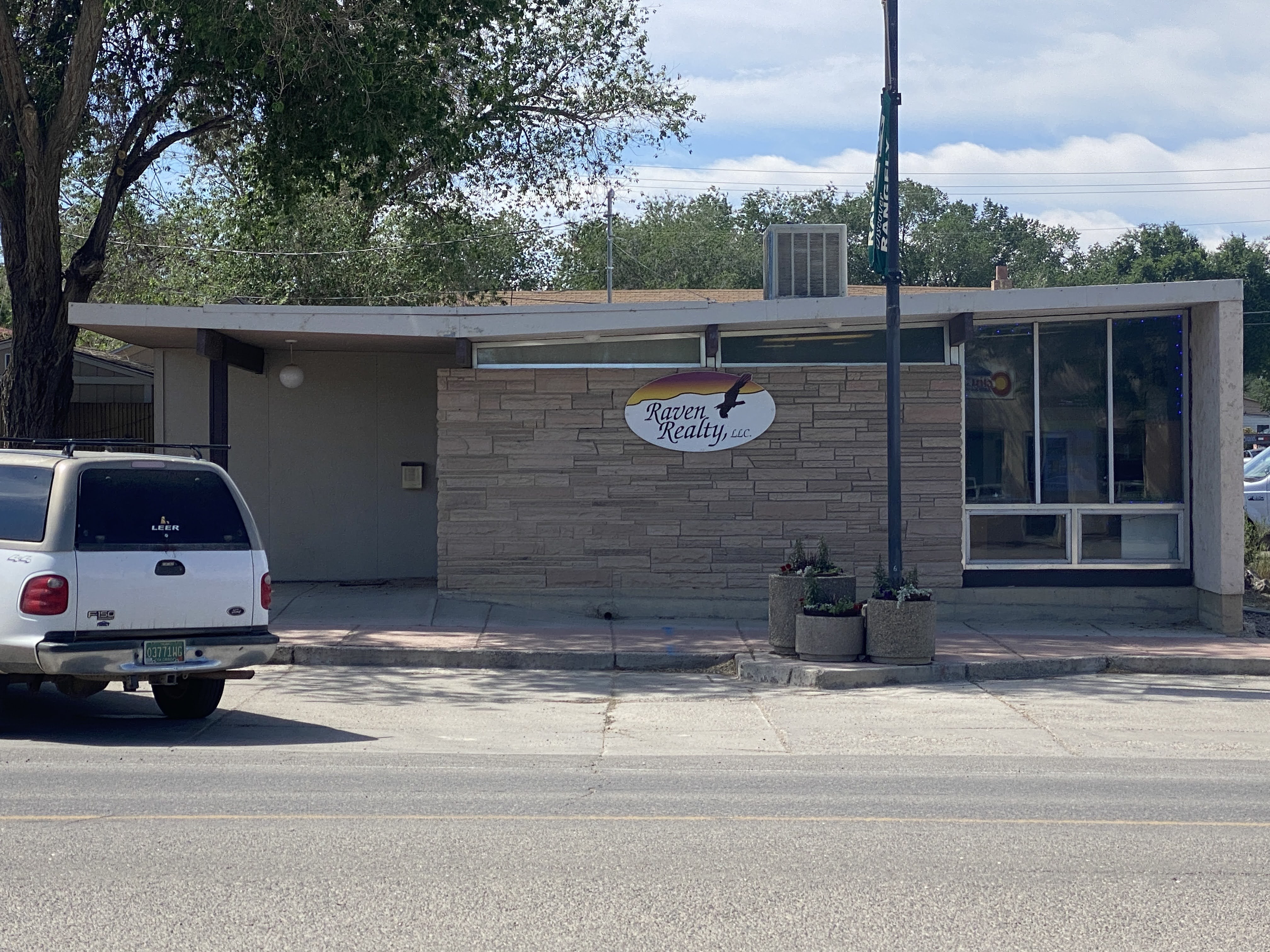
Walking back to the Villa we passed one of the very few modern building we have seen on this trip…
We walked back to the Villa and continued west, into Utah!
We proceeded west, passing through Dinosaur, CO, where the local townsfolk have a lot of fun naming their streets things like Brontosaurus Street and naming their ice cream parlor “Bedrock”…
Utah looks a lot like Colorado here…
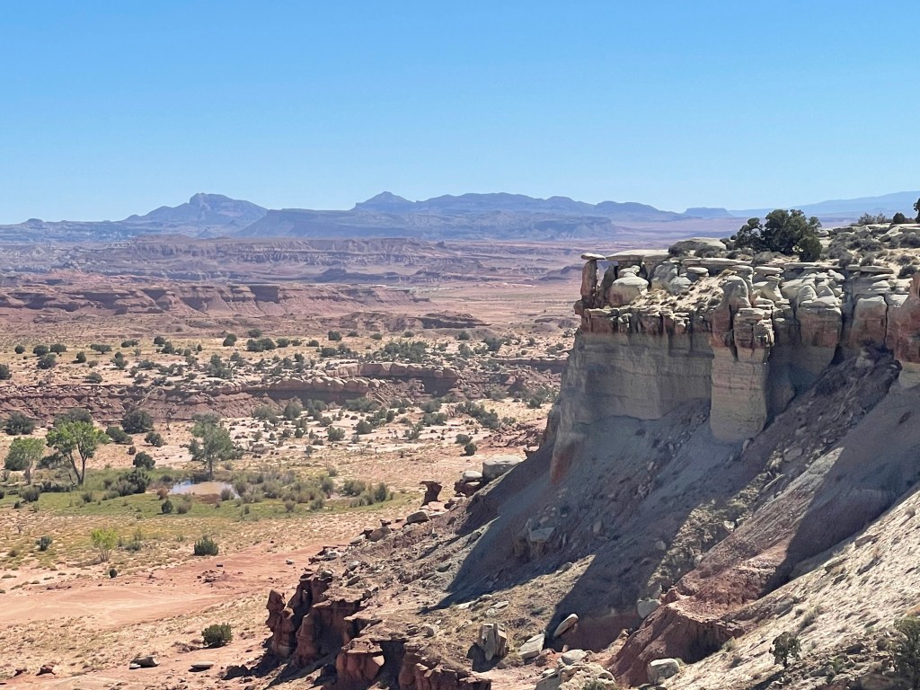
We proceeded west, finally arriving at the tiny town of Jensen, UT. We turned north and entered Dinosaur National Monument…
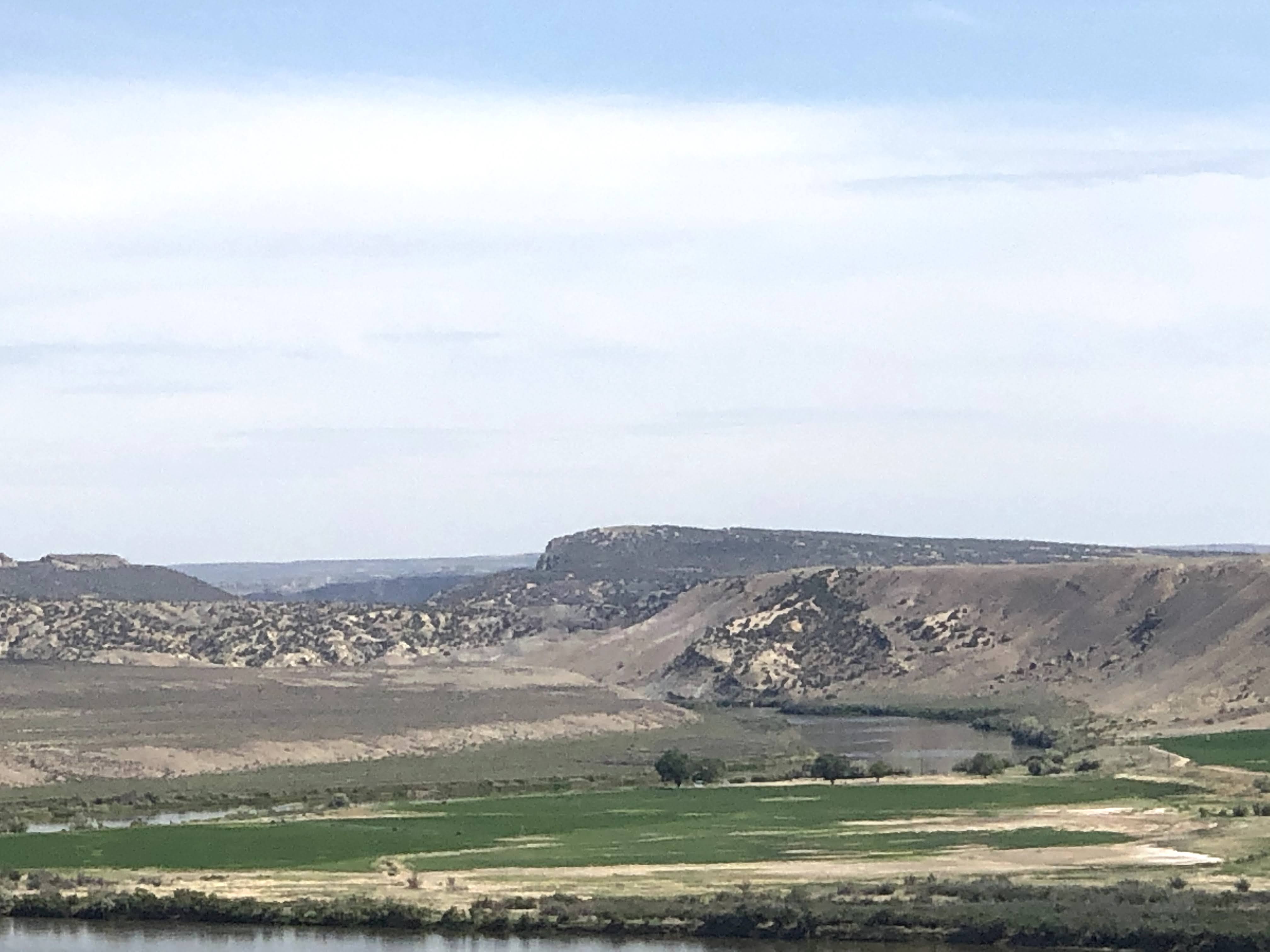
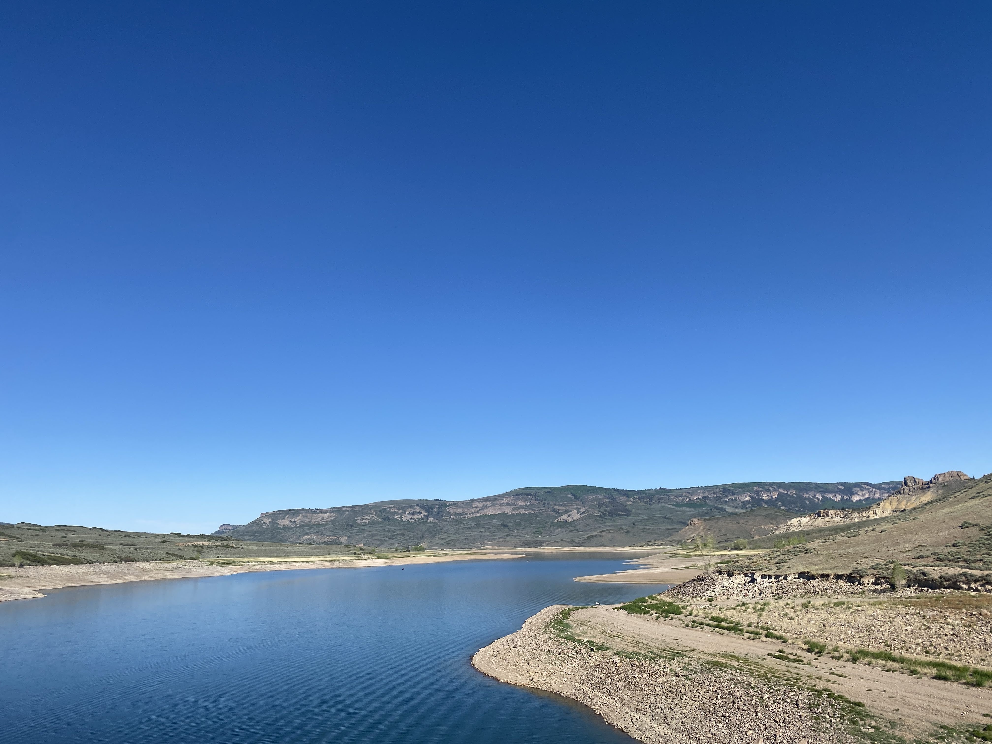
Our RV park is in a valley adjacent to the Green River. The Green River here is about as large as the Colorado River was near Fruita. Many miles south of here, just north of Moab, Utah, in the city of Green River, Utah, the Green joins the Colorado, and the Colorado becomes a very large river. It was at this point, on the Green River, that John Wesley Powell began his exploration of the Colorado River, starting in 1869, eventually traveling through the Grand Canyon…
We set up the Villa in the park. We are “dry camping” here – no electricity, water, or sewer hook-ups. We are really roughing it! I set out the solar panels, and I hope we won’t have to bring out the generators…
We left the RV park to visit the Dinosaur National Monument Visitors Center and Quarry Exhibits.
We approached the Visitors Center. Quite a nice modern building…
Dinosaur National Monument is located on the southeast flank of the Uinta Mountains on the border between Colorado and Utah at the confluence of the Green and Yampa rivers. Although most of the monument area is in Colorado, the Dinosaur Quarry is located in Utah, north of the town of Jensen. The nearest Colorado town is Dinosaur, while the nearest cities in Utah are Naples and Vernal.
Originally preserved in 1915 to protect its famous Dinosaur Quarry, the monument was greatly expanded in 1938 to include its wealth of natural history. The park’s wild landscapes, topography, geology, paleontology, and history make it a unique resource for both science and recreation. The park contains over 800 paleontological sites and has fossils of dinosaurs including Allosaurus, Deinonychus, Abydosaurus, and various sauropods. The Abydosaurus fossil consists of a nearly complete skull, the lower jaw, and first four neck vertebrae.
Paleontologist Earl Douglass of the Carnegie Museum discovered eight vertebra of an Apatosaurus on August 17, 1909, which became the first dinosaur skeleton discovered and excavated at the new Carnegie Quarry. The area around the quarry was declared a national monument on October 4, 1915.
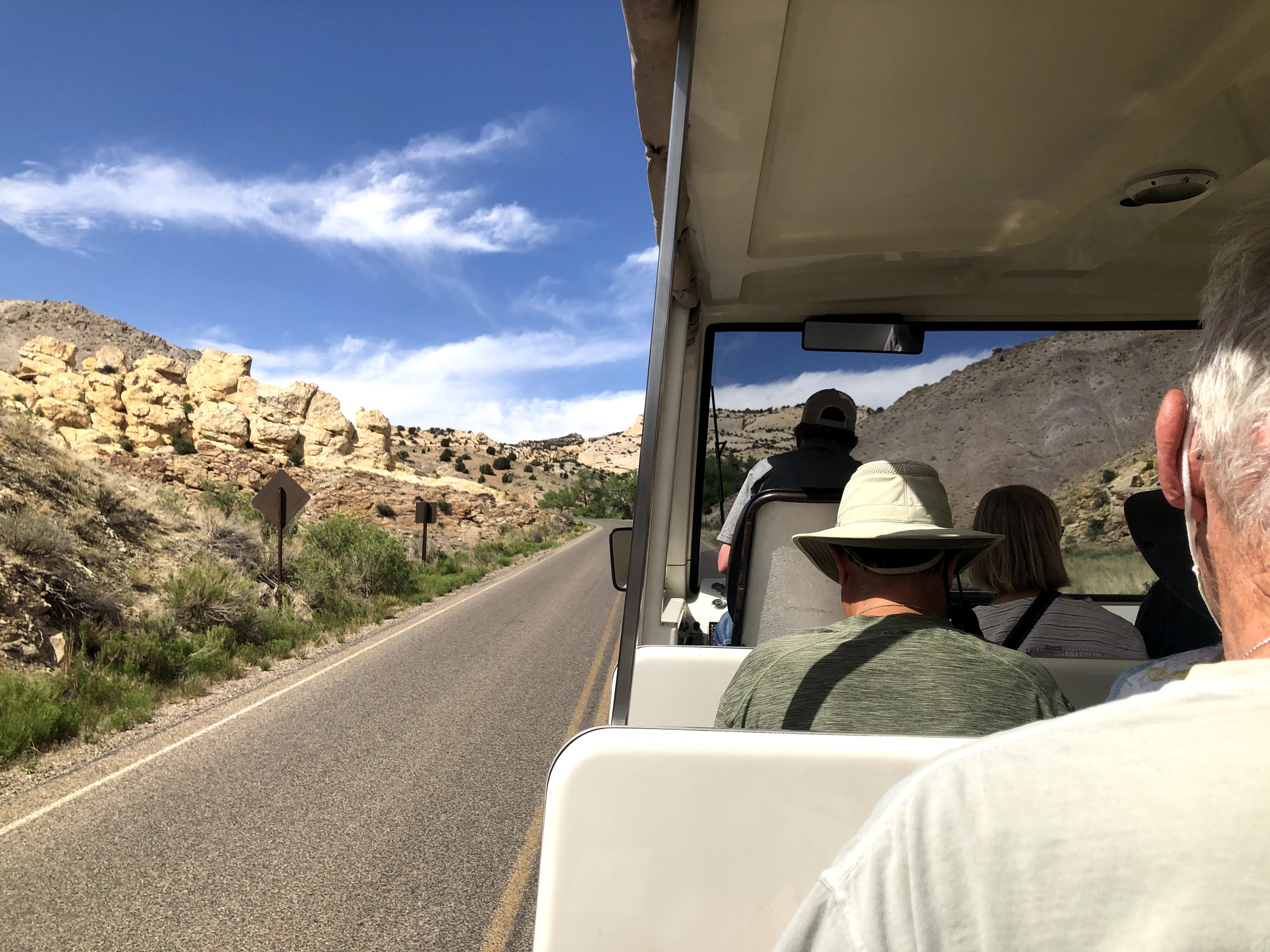
We took a shuttle from the Visitors Center up to the Quarry…
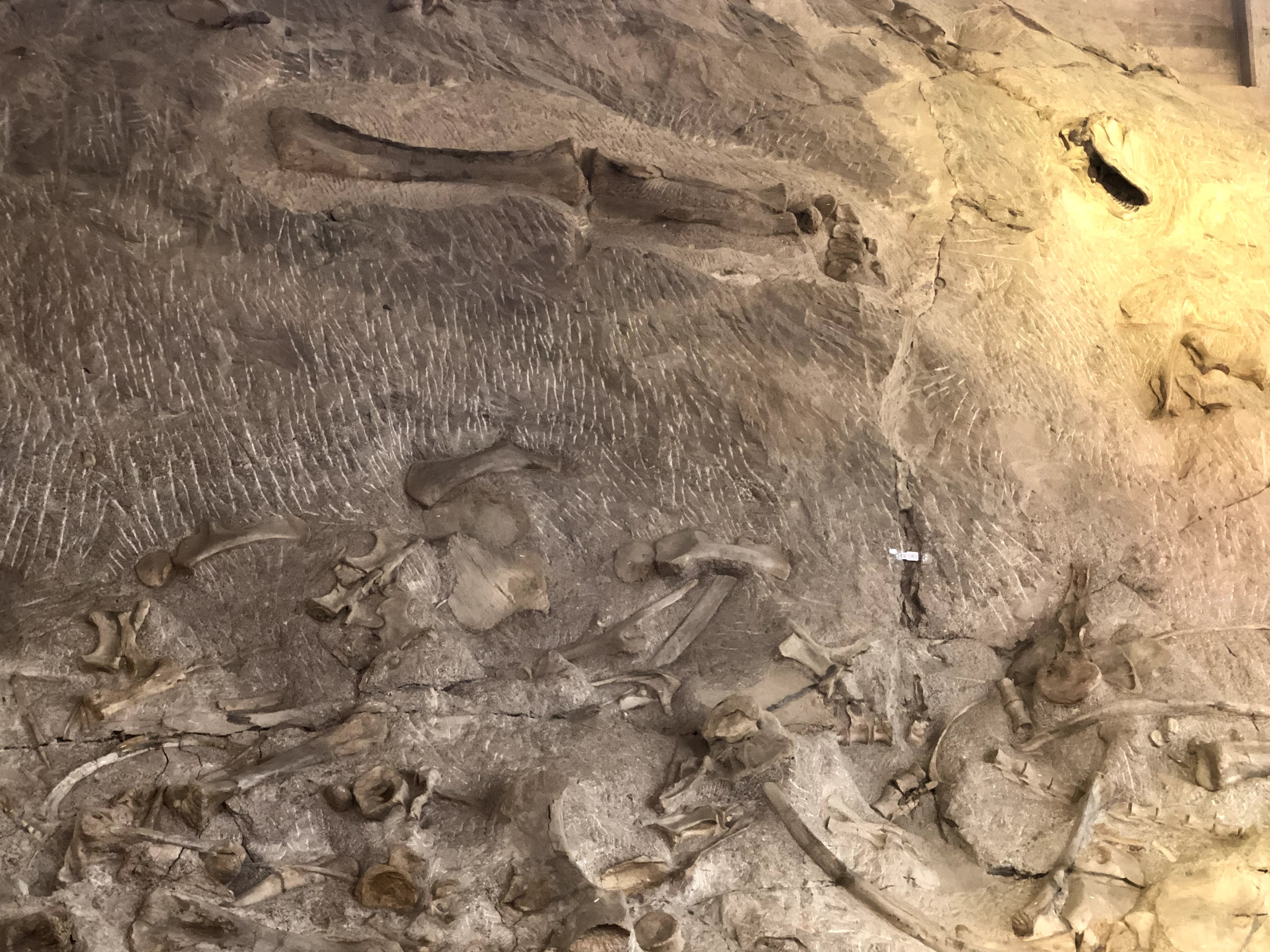
The Quarry Exhibit Hall is a magnificent building, built into the side of the mountain, to shield the quarry exhibits from the elements, and to show visitors what the bones and fossils look like when they are uncovered.
Again, I find the building much more interesting than dinosaur bones… I found this picture of the original building, erected in 1958. Unfortunately, due to the soils under the building and the seismic activity over the years, the original building was condemned in the 1990s, and totally reinforced and rebuilt. Note the difference between today’s building, above, and the original building, below…
Inside is a giant, two level exhibit hall, allowing visitors to see the fossils and bones on display…
All these fossils and bones are in their “as-found” condition… It is quite a display…!
The views were great from the Quarry Exhibit… After we had had enough of bones and fossils, we returned to the Villa…
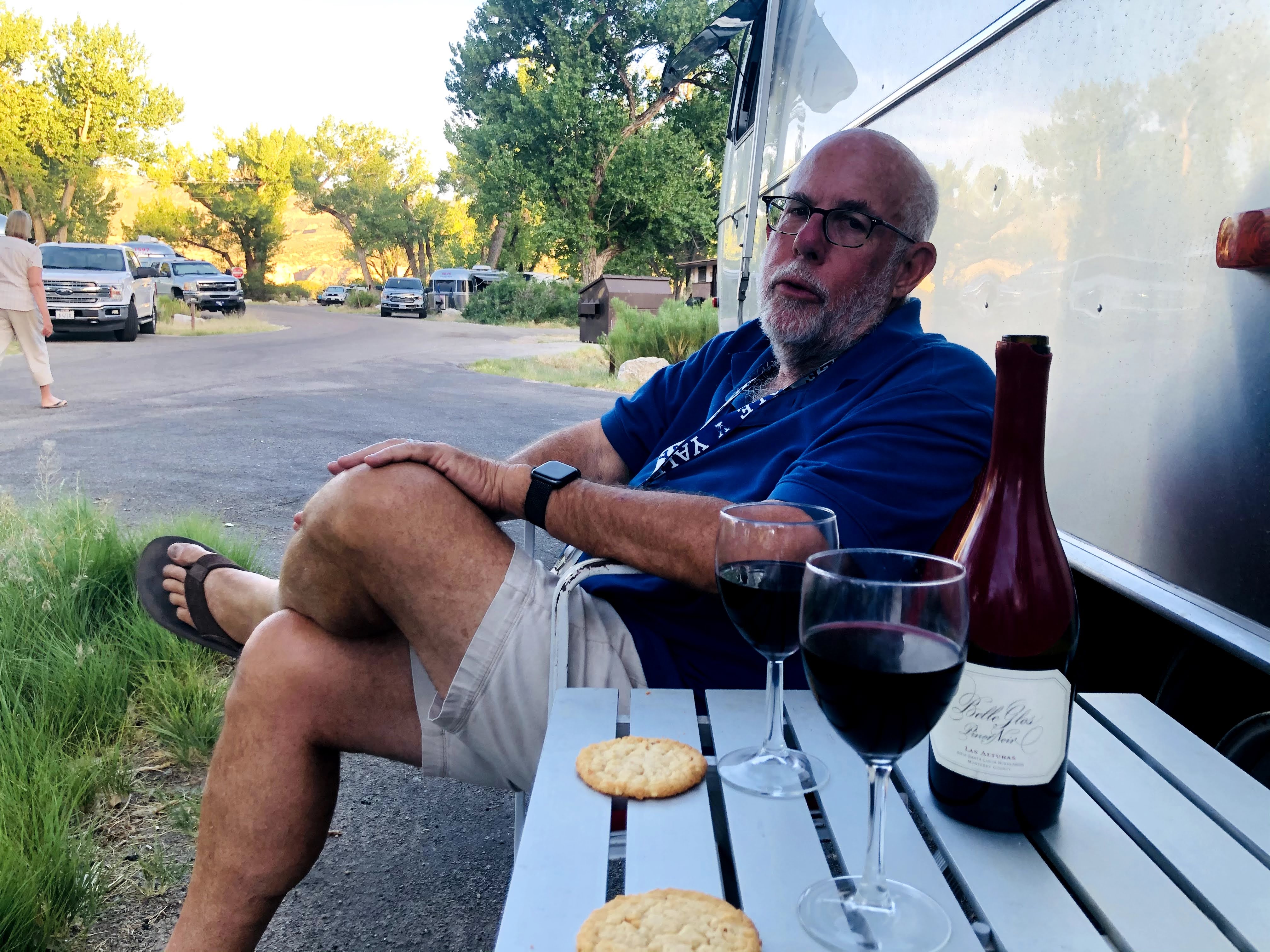
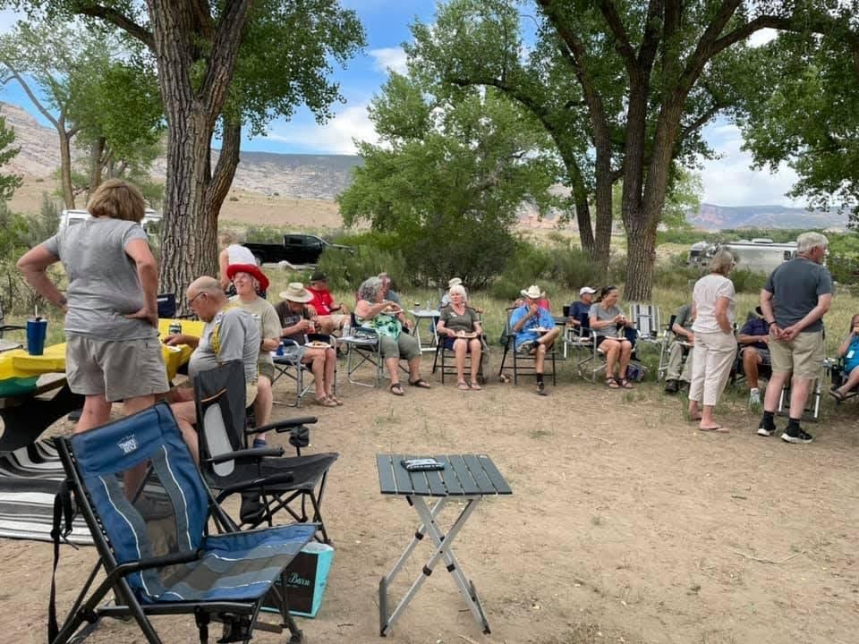
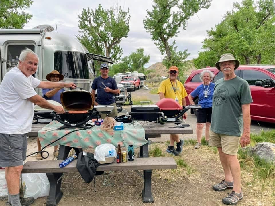
Happy Hours ensued, which turned into a weenie roast..
This is a typical thing on Airstream caravans – social get-togethers to share ice cream, birthday cake, or, in this case, a weenie roast…
We have cooking crew volunteers to set these things up…
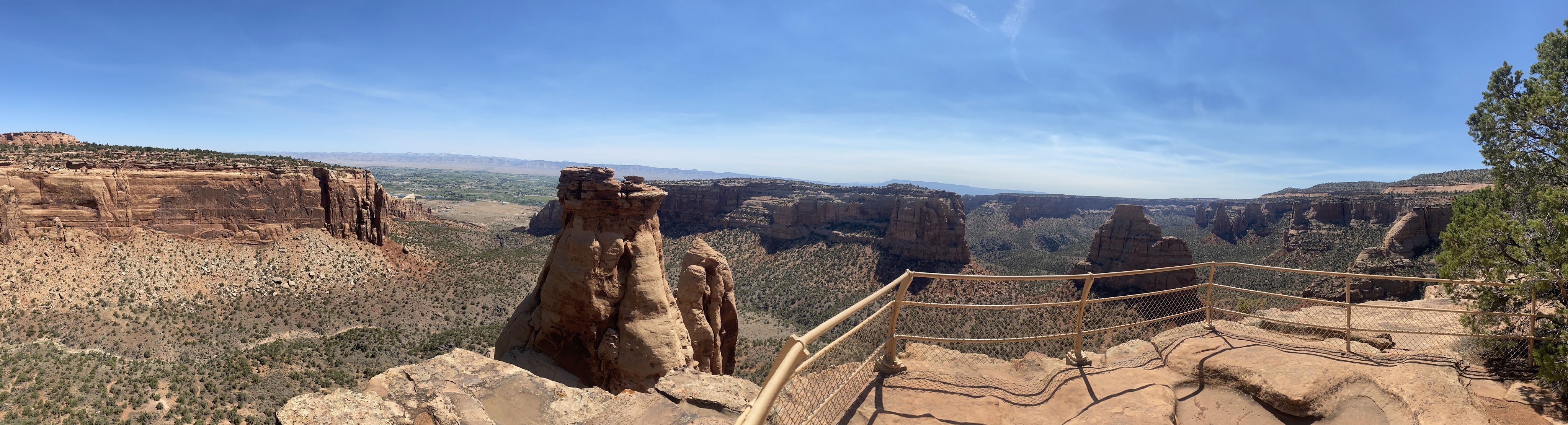
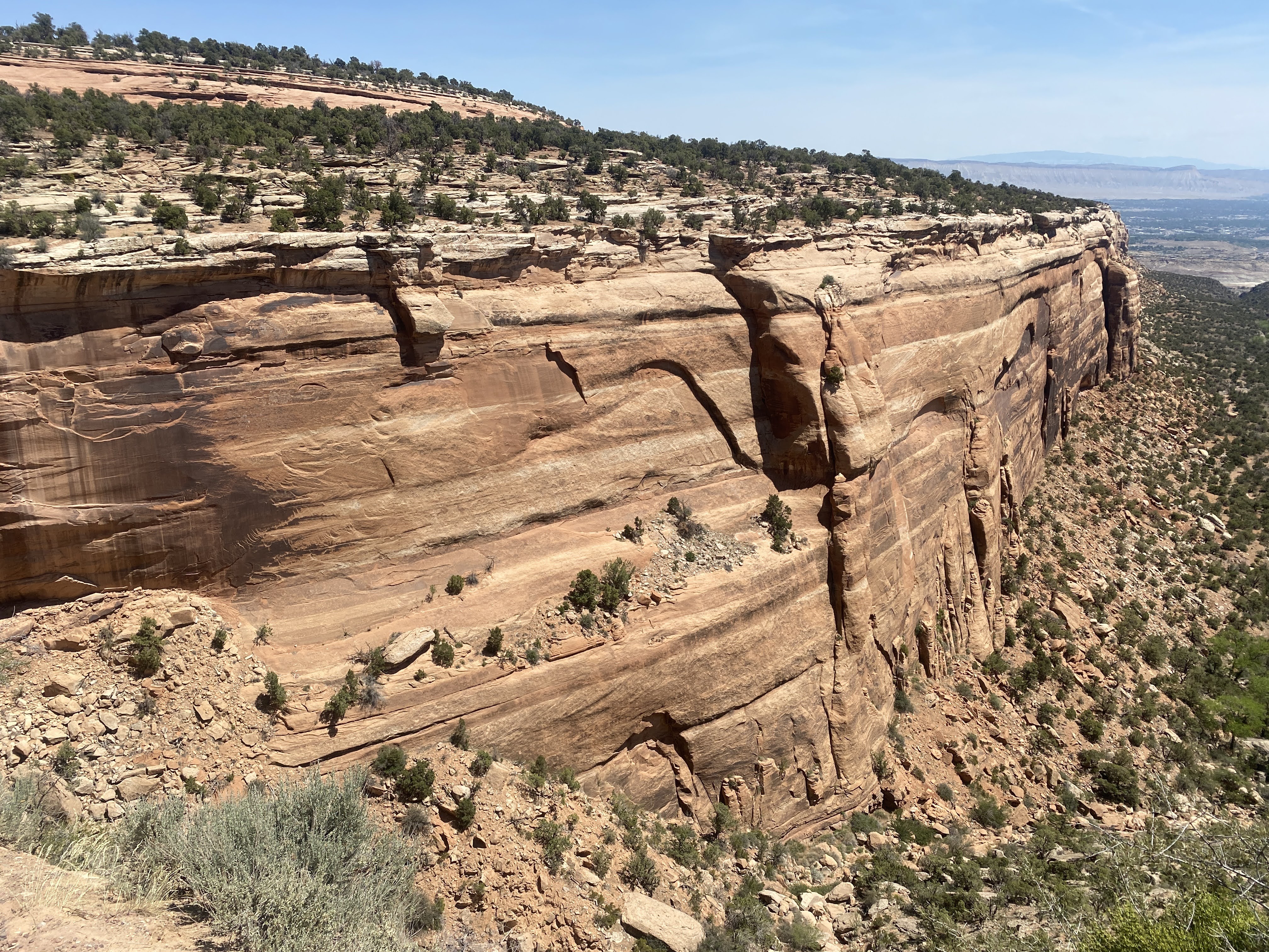
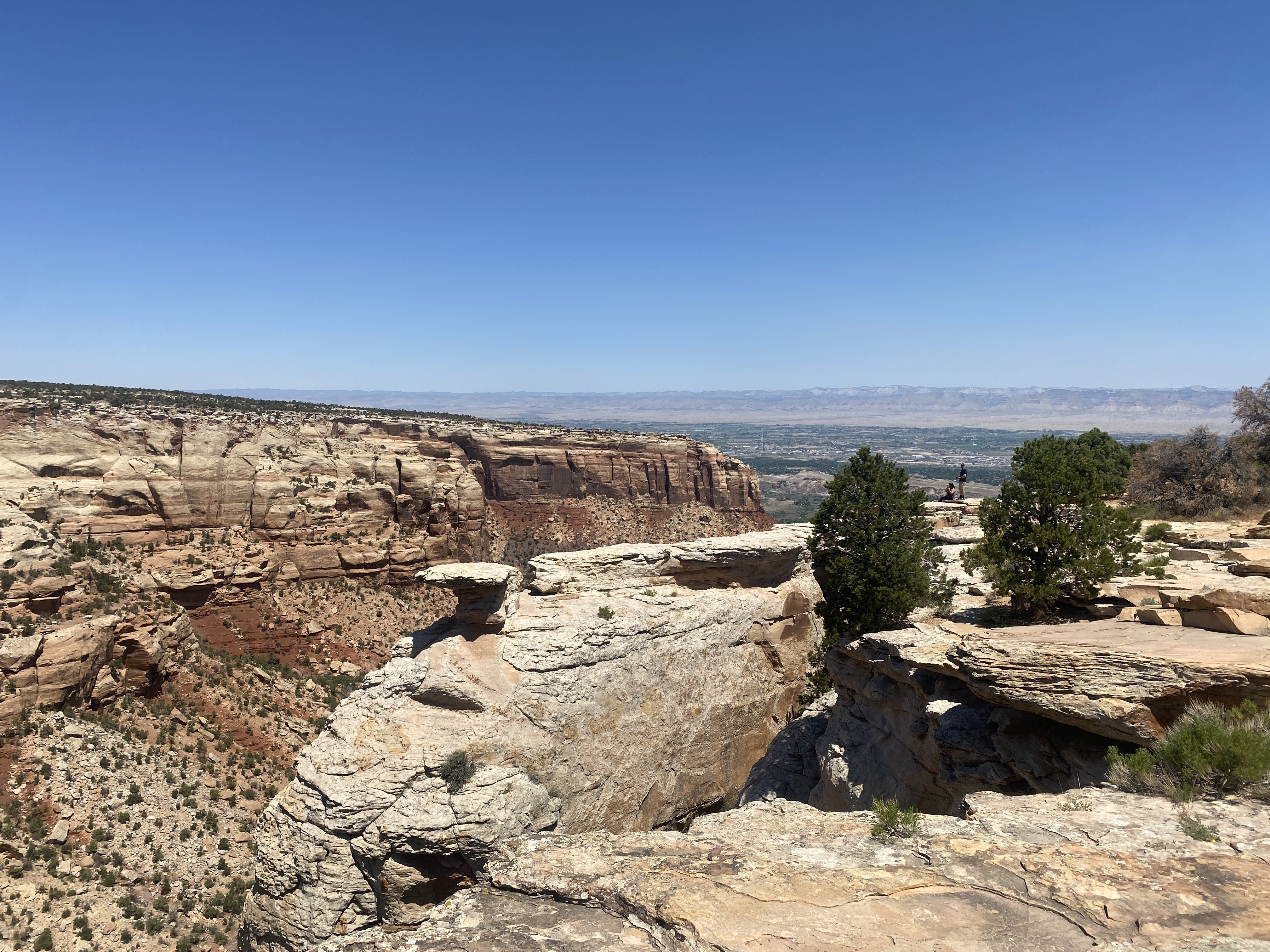
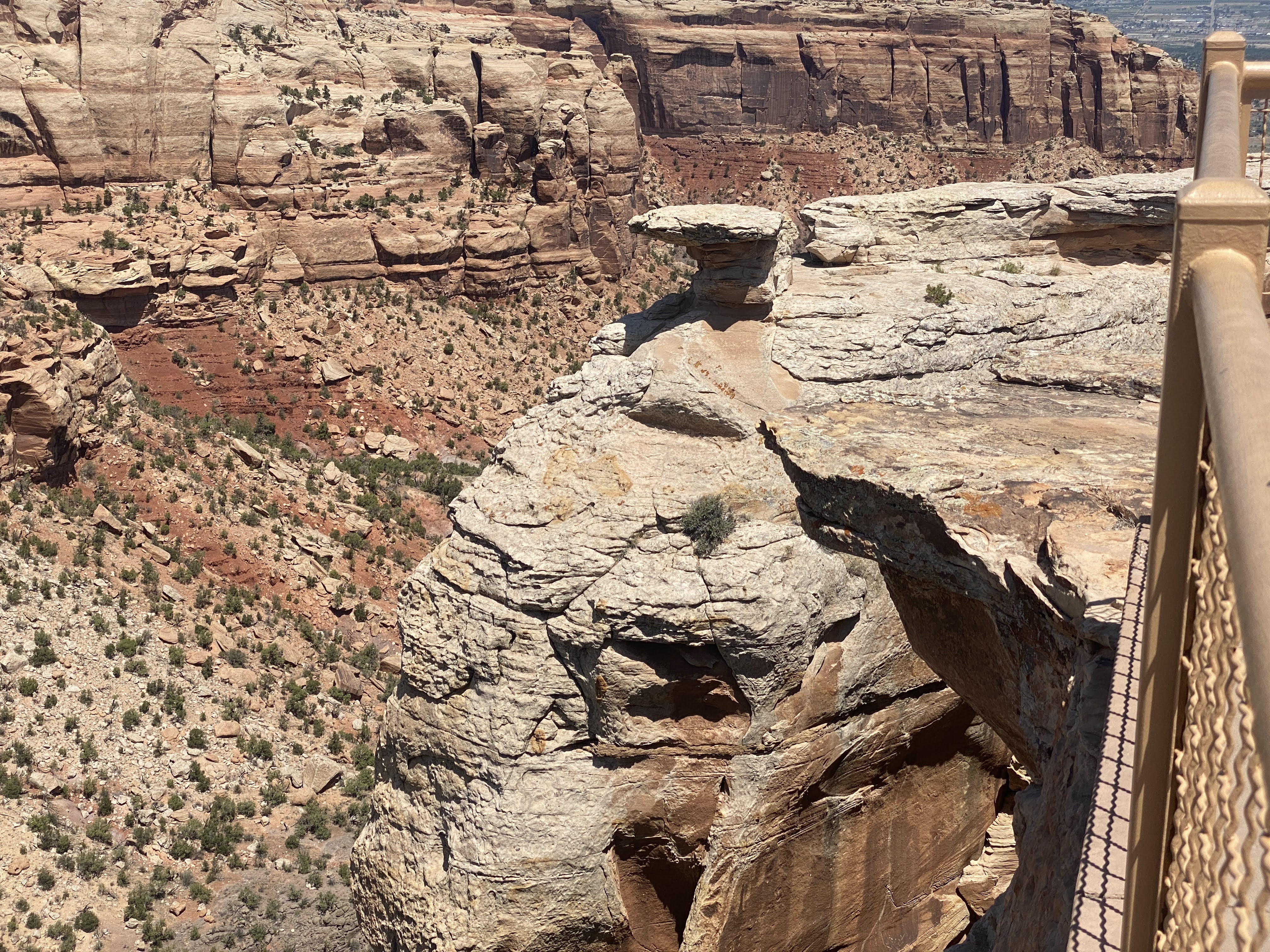
Today we return to the Colorado National Monument to see more of its beauty…
On our way to the entrance we crossed the mighty Colorado River…
The Colorado River is the major river of the southwestern United States and northwest Mexico. Its headwaters are in Rocky Mountain National Park where La Poudre Pass Lake is its source. It flows southwest through the Colorado Plateau country of western Colorado, southeastern Utah and northwestern Arizona, where it flows through the Grand Canyon. It turns south near Las Vegas, Nevada, forming the Arizona–Nevada border in Lake Mead and the Arizona–California border a few miles below Davis Dam between Laughlin, Nevada and Needles, California, before entering Mexico in the Colorado Desert. Most of its waters are diverted into the Imperial Valley of Southern California. In Mexico its course forms the boundary between Sonora and Baja California before entering the Gulf of California.
We re-entered the Colorado National Monument.
On August 25, 1916, President Woodrow Wilson signed the “Organic Act” creating the National Park Service, a federal bureau in the Department of the Interior responsible for maintaining national parks and monuments that were then managed by the department. The National Park System has since expanded to 423 units (often referred to as parks), more than 150 related areas, and numerous programs that assist in conserving the nation’s natural and cultural heritage for the benefit of current and future generations.
The National Park Service manages all of the various “units” – Parks, Forests, Monuments, Historic Sites, Lakeshores, Recreation Areas, Scenic Trails, and several other designations. The first parks were Yellowstone (1872), Sequoia (1890), Yosemite (1890), Mt. Rainier (1899), Crater Lake (1902), Wind Cave (1903), Mesa Verde (1906), Glacier (1910), Rocky Mountain (1915). Colorado National Monument was established in 1911. The different desinations have to do with how they are created. National Parks are created by acts of Congress. National Monuments and most other designations are created by the President via Executive Order. Thirty States have National Parks; the States with the most parks are: California (9), Alaska (8), Utah (5), and Colorado (4).
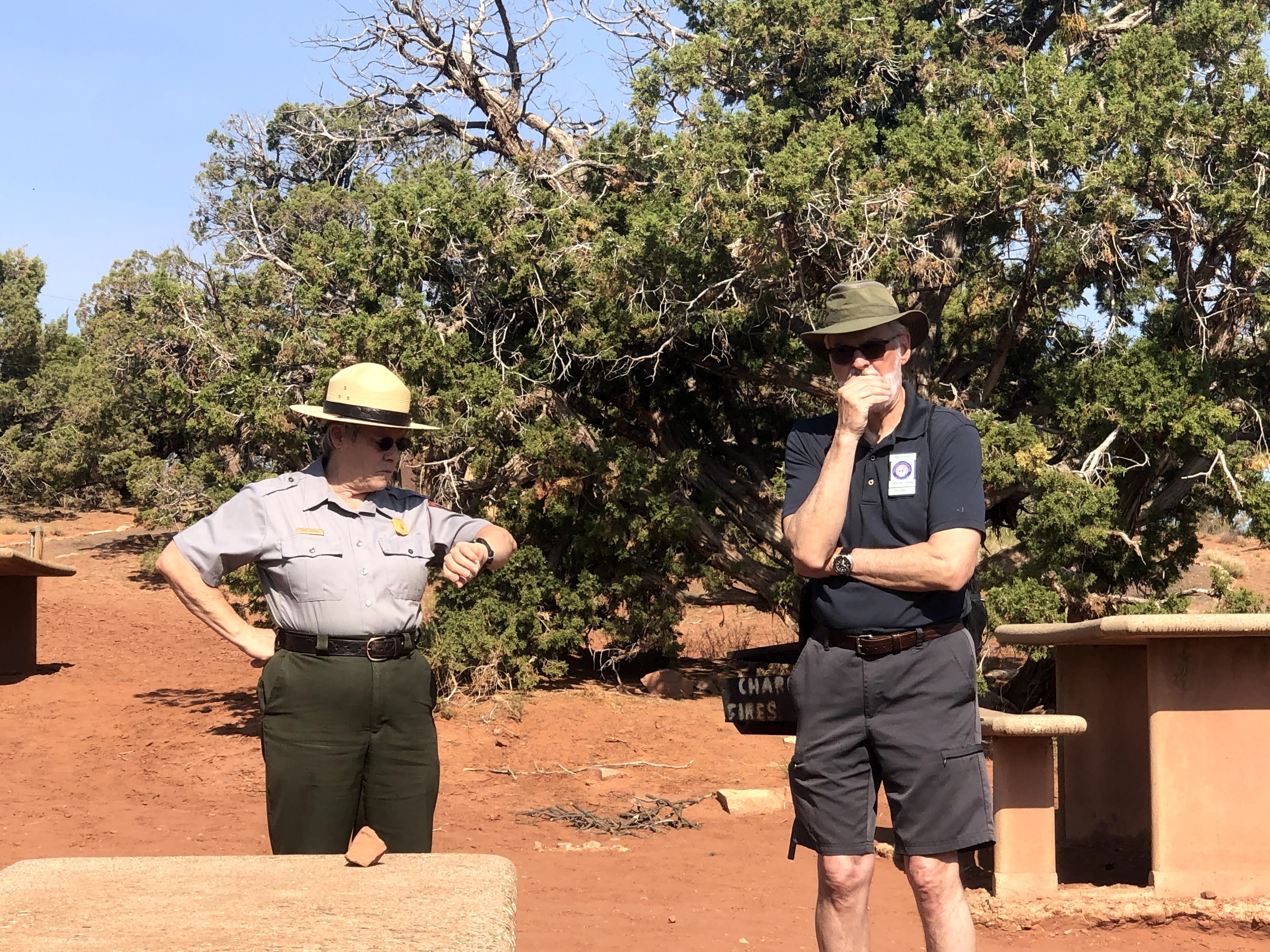
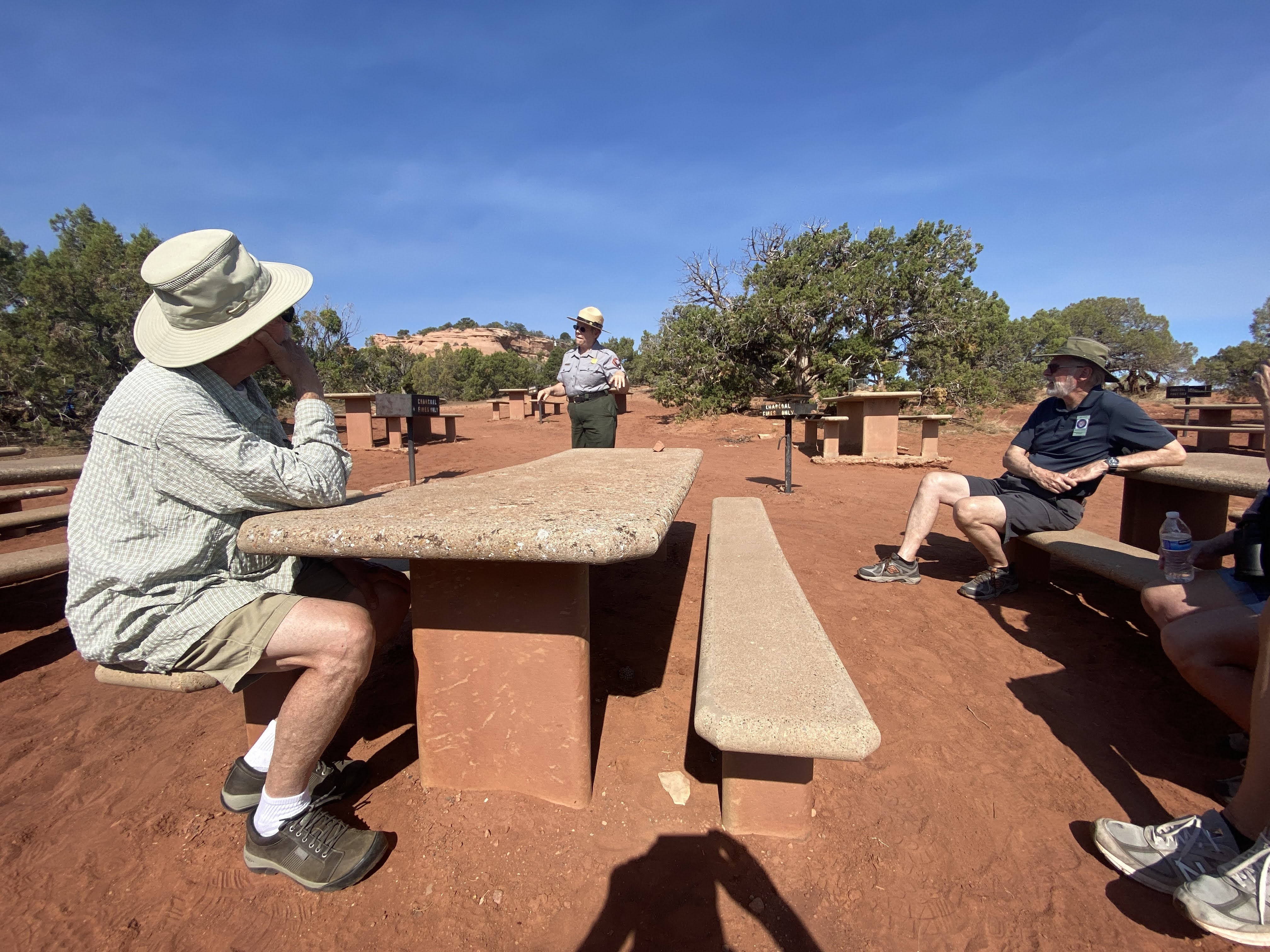
We began our visit with a ranger talk in the picnic area where we had had dinner last night…
We learned about the geology of these magnificent cliffs and canyons, plus a little of the park history. The man behind the creation of the Colorado National Monument was John Otto, who settled in Grand Junction in the early 20th century. Otto was the first white man to explore the area.
Prior to Otto’s arrival, many area residents believed the canyons to be inaccessible to humans. Otto began building trails on the plateau and into the canyons. As word spread about his work, the Chamber of Commerce of Grand Junction sent a delegation to investigate. The delegation returned praising both Otto’s work and the scenic beauty of the wilderness area, and the local newspaper began lobbying to make it a National Park. A bill was introduced and carried by the local Representatives to the U.S. Congress and Senate but a Congressional slowdown in the final months threatened the process. To ensure protection of the canyons President William Howard Taft (who had visited the area) stepped in and used the highest powers available to him via the Antiquities Act and presidential proclamation to declare the canyons as a national monument
John Otto was hired as the first park ranger, drawing a salary of $1 per month. For the next 16 years, he continued building and maintaining trails while living in a tent in the park.
For many years during the Great Depression, the Civilian Conservation Corps. built roads, tunnels, trails, and other features of the park. The CCC left in 1941; the major Rim drive was completed in the 1950s.
Following the Ranger talk we visited the Visitor Center. I liked the fact that it is built from the native sandstone…
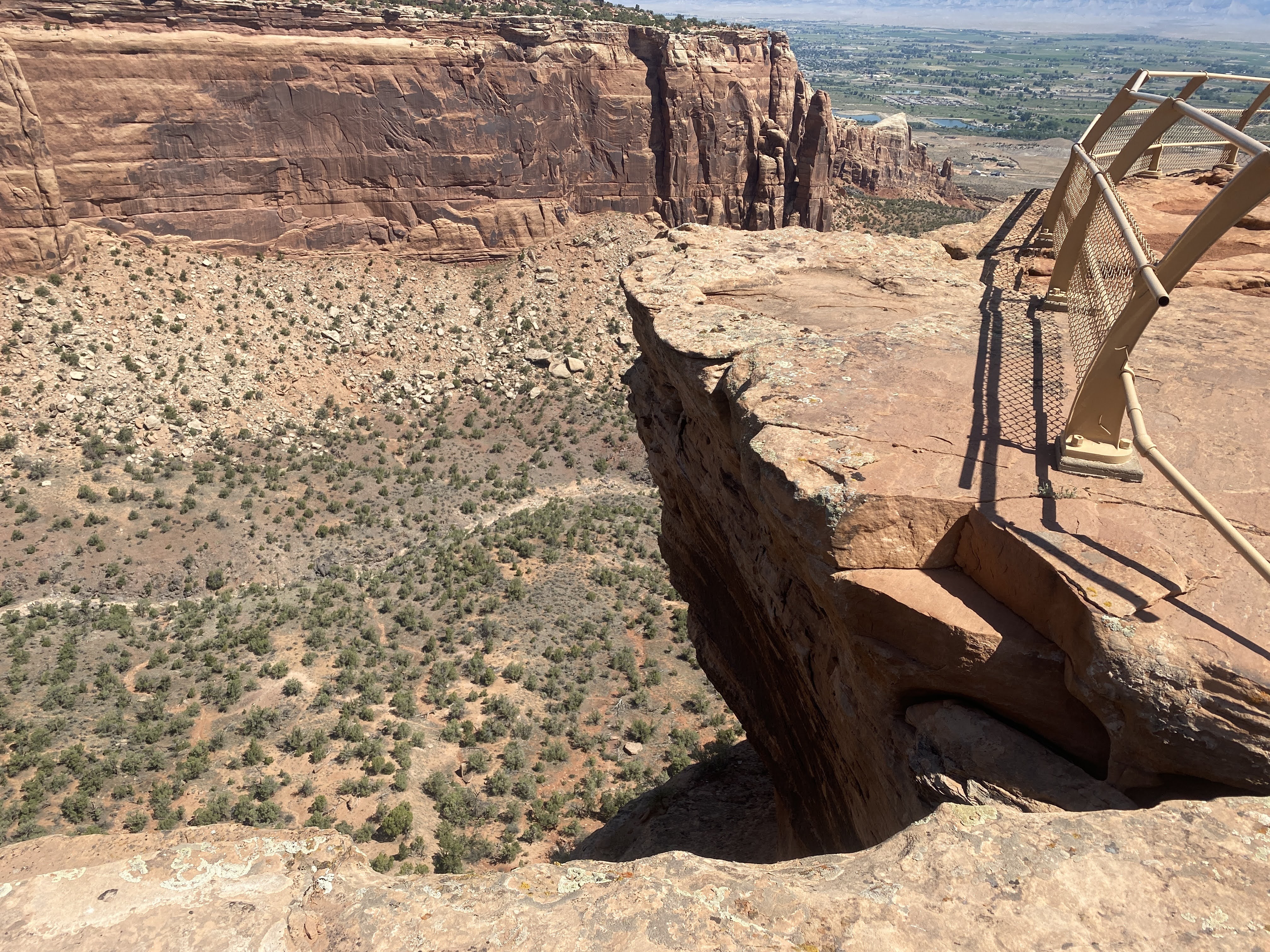
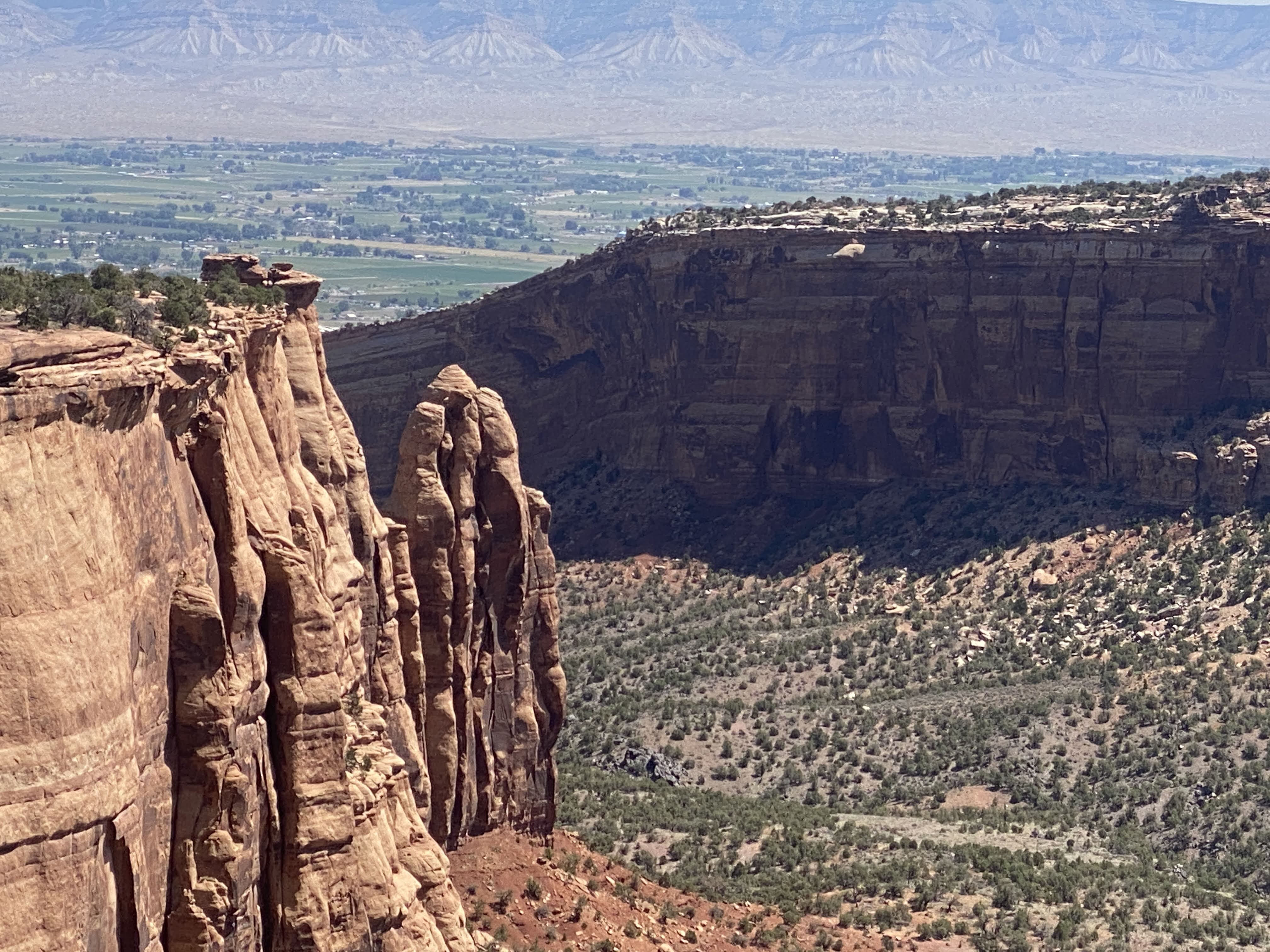
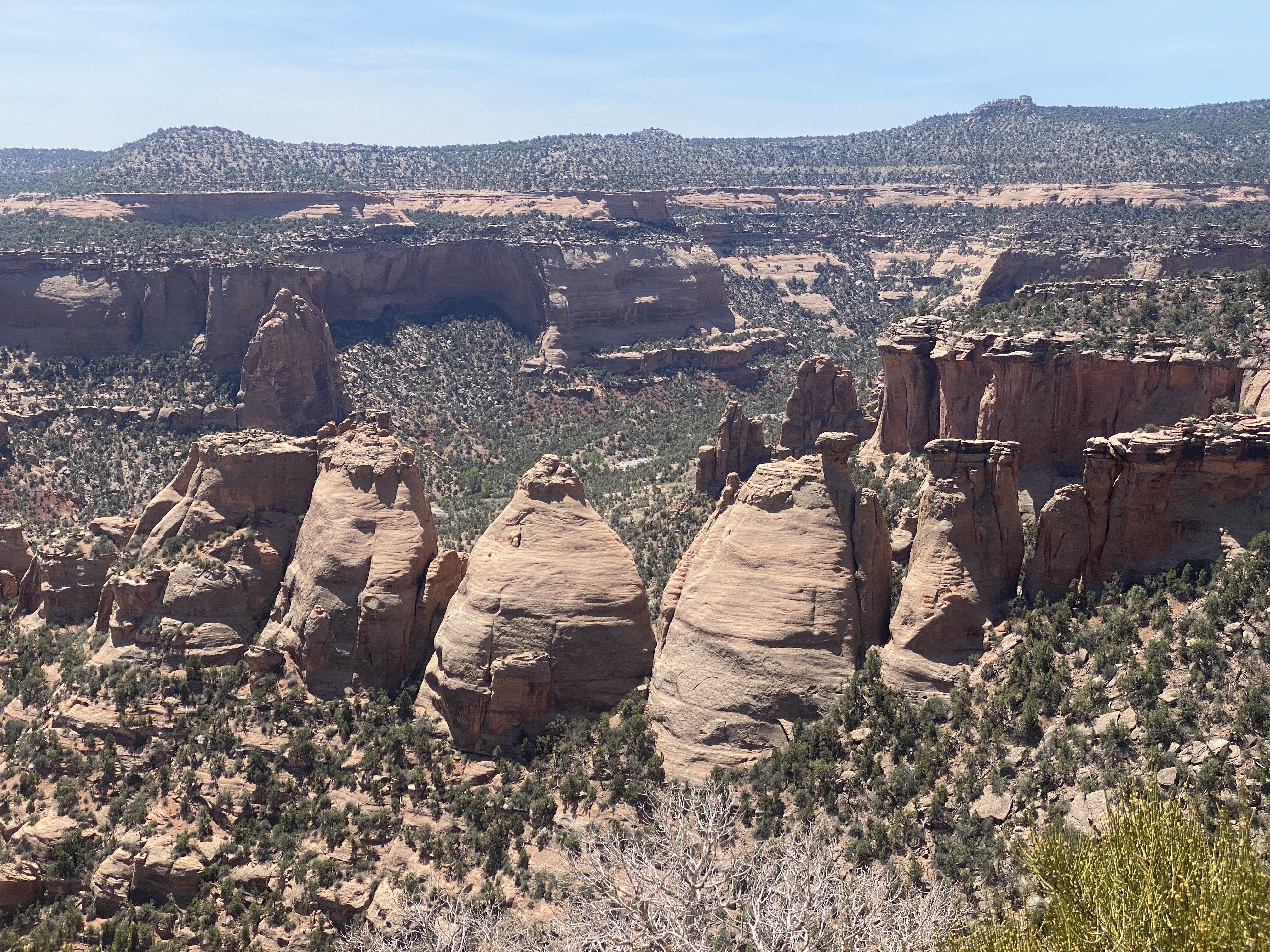
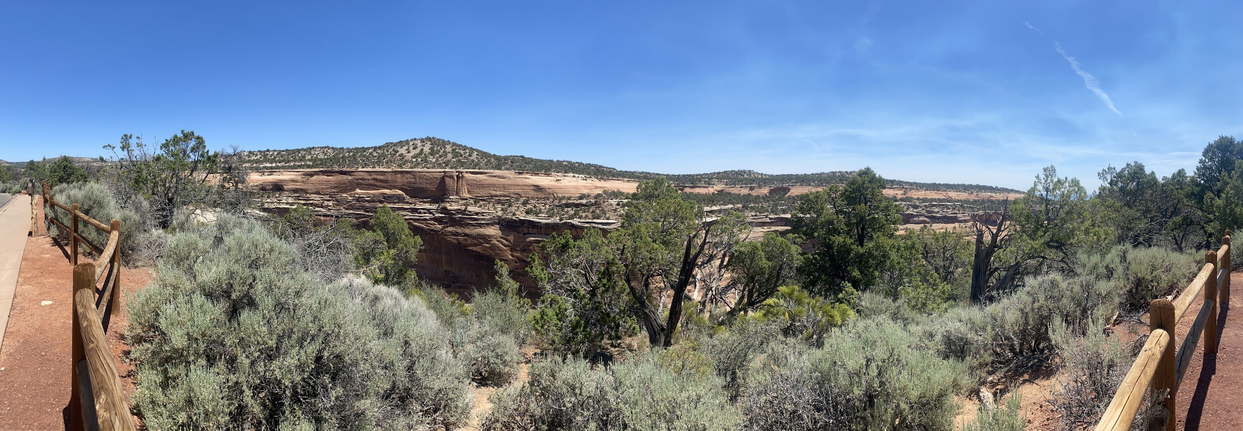
After we had seen a few exhibits in the Visitor Center we drove the Rim drive for 23 miles, all the way to Grand Junction. We saw 23 miles of rocks.
Here I liked the walls made from the natural sandstone… These walls are several hundred feet long, and they occur at many of the pull-outs along the Rim drive…
After we left the park we drove through Grand Junction again. We found truck fuel and DEF. Tomorrow we will return to Fruita for some final grocery shopping before we enter the wilderness of Dinosaur National Monument, Flaming Gorge Dam, and the Grand Tetons National Park…
It was 97 degrees again, but we have good, clean power, so both AC units are running in the Airstream… At 5:00 we took a walk around the lake in the park.
We also saw the Colorado River again, adjacent to the park…
Unfortunately, we walked out of the park and around the outside of the park, and finally had to go totally around the park and walk in the maim entrance…
After a short break we joined other caravaners for happy hours. We returned to the Villa, and an enjoyable time was had by all…,
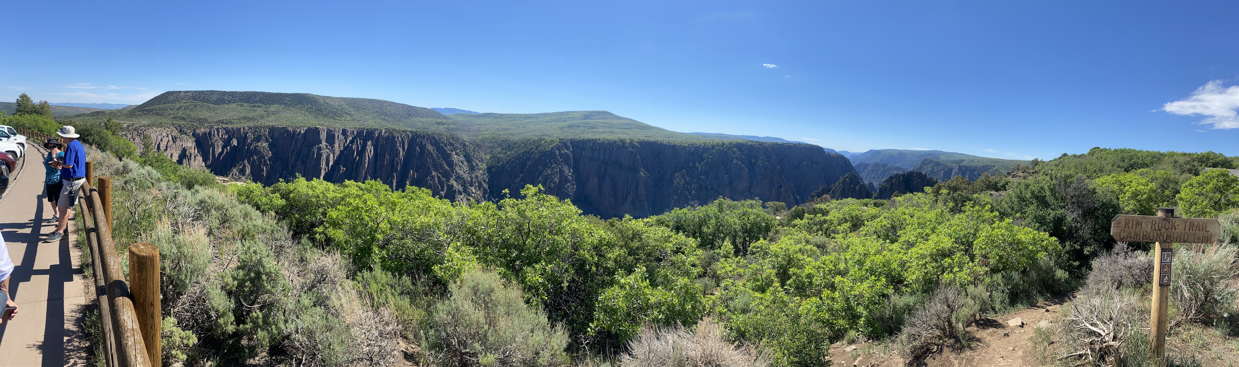
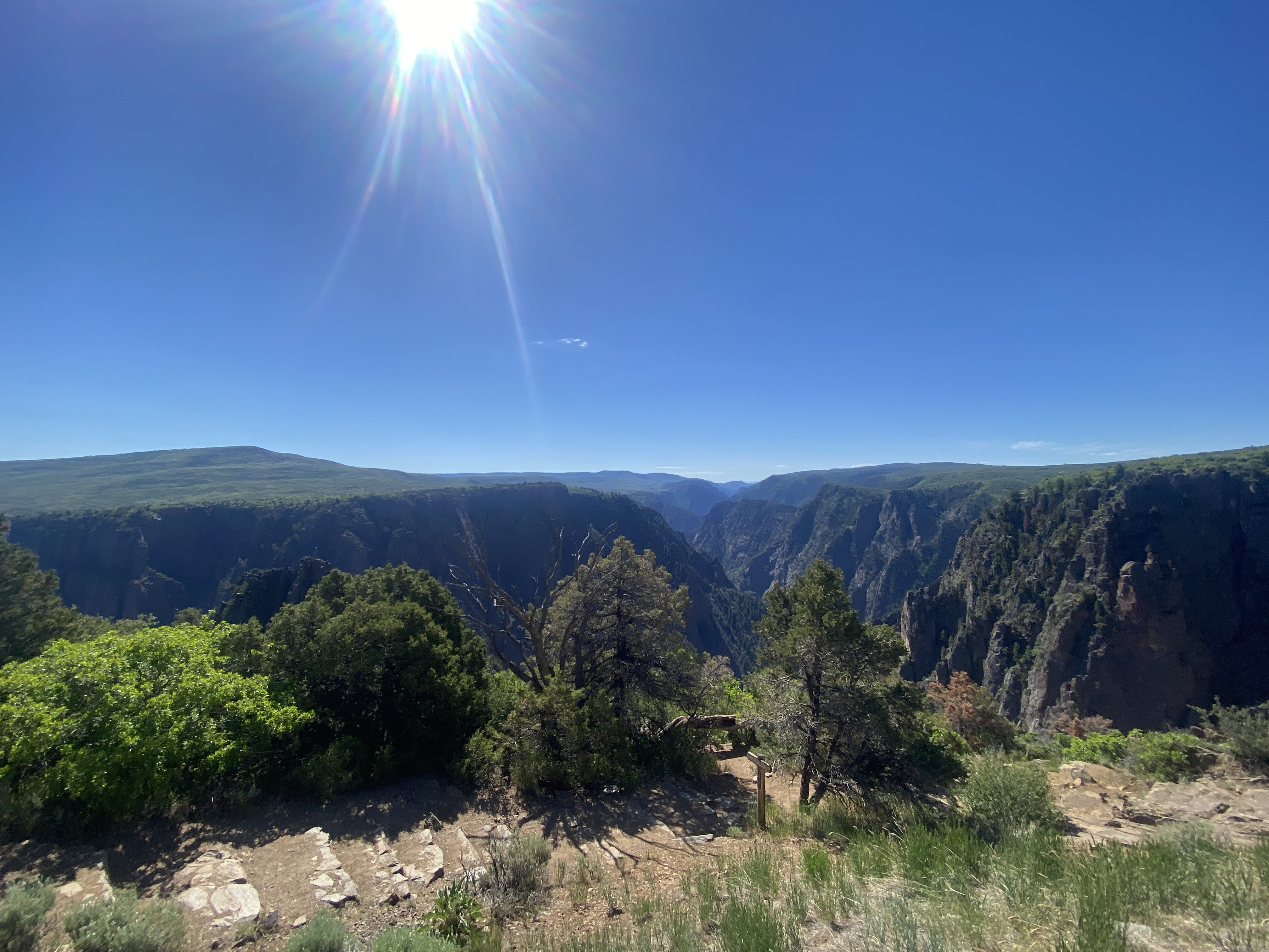
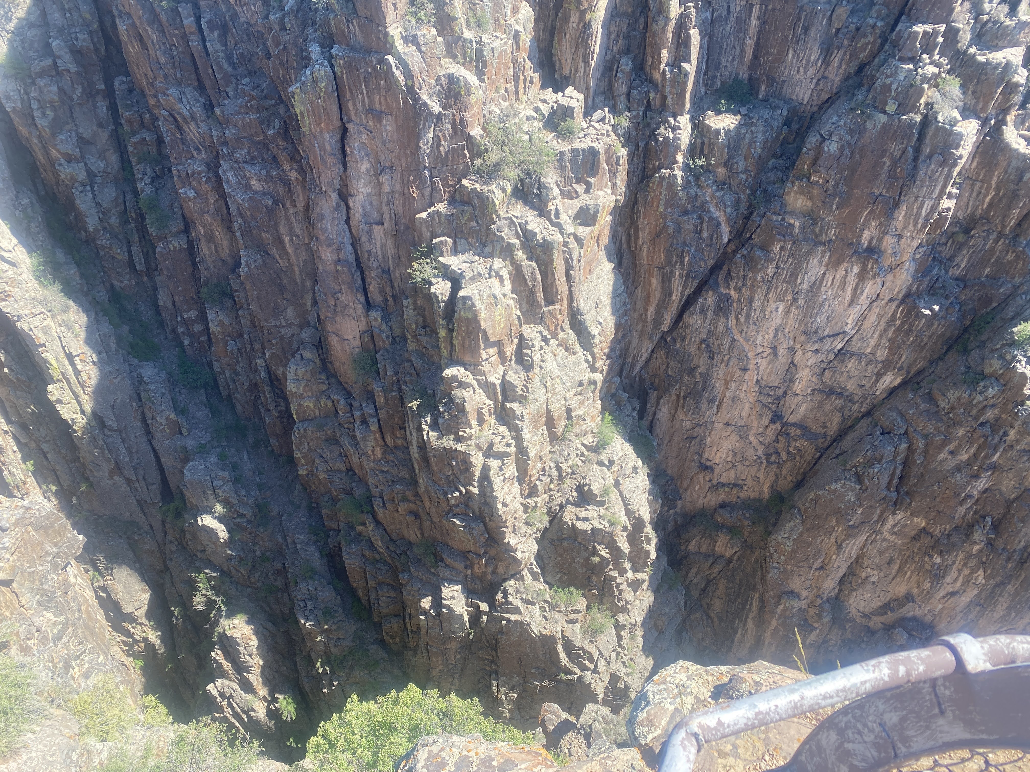
Outing of the day is Black Canyon, in the Gunnison National Park.
We drove west from the RV park, enjoying the quiet beauty of this area…
Our first hint of the awe-inspring cliffs of Black Canyon occurred just after entering the park….
Black Canyon of the Gunnison National Park is in western Colorado. It surrounds part of a deep, steep-walled gorge carved through Precambrian rock by the Gunnison River. Roads and trails along the north and south rims have views of the Black Canyon’s dramatic drops and the striated Painted Wall cliff. The winding East Portal Road descends to the river. Wildlife includes mule deer, elk and golden eagles.
Big enough to be overwhelming, still intimate enough to feel the pulse of time, Black Canyon exposes you to some of the steepest cliffs, oldest rock, and craggiest spires in North America. With two million years to work, the Gunnison River, along with the forces of weathering, has sculpted this vertical wilderness of rock, water, and sky.
John Williams Gunnison (born November 11, 1812 in Goshen, New Hampshire) attended Hopkinton Academy, where after one term, he went on to teach at the local school. During his years as a teacher, he prepared himself to enter West Point Military Academy. In June of 1837 he graduated second out of fifty.
Gunnison’s first sight of the western lands came as a member of the Captain Stansbury Utah Territory Expedition of 1849. Gunnison, having caught the exploration bug during his previous expeditions in Florida and Michigan, was thrilled to embark on this new adventure. Their task was to explore the route to the Mormon community in Utah.
The canyon has been a mighty barrier to humans. Only its rims, never the gorge, show evidence of human occupation – not even by Ute Indians living in the area since written history began.
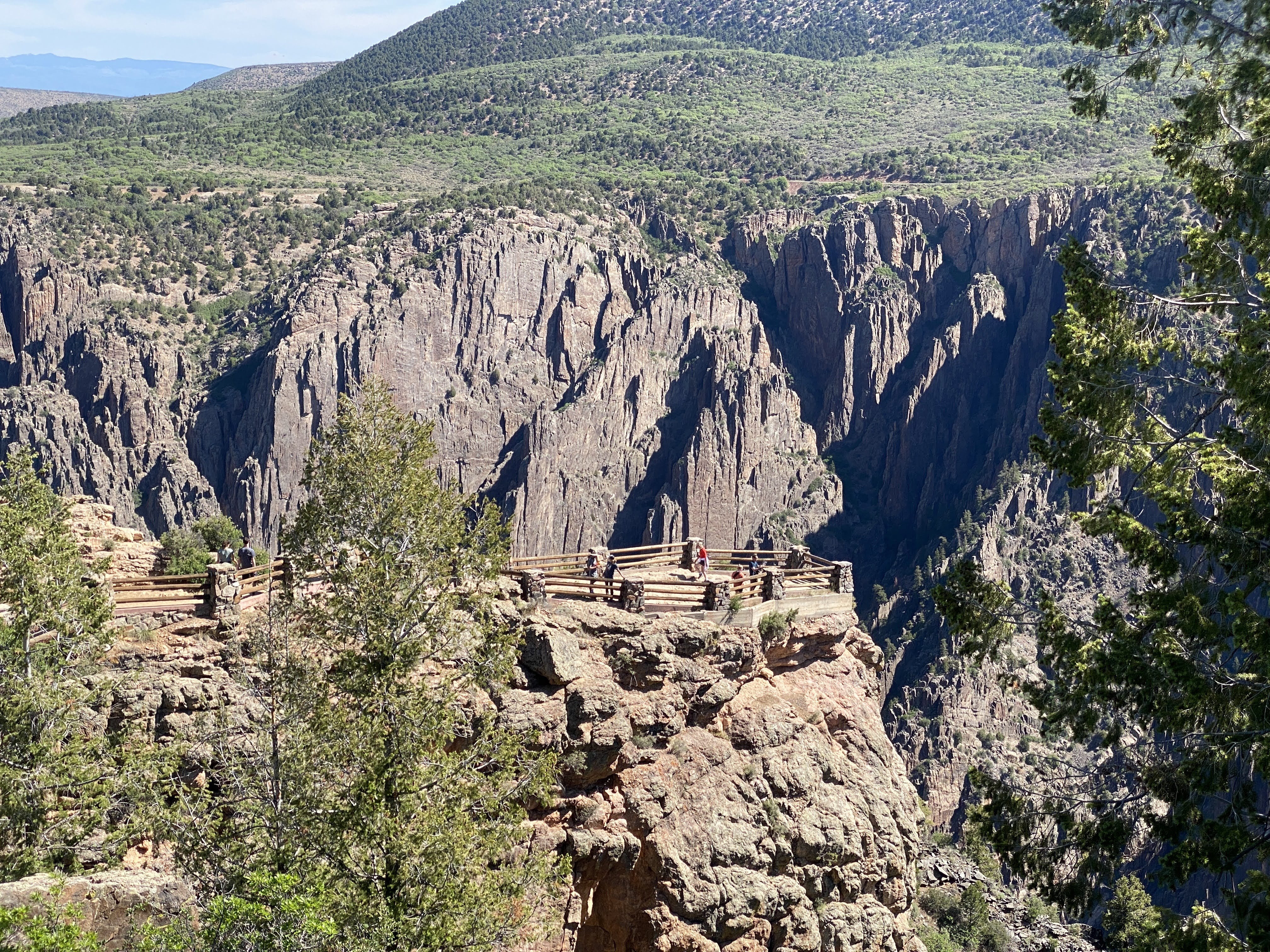
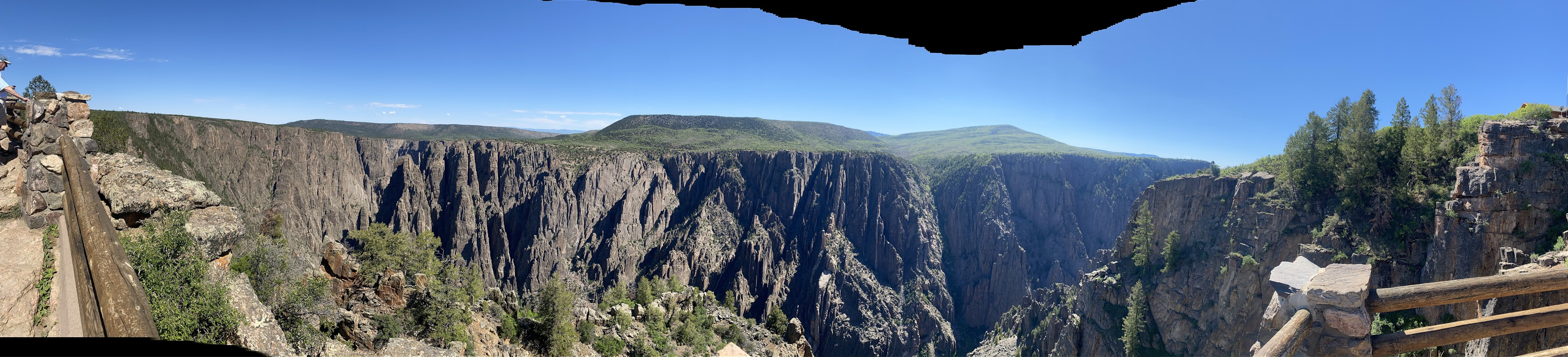
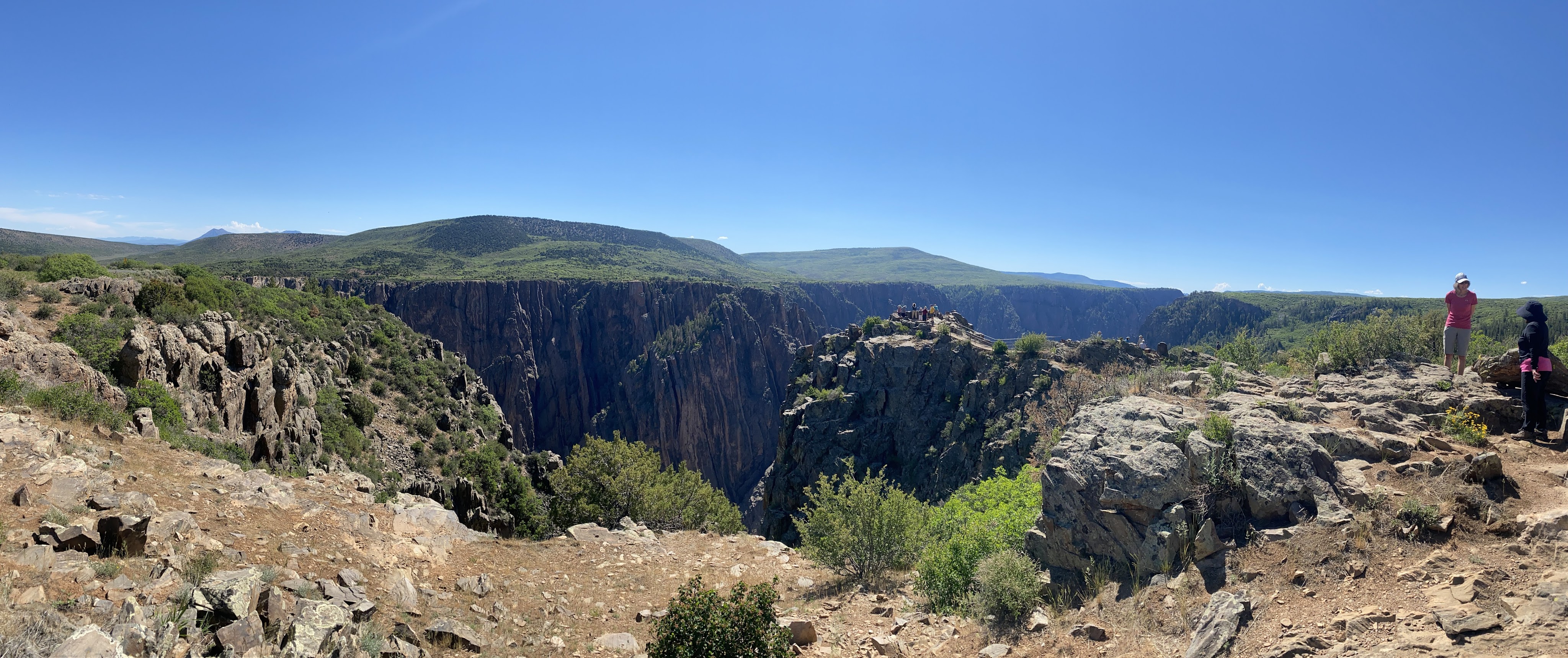
We drove the loop road along the south rim. There are turn-outs to park, then we can walk down to viewpoints…
What we are looking at here are Pegmatite Dikes, which form when water is separated from lava as these mountains are pushed up from the crust of the earth. The water is forced though fractures in the rock. The water then forms crystals, which in turn produces pegmatite dikes.
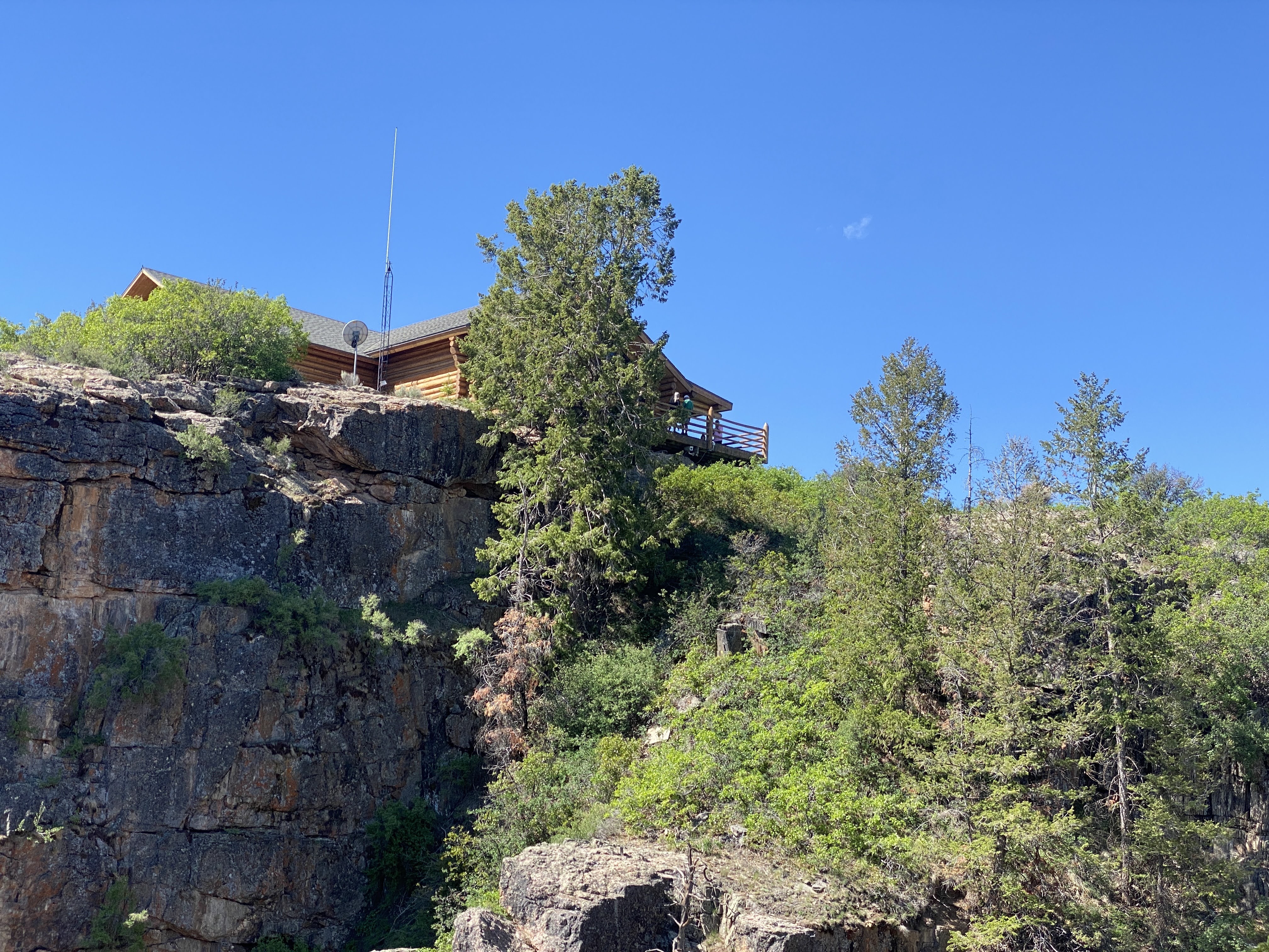
We are at the visitors Center, looking down at a viewpoint below…
Here we are at the look-out…
Above us is the Visitors Center…
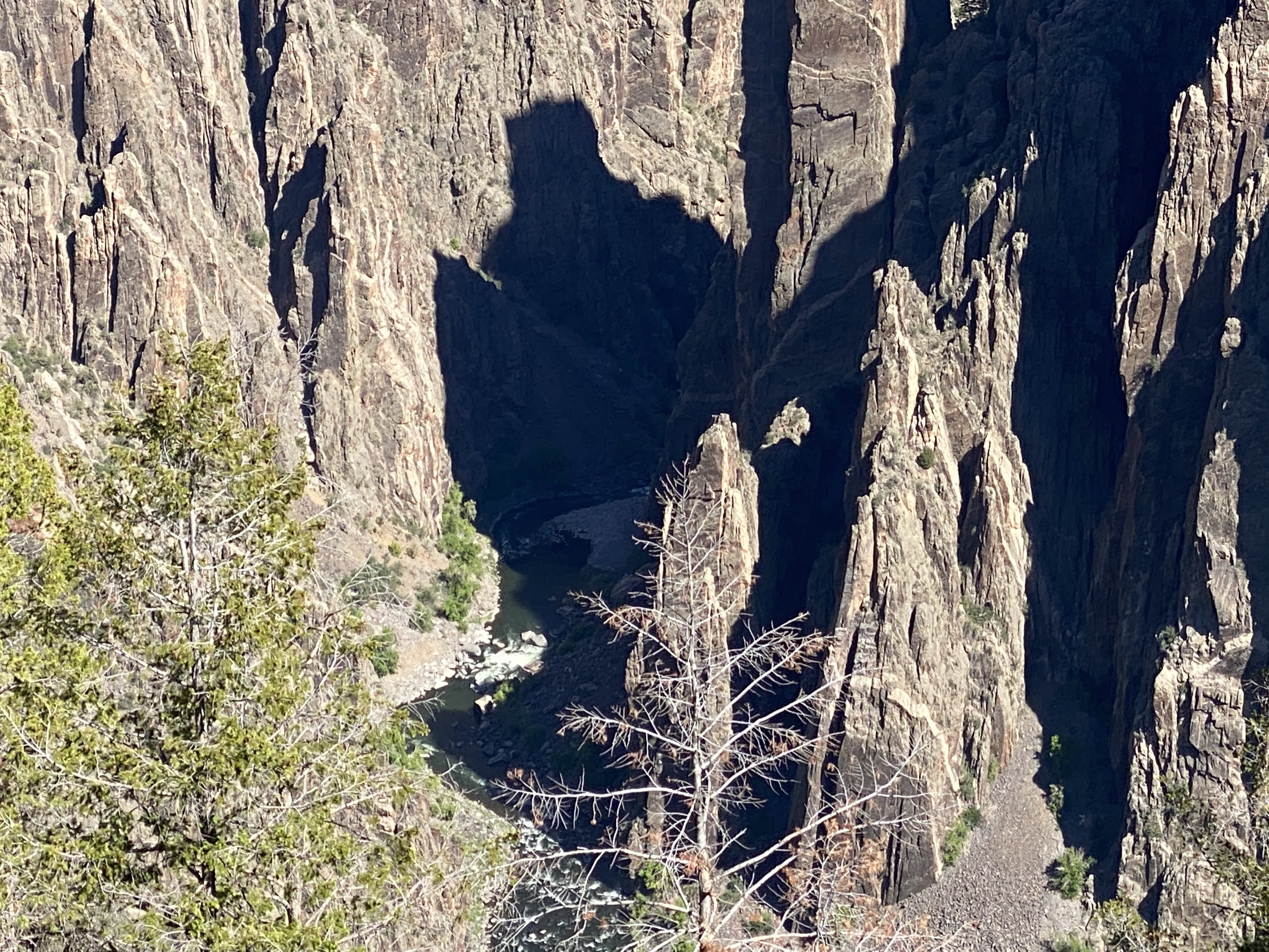
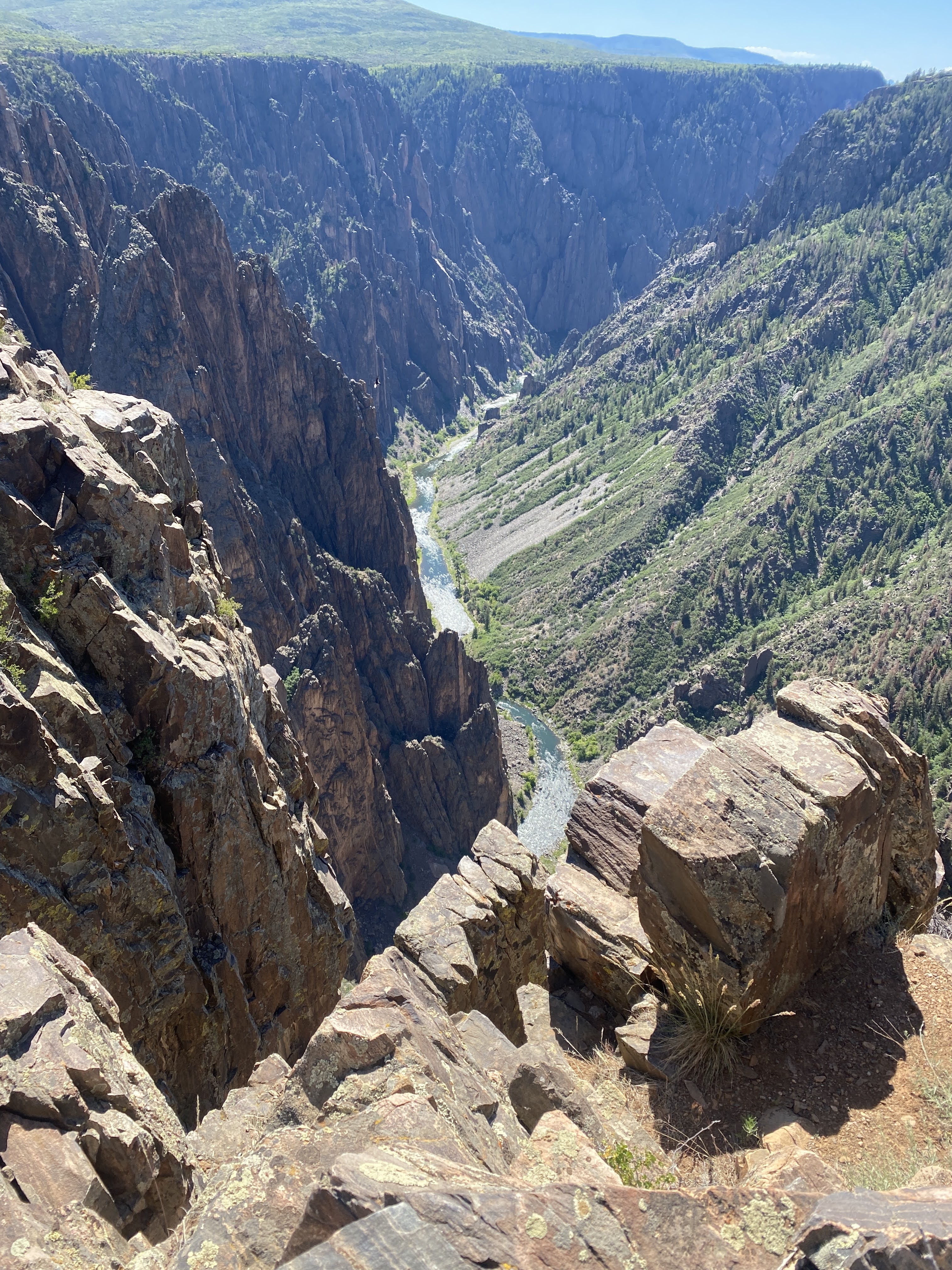
And below is the Gunnison River…
The Gunnison River has been carving this canyon for about 2,000 years…
This is Painted Wall… It is showing the striations of the different rock and crystals. Painted wall is the highest cliff in the park. It is 2,300 feet tall. If the Empire State Building were placed at the river below it would barely reach half way to the top…
Black Canyon is quite amazing in that everything is so close. It is only 48 miles long, 2,700′ deep, and 1,300′ wide at the top (40′ at the narrowest point at the bottom). In comparison, the Grand Canyon is 277 miles long, 18 miles wide, and one mile deep!
After our amazing visit to Black Canyon, I had to write about it… We drove to Gunnison and found a coffee shop with internet access…
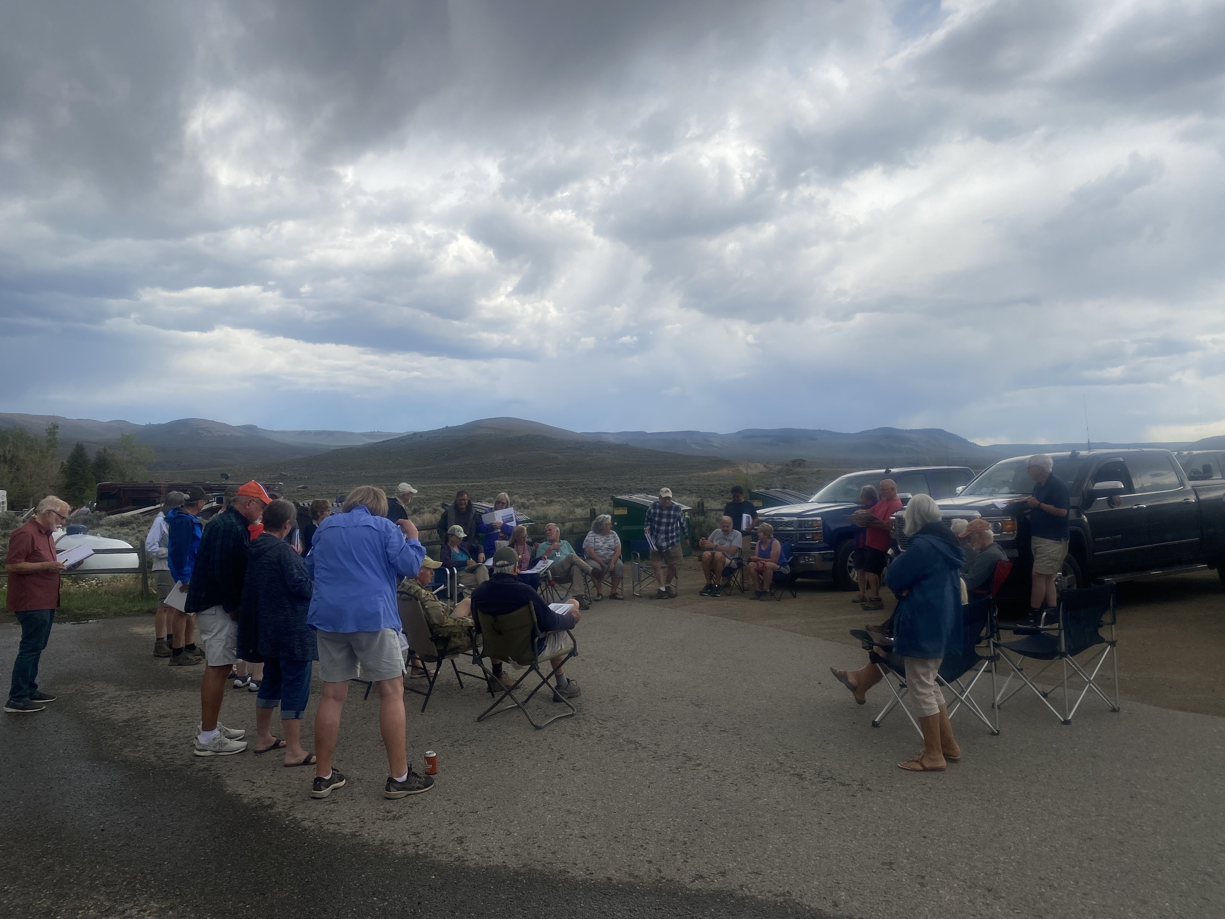
After about 3 hours of work, we returned to the Villa. Tonight is the obligatory drivers meeting. Tomorrow we drive to Fruita, CO…
So this is what you see when you head north on the 15 out of Las Vegas… We left a little before 9:00 am, fueled up at the Loves truck stop, and hit the road. We will stay on the 15 for 270 miles today…
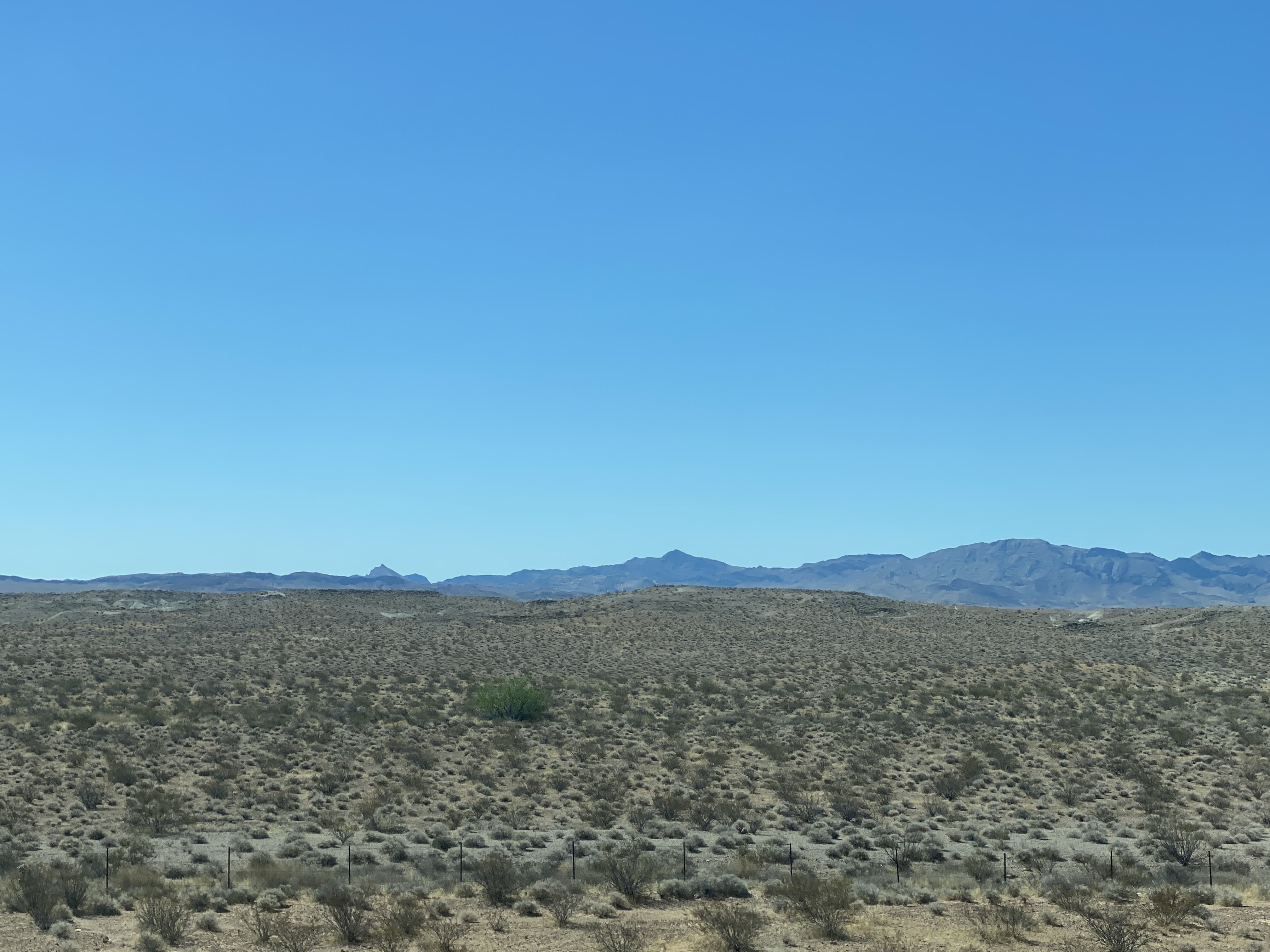
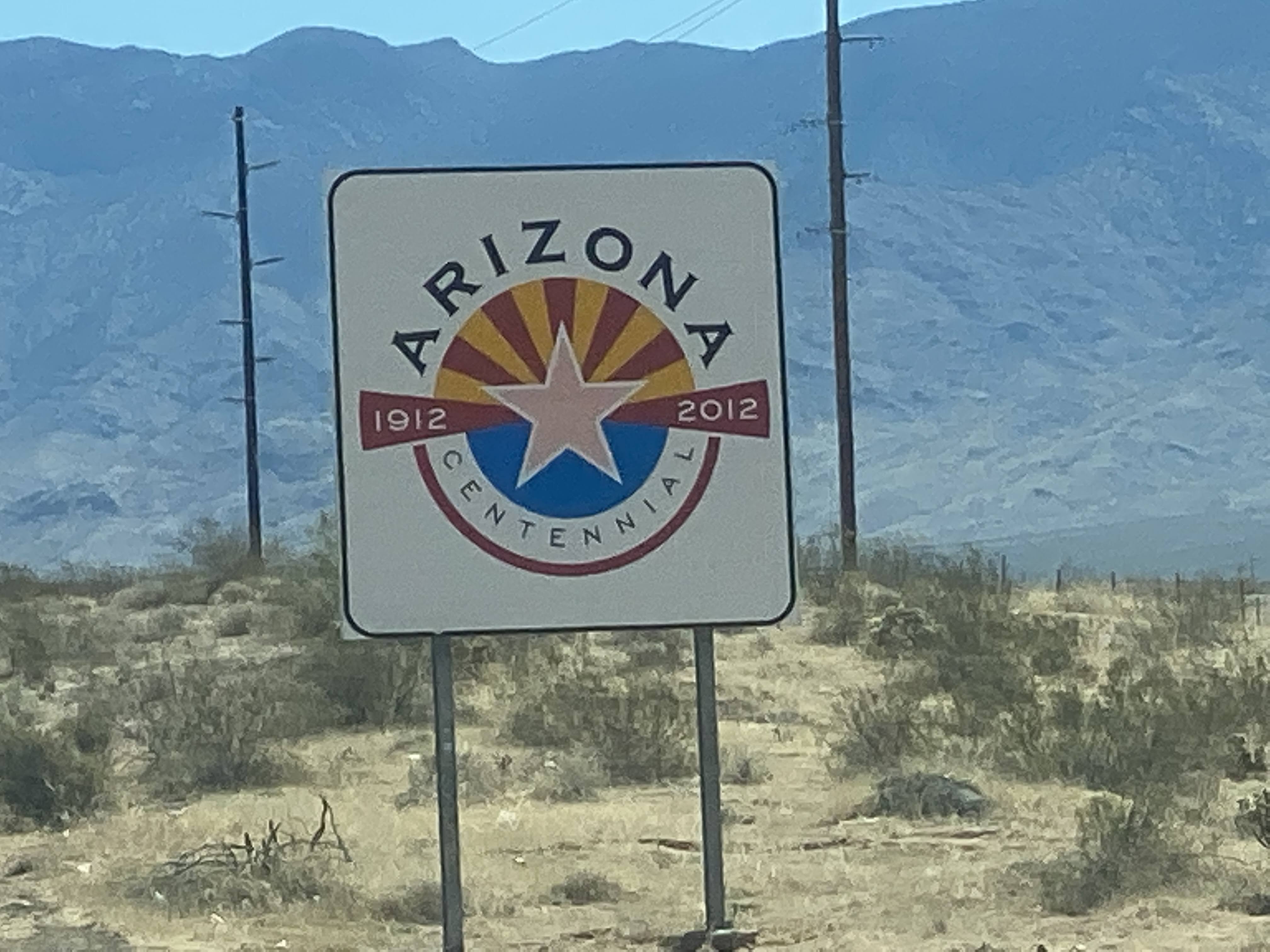
After an hour or so we entered Arizona. We were in Arizona for less than an hour, making a diagonal across a corner of the Arizona Strip. We had learned about the Arizona Strip in 2018 while we were on the Southwest Adventure caravan. TheArizona Strip is the part of Arizona lying north of the Colorado River and the Grand Canyon. The difficulty of crossing the Grand Canyon causes this region to have more physical and cultural connections with southern Utah and Nevada than with the rest of Arizona. It really ought to be part of Utah. It covers almost 8,000 square miles, and it is virtually uninhabited, with absolutely no cellular service. If you want to drive some of the few wilderness roads you are advised to bring a tent, firewood, and food and water for 3 days. If you breakdown, you won’t be found for 3 days…
And then we were in Utah. One of the few cities in southern Utah is St. George. We stopped for lunch at a “Culvers”, a first for us… We were able to stretch our legs and have a nice break… Parking was a little rough…
After lunch we continued north and northeast…
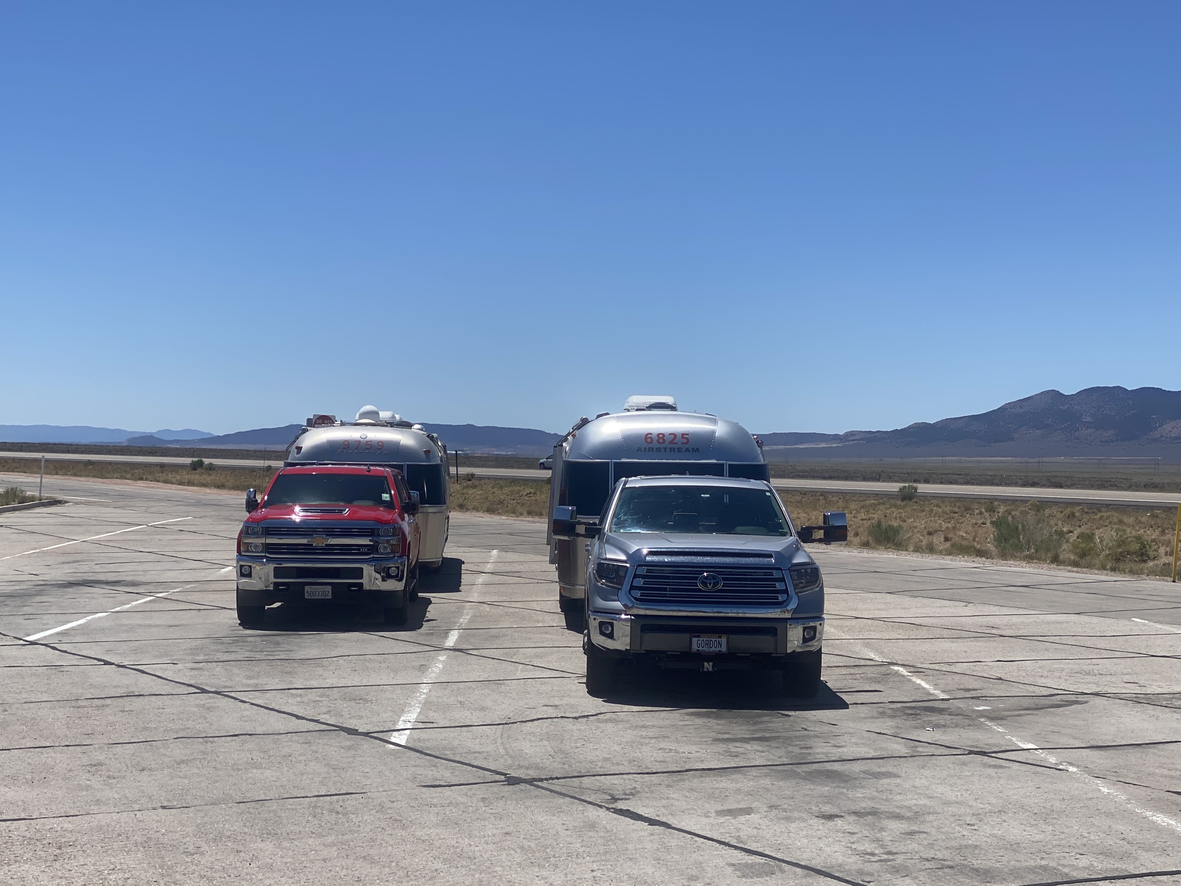
We are traveling with fellow Airstreamers and fellow Caravaners from Nebraska, Gordon and Debbie Opp. Today was their turn to lead… We are driving through these small hills on the valley floor. The topography is constantly changing, from meadows and grass to hills and rocks…
Here’s a new sight for us:
We actually saw a sign warning of a curve ahead, saying, “Slow 70″…
Best part is that there is no special 55 MPH limit for vehicles towing trailers! We stopped for a mid-afternoon leg stretch at a rest stop…
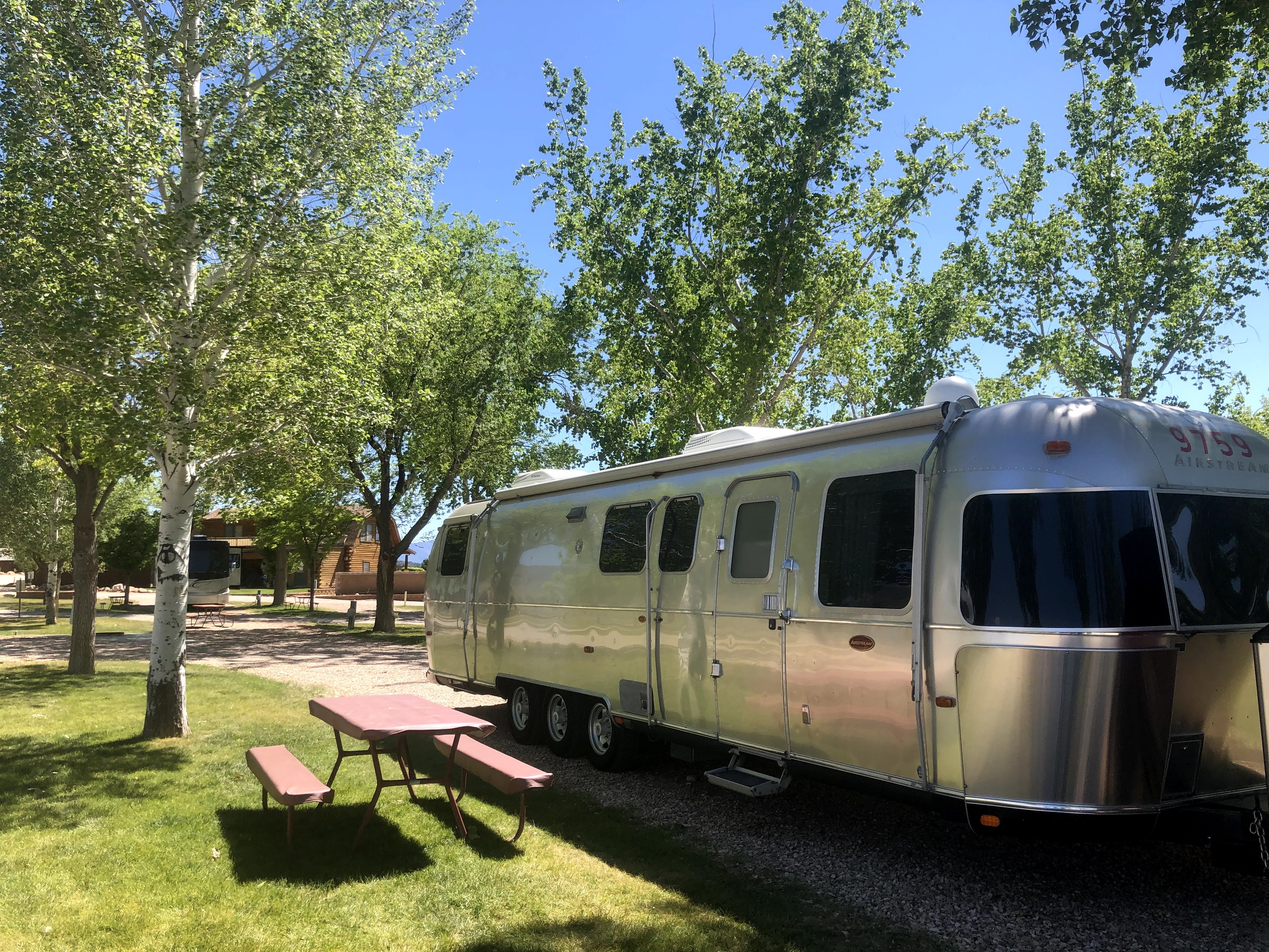
We arrived in the outskirts of Fillmore, and easily found the KOA. Beautiful, quiet park, lovely trees; it is is surrounded by grassy meadows overlooking the surrounding hills…
Along with us and the Opps, there was another Airstream in the park, but we were unable to meet them.
We enjoyed happy hours (with my signature Old Fashioneds) and a nice dinner of chicken Caesar salad…
But we are continuing on tomorrow, and we just realized that Utah is in Mountain Time Zone! We lost an hour somewhere along the road. So we turned in early. And an enjoyable time was had by all…
Today we once again traveled into the green hills of Kentucky; all around us is the Daniel Boone National Forest. We are headed to the State Park to see the Cumberland Falls and the Dupont Lodge…
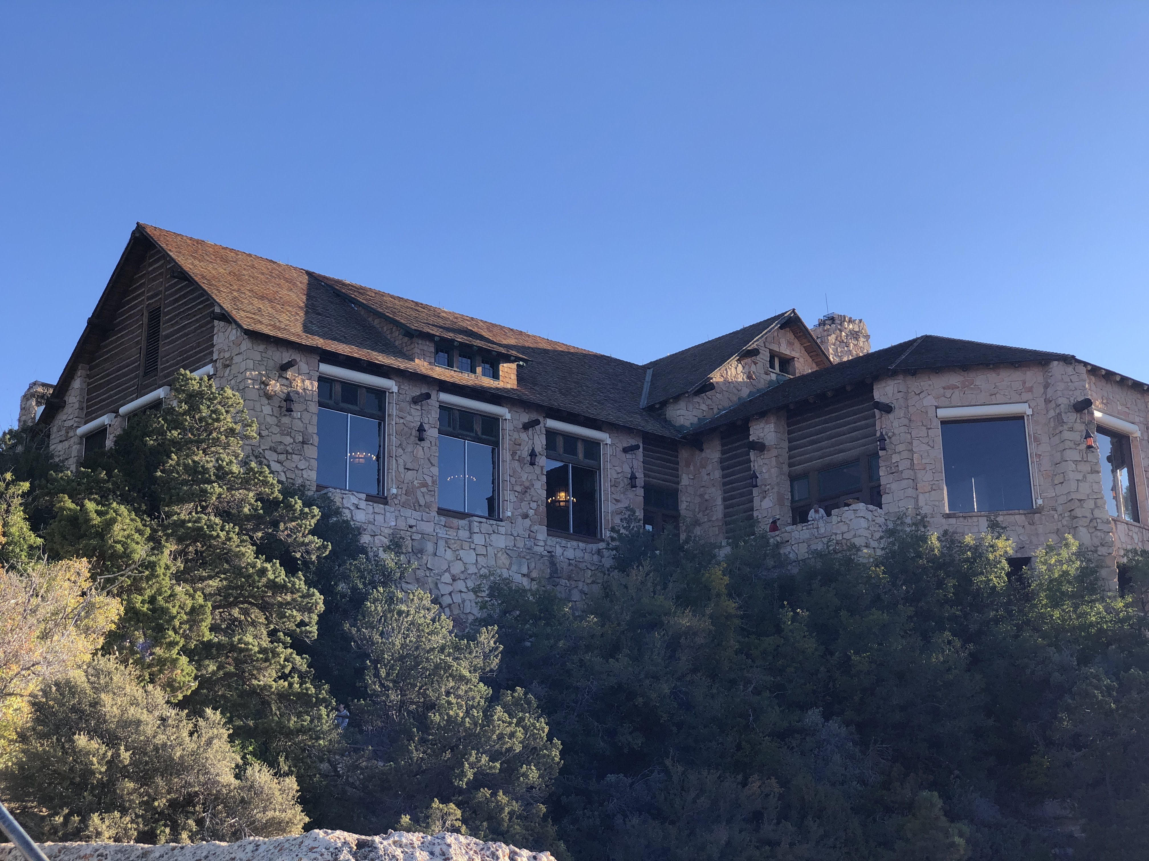
It was a lovely lodge. Not as nice as the Grand Canyon North Rim Lodge, but still nice…
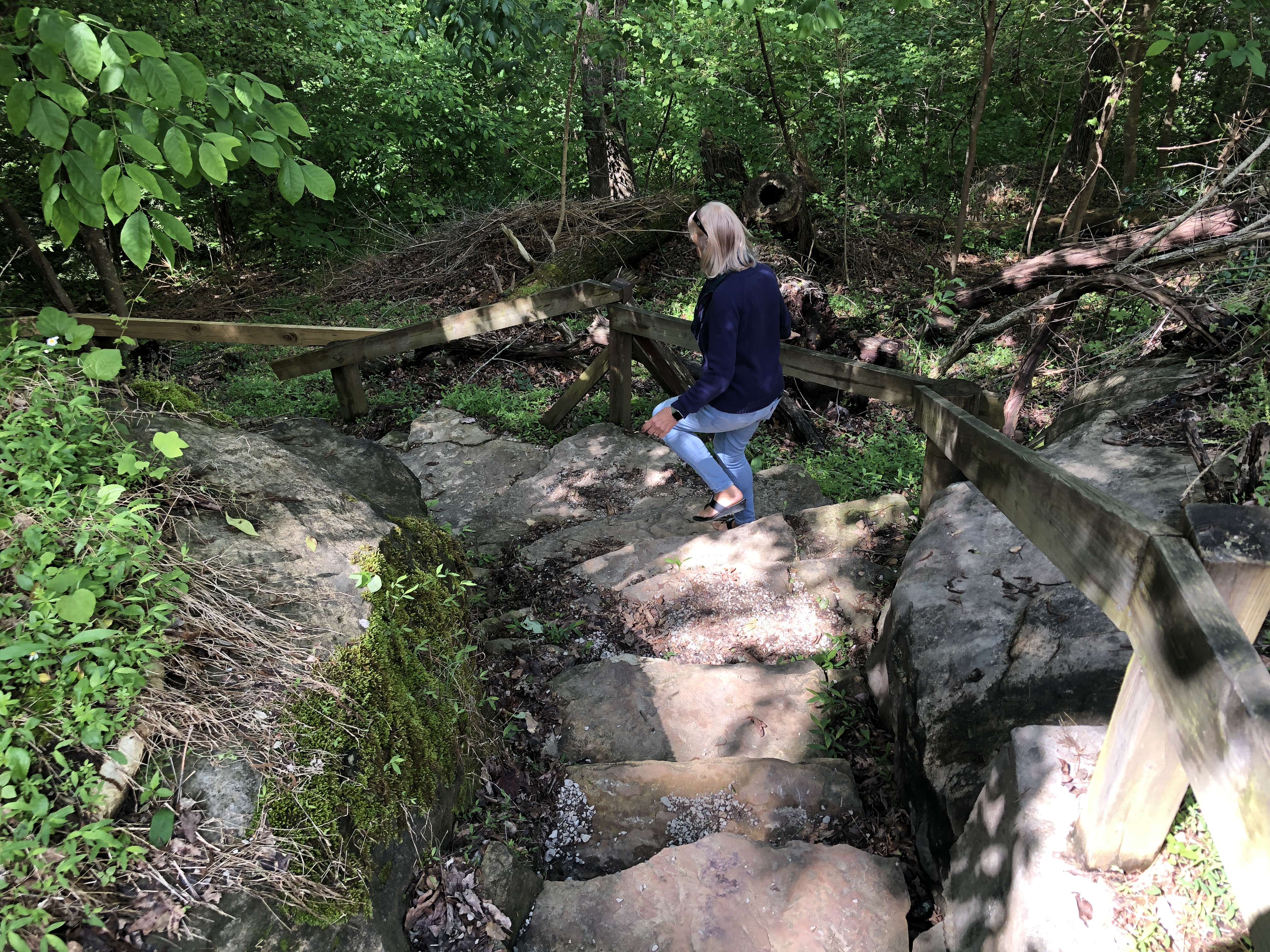
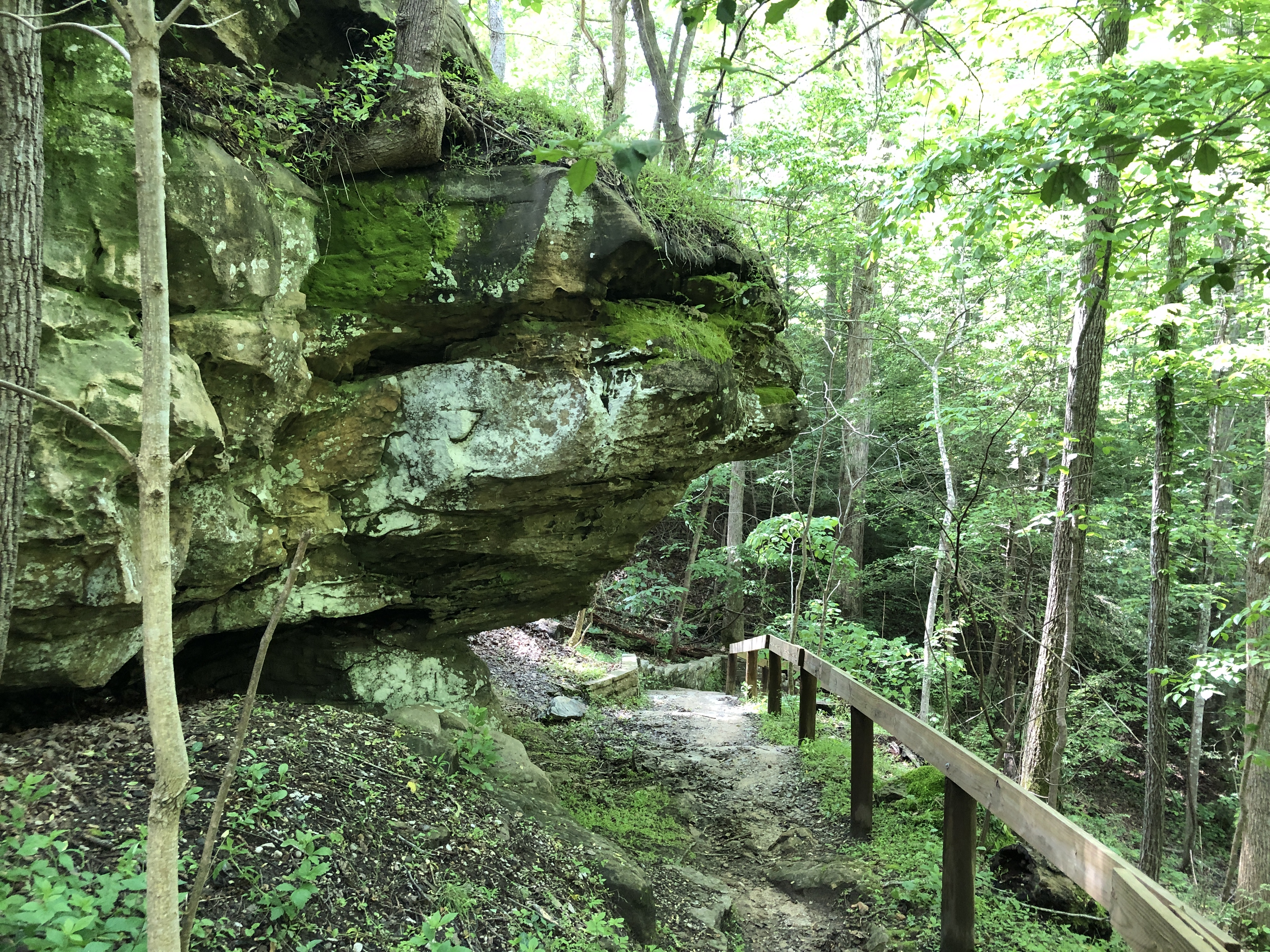
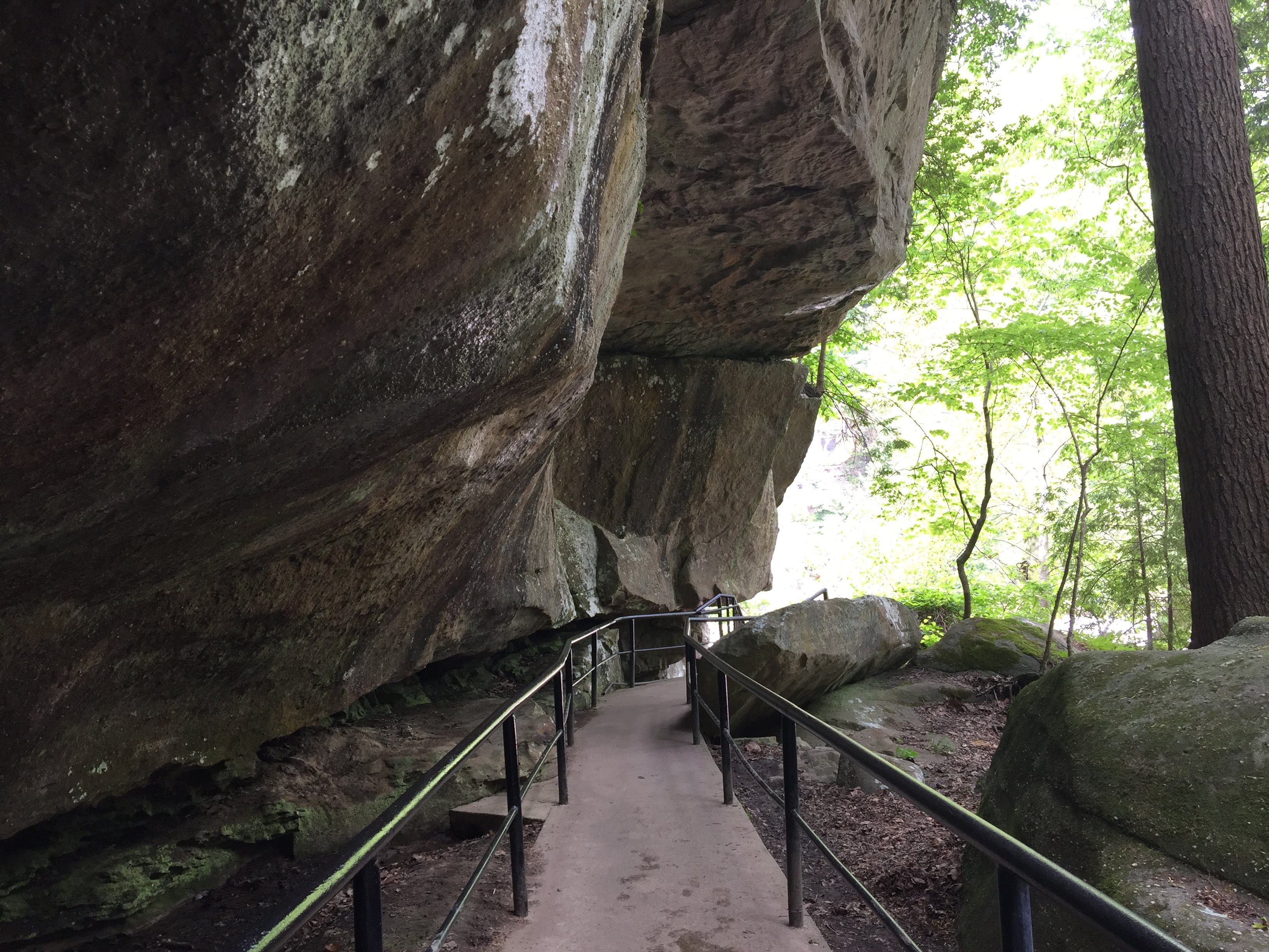
But before we could enjoy the lodge we walked 3/4 mile to the falls. The path was wet, but fairly easy; there is a 270′ elevation change walking down to the falls…
We could see the highway bridge over the Cumberland River far below…
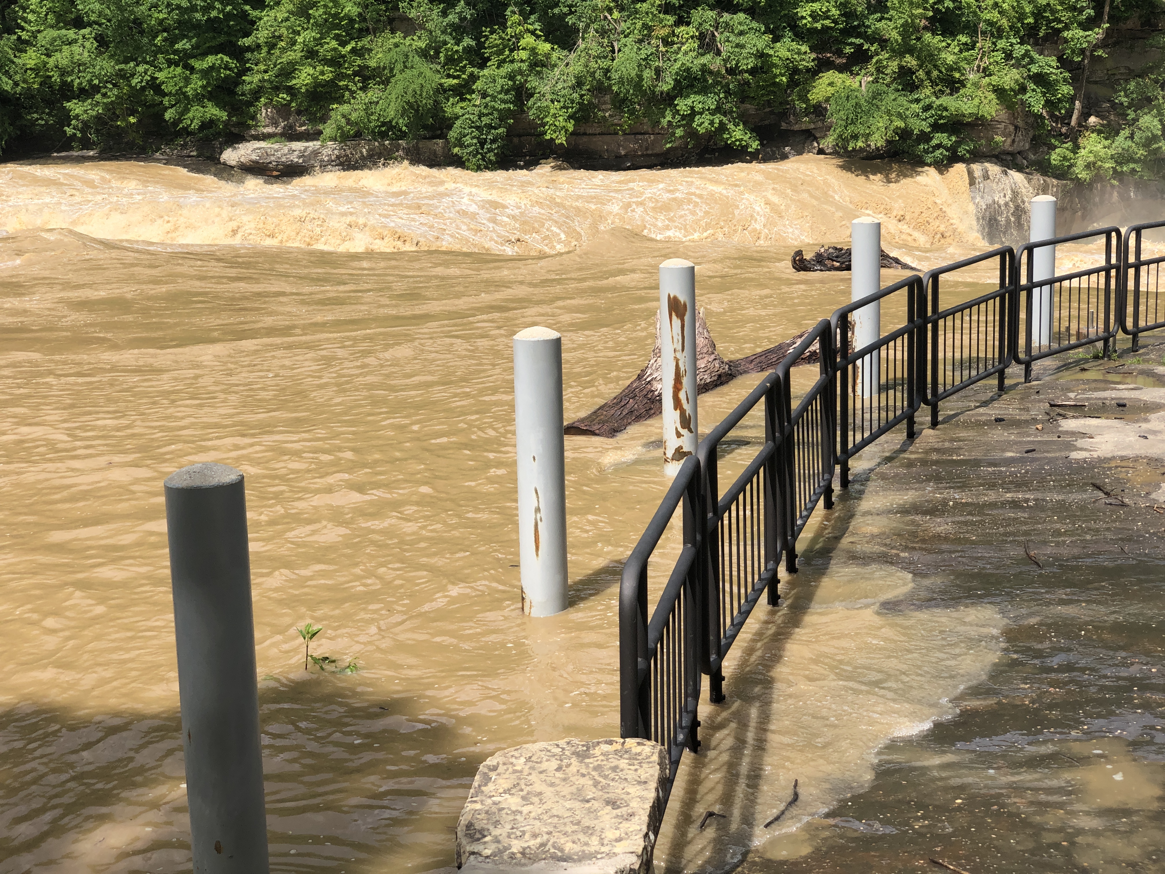
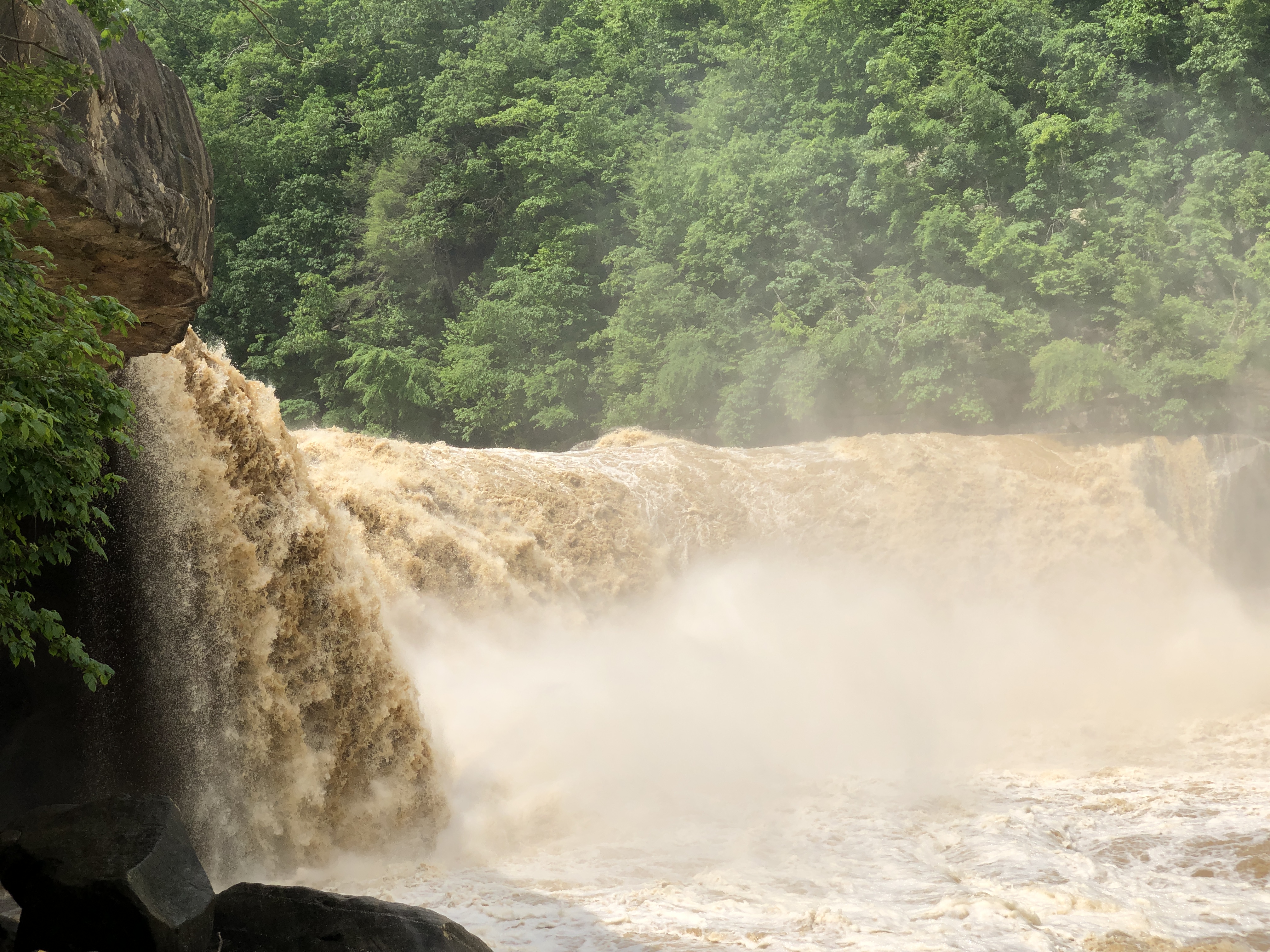
The raging river was lapping over this walkway… There is about 10 times the normal water flow today due to melting snow up north and the recent rains locally… (thus, the muddy appearance…)
We finally arrived at the falls… They were great!
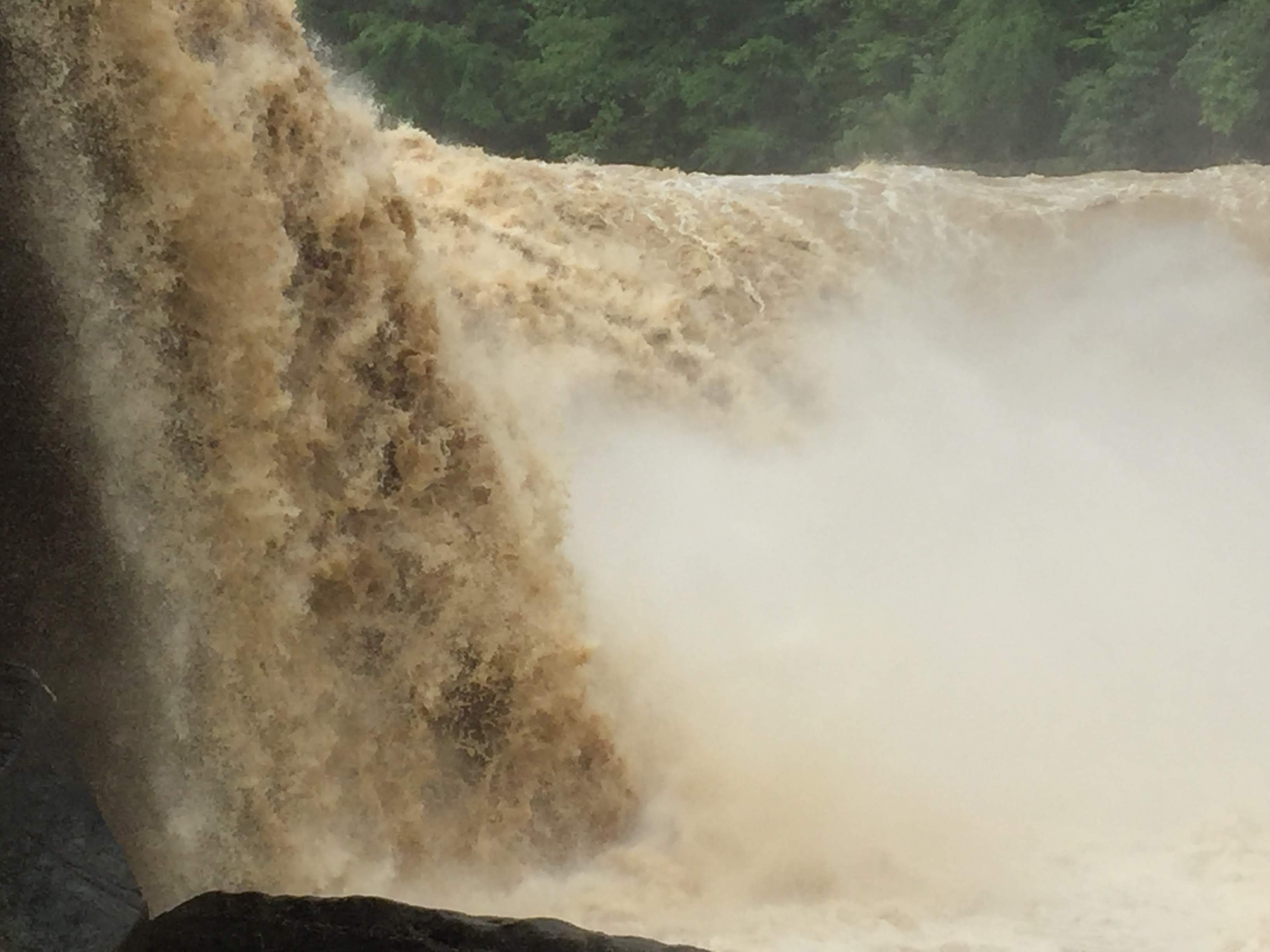
We went down below for a closer view…
Did you know that over 280 people die each year taking selfies in dangerous locations?
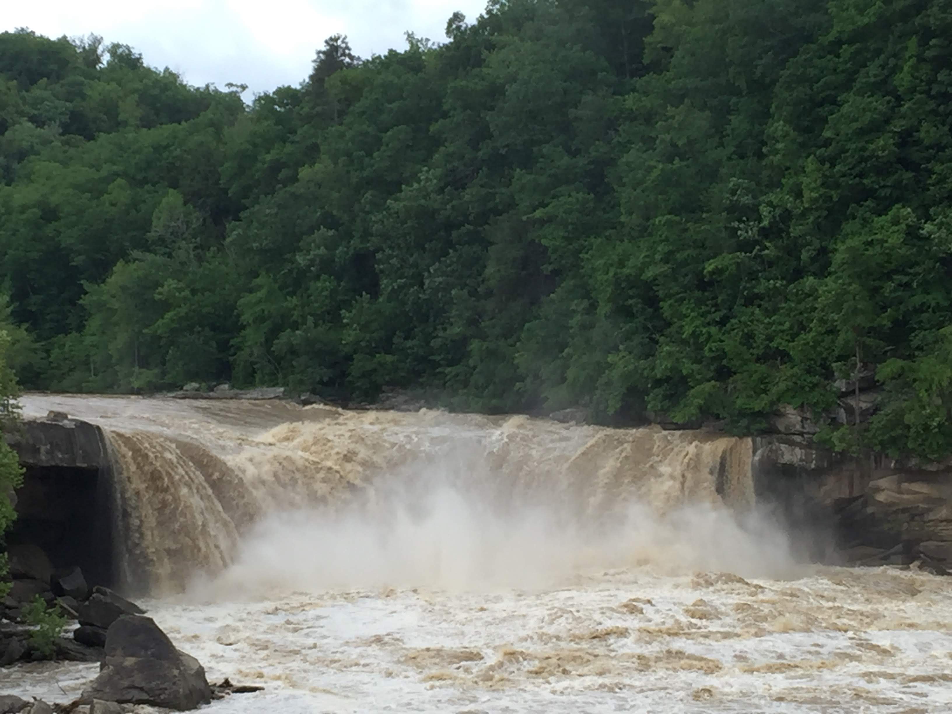
Further downstream we got a wider view…
And then it was time to walk back up… But by now we were even further down. We walked up 66 steps, then up the 270′ rise on the 3/4 mile path back up to the lodge…
And then we sat down…
Soon it was time for lunch…
The food was decent and the view was great!
We returned to the campground. We stopped along the way for Lynda to get her hair cut, and we took the truck to the local Chevy dealer for an oil change.
We had an “Open House” so that we could peak into all the other Airstreams; this gave way to Happy Hours…
We had an uneventful drive from Grand Canyon, back to Jacob Lake, and on towards Lake Powell, just outside Page, AZ.
As we left the grand canyon National Park we had a few more glances of the canyon…
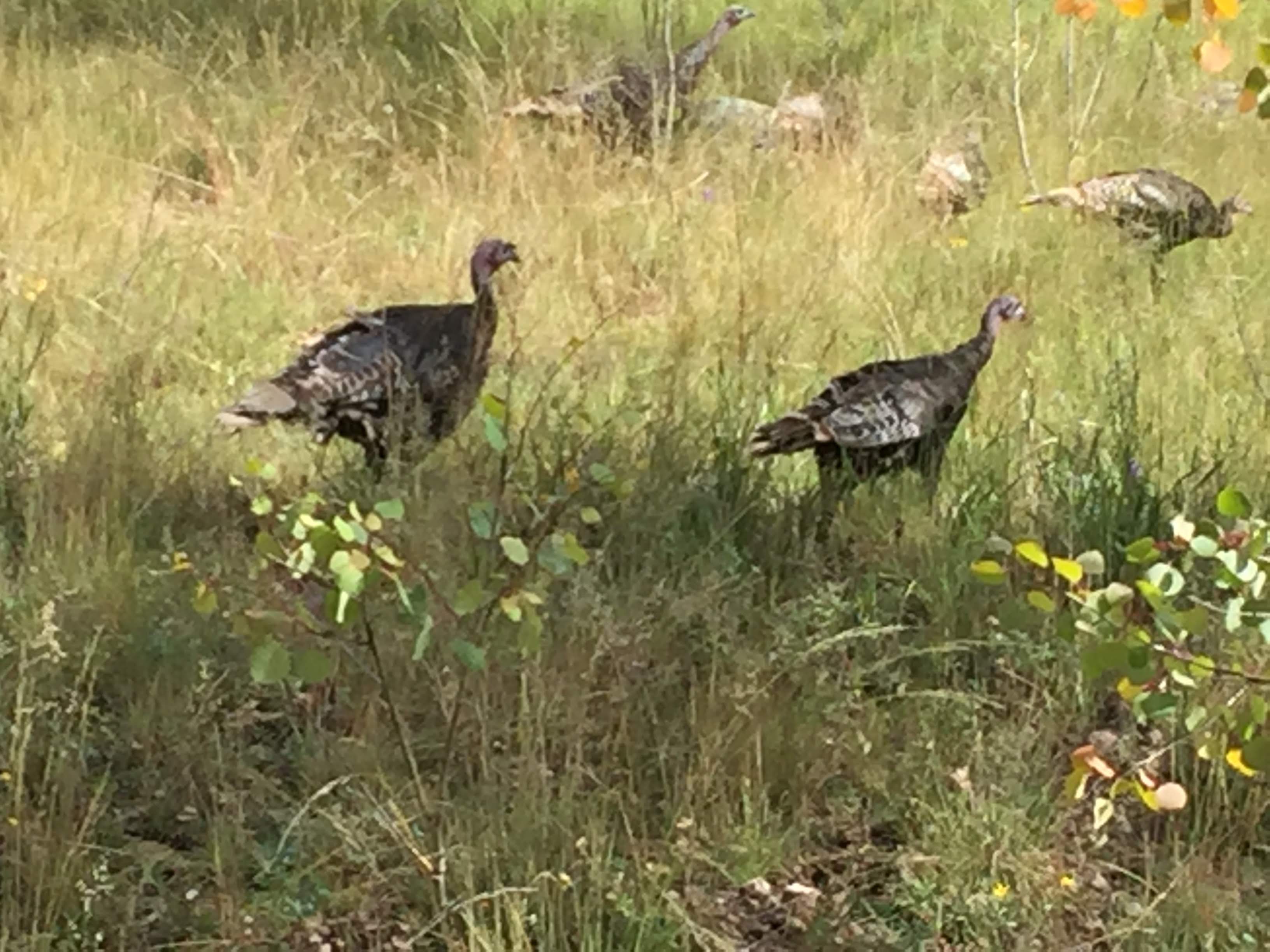
As we neared the exit to the park we saw some wild turkeys…
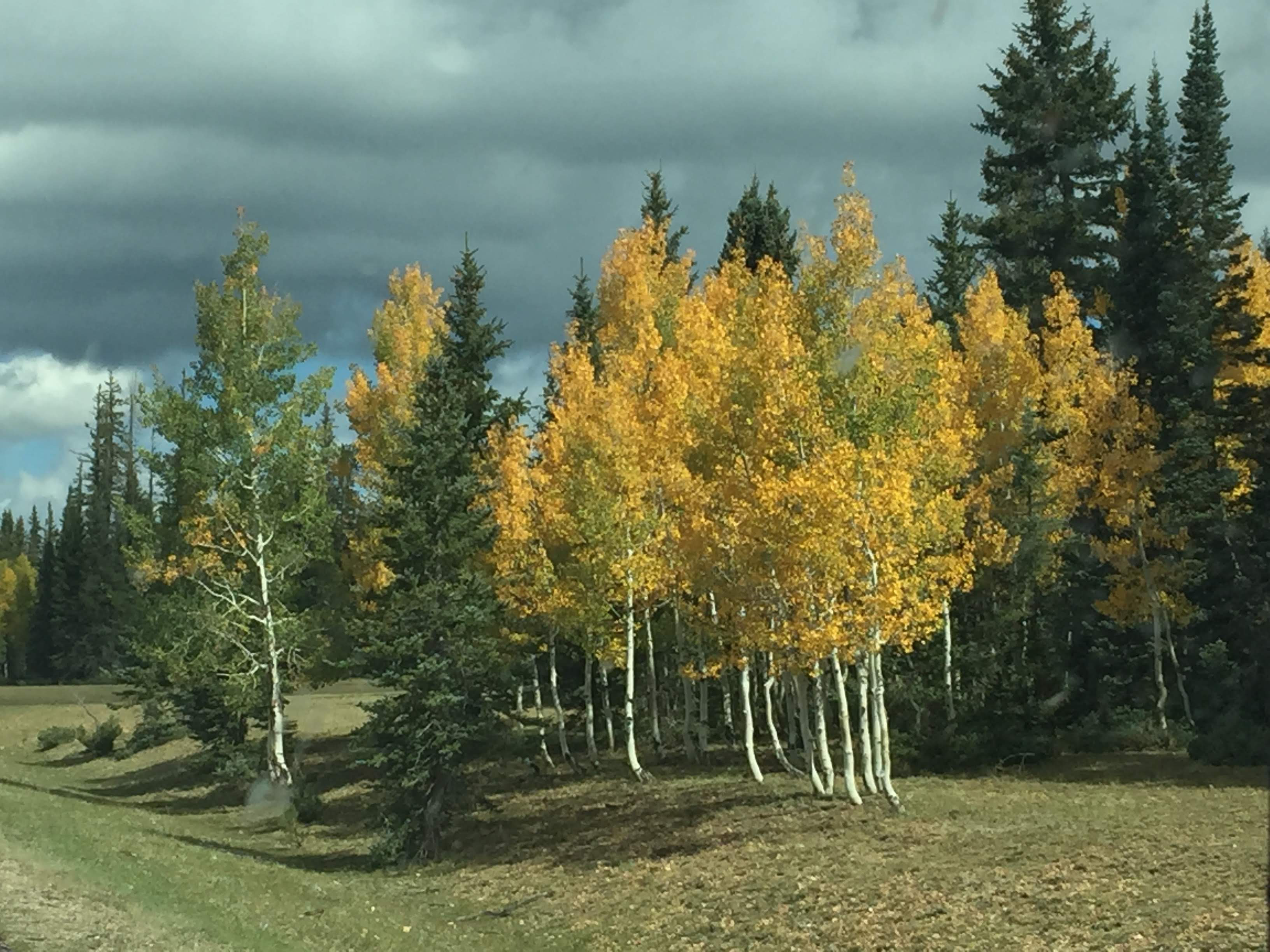
More Aspen showing their fall colors…
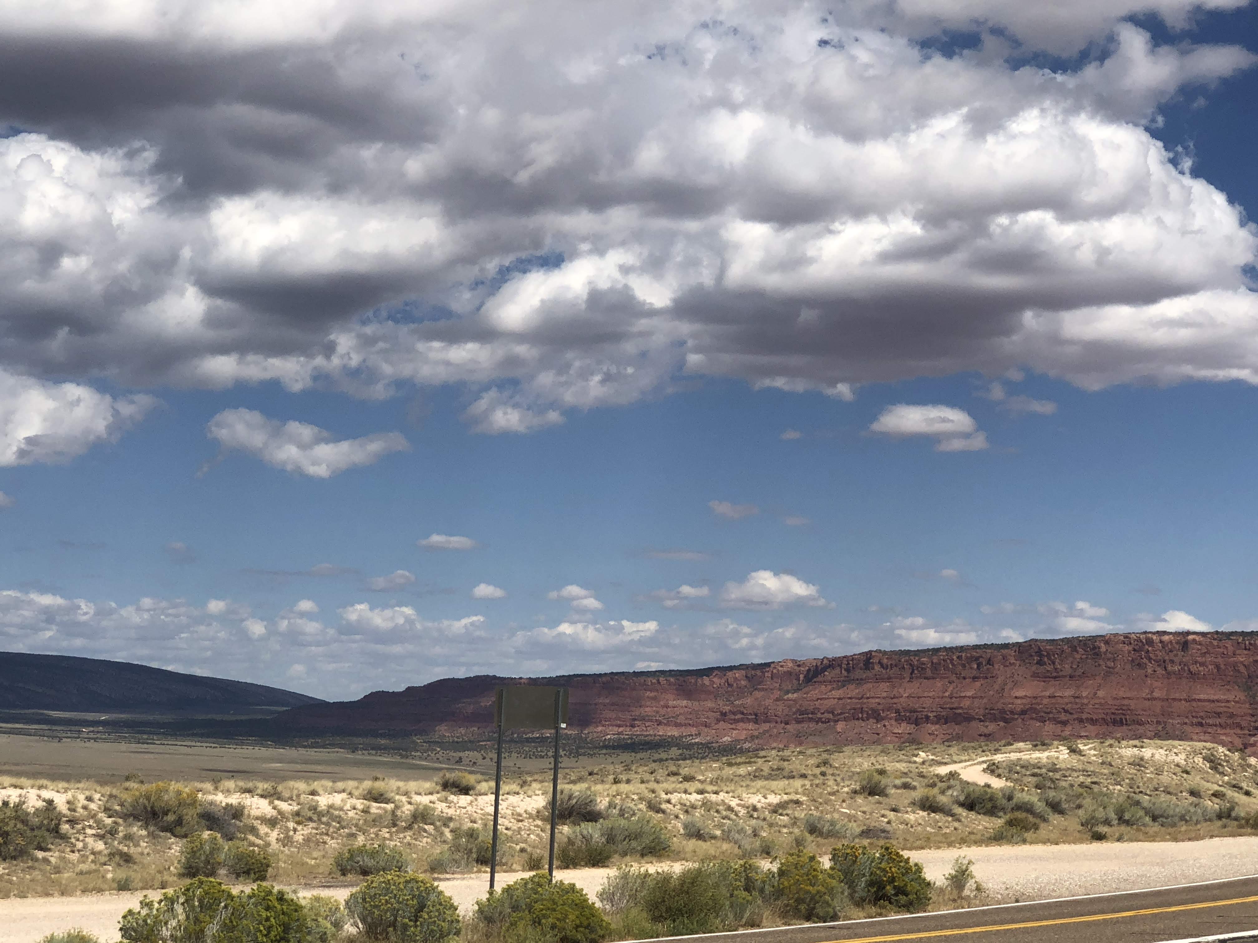
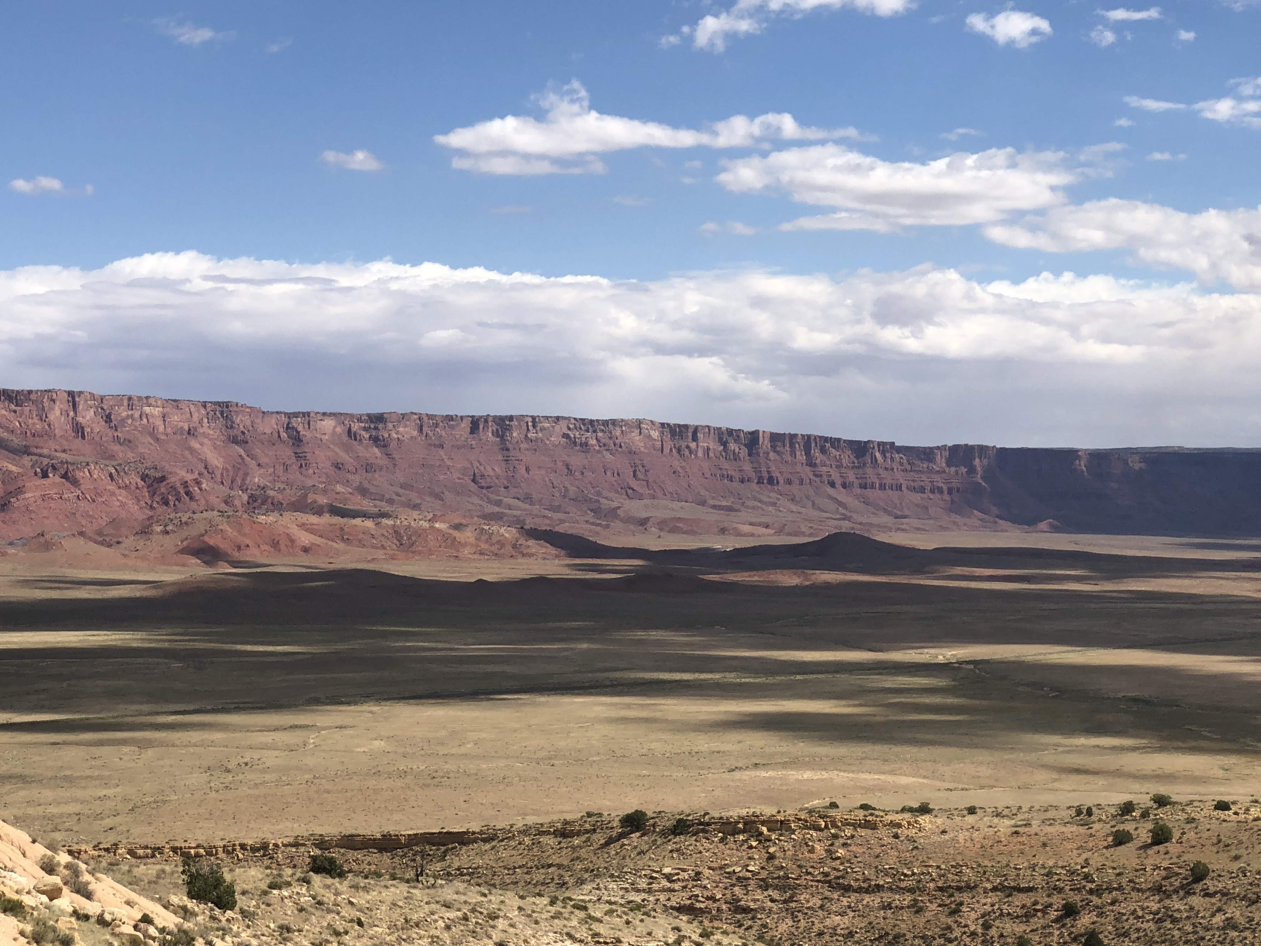
We were soon down in the valley, traveling towards Vermilion Cliffs National Monument…
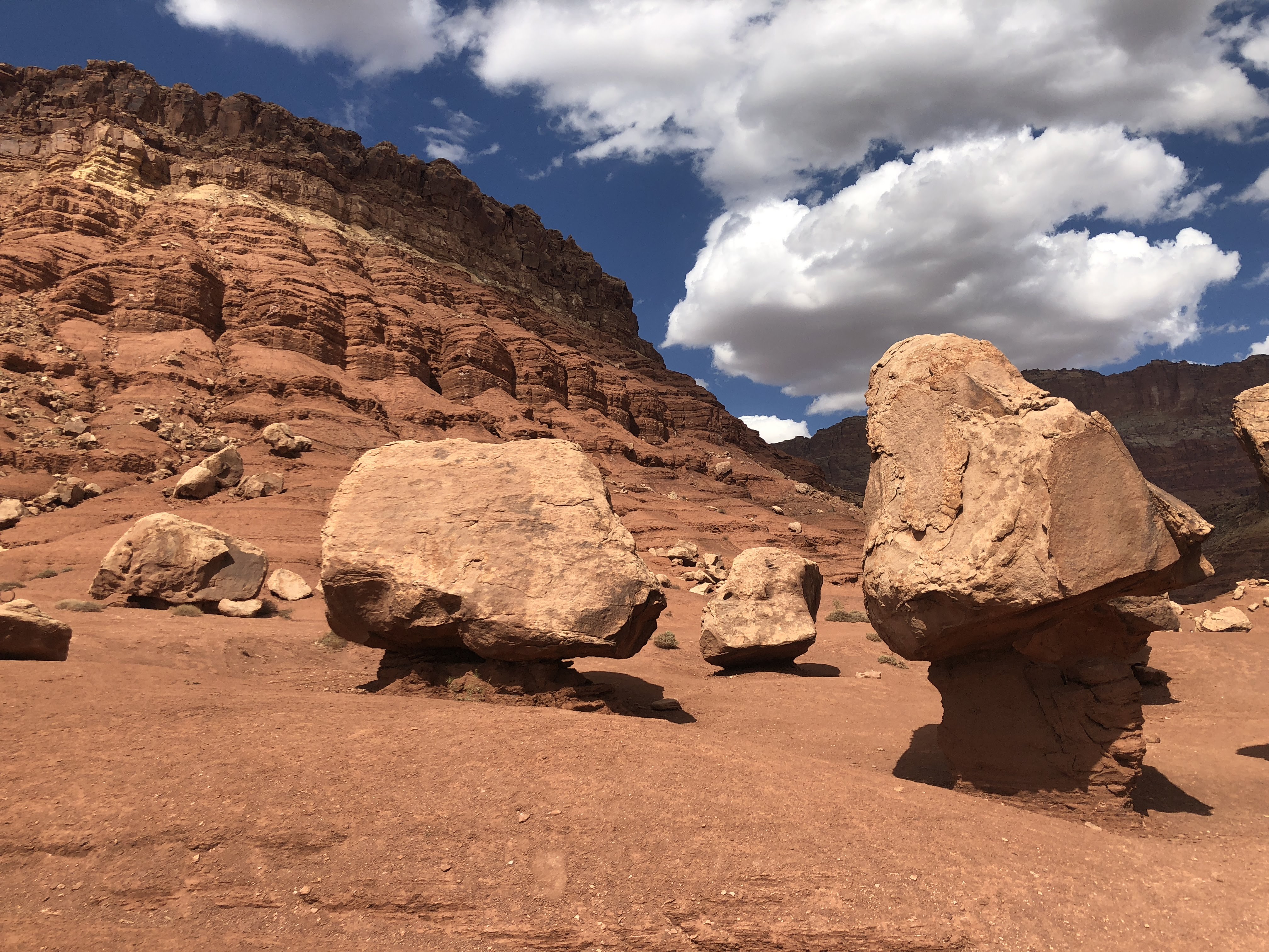
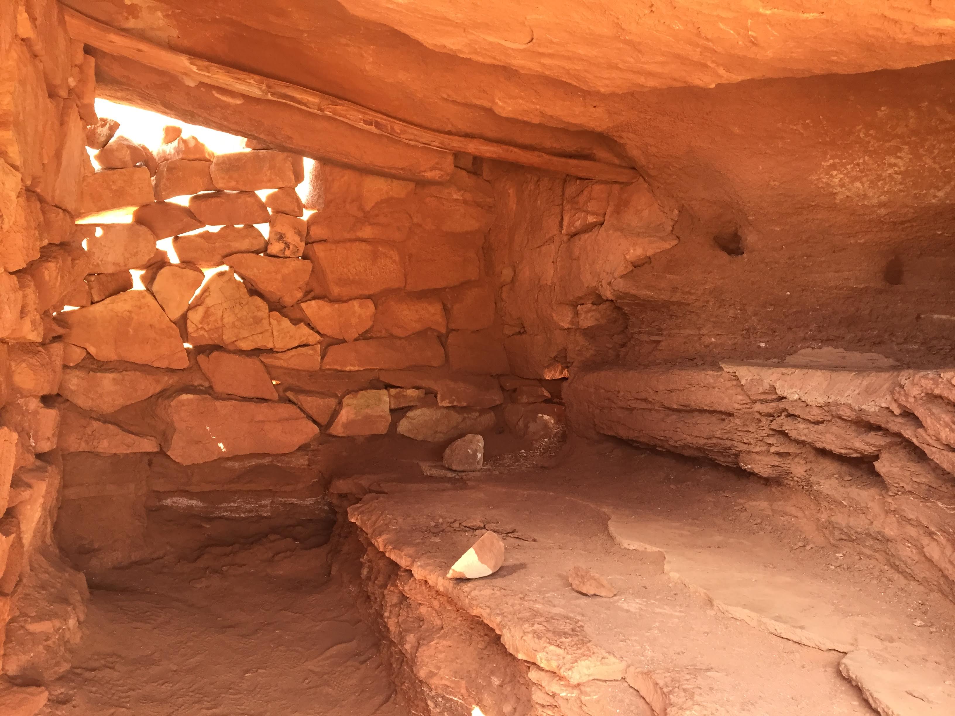
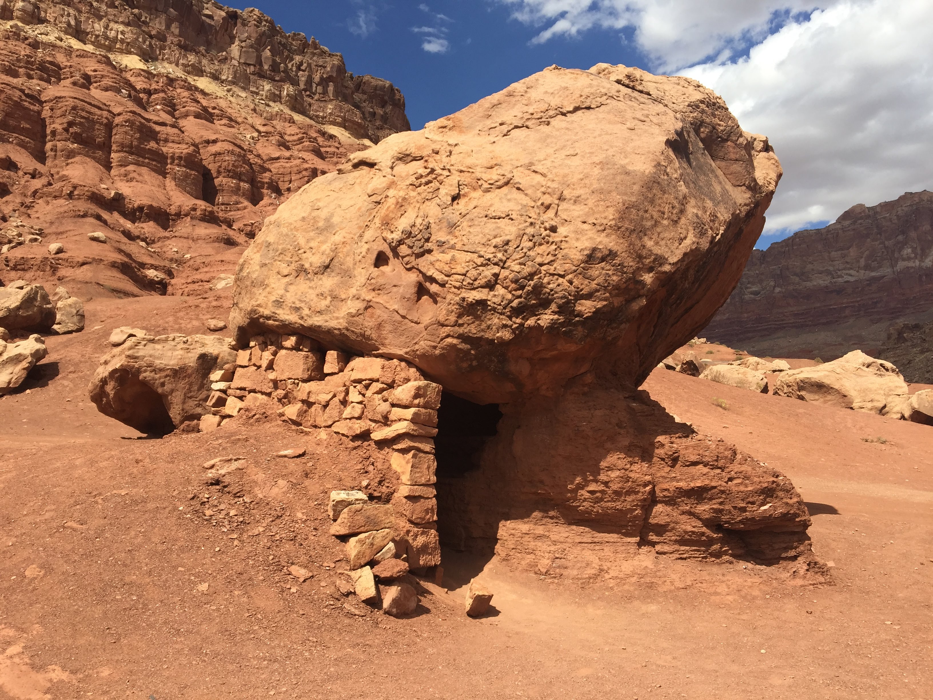
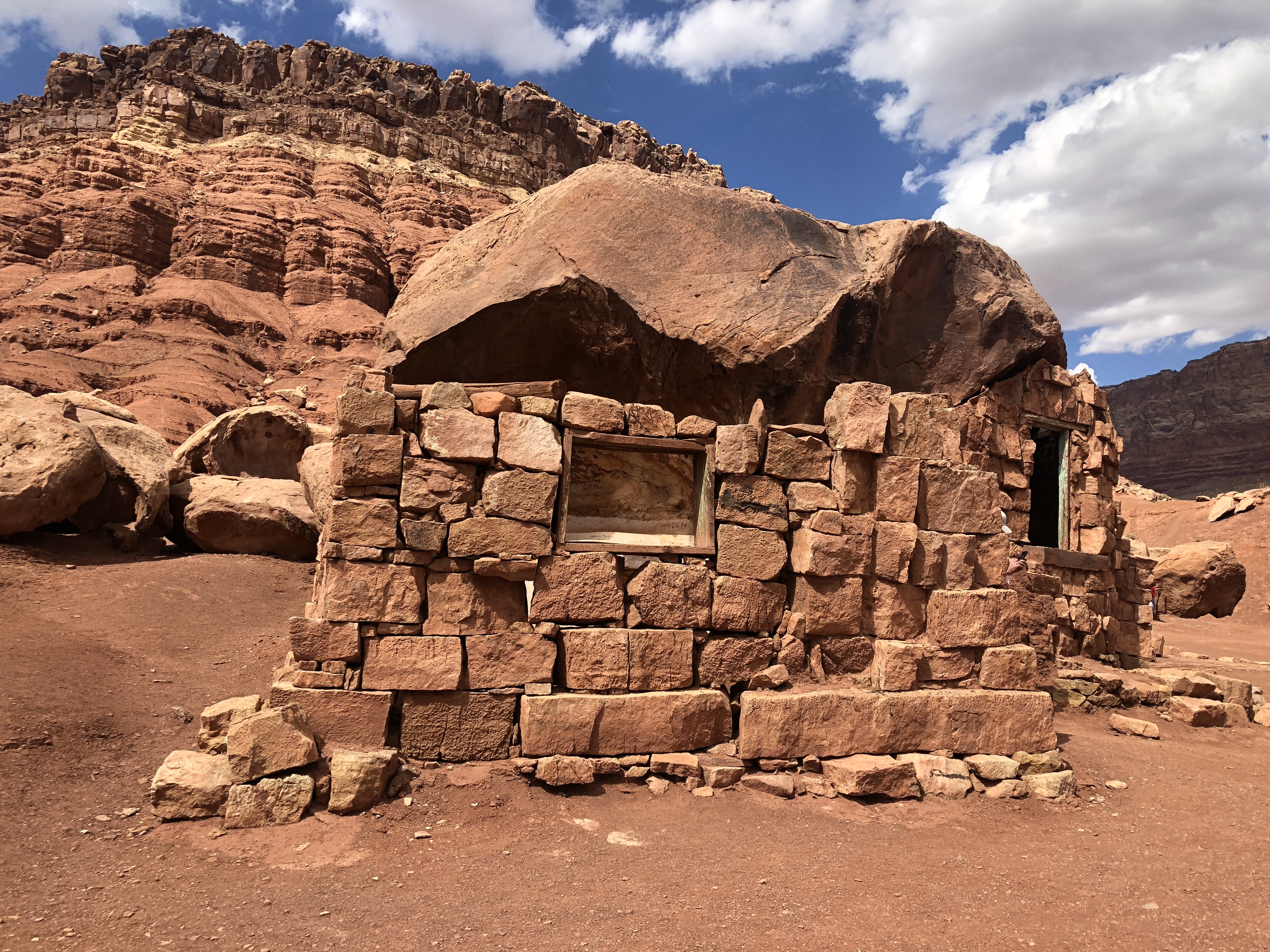
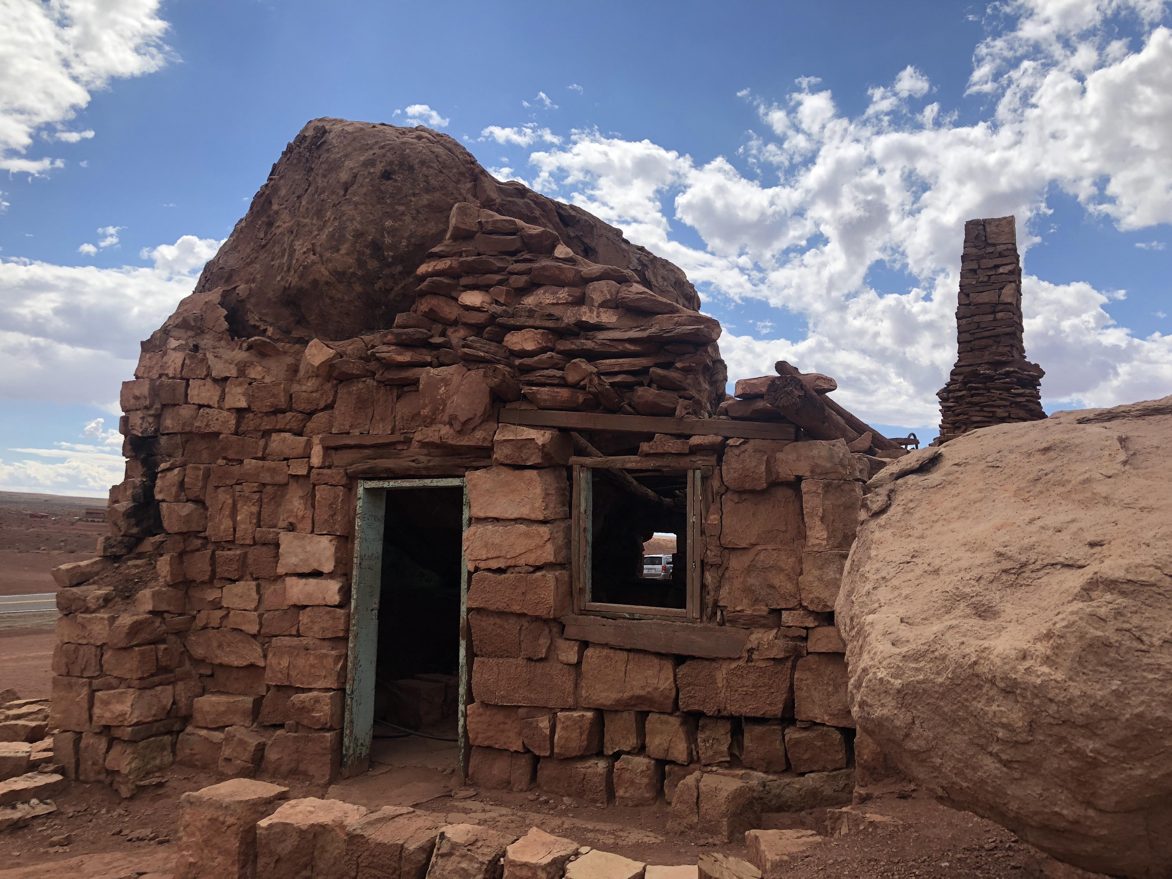
We drove along the Vermilion Cliffs for quite a while. We came by a sign that said, “Cliff Dwellers”, but all we saw was a motel – The Cliff Dweller Motel. About one mile further we stopped at a curious sight:
There was no information on just what we were seeing here, but it was interesting, authentic or not…
Moving on…
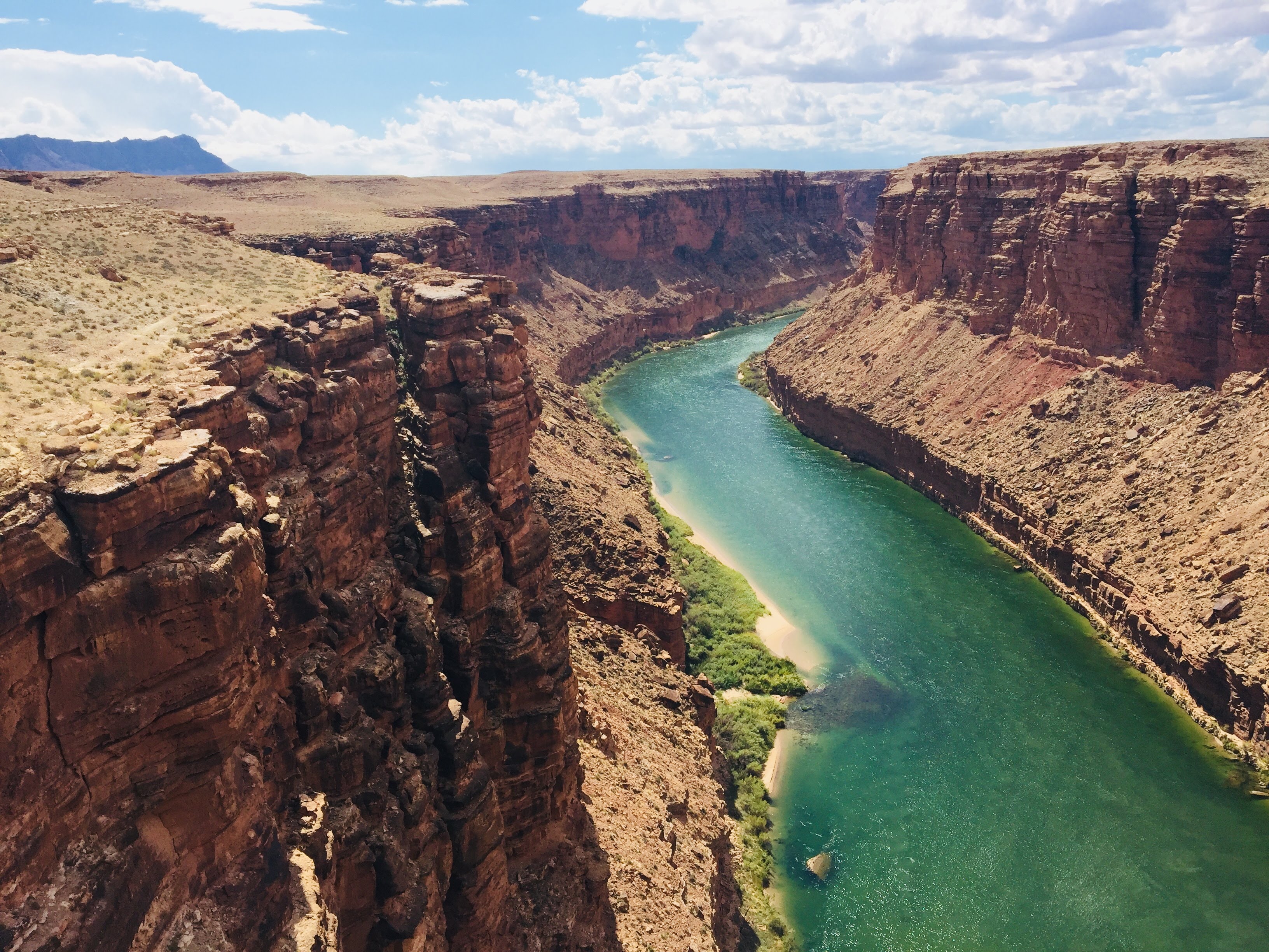
We stopped to take pictures at Navajo Bridge – The Colorado River, again…
Then we passed through Page, AZ, and we drove over the Glen Canyon Bridge. We will be back here tomorrow to tour the dam…
We caught a few glimpses of Lake Powell as we arrived at the RV Park…
We checked into the campground and we parked with the other Airstreamers…
This evening we enjoyed a BBQ dinner with the rest of the gang at the campground picnic area…
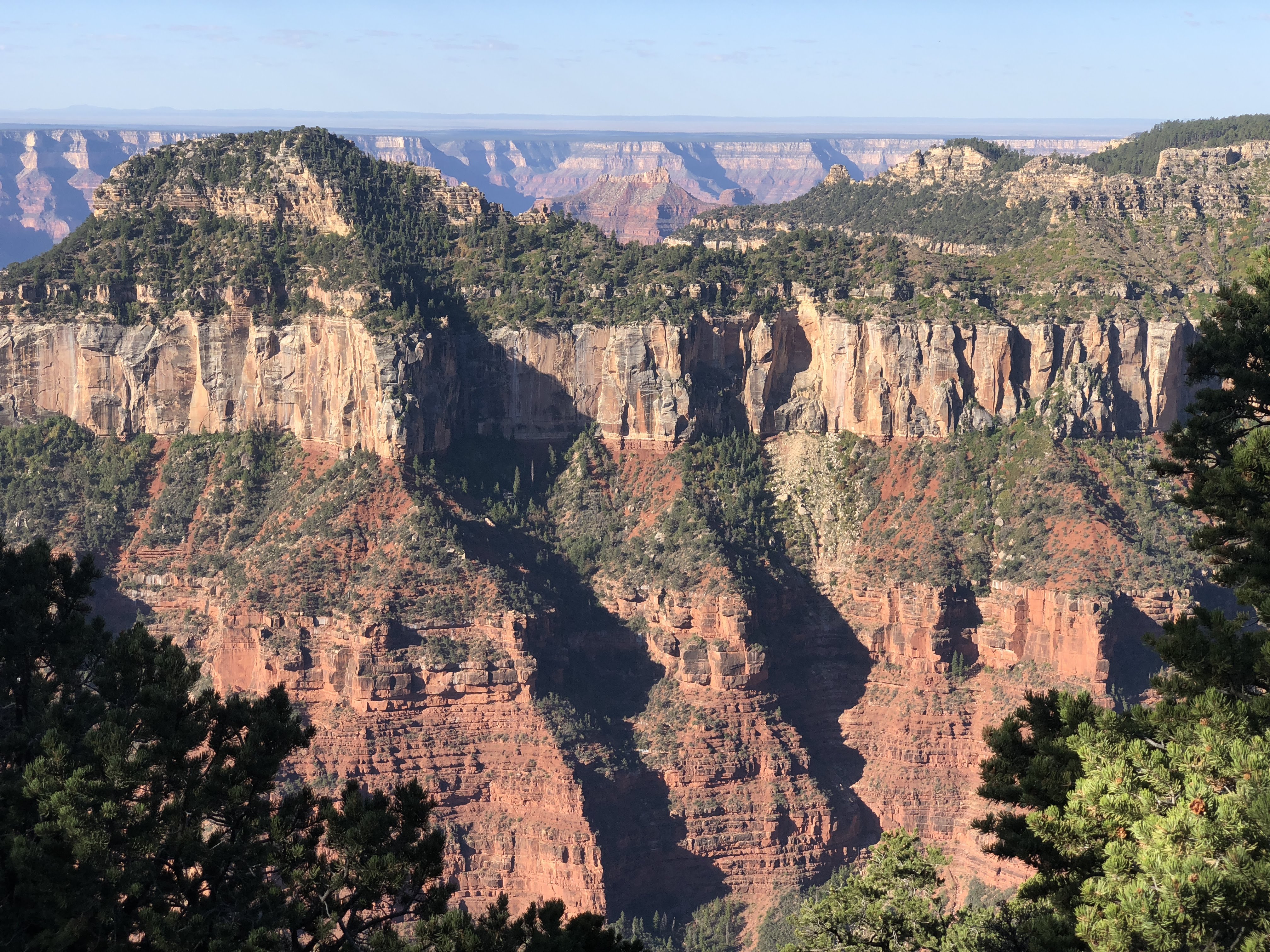
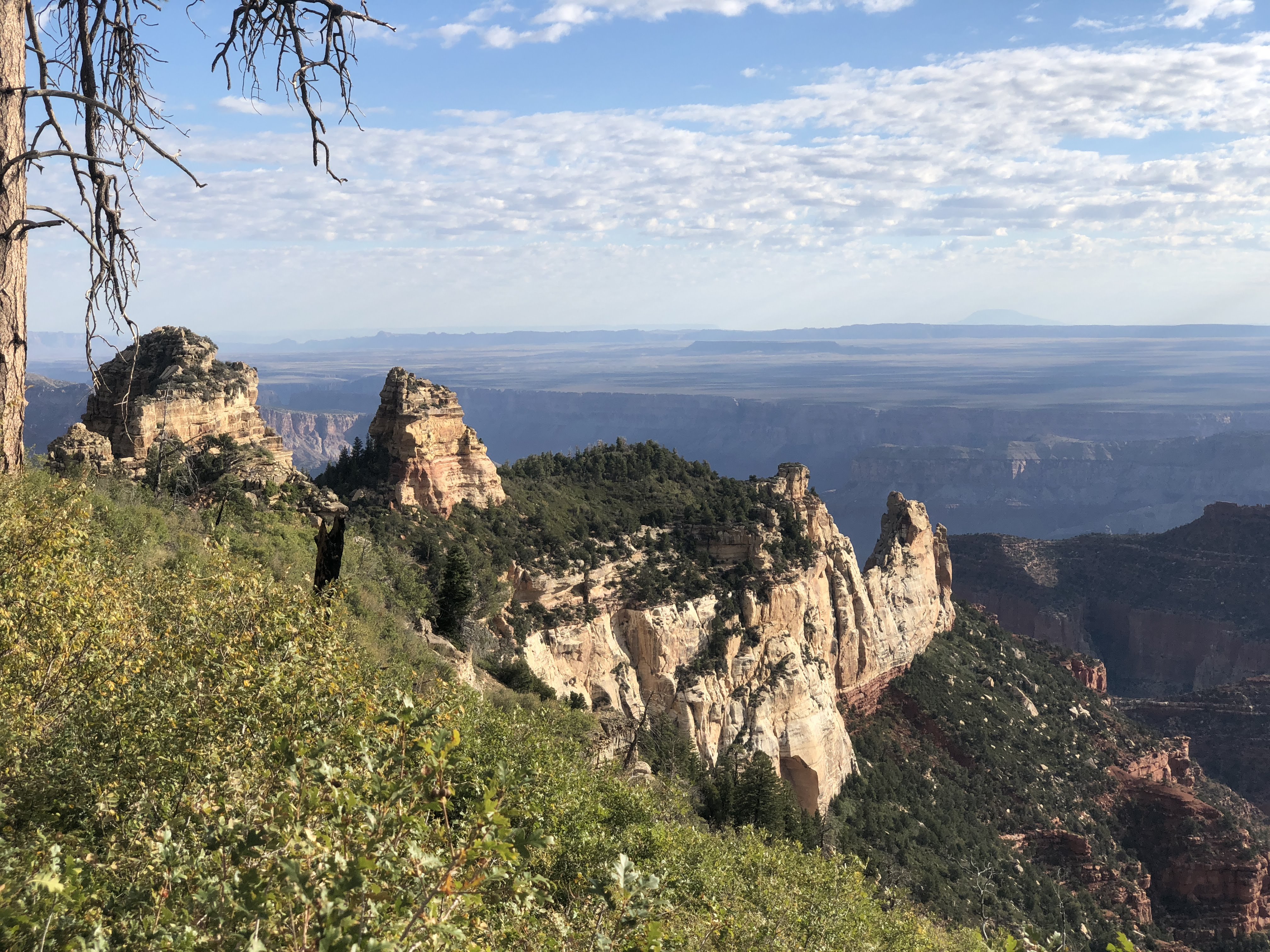
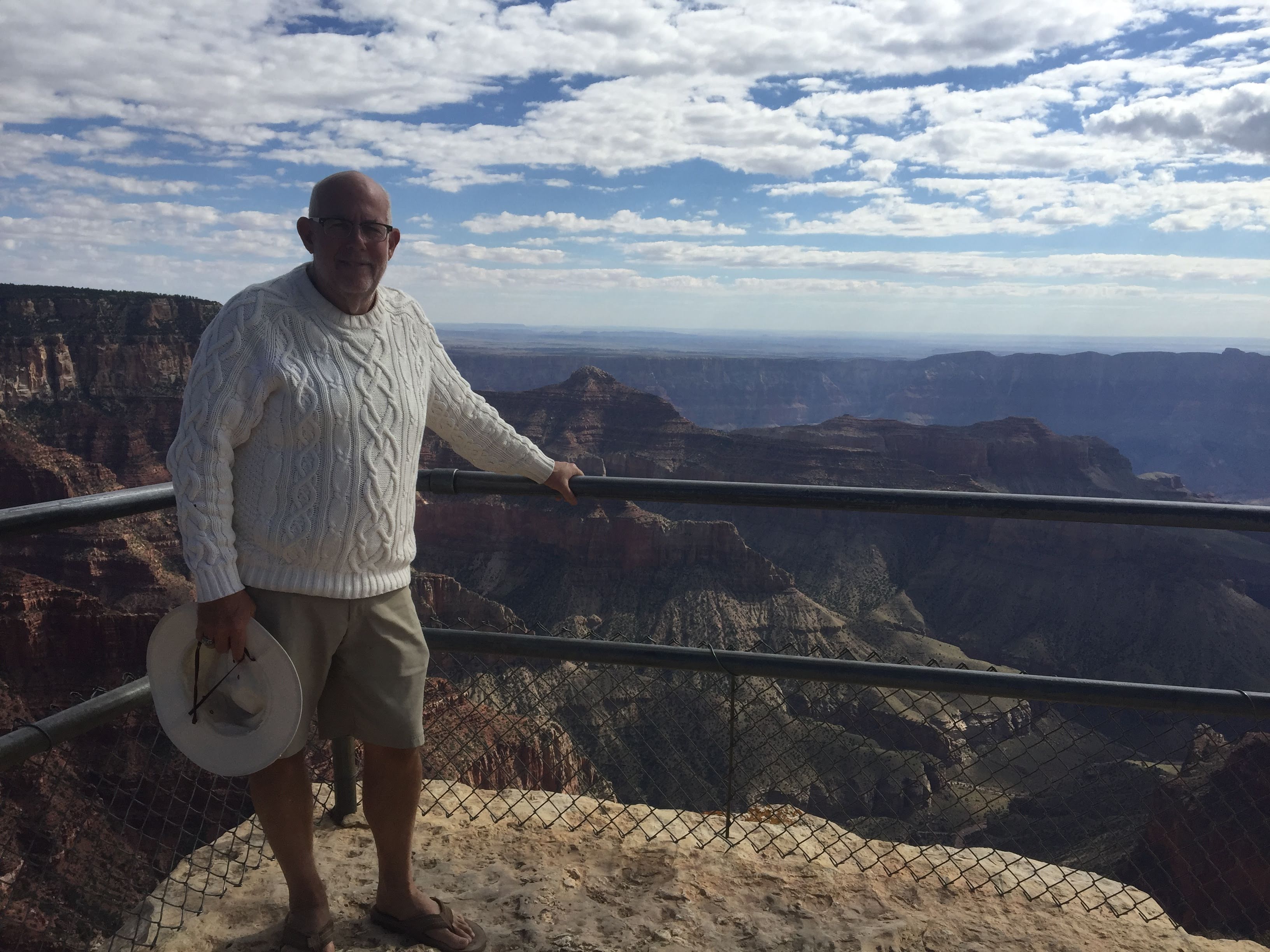
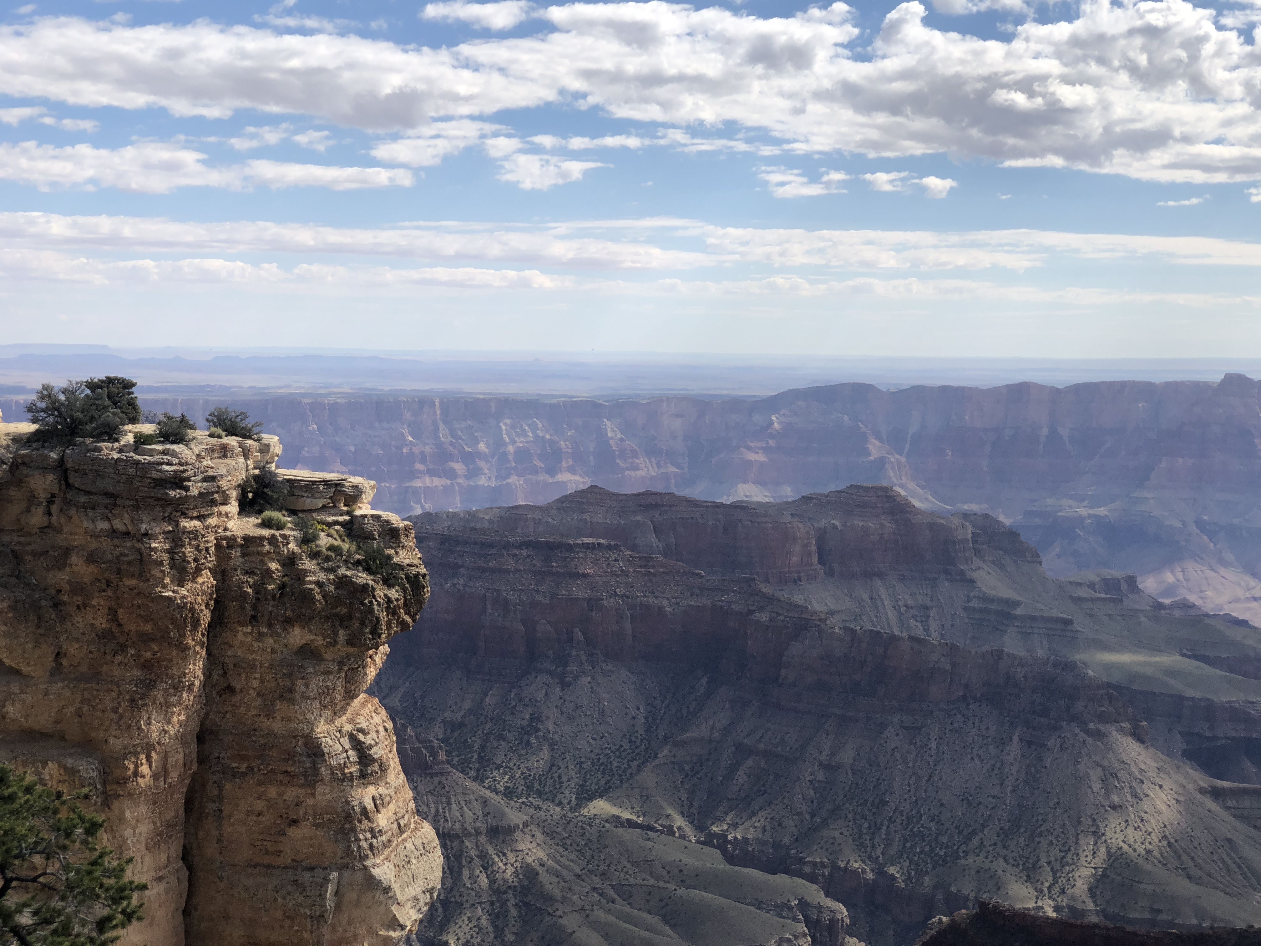
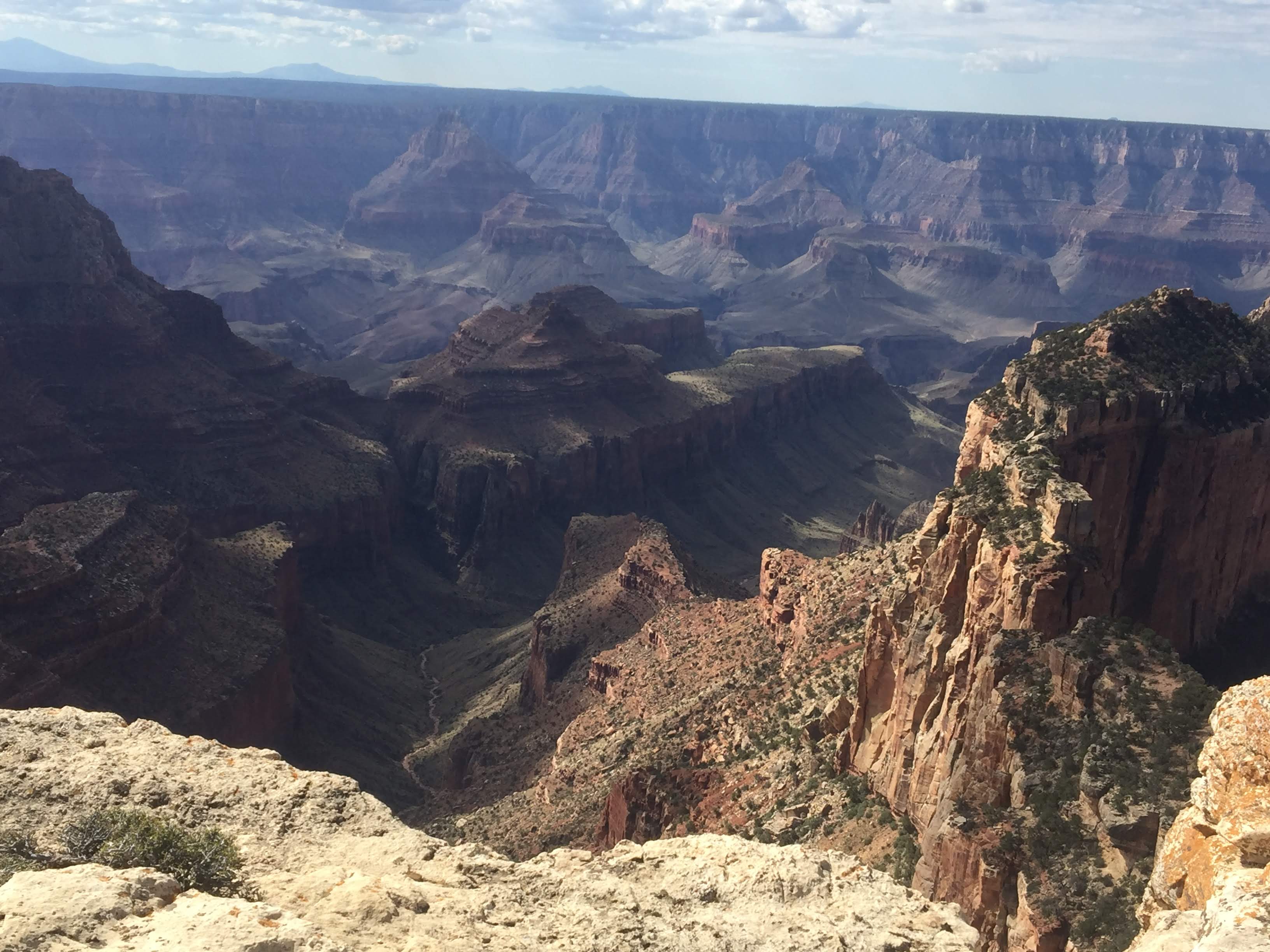
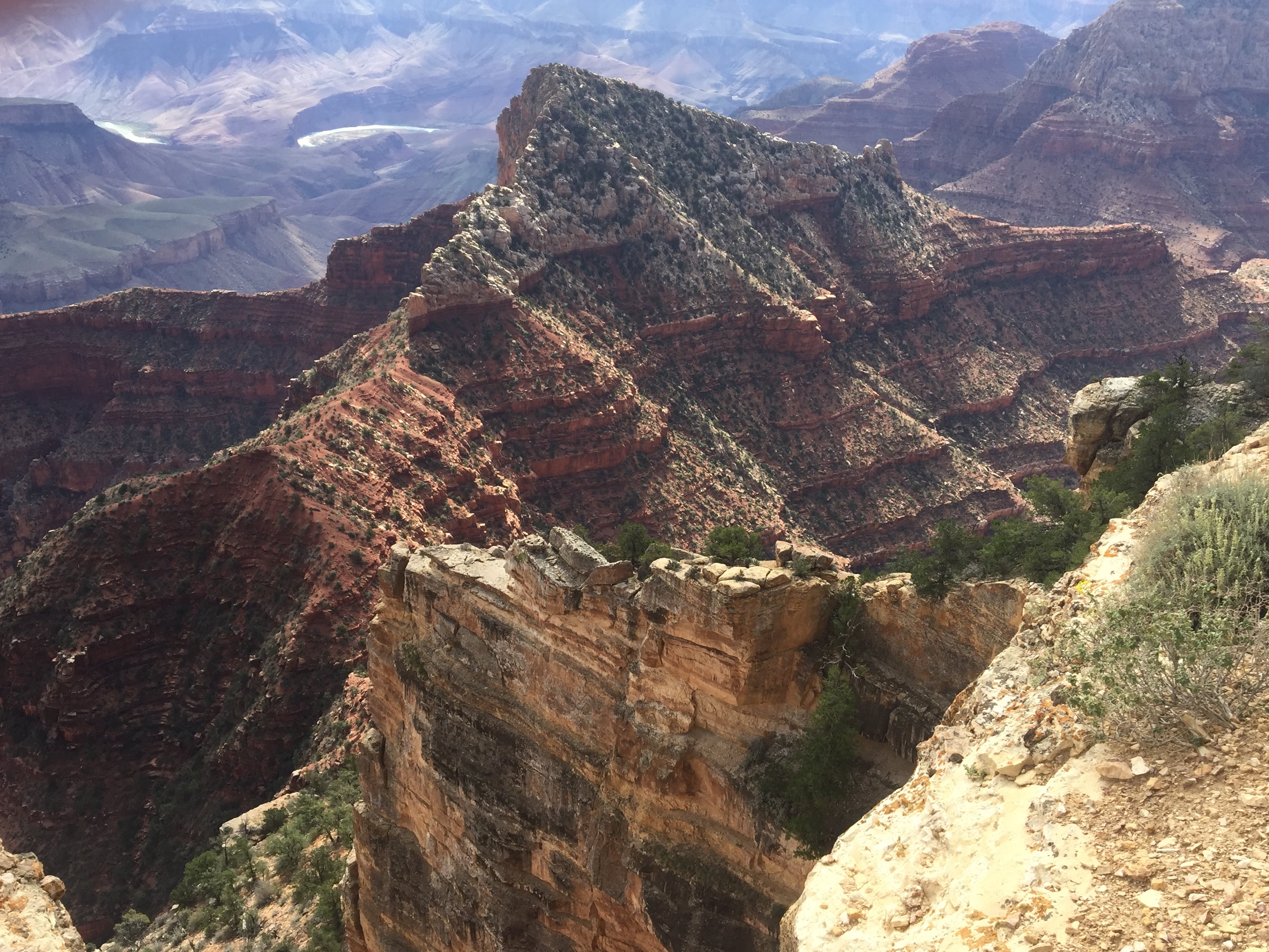
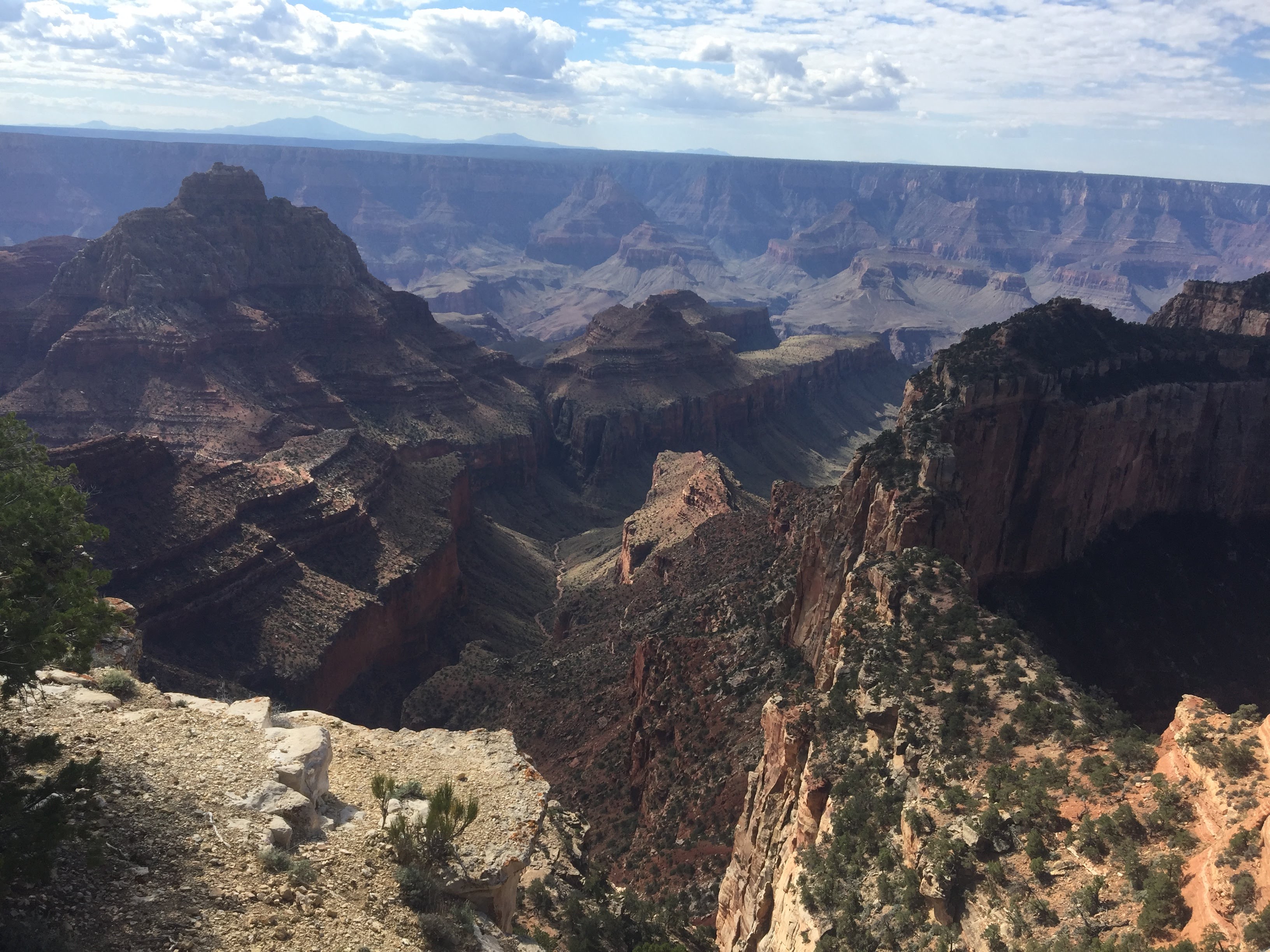
Slightly less vigorous day today… We drove, along with another caravaner, to another plateau, surrounded by more cross canyons. This is in the eastern portion of the park.
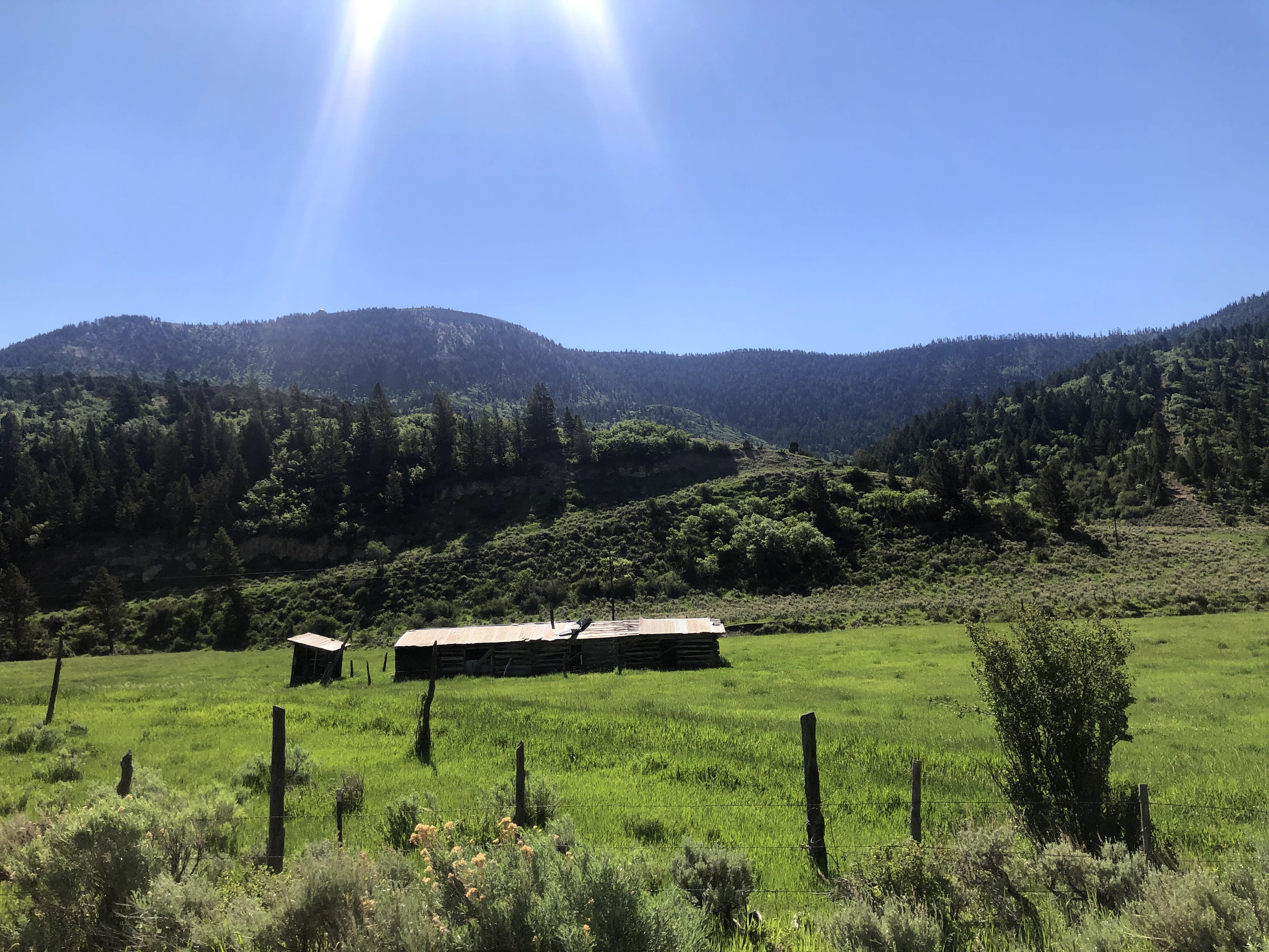
We saw a meadow with a watering hole used by the wildlife in the area. And a 19th century log cabin used by early settlers to store grain and salt for their cattle…
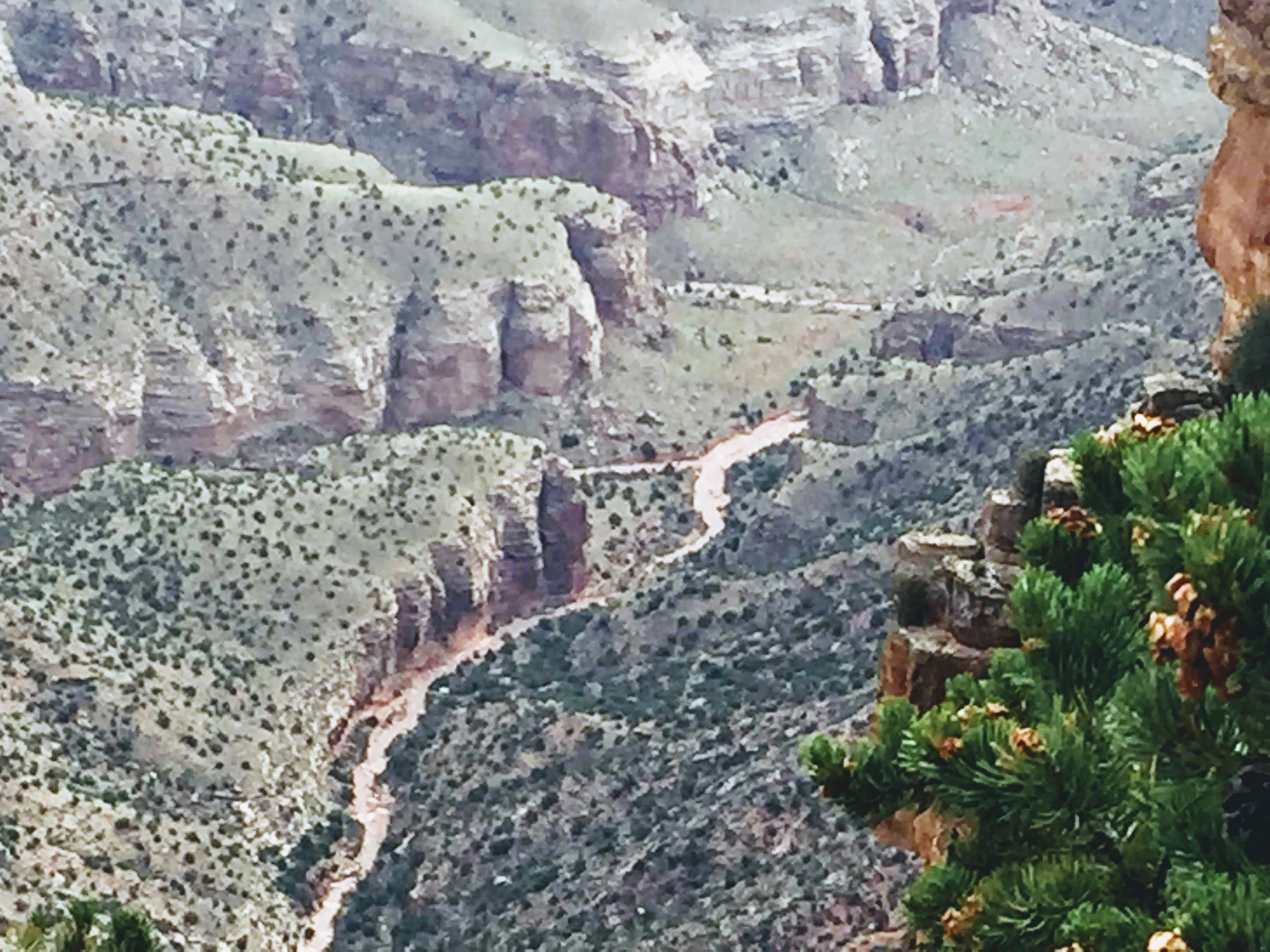
We stopped at many overlook areas viewing east across and down into the canyon.
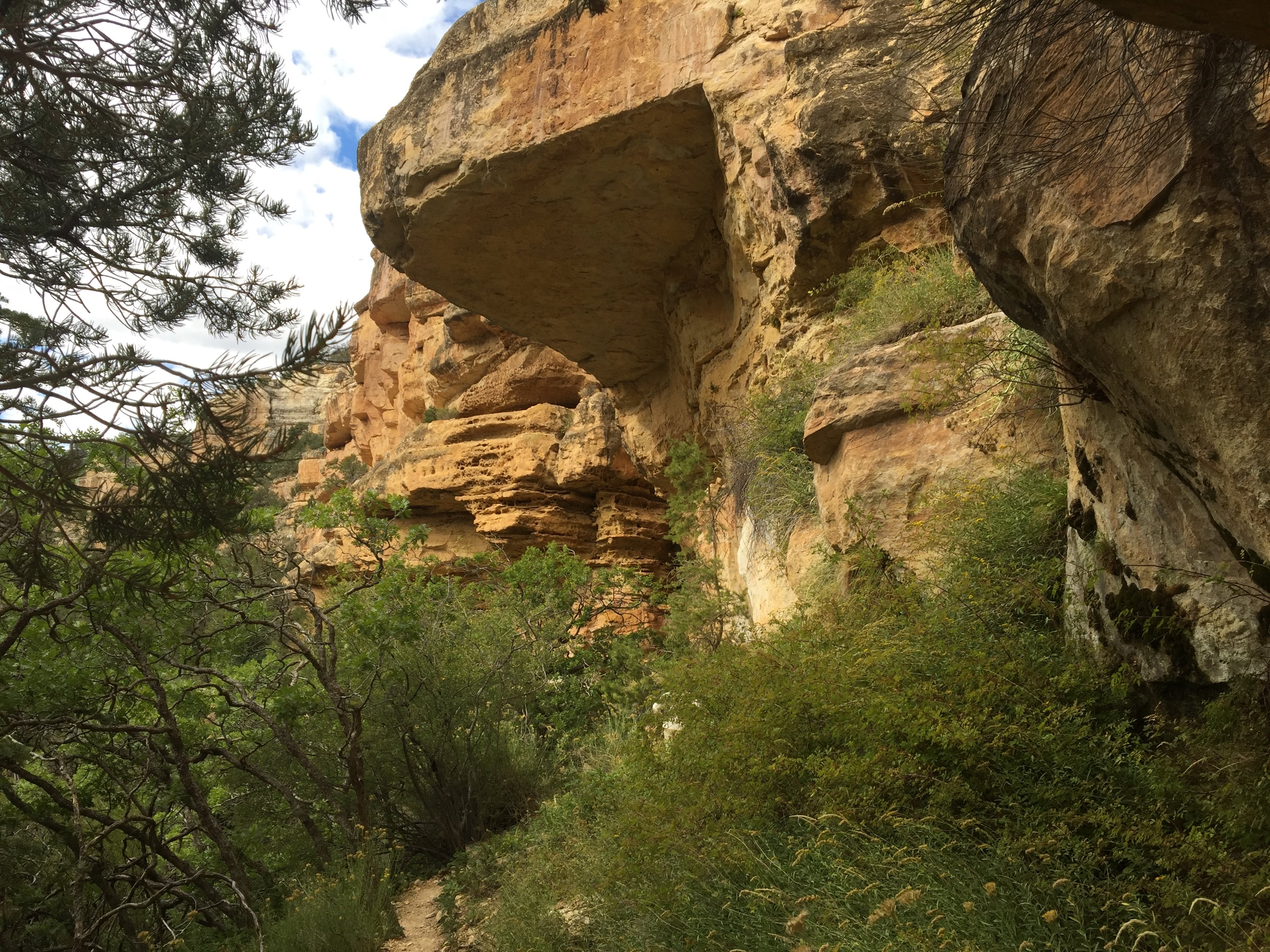
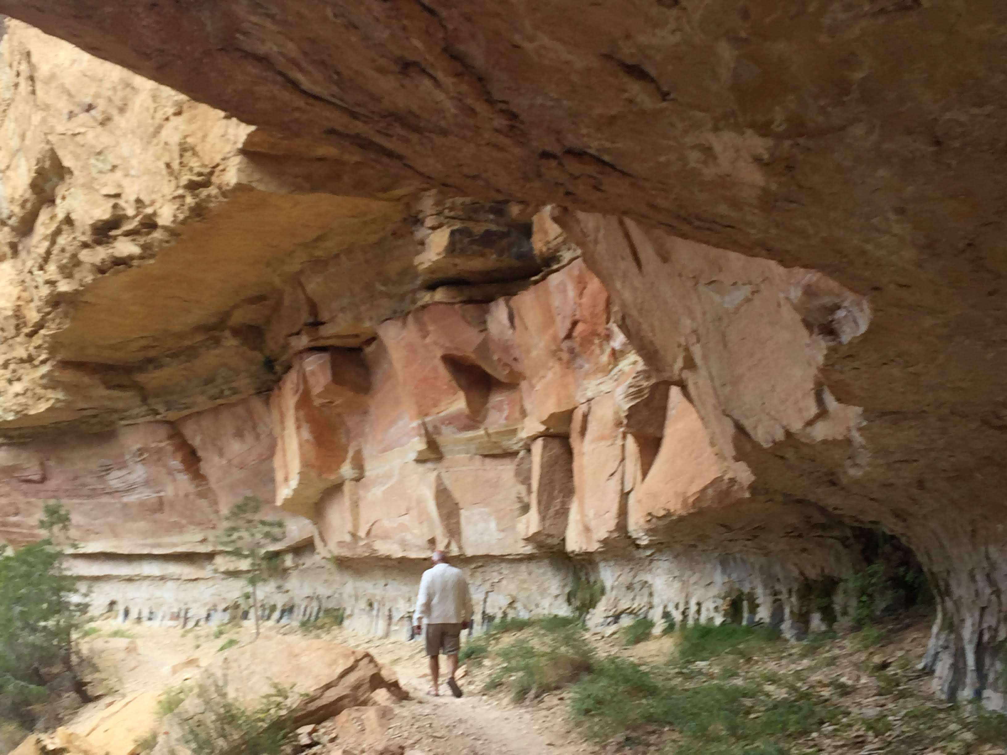
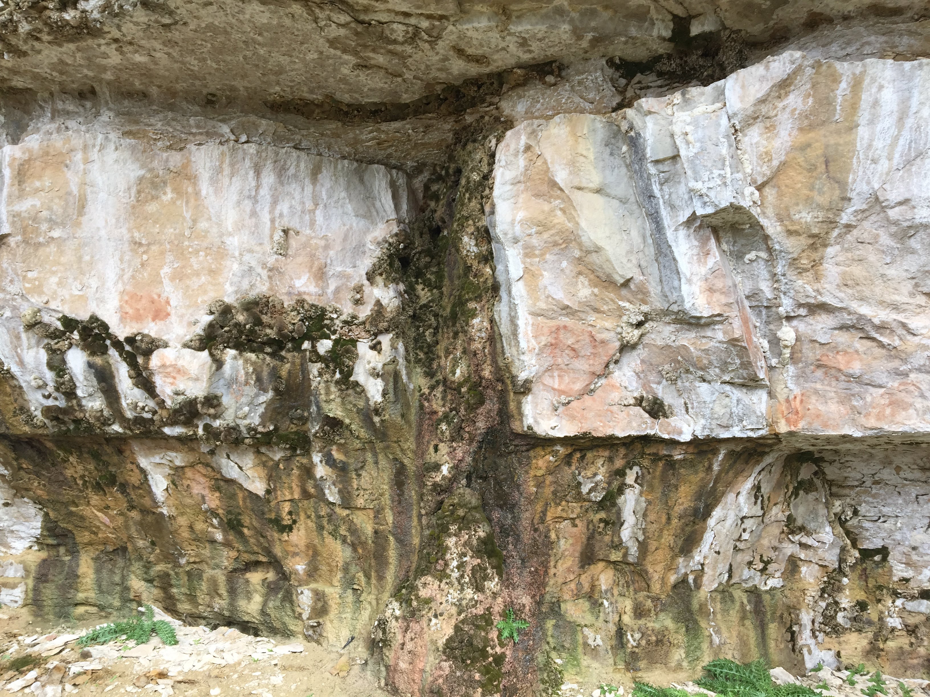
We walked down a canyon to a spring, with water seeping out of the sandstone walls…
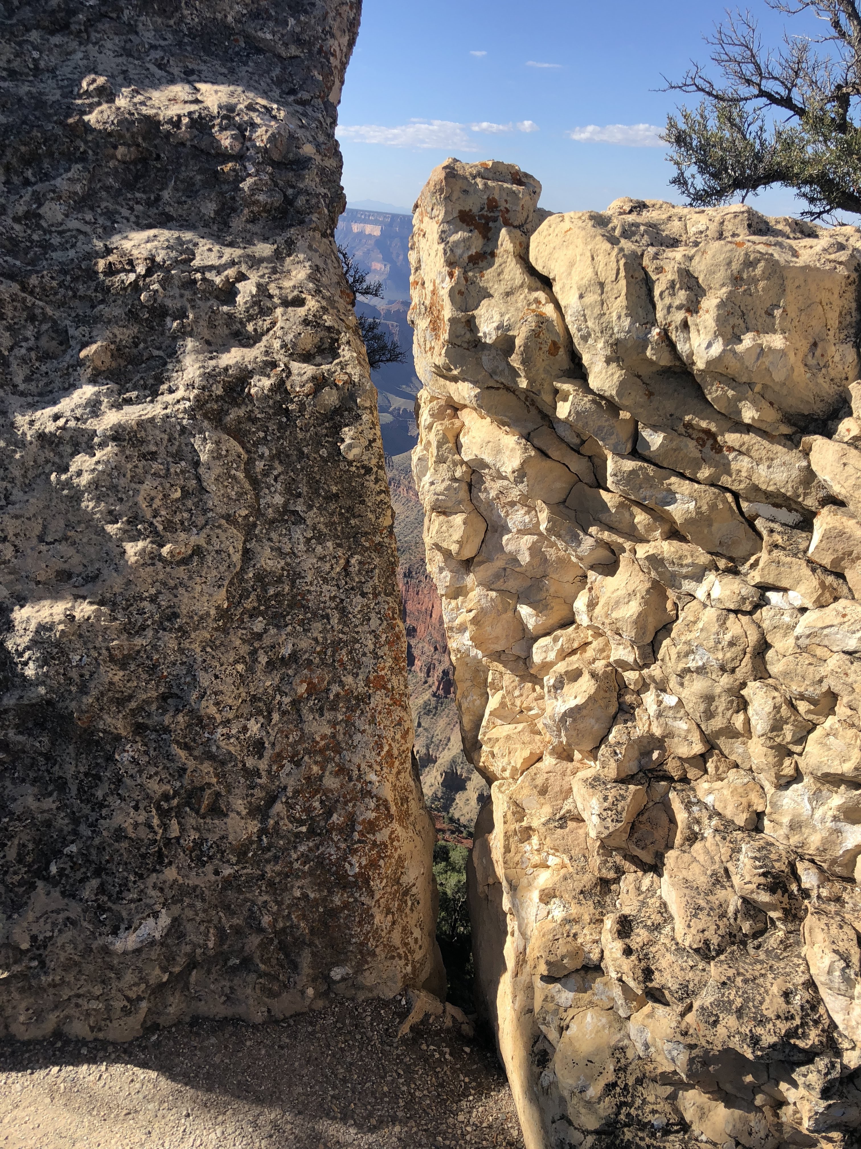
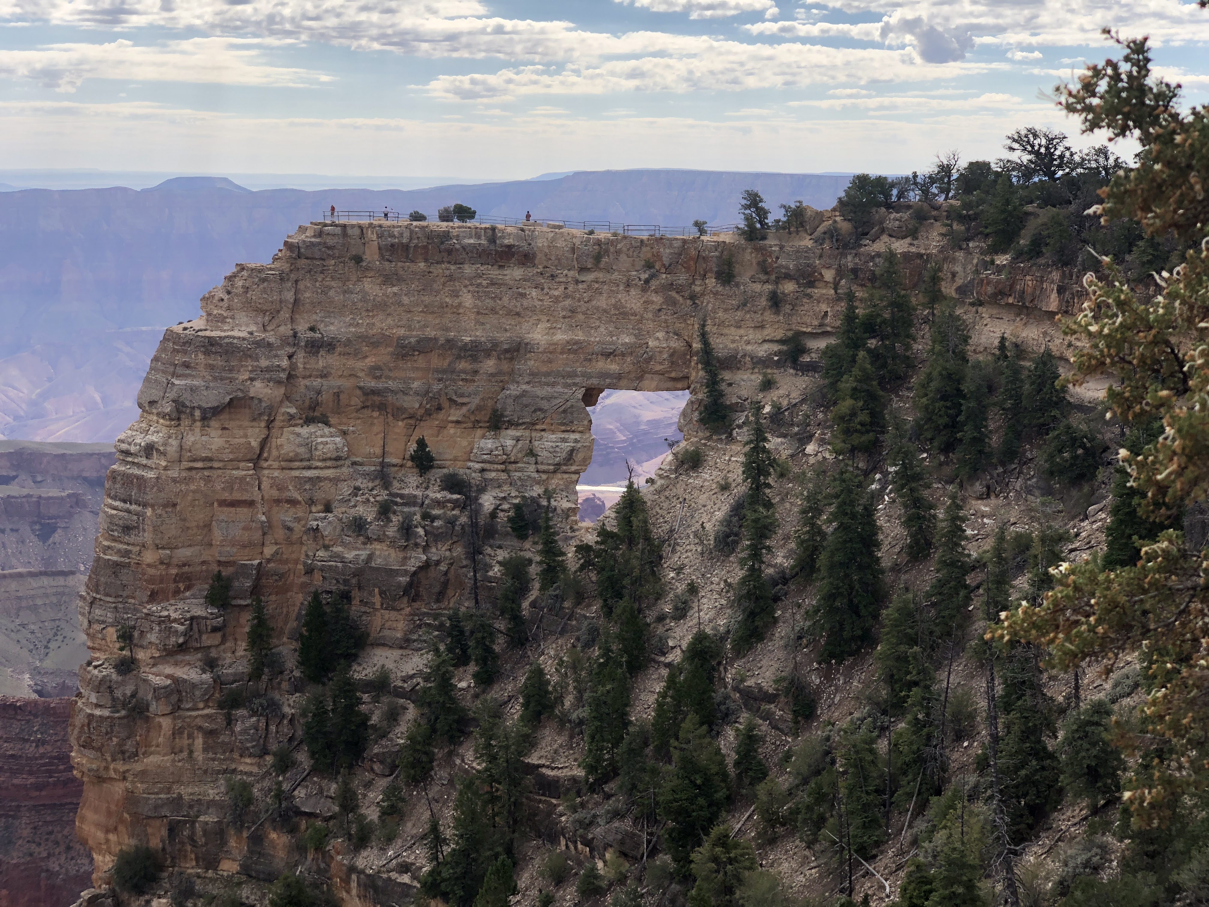
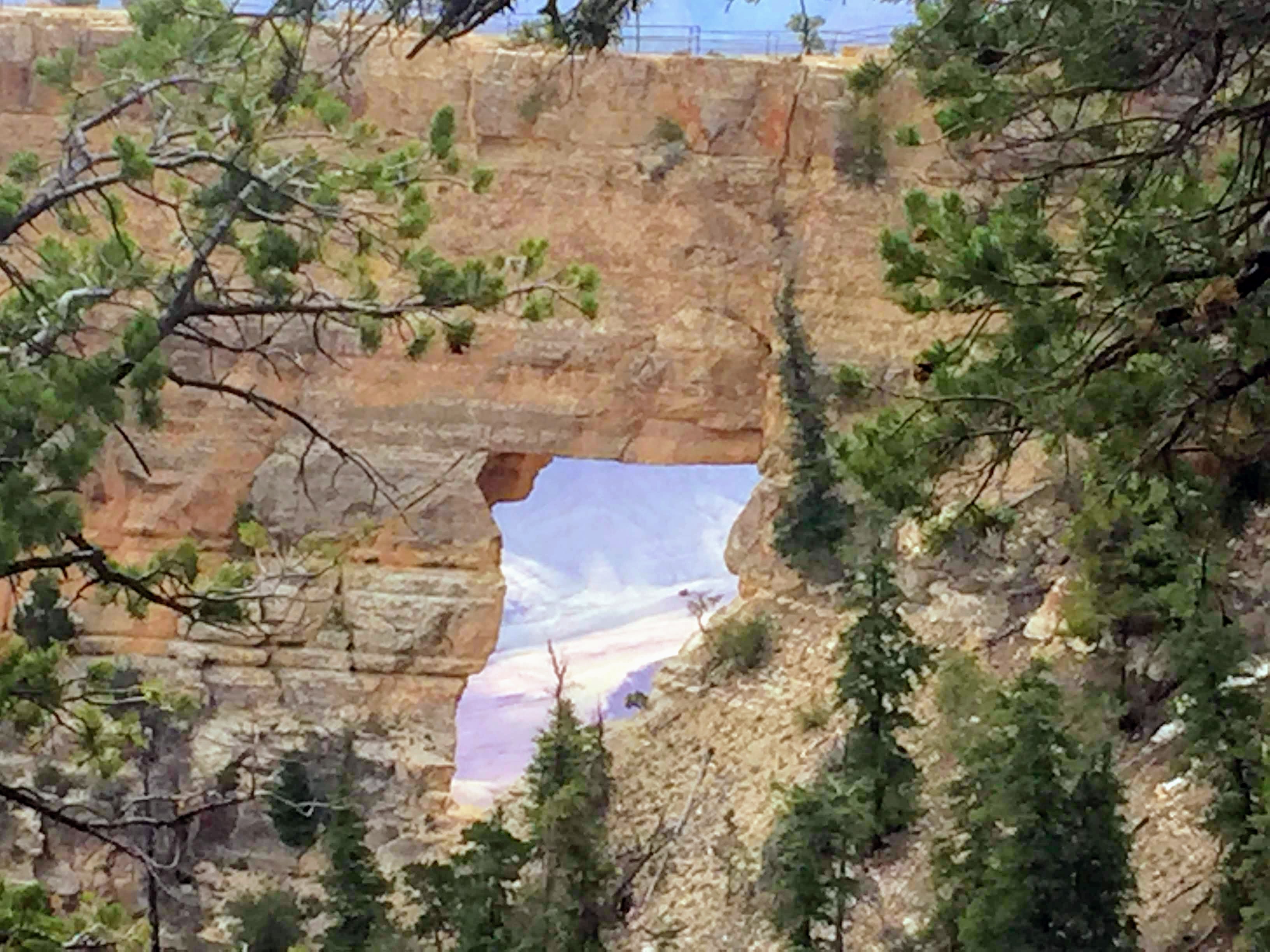
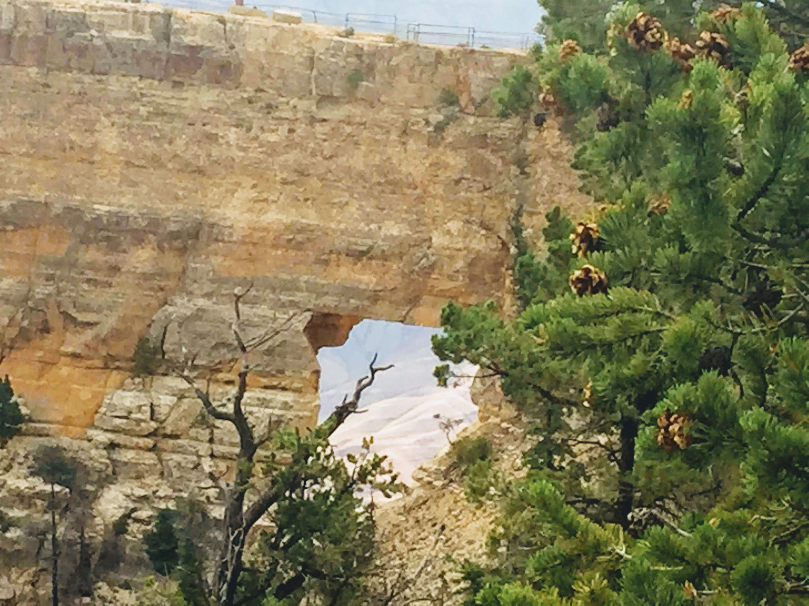
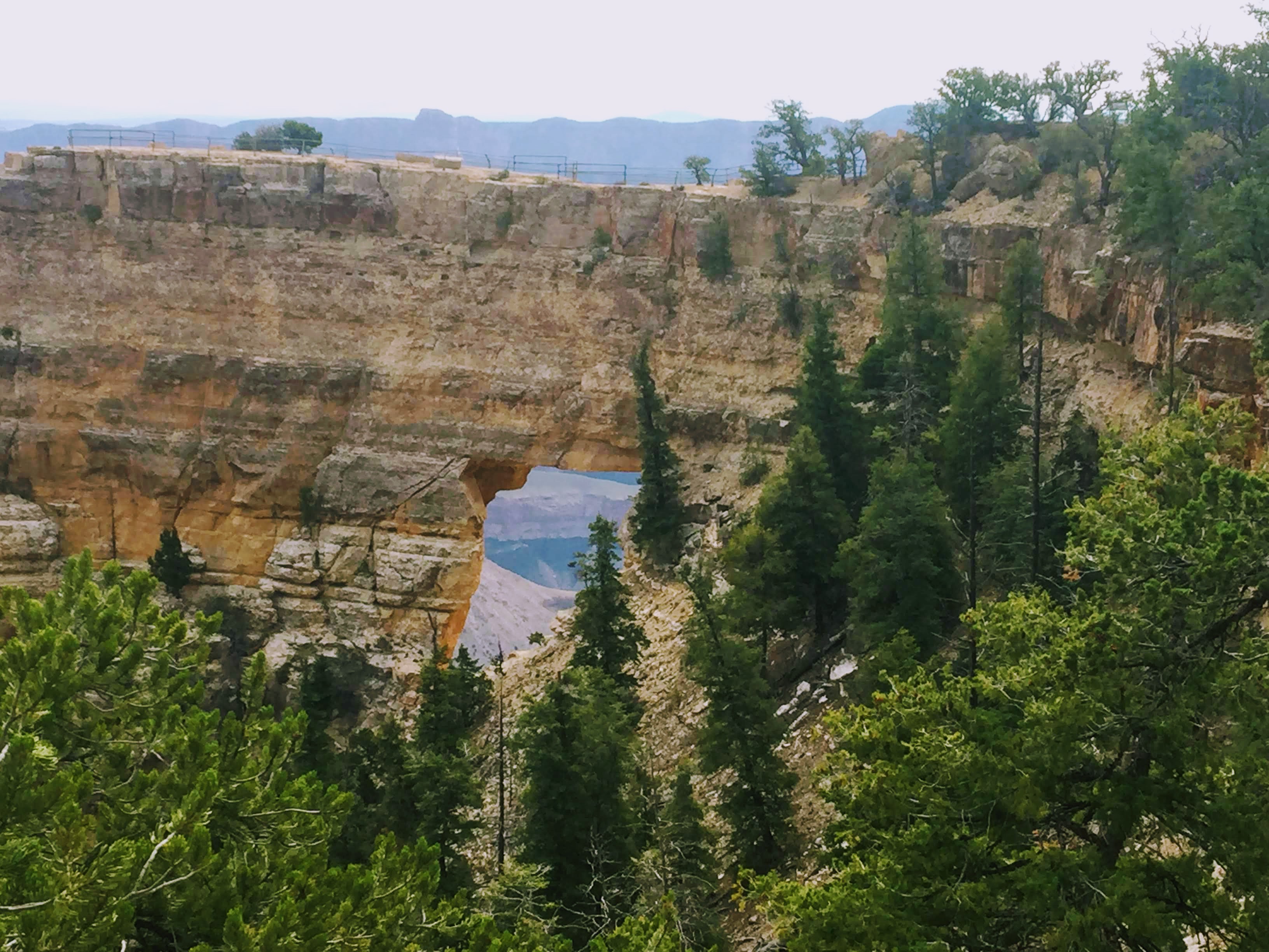
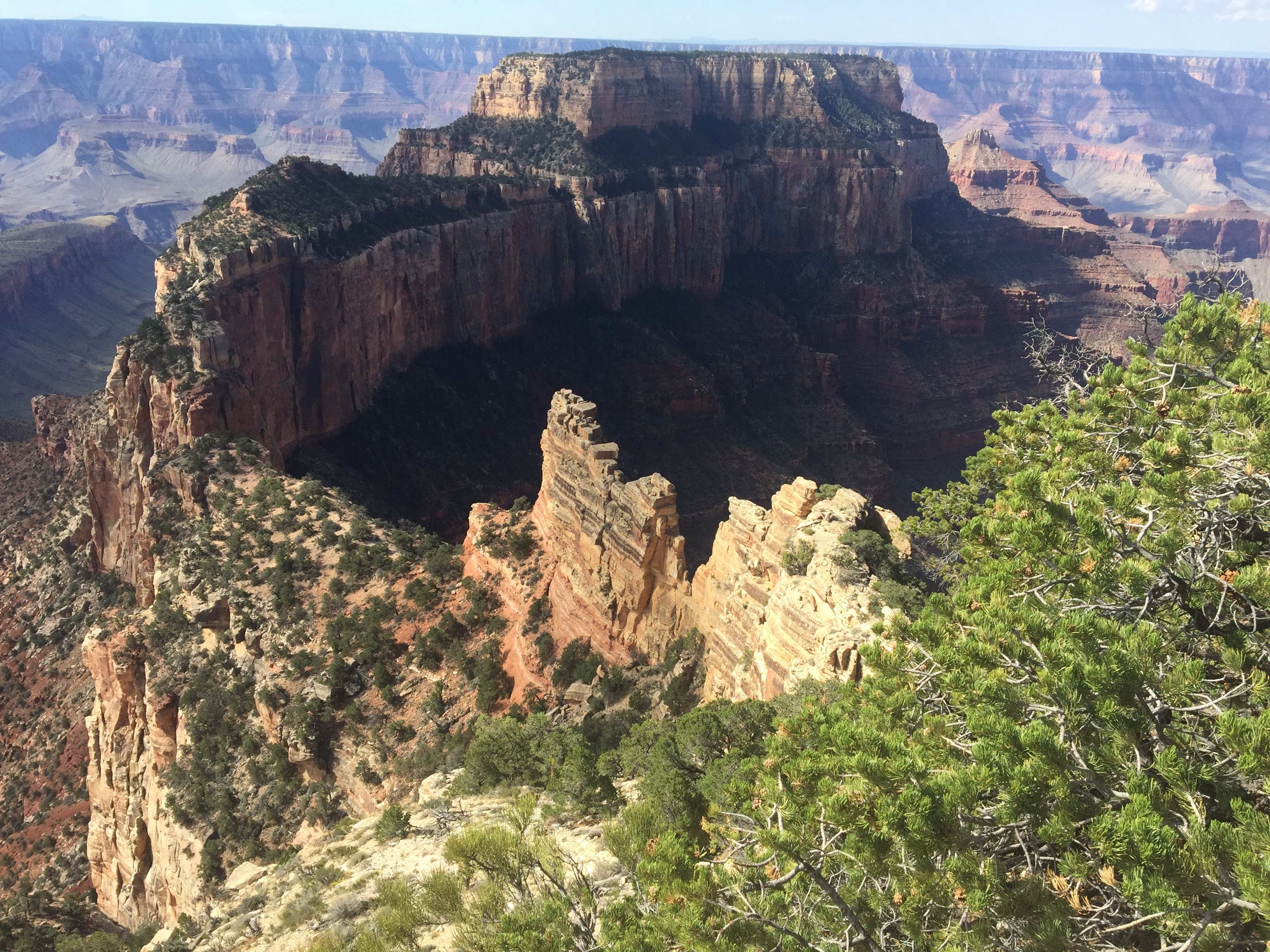
The big payoff was Angel’s Window, an arch in the sandstone… (note the people standing atop the arch… )
The valley below was quite green…
We also walked atop the arch…
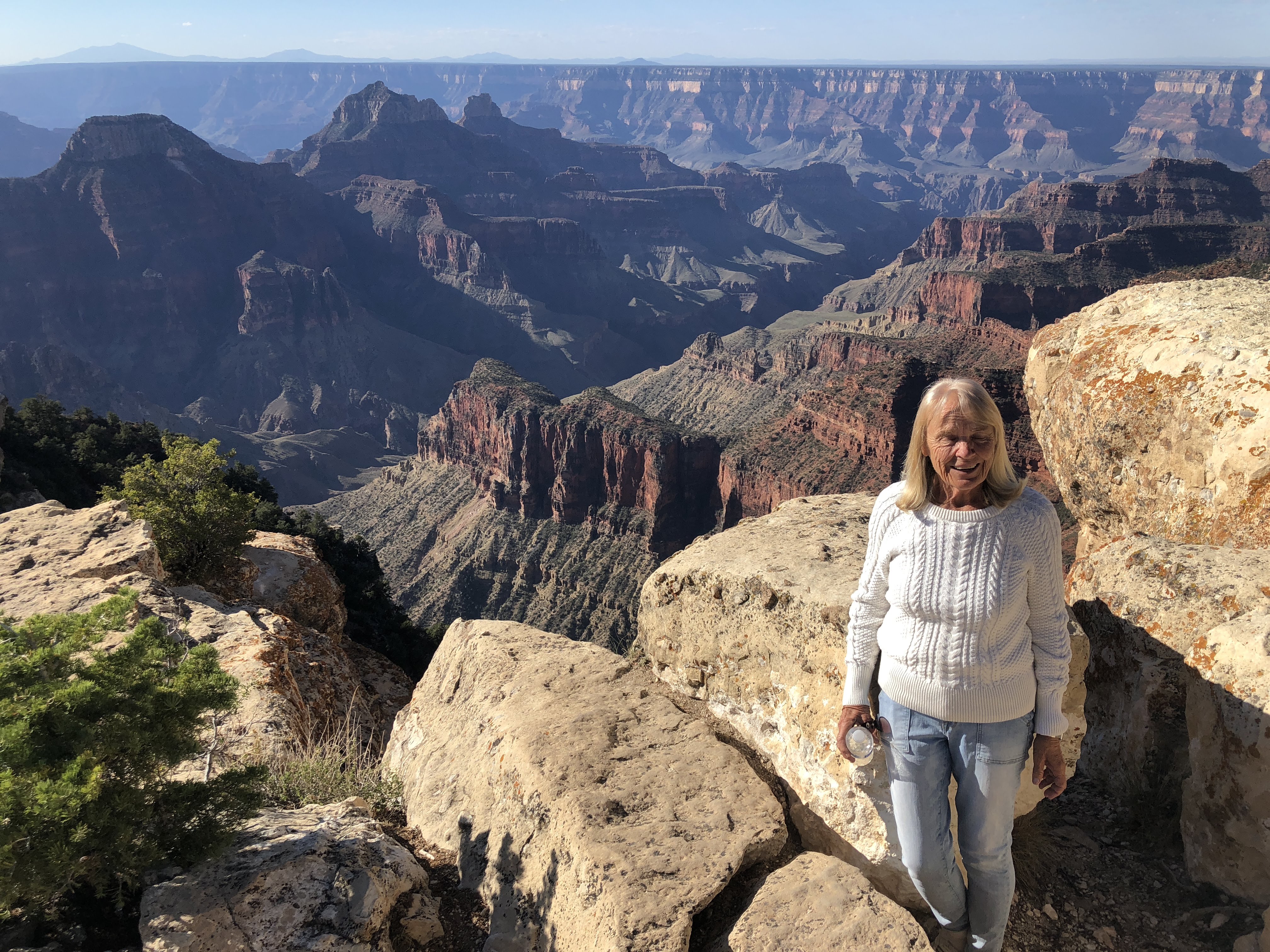
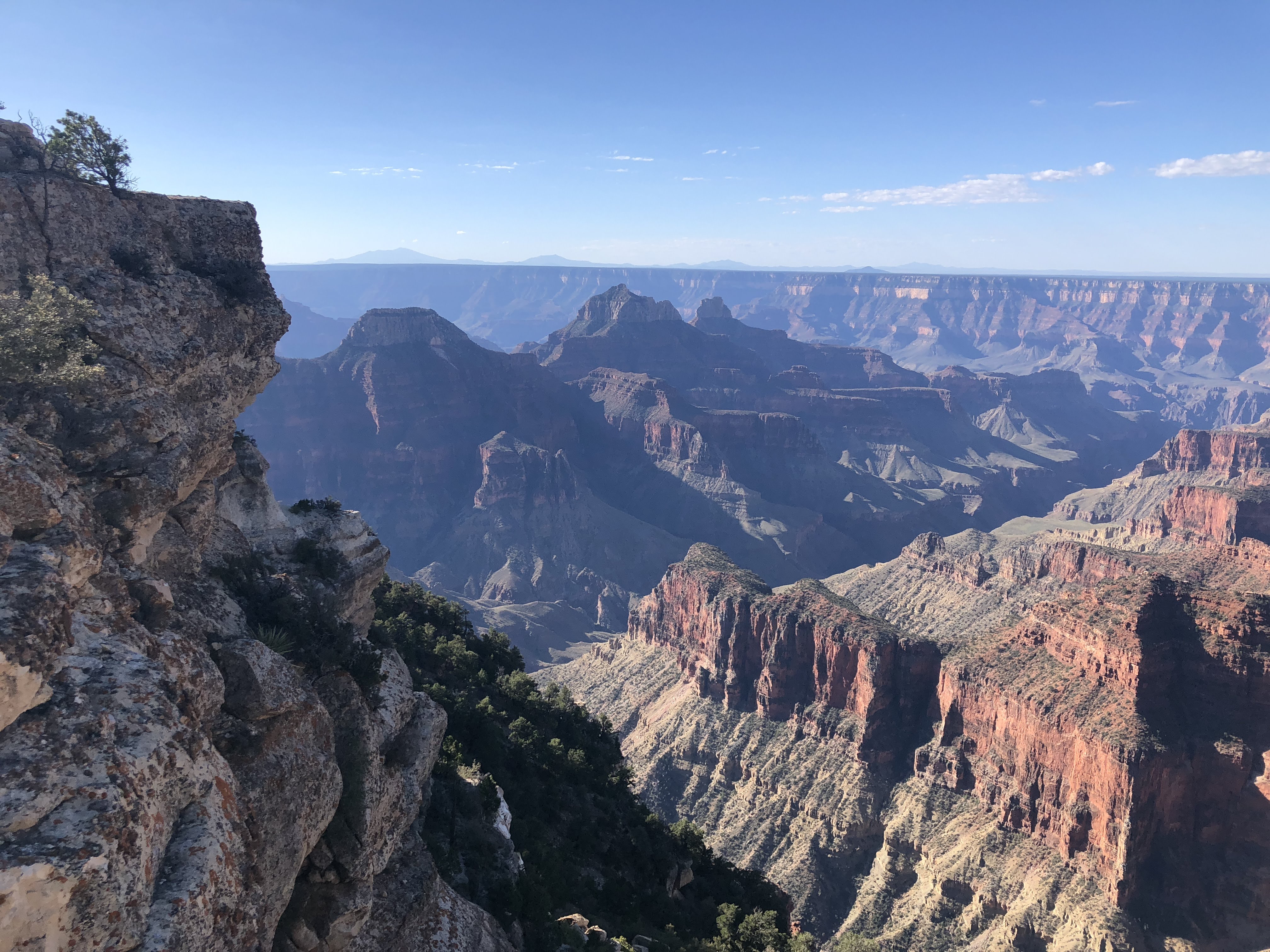
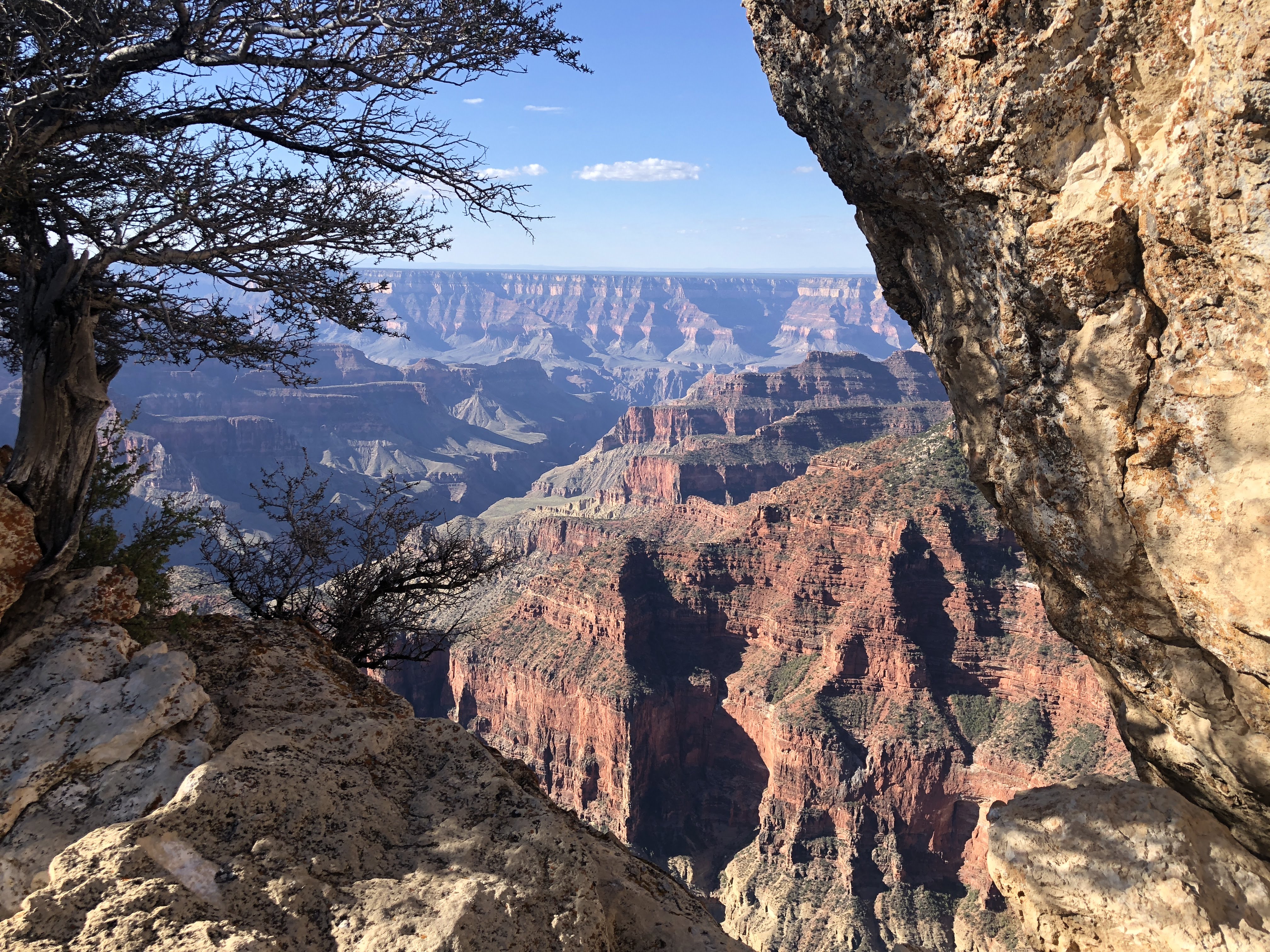
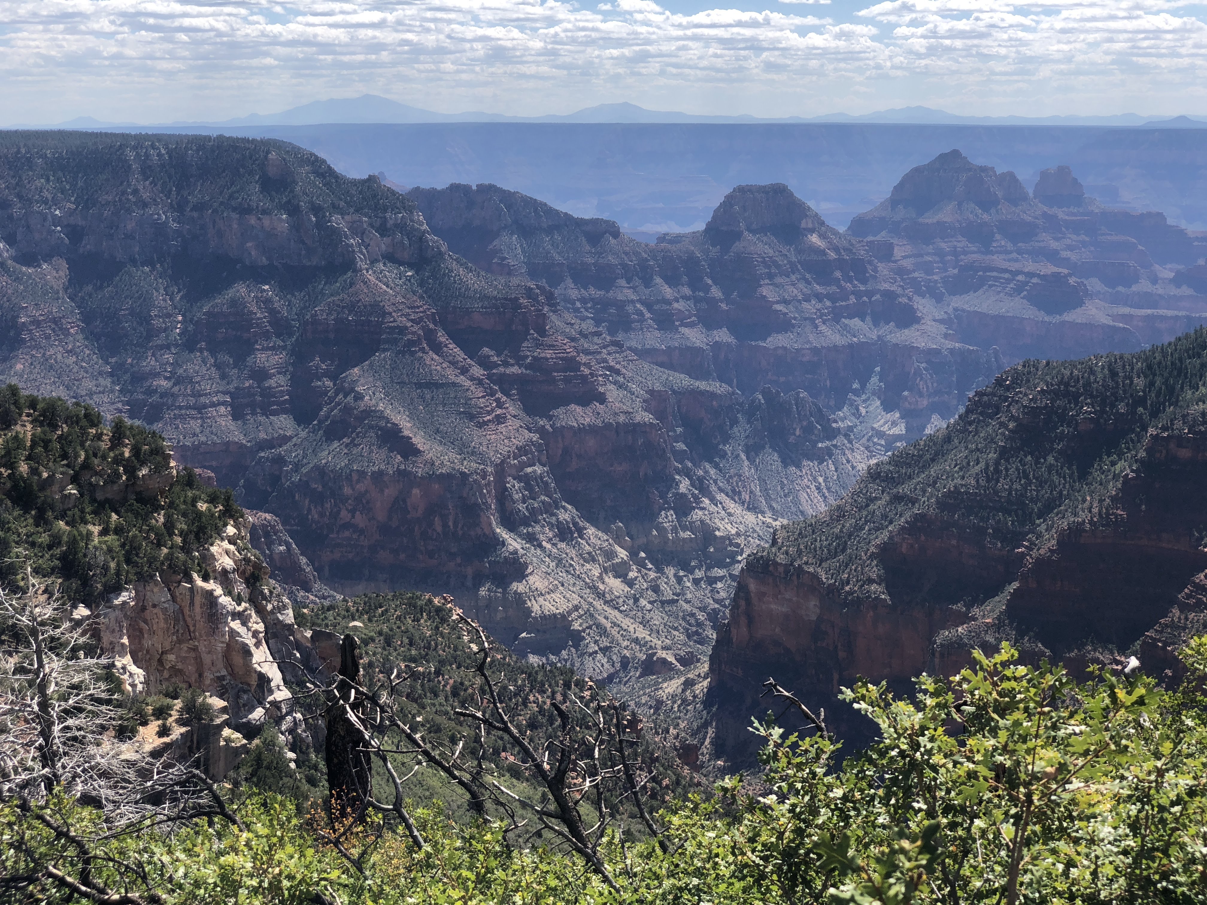
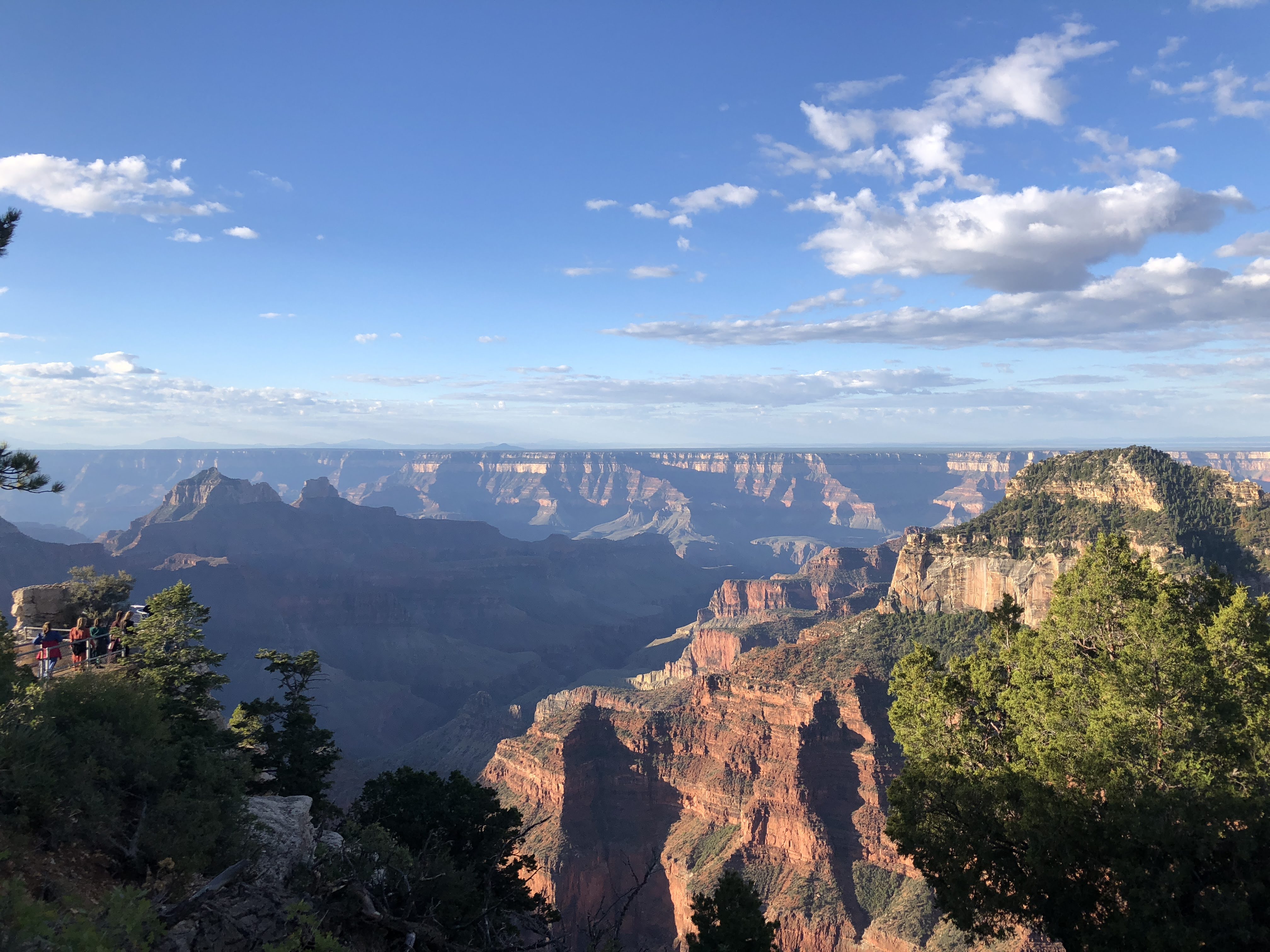
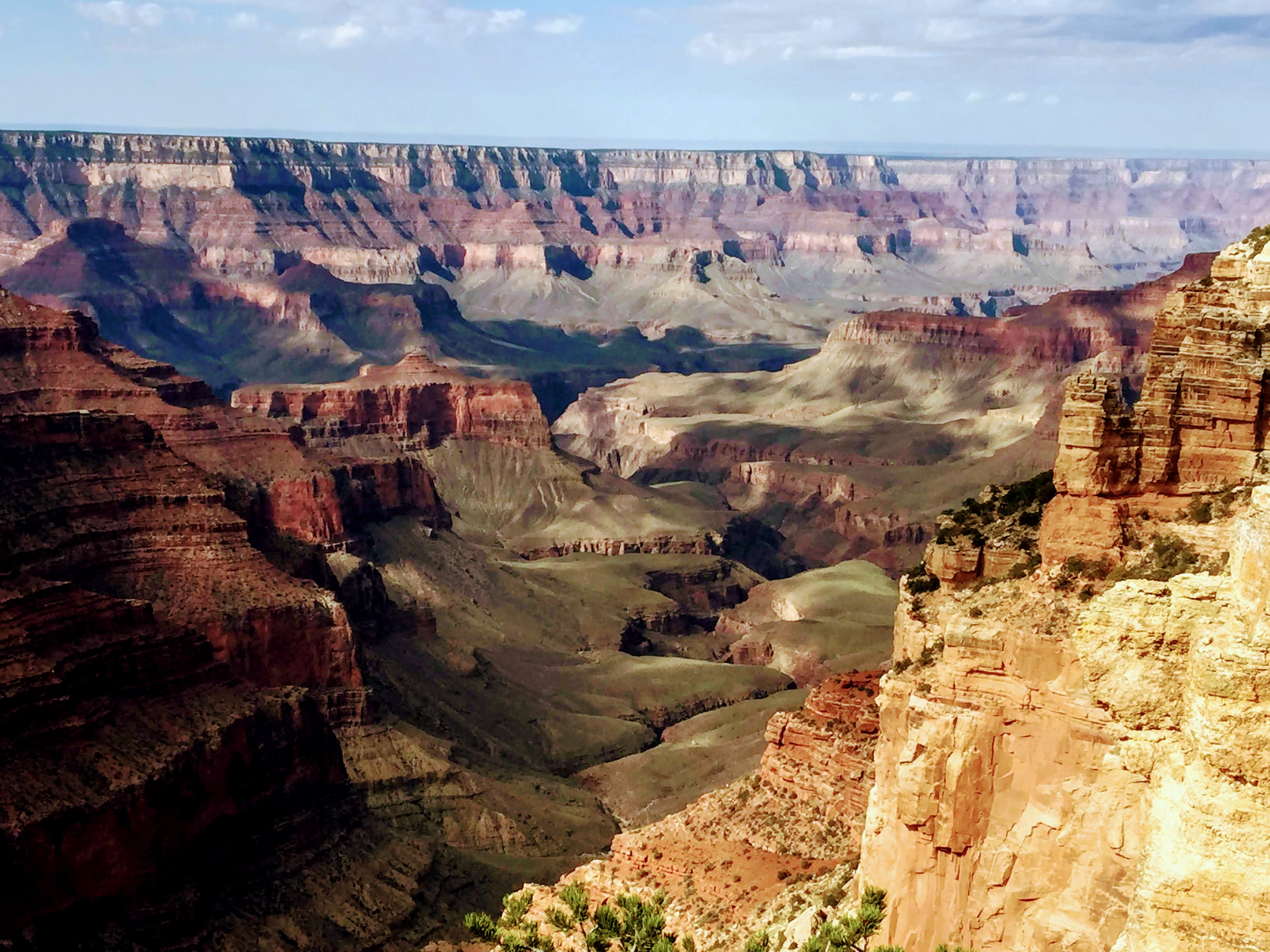
And we went out onto Cape Royal to see the main portion of the Grand Canyon… And we could finally look down into the canyon and see the Colorado River far below – the river is about one mile below the rim of the canyon…
That’s it – about five miles away and about one mile down…
The other views from Cape Royal were also spectacular! Way better than Uncle Jim’s Trail yesterday…
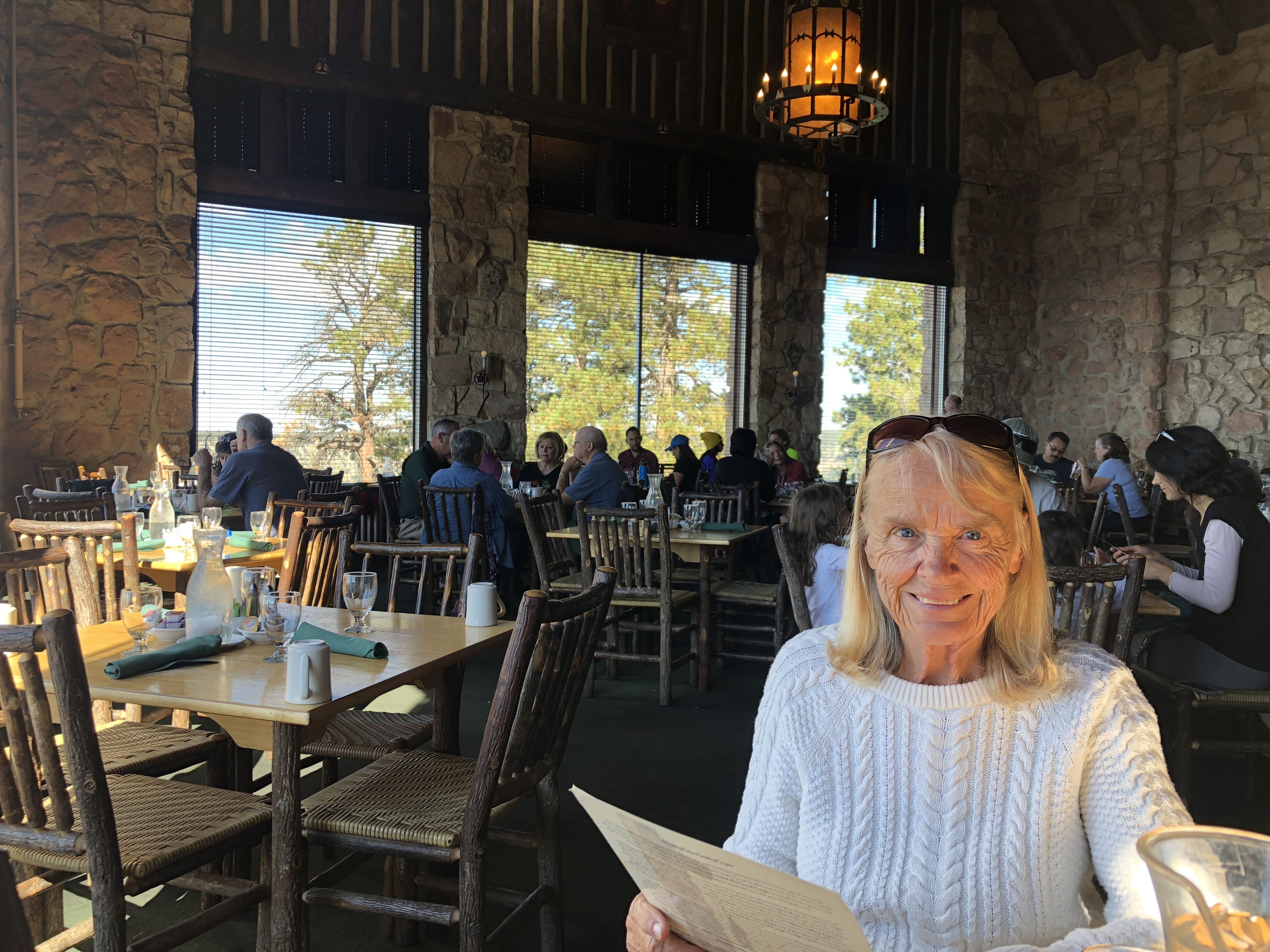
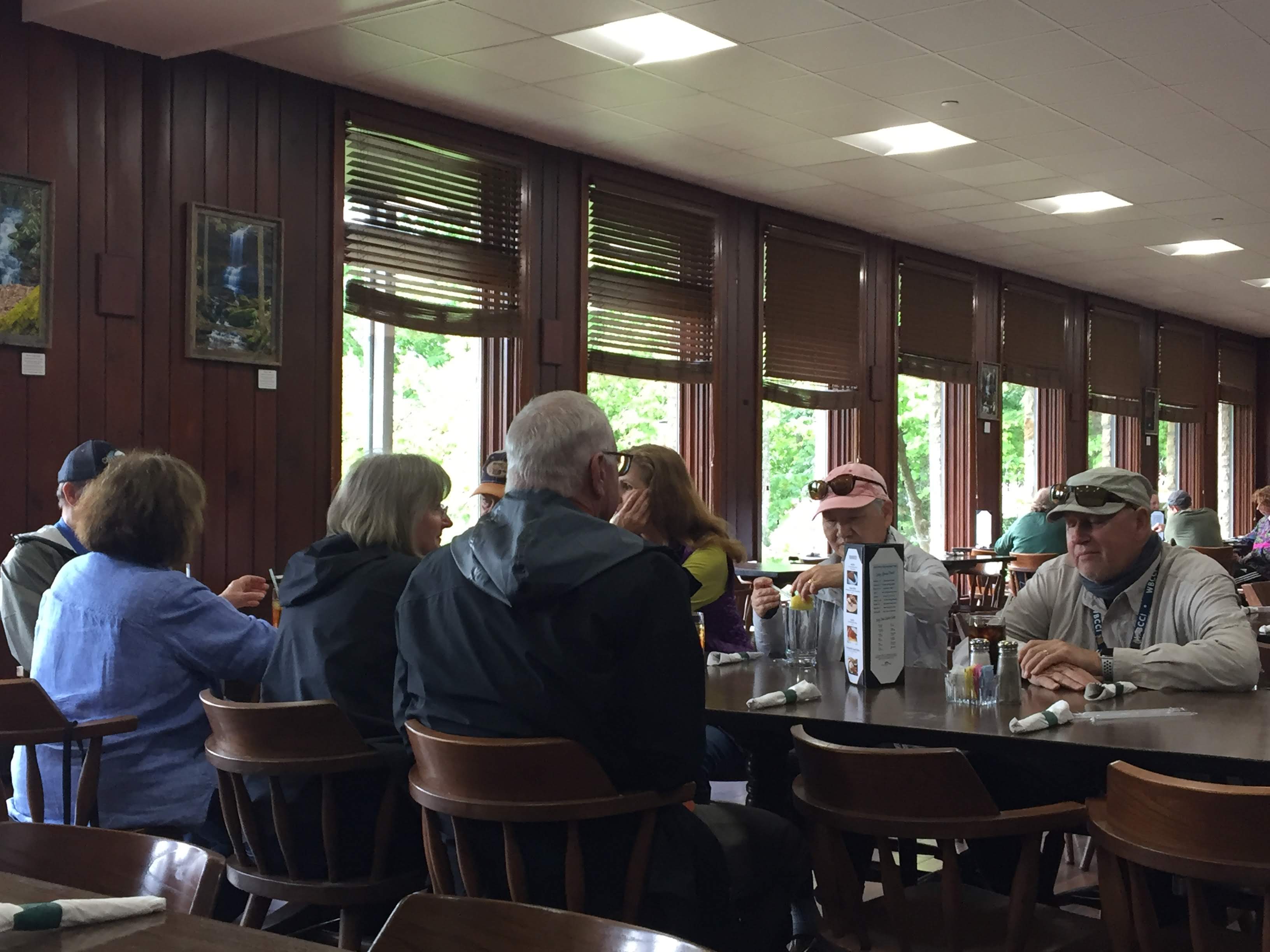
We returned to the lodge and enjoyed lunch in the dining room…
We walked back to the campground via the Bridle Trail. We enjoyed happy hours and had a quiet evening in The Villa…
We had our Drivers Meeting to discuss our drive to the Glen Canyon National Recreation Area, home of the Glen Canyon Dam and Lake Powell…
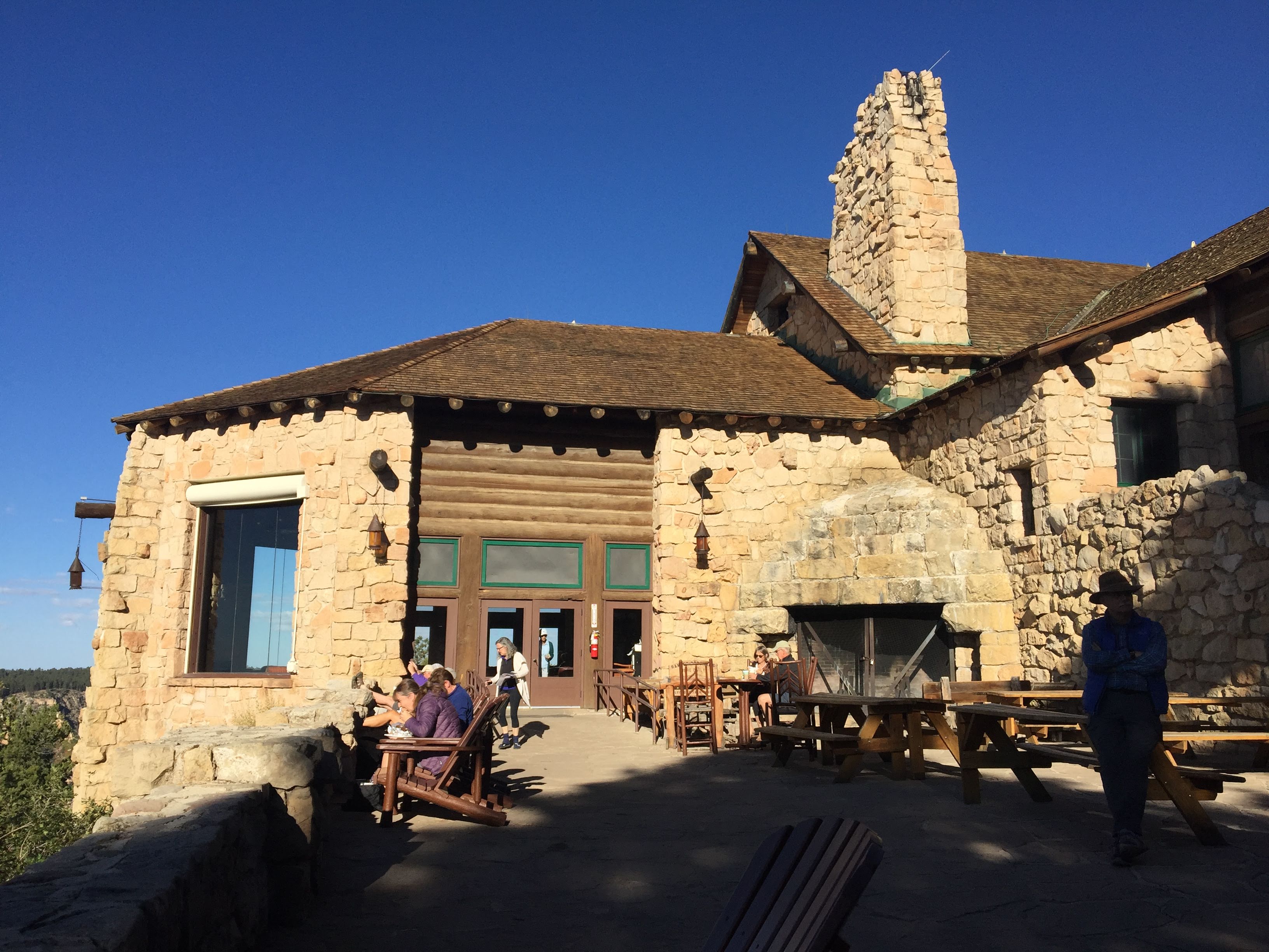
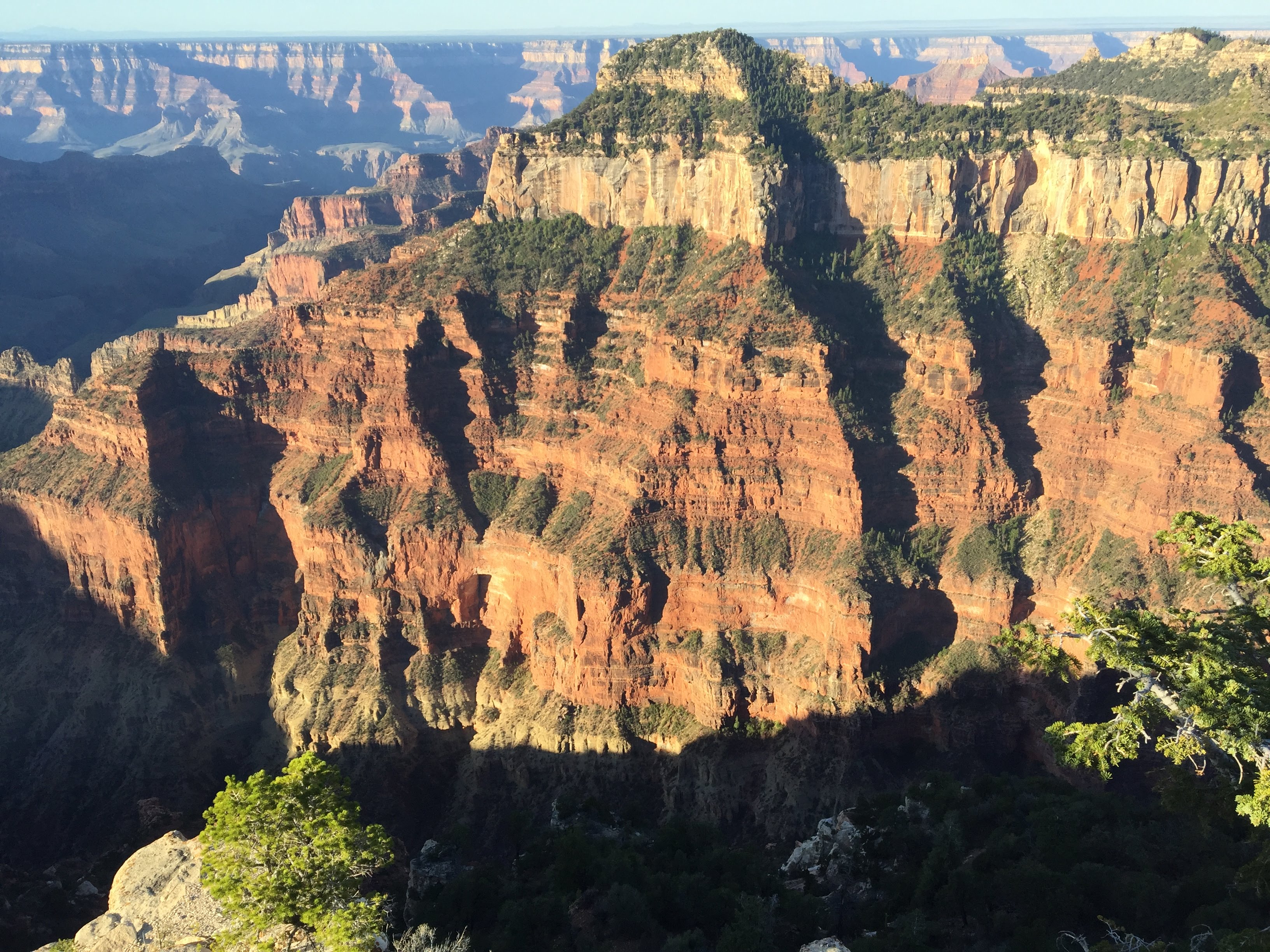
We woke up early this morning – it was still dark. We quickly got dressed and we were out the door before sunrise.
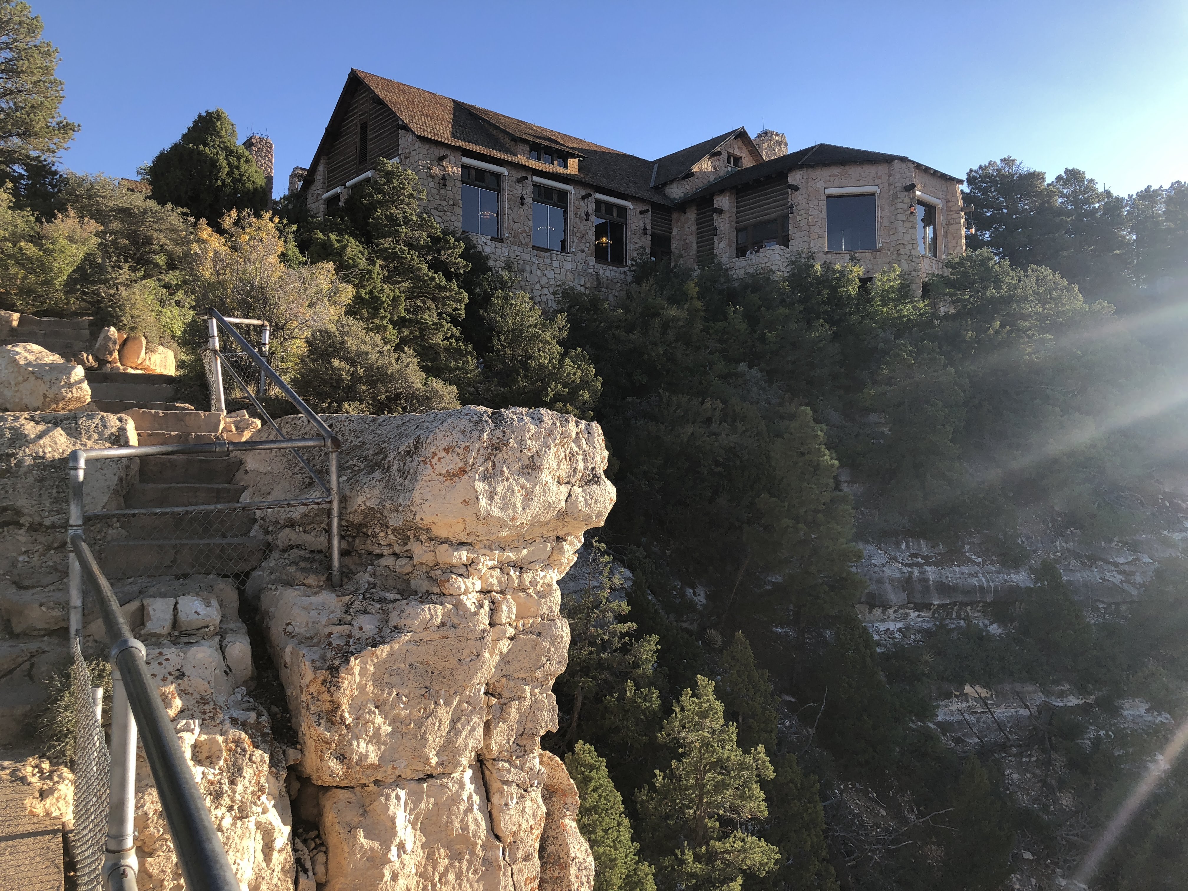
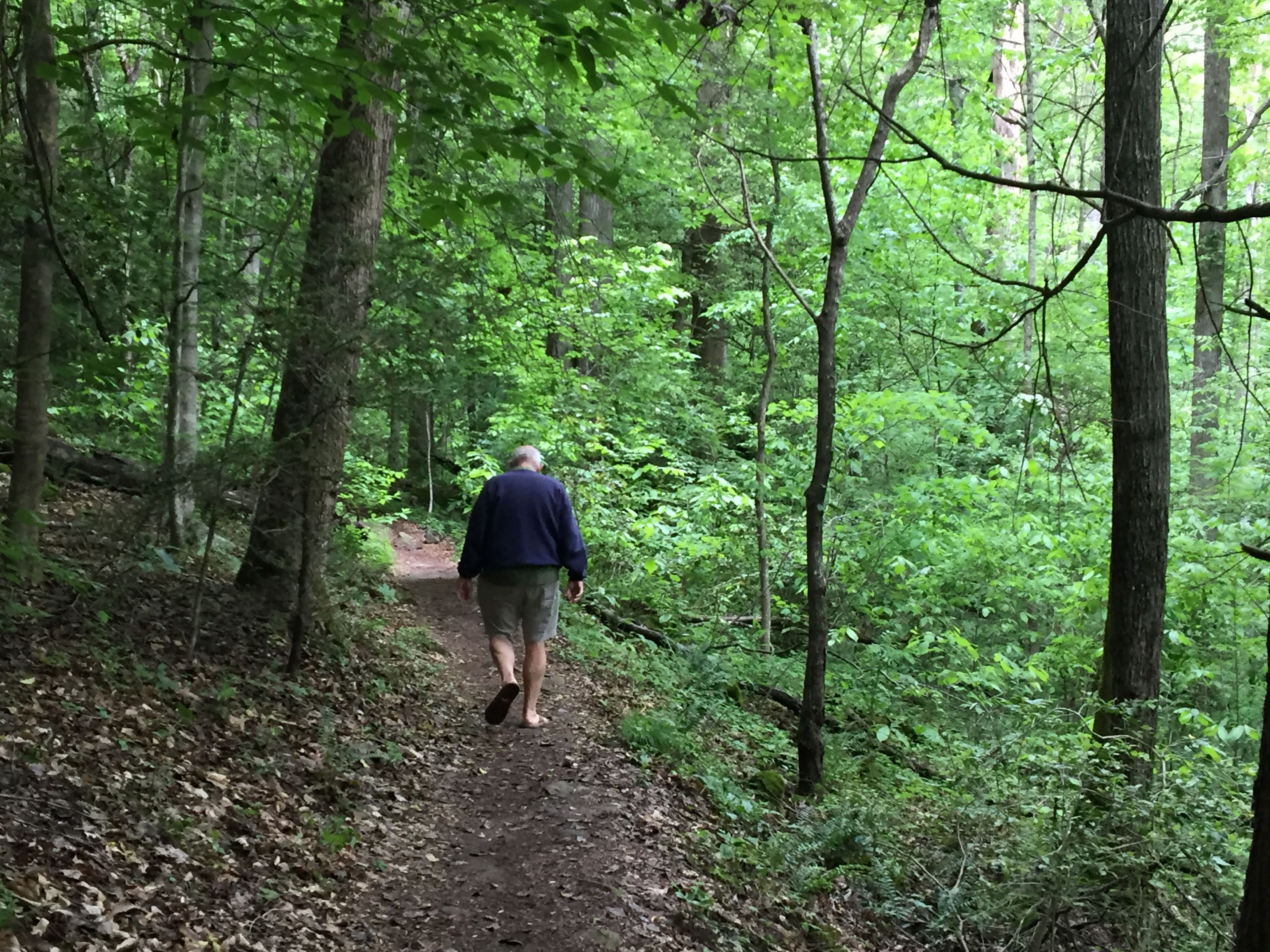
We walked the Transept Trail to the lodge. Transept is the name of a cross canyon that leads to the main Grand Canyon. The trail winds along the rim of the canyon. We were generally walking south, looking west, watching the sun light up the east facing canyon walls across the way…
After 1 1/2 miles along the trail we arrived at the Lodge…
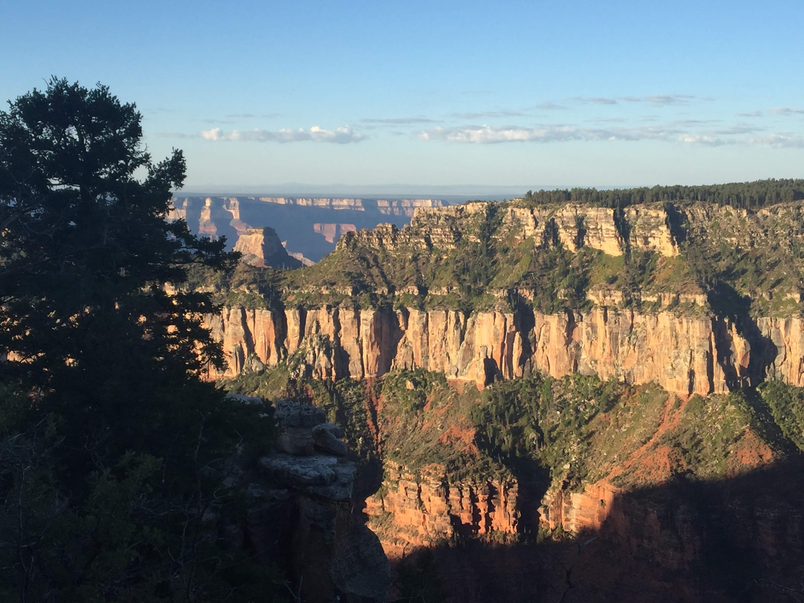
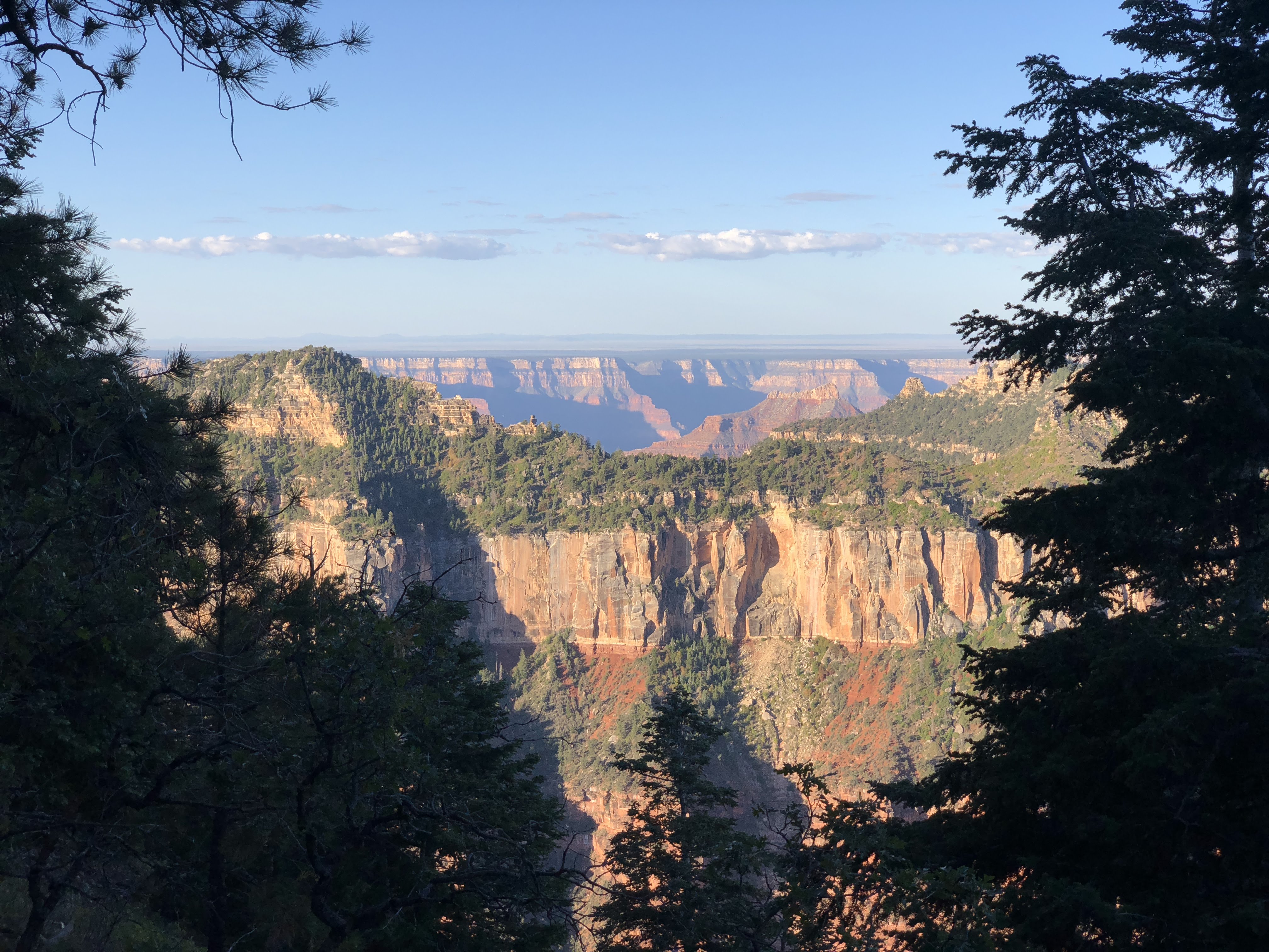
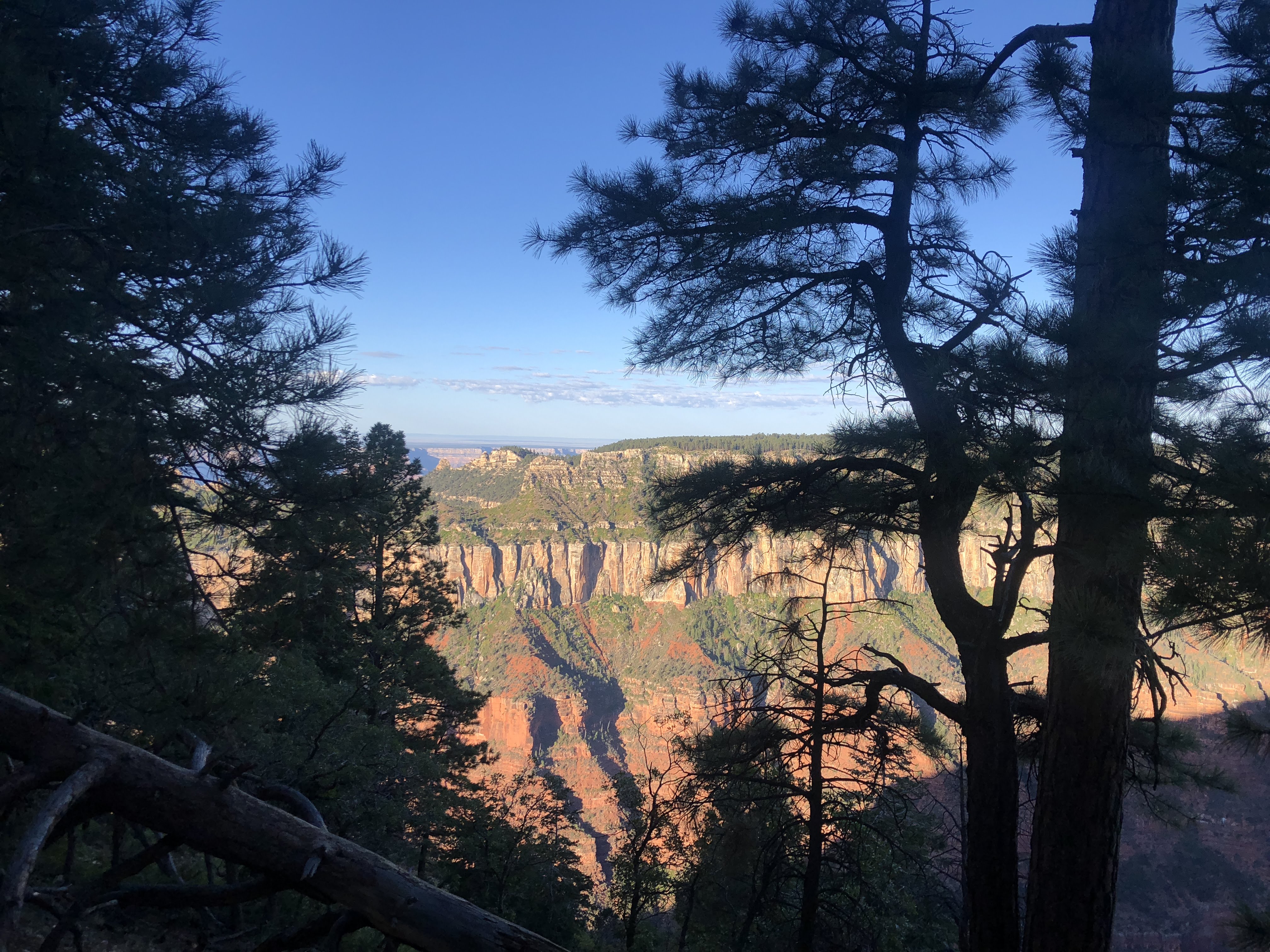
After arriving at the lodge, (1.5 miles) we again walked out to the end of Bright Angel Point… (+.5 miles = 2.0 miles) Not to many teenagers risking life and limb this morning…
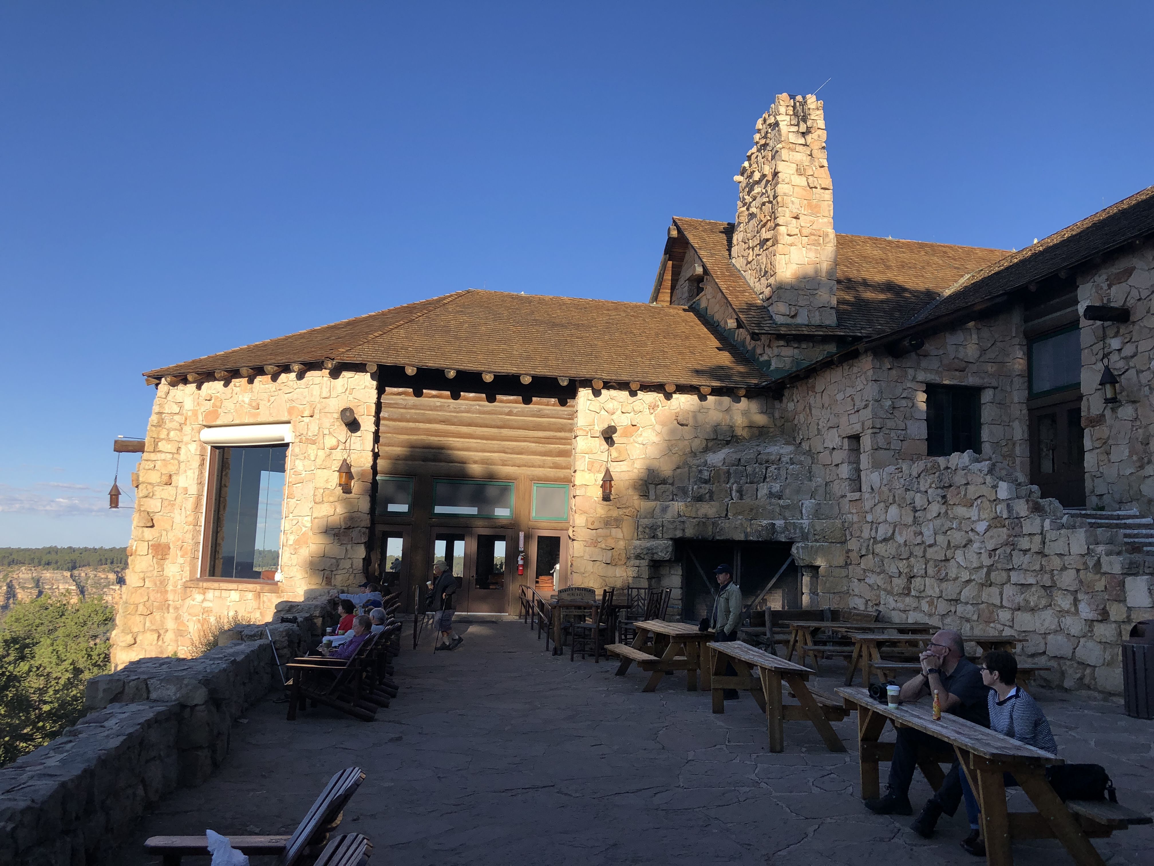
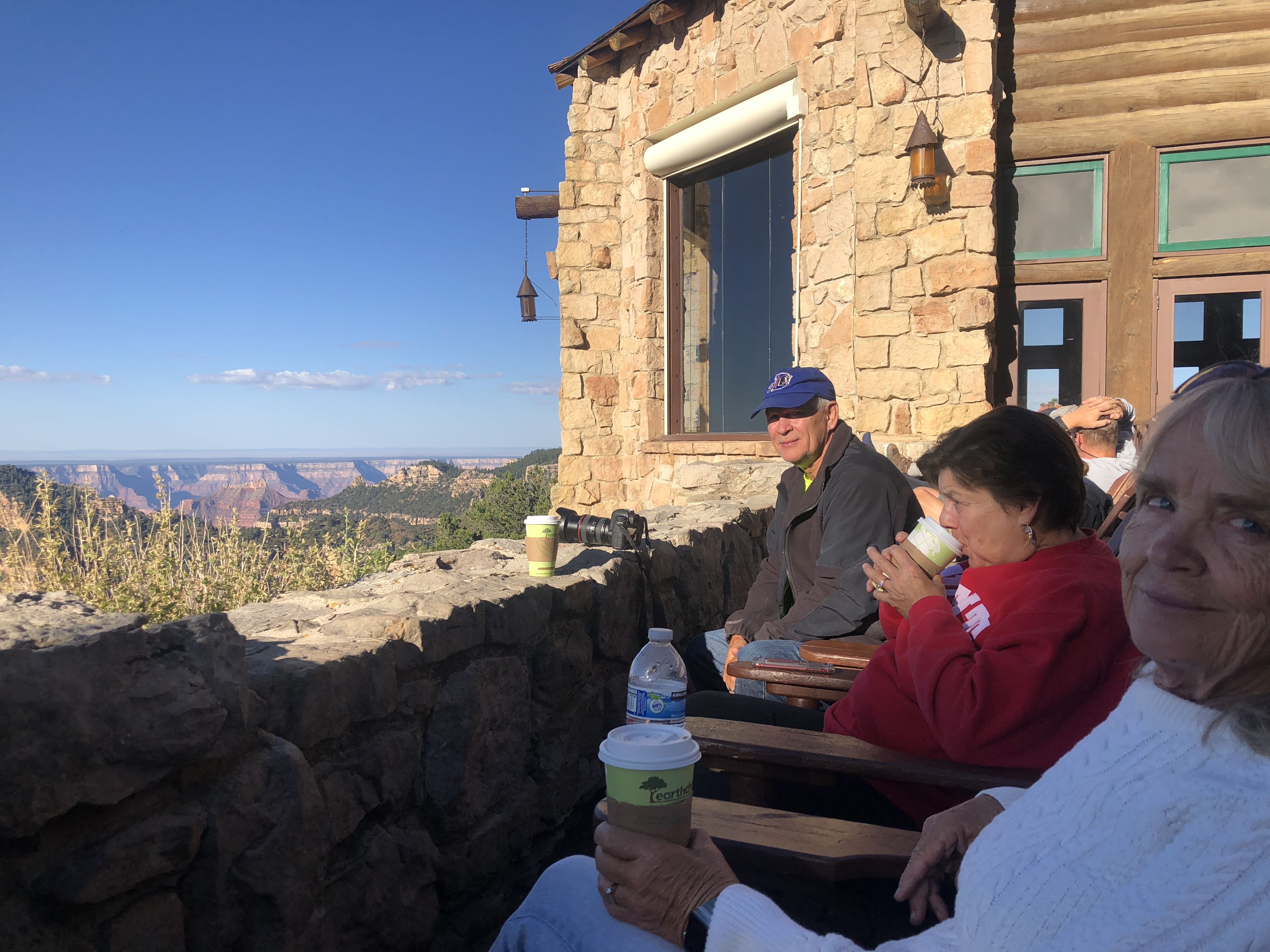
We bought coffee at the lodge, then sat on the terrace and watched as the sun continued to rise and paint the canyon walls…
Finally we went to the dining room and had a late breakfast of Pancakes and Eggs Benedict…
We then needed to do some more walking. We walked back towards the campground along the Bridle Trail…
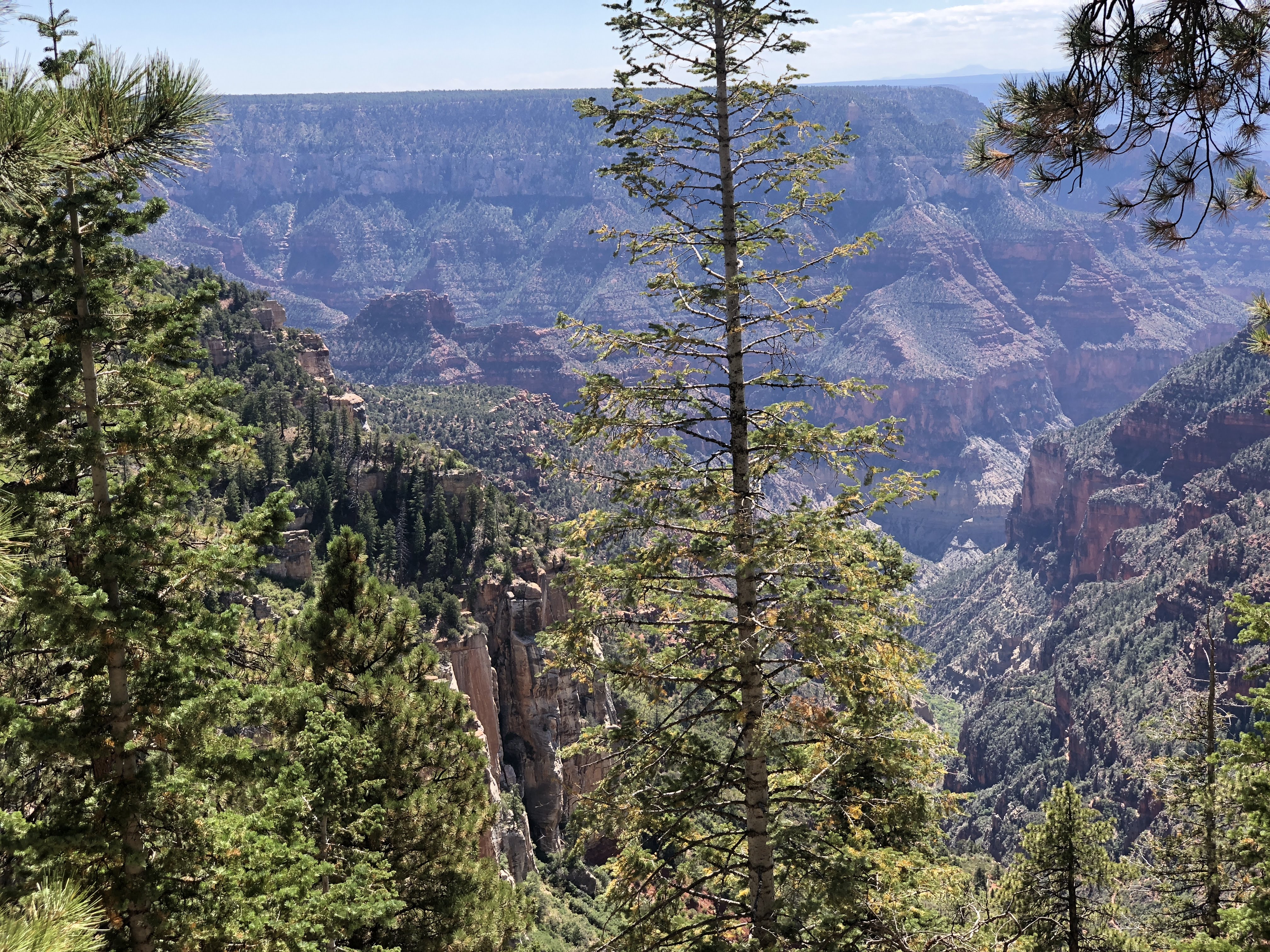
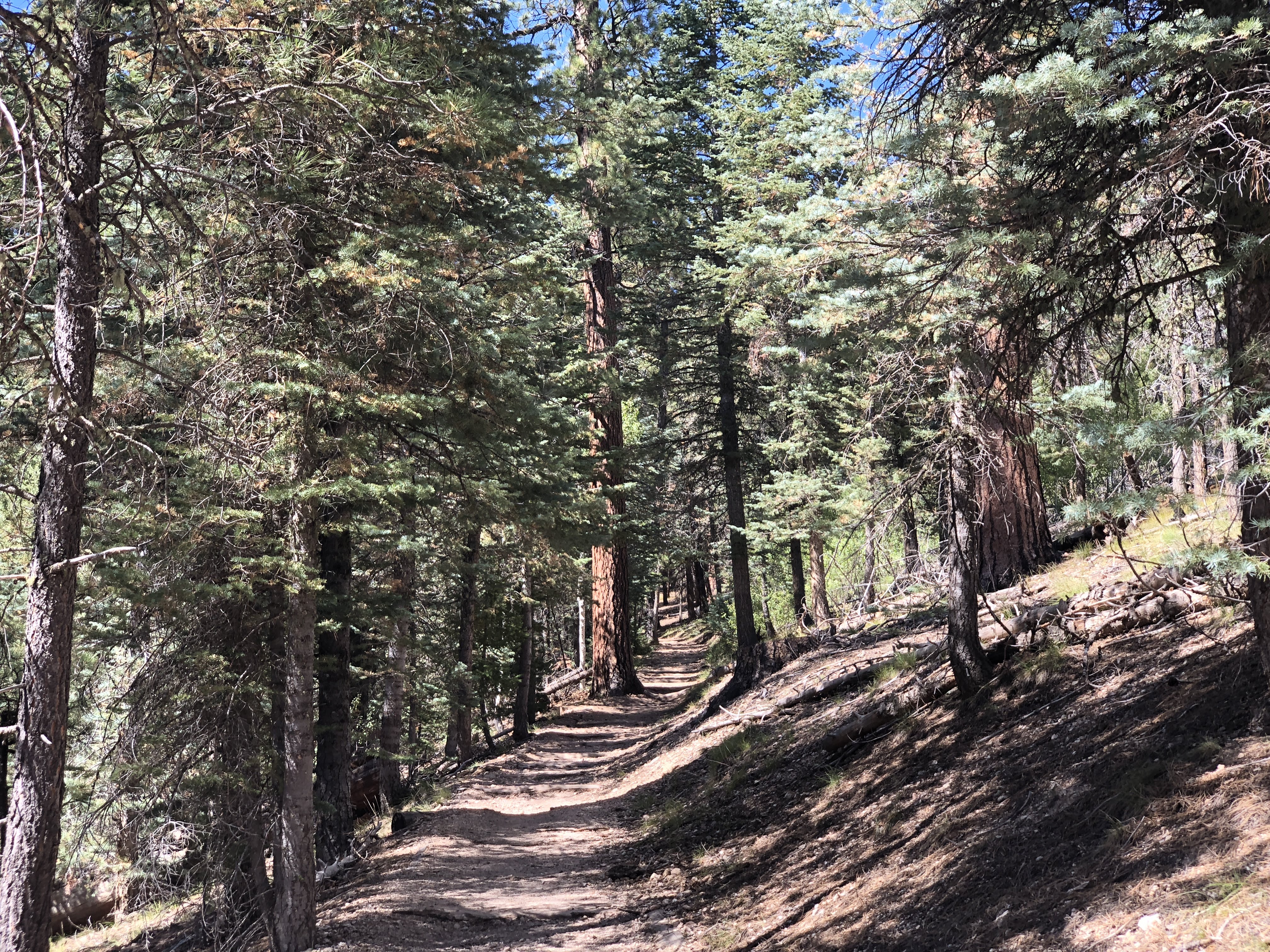
Then we continued to the trail-head for Uncle Jim’s Trail. (+3.0 miles = 5.0 miles)…
We walked the entire loop of Uncle Jim’s Trail. (+5.0 miles = 10.0 miles) Pro-Tip: Don’t bother – views were less than overwhelming, and the trail contained many trip hazards – roots, rocks, pine cones, and mule poop…
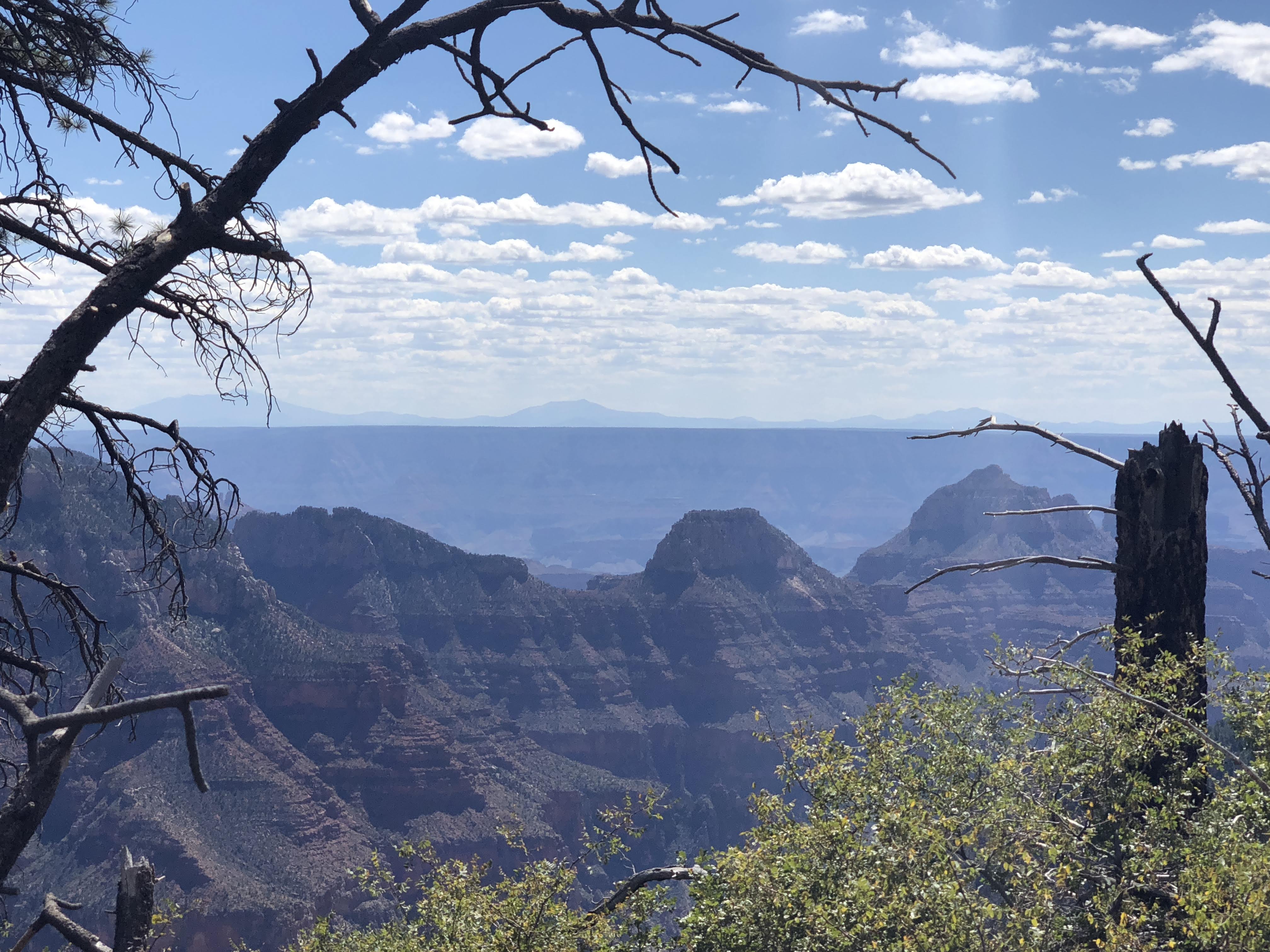
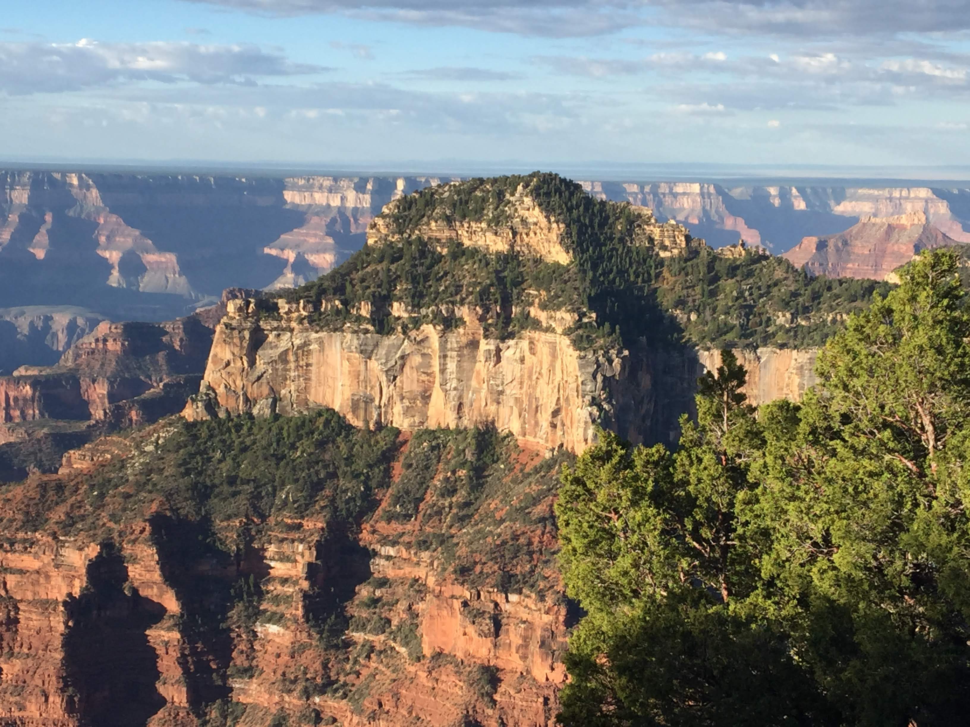
We walked so far I thought I spotted the ocean on the horizon…
No, it was only more of this hole in the ground surrounded by rocks… And a hazy view at that…
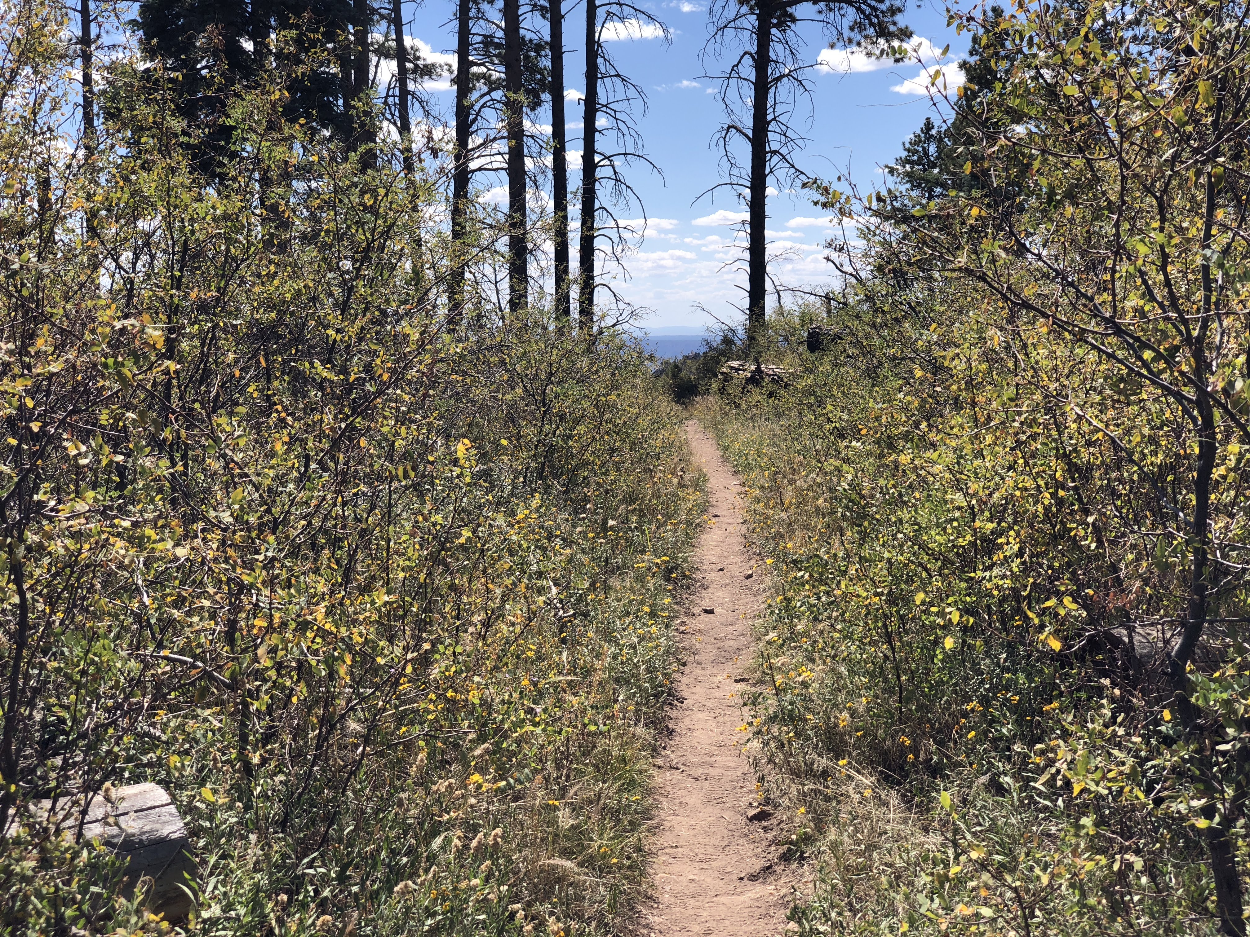
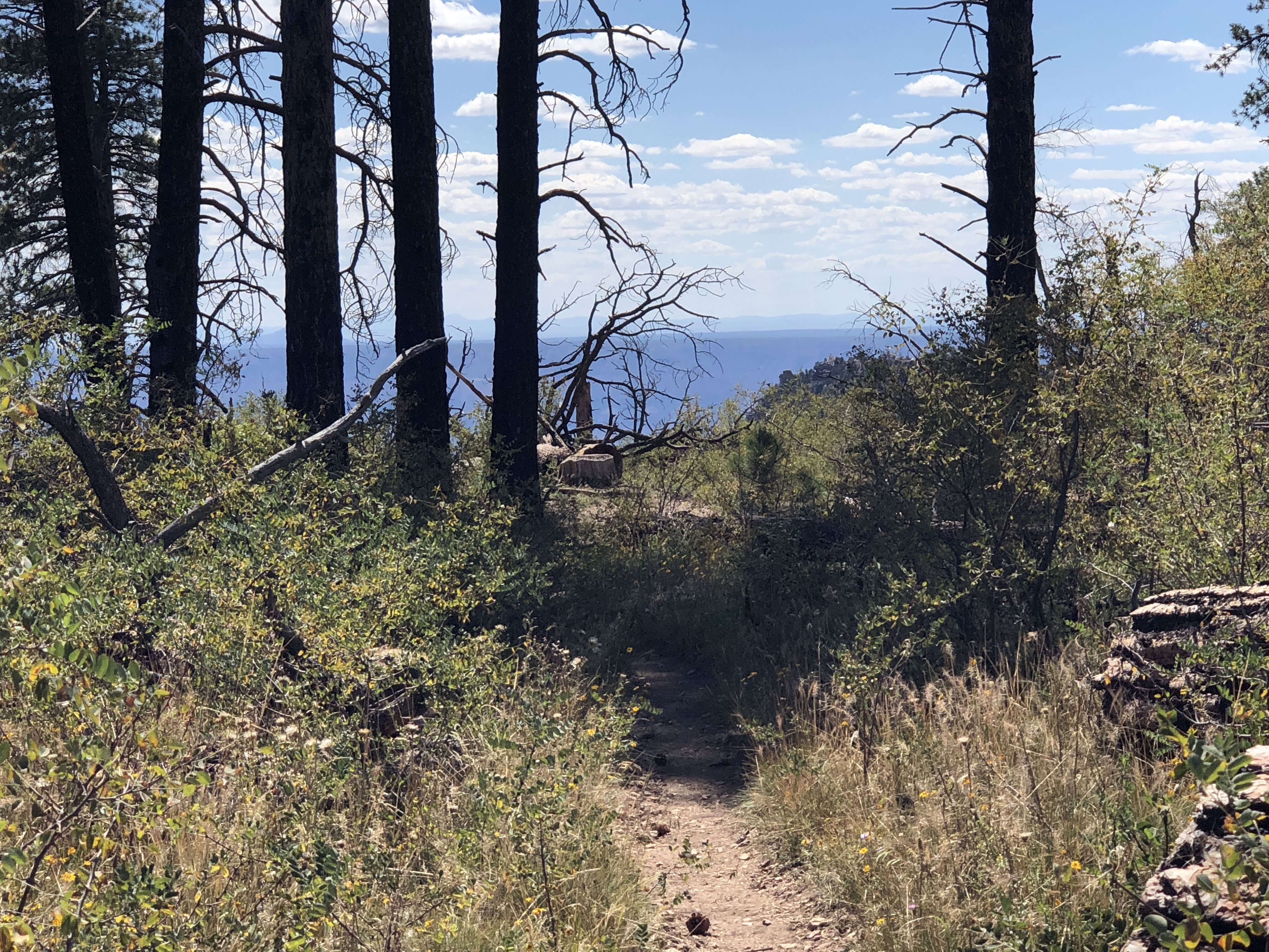
More trails, with more obstacles…
After returning to the trail-head we walked back to the Villa. (+2.0 miles = 12.0 miles). Other Airstreamers were having happy hours, sitting around campfires, and going out to dinner. We took off our shoes, drank a few bottles of water, and went to bed before dark…


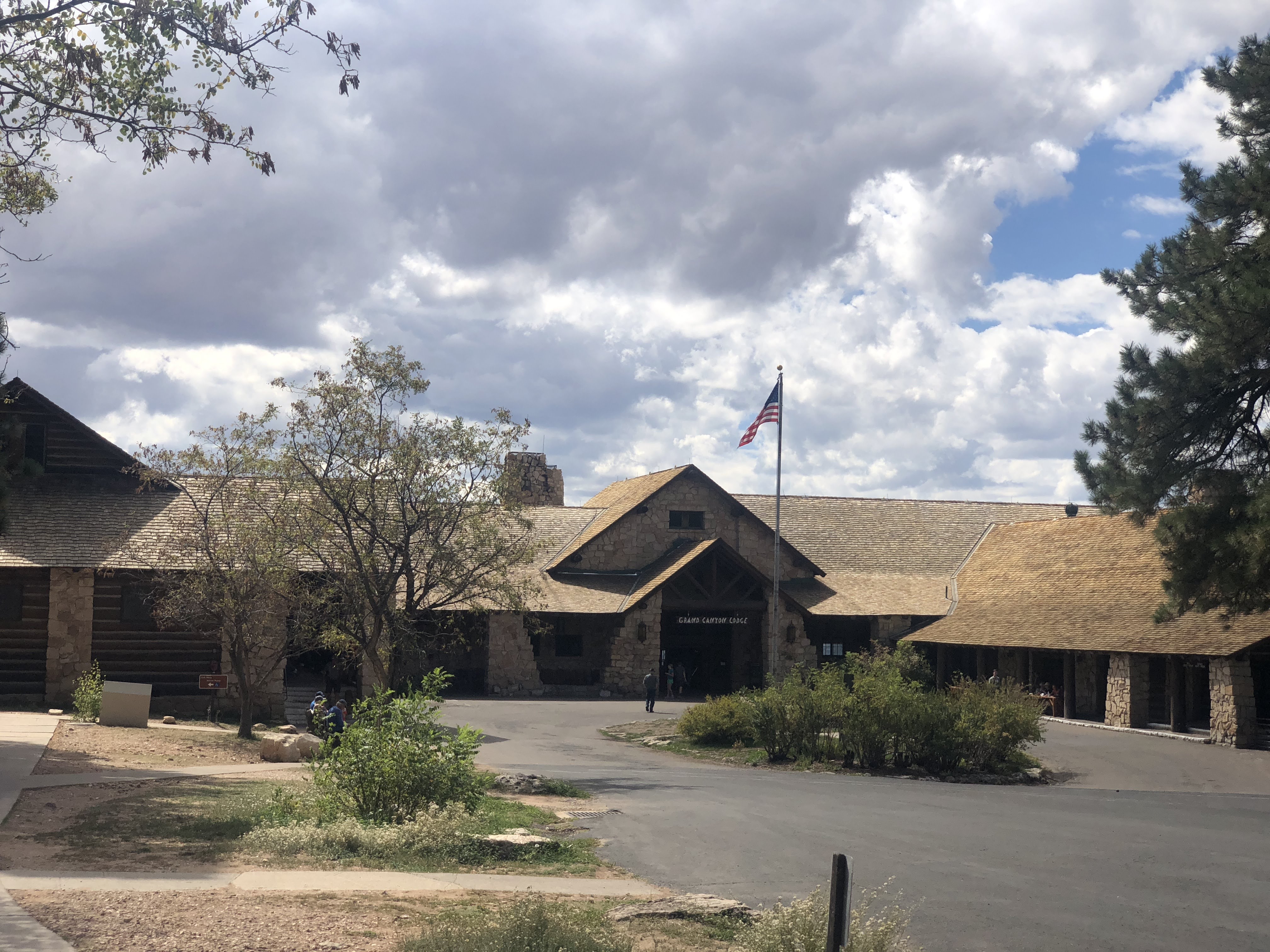


 After 1 1/2 miles along the trail we arrived at the Lodge…