Search

Adventures in the Villa

Category

Bridge

2019-05-02 – Airstream Caravan Travels – Springtime in Kentucky; Louisville and their Slugger! – Day #8

Once again we boarded the bus…

GRP_026220190501_065357

Soon we found ourselves in Louisville.

img_2427

Our first stop is at the Louisville Slugger factory.  But first, we once again attempted a group photo…

img_2393

And a selfie..

img_2391

And the final shot:

GRP_0277

The giant bat does dominate the skyline in this historic section on downtown Louisville…

img_2397

Inside we reviewed the current major league standings; how ’bout them Dodgers!

img_2398

The Louisville Slugger is made by Hillerich &  and Bradsby & Co.  They used to make butter churns, but they found that making bats is a more profitable business…

They have many bats that have been used in MLB games;  Lynda tried out the bats of current Dodgers Cory Bellinger and Justin Turner…  She also took a photo with Jackie Robinson…

img_8314img_2405img_2401img_2402

We watched a master bat maker working at his lathe making a bat.  It takes him about 30 minutes to make a bat, using the model bat as a template and hand-measuring every aspect of the new bat with a set of calipers to make sure it is an exact replica…

img_2407img_8315

(By the way, it takes 30 seconds for the CNC controlled lathes in the factory to make a bat, which is an exact replica of the specs that are programmed into the computer…)

The museum even has bats in its belfry…

img_2408

We enjoyed the tour (sorry, no photos…).

They use trees from western New York and eastern Pennsylvania; their trees are in sustainable forests, and most trees selected for bat-making are about 65 years old.  Bats are made mostly of maple, but also birch and ash.  They maintain 3,000 different bat designs.  Pros usually order 80-100 bats per player per season, to the tune of about $80 each.  Retail bats, and bats made for minor league baseball are cheaper…

Next on our agenda today is a river cruise up the Ohio River; Indiana is across the river at this point.

img_2416img_2417

We assembled for the lunch buffet on the lower, enclosed deck, out of the rain…

img_8324img_2418img_2419

Once underway the rain slowed and we could walk around the boat and see the sights…

img_2423img_8332

The water is quite high this time of the year…

img_8333img_8334img_2424img_8343img_8345img_8348img_8349img_8351

It was a nice boat ride.  Who doesn’t like boat rides?

Next we walked around downtown Louisville.  We are in the historic downtown, adjacent to the main financial district…  Lots of historical storefronts…

img_8305img_8306img_8307img_2415

Here is an area where the old buildings have been torn down, but the facades have been saved.  We also saw this with new, modern buildings built behind the historic facades.  Very nice!

img_2409img_2410img_2411img_2412

There are some Bourbon tasting rooms here, but we didn’t have time…

img_2429img_2430

We spent about an hour in the Frazier Museum…

We returned on the bus, and once again turned in early…

And an enjoyable time was had by all…

And in the spirit of all things baseball, I present the McAnoy children…

img_0238img_0236

2018-09-27 – WBCCI 2018 Southwest Adventure Caravan – Day 40 – Glen Canyon National Recreation Area

img_5897

We’ve had a busy few days… Today is a little more laid back…

The caravan broke into four groups to take a short trip to see Horseshoe Bend Slot Canyon, on the Navajo Nation Reservation… We were lucky to get the Noon time slot.  We were able to have a leisurely morning…

To get to the Slot canyon, we drove into Page, then rode in a truck outfitted with 15 seats… We were driven along the highway for three miles, then we rode over dirt and rock roads for another six miles…

img_8925img_8920img_8921img_8923img_8924

Once the truck parked, we walked the last 1/2 mile…

img_8926img_8928img_8929

Once we reached the entrance to the slot canyon our guide told us about it… Slot canyons are formed by erosion due to water and wind.  While they are beautiful, they are dangerous if thunderstorms are in the area.  They can fill with raging torrents of water within seconds…

img_8930

The canyon averages about six feet wide, with many places only about three feet wide.  It is mostly open to the sky, but, because of the narrow width of the canyon, sunlight sometimes does not reach in to the bottom of the canyon…

We walked from one end of the canyon to the other, then back again.  All along the way are spectacular views up, out, around, and through the sandstone walls.  These canyon walls are Navajo Sandstone, and they really are this color red…

img_8989img_8991img_5926img_5929img_8994img_5933img_9014img_9016img_5940img_5942img_9025img_5944img_9030img_9031img_9041

Our driver, and tour guide, was a Navajo women who grew up on this land.  She first saw this slot canyon when she was six years old and the sheep she was tending wandered into the area.  Her grandfather was named Manson, and it was he that traded the land named after their family to the Federal Government for the construction of the Glen Canyon Dam.  In exchange for his land, the Navajo Nation received some much coveted land in Utah.

(The Navajo Nation Reservation is one of the few reservations in the US that is actually on the ancestral land of these particular Indians.  They owe this to  the Spanish explorers, who controlled this entire area, in the 1600s and 1700s.  The Spanish explorers and the subsequent Spanish government kept meticulous records of who owned what.  When the Federal government wanted to put the Navajo Indians onto a reservation, the courts held that this was their ancestral land and that they could stay on it as their reservation… Zuni, Acoma, and Hopi Indians are in a similar situation…)

After our tour we returned to the Villa and had a relaxing evening.  Most Caravaners went out for one thing or another, so the entire campground was quiet…

img_5954img_5951

And an enjoyable time was had by all…

2018-09-25 – WBCCI 2018 Southwest Adventure Caravan – Day 38 – Glen Canyon National Recreation Area

img_8675

Another busy day on the caravan…

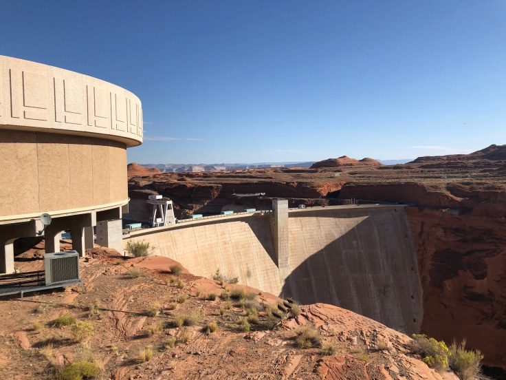
We began with a tour of the Glen Canyon Dam…

Glen Canyon Dam is a concrete arch-gravity dam on the Colorado River, near the town of Page.  The 710-foot high dam was built by the U.S. Bureau of Reclamation (USBR) from 1956 to 1966 and forms Lake Powell, one of the largest man-made reservoirs in the U.S. with a capacity of 27 million acre feet.  The dam is named for Glen Canyon, a series of deep sandstone gorges now flooded by the reservoir; Lake Powell is named for John Wesley Powell, who in 1869 led the first expedition to traverse the Colorado’s Grand Canyon by boat.  You will remember that we saw the Powell Museum in Green River, UT.

Because the dam site was in a remote, rugged area of the Colorado Plateau – more than 30 miles from the closest paved road, U.S. Route 89 – a new road had to be constructed, branching off from US 89 north of Flagstaff, Arizona, and running through the dam site to its terminus at Kanab, Utah.  Because of the isolated location, acquiring the land at the dam and reservoir sites was not particularly difficult, but there were a few disputes with ranchers and miners in the area (many of the Navajo Nation).  Much of the land acquired for the dam was through an exchange with the Navajo, in which the tribe ceded Manson Mesa south of the dam site for a similar-sized chunk of land near Aneth, Utah, which the Navajo had long coveted.  (Tomorrow we will meet descendants of the Navajo man named Manson.  Stay tuned…)

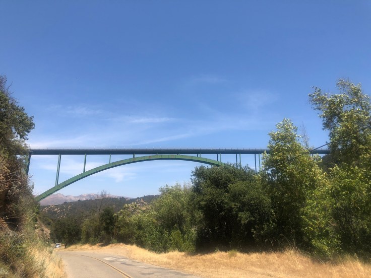
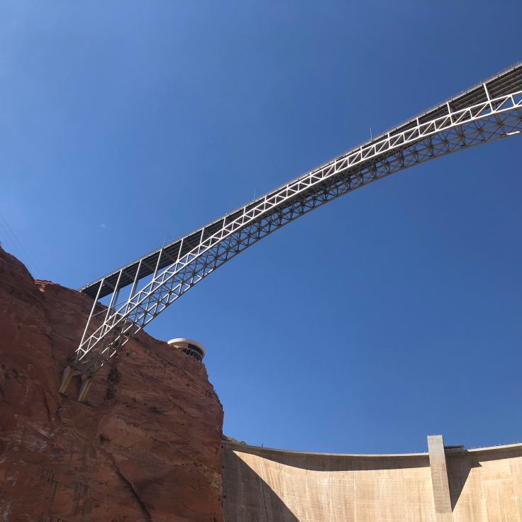
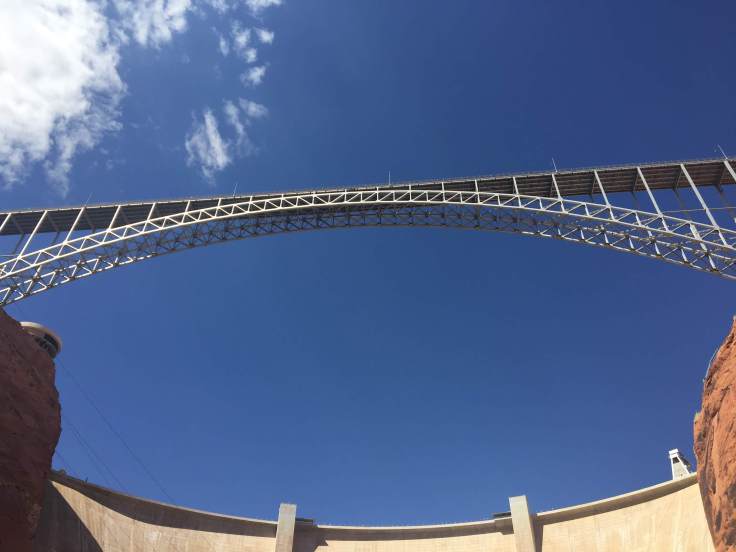
One of the first acts of construction was a suspension footbridge made of chicken wire and metal grates. At the time it was the only way to cross Glen Canyon.  Vehicles had to make a 225-mile journey in order to get from one side of the canyon to the other.  A road link was urgently needed in order to safely accommodate workers and heavy construction equipment.   A steel arch bridge was built; construction began in late 1956, reaching completion on August 11, 1957.  When finished, the steel arch Glen Canyon Bridge was itself a marvel of engineering: at 1,271 feet long and rising 700 feet above the river, it was the highest bridge of its kind in the United States and one of the highest in the world.  The bridge soon became a major tourist attraction.  The March 1959 issue of LIFE reported that “motorists [were] driving miles out of their way just to be thrilled by its dizzying height.”

During the construction of the Glen Canyon Bridge, the USBR also began planning a company town to house the workers.  This resulted in the town of Page, Arizona, named for former Reclamation Commissioner John C. Page.  By 1959, Page had a host of temporary buildings, electricity, and a small school serving workers’ children.  As the city grew, it gathered additional features, including numerous stores, a hospital, and even a jeweler. 

Prior to and during construction, three separate grants were issued by the National Park Service to document and recover artifacts of historical cultures along the river. These went to University of Utah historian C. Gregory Crampton and anthropologist Jesse Jennings, and to the Museum of Northern Arizona.  Crampton subsequently wrote several books and articles on his findings.

We walked atop the dam, viewing the bridge above and the river below…

img_8495

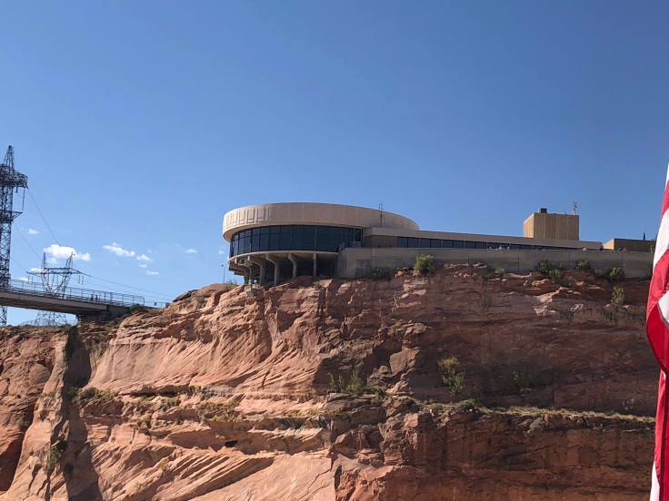
The visitors center perches atop the canyon rim above the dam…

img_8496

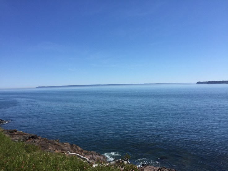
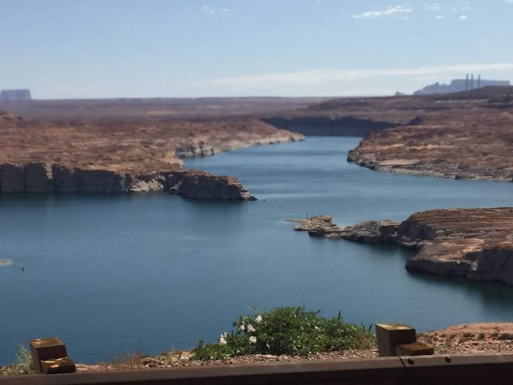
Lake Powell behind the dam…

img_5781img_8506

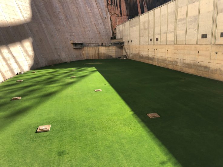
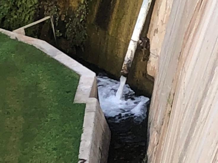
As the giant pipes carry water from the lake to the power plant at the bottom of the dam, the water forms such a turbulent force that the pipes vibrate and shake and would destroy anything rigid that seeks to contain them… Therefore, they covered the pipes with gravel, sand, and finally grass that would give pride to any golf course…

img_8517

From the bottom of the dam we looked up to see the visitors center…

img_8520img_8525

This is the water that seeps through the concrete that makes up the dam – about 1,600 gallons per minute…

img_8522

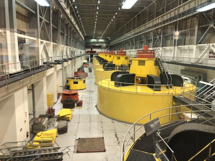
The power plant – 8 giant turbine generators providing electricity for the surrounding states…

img_8524

We can see Lake Powell stretching over 186 miles up-stream…

img_5803img_5804

Interesting facts:  See the tunnel entrance in the canyon walls beyond the power plant?

img_8526

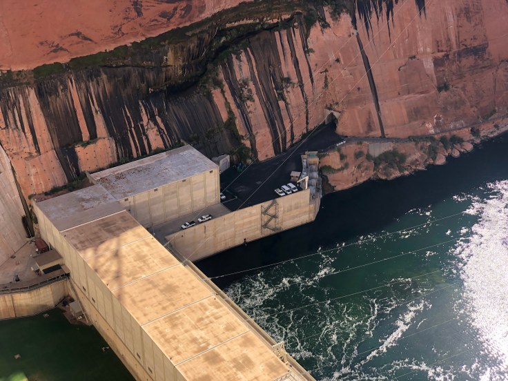
The tunnel is two miles long and it extends from the power plant at the river to the rim of the canyon above.  It took two years to build, and it was necessary to get equipment to the dam foundations and to the power plant…

Stay tuned for more information… This afternoon we will travel through this tunnel…

It was an interesting tour, as all dam tours are…

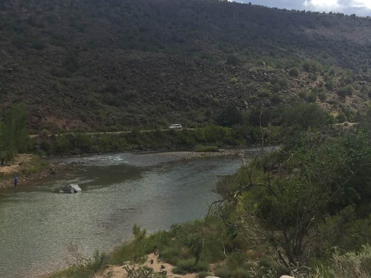
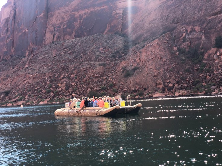
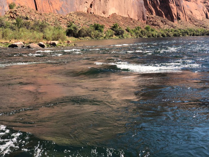
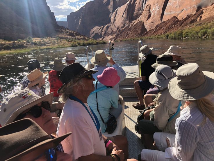
We returned to the Villa in time to turn around and head out for our raft trip on the Colorado River.  We will be starting just below the dam and we will be going down the river about 16 miles to Lee Ferry.  This is a quiet stretch of the river.  Rapids in rivers such as the Colorado are rated from 1-10, with 10 being the biggest.  The “rapids” on this portion of the river are about .3!

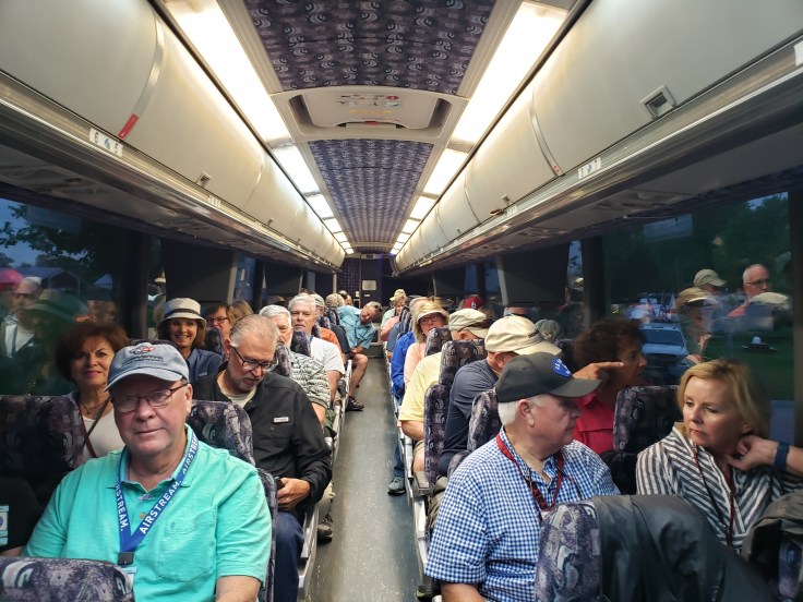
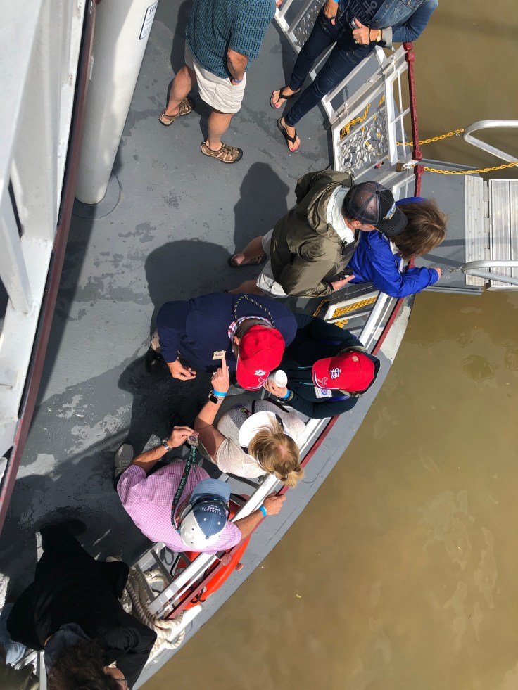
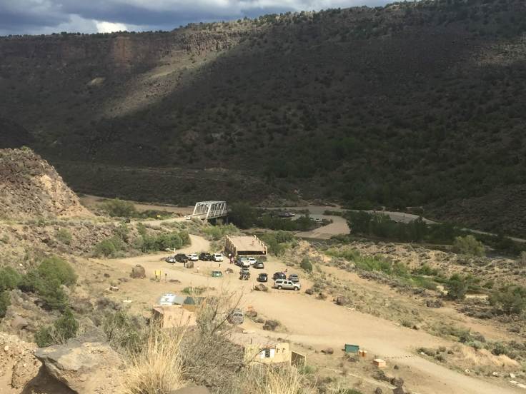
We met at the Raft Tour office in Page.  After the Homeland Security check we boarded a bus (salvaged from LA Unified School District in 1959) to ride to the river.  Why a Homeland Security check?  We get to ride in our bus down the two mile long tunnel and park at the foot of the dam.  We were admonished not to take pictures in the tunnel, of the tunnel, or anywhere around the tunnel.  Nor were pictures allowed of the wharf at the foot of the dam.  The bus parked with its door directly adjacent to the ramp down to the dock.  We even had to wear hard hats!  Apparently people on the bridge overhead like to throw things off the bridge!  Who knew?  So we left the bus and boarded the rafts…

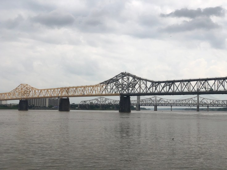
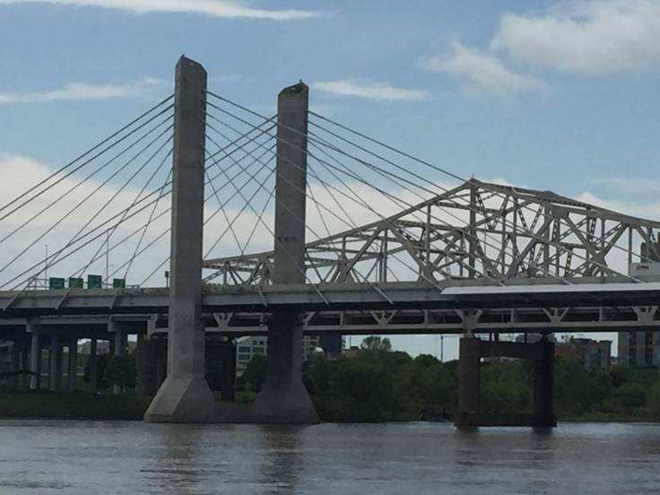
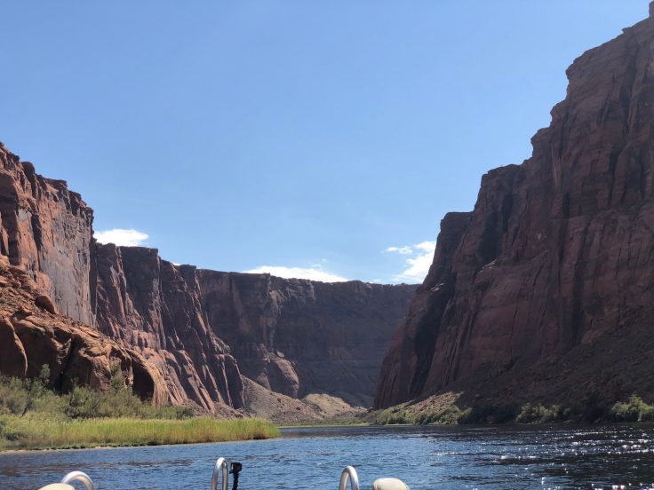
We were allowed to take pictures of the river and the bridge overhead…

img_8531img_8533img_8534img_5807

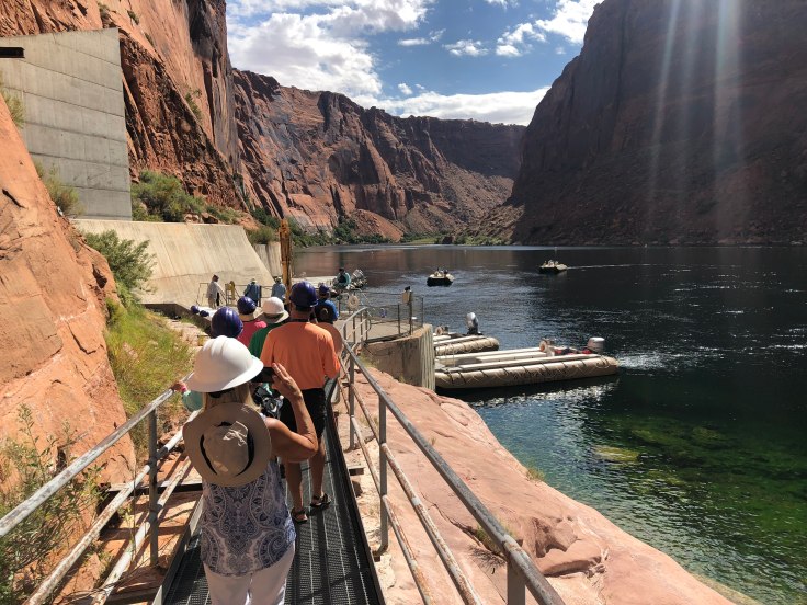
We boarded the rafts and away we went…

img_8537img_8542

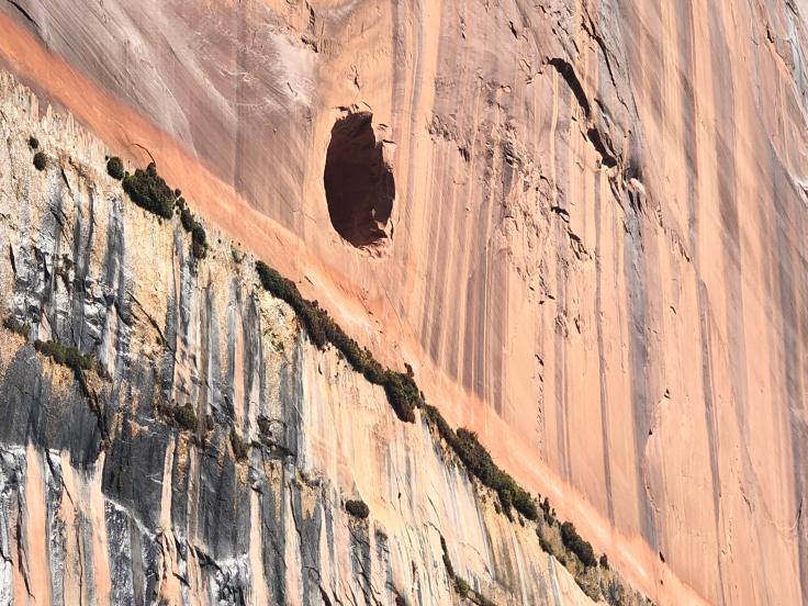
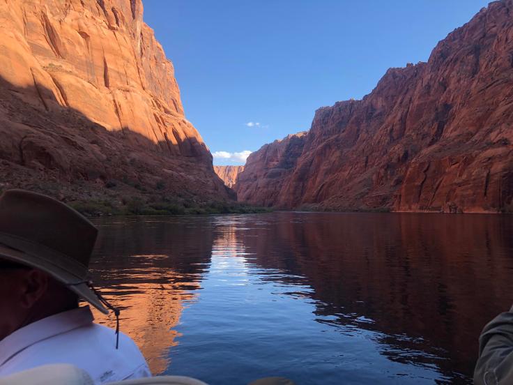
The first thing we noticed were these holes in the canyon walls… They are “windows” into the tunnel.  (about 15 feet diameter…) We could follow them along the two miles, as they rose up to the canyon rim… They used these holes for ventilation, and to push the debris out, where it fell to the river below…

img_8545

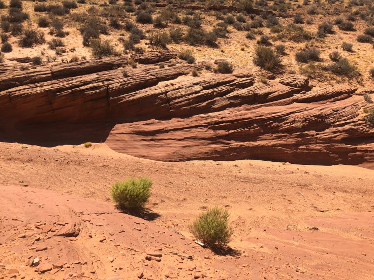
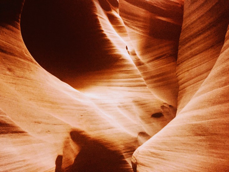
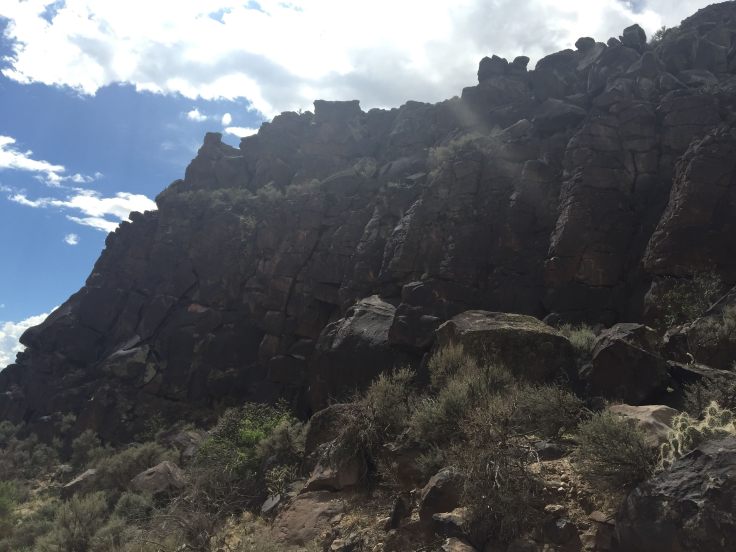
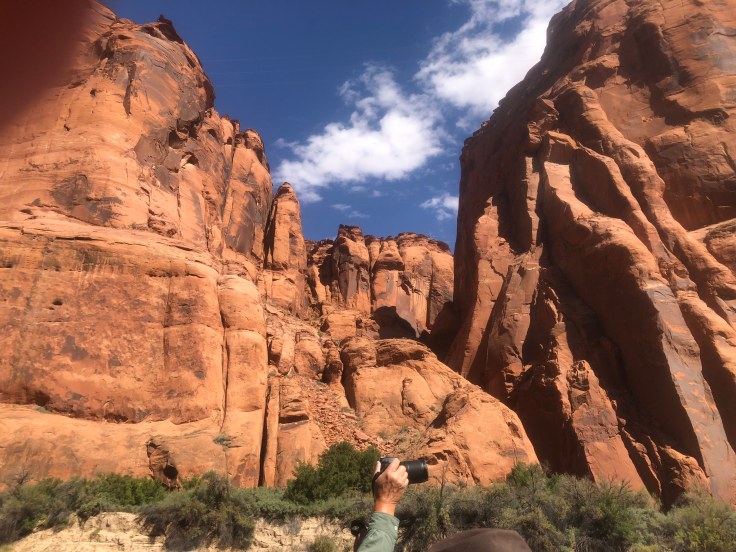
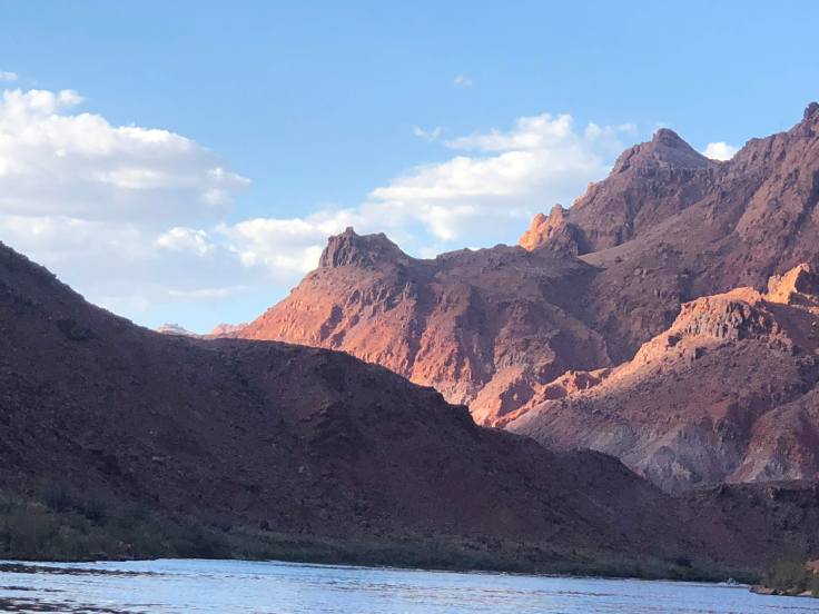
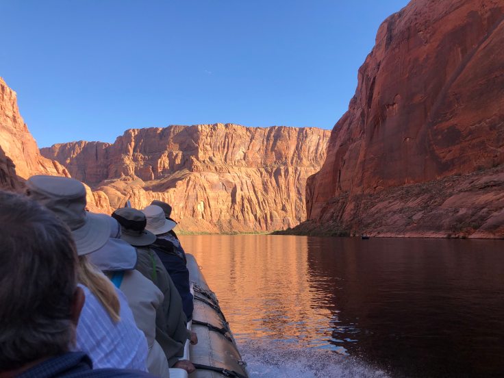
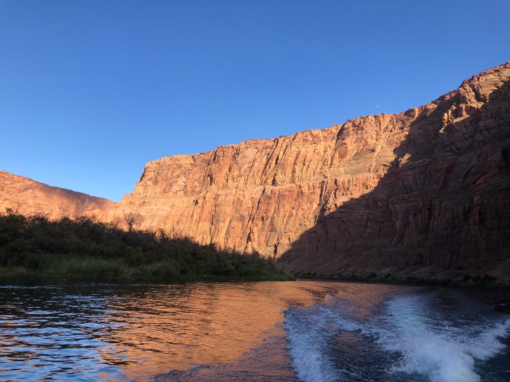
All along the river we had fabulous views of the canyon walls.  They extend up above the river to a height of about 500 feet at the dam to over 1,000 feet at Lee Ferry.  In contrast, the rim of the Grand Canyon is about one mile, over 5,000 feet, above the river… We took literally hundreds of pictures.  I’ll only show a few…

img_8550img_5813img_8560img_8570img_8564

The “rapids”…

img_8572img_8577img_8576img_8591

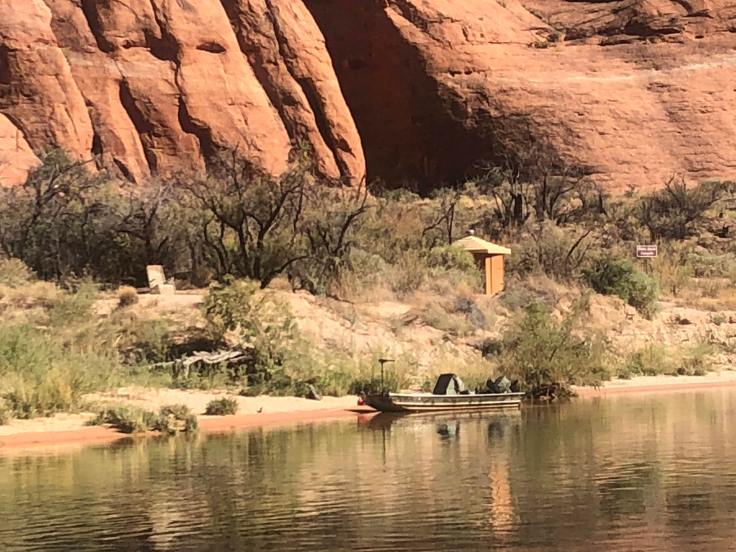
Camping is allowed along the river, at about 10-12 sites.  Obviously, you must boat or kayak in, and pitch a tent… Restrooms are provided…

img_8595

Rocks…

img_8601img_8605
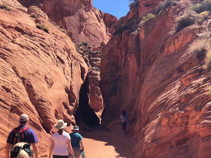
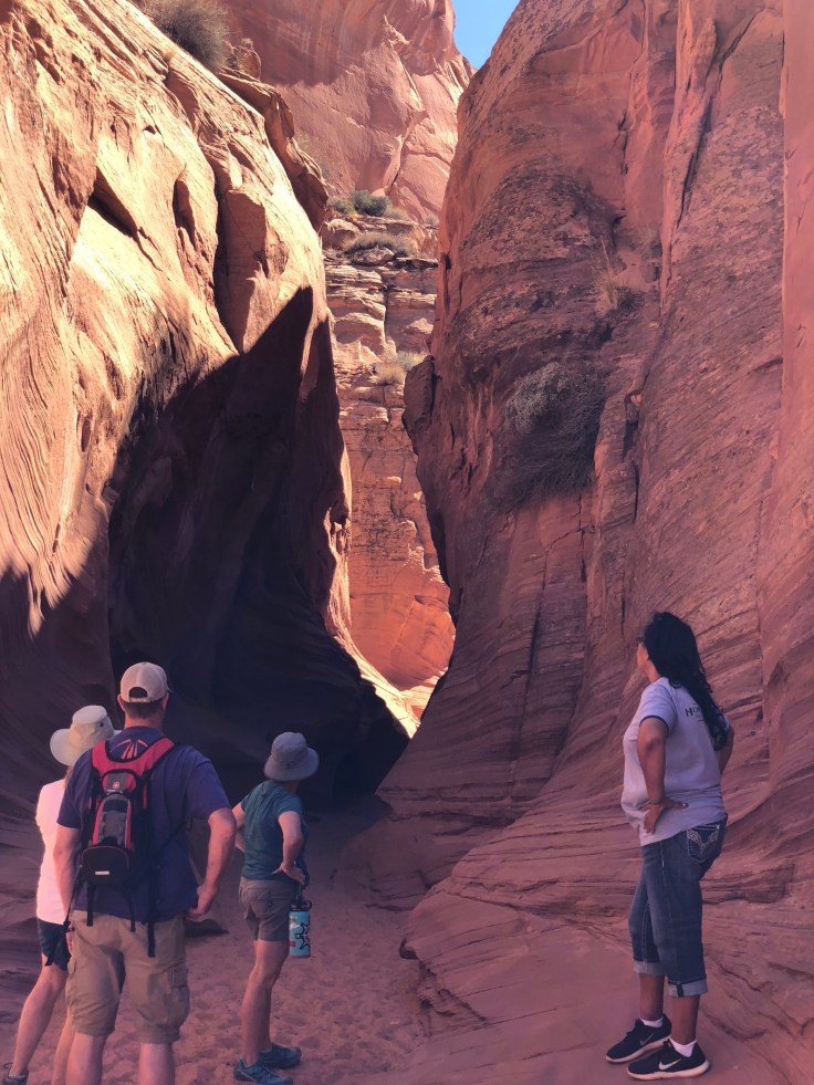
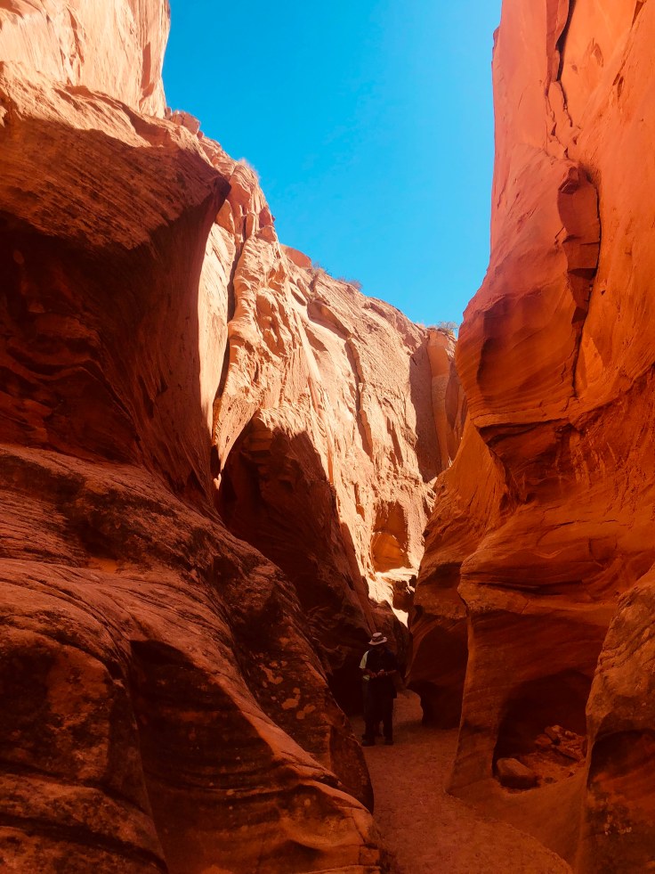
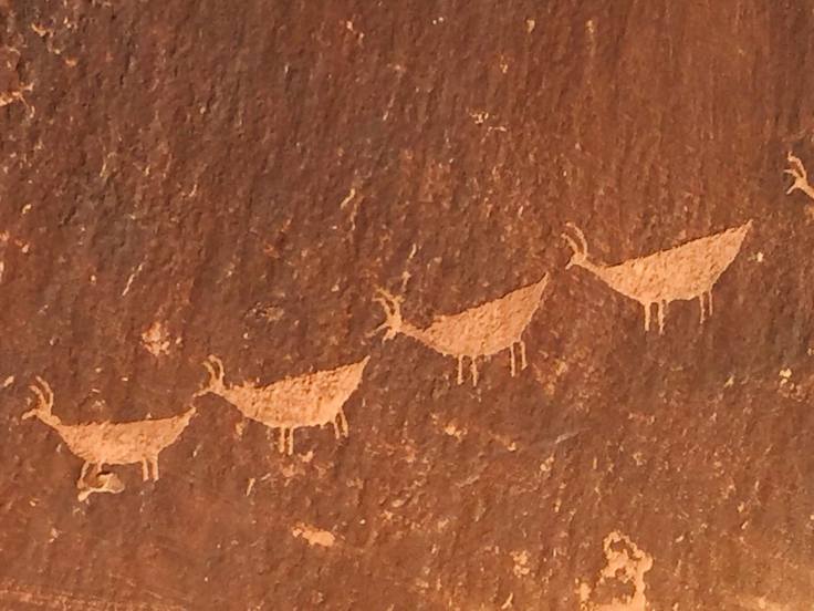
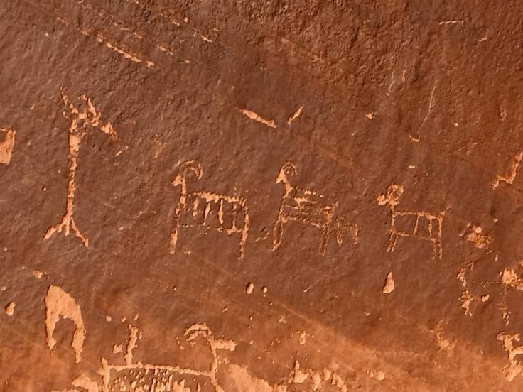
We stopped at one point to stretch our legs and hike up a short distance to see some petroglyphs…

img_5824img_5822img_5821

We re-boarded the rafts and continued on our way…

img_8638img_5826img_8634

Our pilot, guide, and expert on all things Navajo…

img_8640img_8655img_8656img_8659

There is a fault that runs across the river – these rocks are virtually identical, on opposite sides of the river…

img_8663img_8661img_8665img_8690img_8693img_8697img_8675img_8680img_8687

We arrived at the end of the trip… Our school bus was waiting to take us back to the offices in Page…  The end of our trip, Lee Ferry, is a departure point for 4-7 day white-water rafting trips through the Grand Canyon and beyond… It sounded like fun!

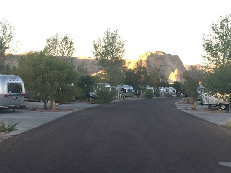
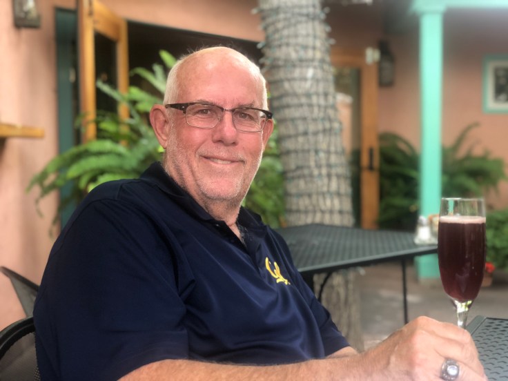
We returned to the Villa quite exhausted.  However, we did have enough energy to spend a few happy hours chatting with another Airstream couple from North Carolina.

And an enjoyable time was had by all…

2018-08-25 – WBCCI 2018 Southwest Adventure Caravan – Day 7 – Taos

img_6664img_4566img_4567

img_4568

Today we traveled to Taos, about 45 miles (1 1/2+ hour drive…).  As usual, the landscape around here is stunning…

Along the way we stopped at several small towns and villages to see some of the local color…

img_4569img_4571

img_4572

In Taos we enjoyed another unique lunch at Lambert’s…

img_6668

We looked around Kit Carson’s house…

img_45741img_45751

Kit Carson was born in the early 1800s and spent most of his life exploring the wild west, enduring many dangers and surviving them all.  He died in Taos at the age of 59 of a burst aneurysm…

Taos has many nice shopping streets, but on a much smaller scale than Santa Fe…

img_6673

img_6671

img_6680img_6674img_6675

After enjoying all that we could, we headed back to Pojoaque, taking a detour to see the Rio Grande Gorge Bridge…

img_6682img_6685img_6687

The Rio Grande Gorge Bridge, locally known as the “Gorge Bridge”,  is a steel deck arch bridge across the Rio Grande Gorge 10 miles northwest of Taos. Roughly 565’ above the Rio Grande, it is the seventh highest bridge in the United States.

Those of you who have followed my blog for a while recall that we recently visited the Cold Springs Canyon Bridge, near Santa Barbara…

img_6200

While the Rio Grande bridge is taller, the span of the Cold Springs bridge is longer… It is also more fun to walk under a bridge like this than to walk over it…

The road back to the main highway turned out to be a little more adventurous than we had expected…

img_6688img_4595img_4598img_4599

The drive along the “Low Road to Taos” is quite beautiful.  The river is well used by rafters, tubers, campers, and people like us, just enjoying the scenery…

img_4600img_4597

img_6689img_4605

We had an uneventful drive back to Pojoaque.  An enjoyable time was had by all…


2017-08-29 Westbound; Lunch in the Soo, Lake Superior, Marathon, Katherines’s Cove, and Wawa…

This morning, before we left the campground, we once again walked to the Serpent River:

2017-08-29 Spragge 03

2017-08-29 Spragge 02

Amazing how quiet it is in the early morning…

But we must press on; we pull out of the RV park and continue traveling west, along the northern shore of Lake Huron…

After checking our maps we see that we might stop in Sault Ste. Marie for lunch.  Sault Ste. Marie is at the junction of Lakes Huron and Superior, and the locks between the two lakes are here. There are actually two cities named Sault Ste. Marie – one in Michegan and one in Ontario…

The bridge and one of the locks:

2017-08-29 Sault Ste Marie 04 Locks

We had parked in the lot at a shopping mall right in downtown Sault Ste. Marie:

2017-08-29 Sault Ste Marie 03

We walked along the waterfront and enjoyed the sights.  Eventually we found ourselves at Solo Trattoria, a nice Italian restaurant; it appears to be a favorite of “Ladies who Lunch”…

And, like the ladies, we lunched:

2017-08-29 Sault Ste Marie 02 Lunch


2017-08-29 Sault Ste Marie 01 Lunch

The mussels were delicious!

Back on the road we came to Katherine’s Cove – recommended by our waitress at Solo. We pulled off the highway, then realized there was no turn-around; however, being adept at 3-5-7-9 point turns with the Villa, I soon had us parked neatly in a “No Parking” zone, and we headed for the beach.  This is Lake Superior, or Lake Gitche Gumee, according to Henry Wadsworth Longfellow and Hiawatha; Gordon Lightfoot also sang about it… the Edmund Fitzgerald sank not far from here in 1975….

(An aside here:  a few years ago TCA (my former architecture firm) did an apartment project for the Northwestern Mutual Life Insurance Company; they were the owners of the Edmund Fitzgerald; in fact, it was named after the president of Northwestern Mutual Life Insurance Company… It was their flagship freighter, and it was a huge hit to company morale for many years, so I’ve been told…)

Anyway, Katherine’s Cove is a lovely beach…

2017-08-29 Katherines Cove 06

2017-08-29 Katherines Cove 07

2017-08-29 Katherines Cove 02

2017-08-29 Katherines Cove 01

2017-08-29 Katherines Cove 05

After enjoying Katherine’s Cove as long as we could we headed to our final stop of the day: Wawa RV Park:

2017-08-29 Wawa 2

It has a river, too:

2017-08-29 Wawa 3

We readied Happy Hours and an enjoyable time was had by all…

2017-08-29 Wawa 1


2017-08-15 Nor by Nor’east Caravan is Over! Back on our own…

The caravan is over – we packed up this morning, said our last good-byes, and headed out of the RV park.

We leave PEI via the Confederation Bridge, locally named Span of Green Cables… Then our plans are to travel west, through New Brunswick, then north to Quebec;  once in Quebec, we head southwest to Quebec City, Montreal, the 1000 Islands, and towards London, Ontario.  There we visit CanAm RV to have new rock guards installed, and to check out our non-functioning refrigerator.  From there we go to Boblo Island, on the far western edge of Ontario – there we will reunite with our grandchildren:

2017-08-26 McAnoy

PEI is beautiful – not much wilderness, but lots of farmland…

2017-08-15 PEI 8

2017-08-15 PEI 6

The trip over the bridge (the longest bridge in the world going over waters that freeze…), across the Northumberland Strait, was uneventful; even paying the toll was easy. Then we were on to New Brunswick.  Just over the bridge we were joined in our travels with two other Airstreams – that of Tom Jones and Ed Krisman.  They had left the RV park ahead of us, but apparently they had stopped for something or other.  We convoyed along for awhile, then parted ways as we stopped for fuel.

We reached our destination – Yogi Bear’s Jellystone Park – in Woodstock, NB.

2017-08-15 Woodstock NB - Jellystone

Obviously, this is a kid and family oriented park, with miniature golf, playgrounds, pools, jumping things, a small water slide area, and all sorts of planned activities put on by the park.  They put us into a site at the rear, away from most of the activities.  We settled into the Villa, and enjoyed a peaceful evening alone.

About 9:00 pm, long after we were in bed, (it was almost dark!) we heard the camp PA system announce that it was time for the “Bedtime Story with Benny the Beaver”, obviously a popular activity. But then they added that there was a thunder storm warning being issued.  So I got up and disconnected our electrical power just to be safe. It was just as well – we plan to leave before first light in the morning…


2017-08-12 Nor by Nor’east Caravan – Visiting Friends on PEI and Span of Green Cables

Today we visit friends who have a summer home here on PEI…

2017-08-12 PEI - Adams 1

But first, we join other caravanners in visiting a Windchime maker:

2017-08-12 PEI Wind Chimes 1

For the last 20 years, Peter Baker has been making wind chimes at his studio situated atop the hills of South Granville – one of the windiest locations on Prince Edward Island.

Peter developed a taste for rural life while working in Vermont. A holiday visit to PEI with his family, in 1971, convinced him to live the rural life Island-style. In the early 1980s he began producing wind chimes with his brother. At the time, people were not familiar with them, but they soon became very popular.

Today, Baker operates his business from a converted barn not far from the old farmhouse he bought when he came to the Island, and where he still lives. In the first year of production, Baker turned out 1,000 wind chimes.

What is unique about these chimes is that they are musically tuned, in several different keys, in major and minor tones, plus the pentatonic scale. Each chime is hand built using quality components to ensure consistency in excellence of sound, durability, and appearance.  They use a galvanized stainless steel alloy, resistant to rust, with high tonal quality.  The length and diameter of each tube determines the pitch and timbre of each note; the longer and wider the bell is, the lower the note.  Each bell was tuned using a silver flute to find the perfect pitch.

My favorite was the chimes with the pentatonic scale. There are, of course, 5 notes – what equates to the black notes on the piano.  These five notes are familiar to most of us in one of two ways: It is the scale used in most Negro Spirituals – think “Amazing Grace”… These five notes are also the only notes used in the tunes produced by slot machines in casinos – this is done so that, while the tune of each machine is different, when played together they don’t clash, but make a semi-musical cacophony…

Anyhow, the last thing we need is more stuff, so we passed on buying any chimes, although many of the caravanners did.  It was quite a profitable day for the wind chime store.

2017-08-12 PEI Wind Chimes 3

2017-08-12 PEI Wind Chimes 2

We left Island Winds as it began to rain.  We arrived at Bob and Cathy Adams’ cottage about noon:

2017-08-12 PEI - Adams 3

Bob and Cathy are Airstream friends from San Clemente, CA.  Cathy was born here on PEI, and she and Bob own this cottage, on the shores of the Northumberland Strait.  New Brunswick is across the water…

Bob and Cathy travel from San Clemente to PEI every year to visit their cottage and to repair damages that have been done over the past winter…

It is a lovely cottage; Bob and Cathy had the fireplace roaring, and it was cozy, or “forty”, inside as we caught up on news from our mutual friends.

2017-08-12 PEI - Adams 4

2017-08-12 PEI - Adams 2

After a lovely lunch of lobster rolls and PEI potato salad, we relaxed, drank some wine, and relaxed some more. About 4:00 we headed out, bound for Charlottetown.

Charlottetown is a great little city – very walk-able streets and diagonal parking on most blocks.  We parked and found a little Italian bistro for dinner, then we joined the rest of the caravanners, along with about 2,000 other folks, to see, “Anne of Green Gables – The Musical”.

Anne of Green Gables is an entirely fictional creation, but her legend has been milked as assiduously as the plump cows that decorate the island’s fields. Lucy Maud Montgomery’s semi-autobiographical novel fuels an entire industry, and Anne’s curly-ginger-haired visage is adored by thousands of young women.

This is a live show; it has been running for 53 years in Charlottetown.  Just about all the creators of the show, and everyone connected with the inception of the show, are dead, but the show goes on.  Not being a fan of annoying, self-absorbed girls, Anne of Green Gables was never a big favorite of mine.  But the show was well done, the singing was good, the sets were creative and interesting, and an enjoyable time was had by all.


PS:  When the Confederation Bridge from PEI to New Brunswick was built (1996 – 1997) it was yet un-named.  After seeing that the steel reinforcing bars being used in the construction were encased in a green-coloured coating, locals dubbed the bridge, the “Span of Green Cables”…


2017-07-27 Nor by Nor’east Caravan – Campobello Island – FDR and Eleanor…

We began our day in the rain.  It was very overcast and foggy.  We drove to the lighthouse:

2017-07-27 Campobello - Quoddy LH 2

The lighthouse is on the northernmost tip of the island, and it is only accessible at low tide; at high tide it becomes its own island. Tides here are about 18′-20′, this being within the Bay of Fundy. (More on that in a few days…)

2017-07-27 Campobello - Quoddy LH 3

First you have to climb down steep steps to the “beach”, which, at high tide, is the ocean floor…) Then you have to walk across the rocks and seaweed and climb up steep steps on the opposite side to access the lighthouse.

2017-07-27 Campobello - Quoddy LH 1

We’ve seen lighthouses before, and several people had already slipped and fallen by the time we arrived, so we stayed on the safe upper path…

After enjoying the view of the lighthouse we drove through the rest of the northern part of the island. This area is very sparsely populated, and the scenery was beautiful.

2017-07-27 Campobello 03

2017-07-27 Campobello 02

These small “islands” are actually salmon farms:

2017-07-27 Campobello 01


We then headed to the main attraction of the day: Franklin and Eleanor Roosevelt’s “cottage” here on the island…

2017-07-27 Campobello - FDR 01

Franklin Roosevelt spent many enjoyable vacations at his summer home on Campobello Island in New Brunswick’s Bay of Fundy.

FDR’s “cottage” has been preserved, and is almost exactly as it was in 1920, the summer before Franklin was stricken with polio. We were able to tour the first and second floors of the 34-room memorabilia filled cottage. Guides were stationed throughout the home to offer interpretation and answer questions about the house, its historic furnishings, and the family.  Interestingly, a ramp installed a few years ago provides easy access to the first floor, although FDR never added a ramp to accommodate his wheelchair… (But, then again, he had “people”…)

The “cottage” was built in 1897 for Mrs. Hartman Kuhn, of Boston.  It is next door to the cottage of FDR’s parents, where he summered as a child.  Mrs. Kuhn developed a fondness for Eleanor when Franklin and Eleanor summered at his mother’s cottage next door. A provision in Mrs. Kuhn’s will offered her cottage to FDR’s mother, Sara, for $5,000.00.  Sara purchased the furnished cottage and 5 acres of land in 1909, and gave the cottage to Franklin and Eleanor.  The growing family spent summers in the cottage from 1909 to 1921.  FDR altered the design of the house in 1915, when he added a new wing to provide additional space for his growing family.

2017-07-27 Campobello - FDR 21


2017-07-27 Campobello - FDR 22

FDR’s cottage exhibits design principles of the Arts and Crafts movement, and also elements of early Dutch-American Colonial architecture.  Considerations in the design of summer homes of the era were comfort, orientation to a scenic view and to the sun, and a “picturesque charm” so valued by the Arts and Crafts Movement.

I’m told that the cottage contains 34 rooms, 18 of which are bedrooms and 6 of which are bathrooms, although I didn’t count them.  The third floor, which we didn’t see, contained guest rooms and servants’ rooms, and, I assume, 3 bathrooms… There was even a bedroom on the second floor for Louis Howe, FDR’s political adviser…

The Kitchen:

2017-07-27 Campobello - FDR 26


The Servants Dining, in the Kitchen:

2017-07-27 Campobello - FDR 23


The Laundry:

2017-07-27 Campobello - FDR 25


The Master Bedroom:

2017-07-27 Campobello - FDR 24

The cottage was considered quite modern for its time, but had neither electricity nor telephone.  Kerosene lamps and candles provided light.  Seven fireplaces and kitchen coal and wood-fired stoves provided heat.  It even had hot and cold running water for bathing, cooking, and cleaning.  (Many cottages on the island had neither kerosene lamps nor running water… these people prided themselves as being “rustic”, but they also had servants to feed the fireplaces, light the candles, cook the meals, haul the water, and empty the chamber pots…)    The water came from storage tanks on the third floor of the cottage.  The storage tanks were fed by gravity from a tank atop a nearby windmill. Drinking water came in large bottles by horse and cart, from a spring called Barrel Well.

Every summer, the Roosevelts brought a nurse and a governess to tutor and instruct the children, and several servants to run the cottage.  Campobello residents were hired to help with the daily chores.

The rear of the house (note the screened porch):

2017-07-27 Campobello - FDR 02


The view from the house:

2017-07-27 Campobello - FDR 03


The rear of the house from the water’s edge, at the dock:


2017-07-27 Campobello - FDR 04


Lynda standing on the dock:

2017-07-27 Campobello - FDR 10


In addition to the Roosevelt cottage we were able to see the Hubbard Cottage… It sits adjacent to FDR’s cottage, on the other side of where FDR’s mother cottage was:

2017-07-27 Campobello - Hubbard 1

(They are working on replacing some siding; thus, the cherry-picker…)

Only the first floor was available to tour, but there were grand rooms to see:

2017-07-27 Campobello - Hubbard 3

2017-07-27 Campobello - Hubbard 4

2017-07-27 Campobello - Hubbard 5


And a grand porch:

2017-07-27 Campobello - Hubbard 2


The rear of the house:

2017-07-27 Campobello - Hubbard 6


We spent the middle of the day at Josie’s porch, a local coffee-house and general community hang-out.  But they had good internet access, so we spent some quality time catching up on important things…

Later that afternoon we had “Tea with Eleanor”. We assembled at the Wells-Shober house; we were led into parlors and dining room where the 49 of us sat and enjoyed tea and cookies. Two docents spoke for about 45 minutes on the life and times of Eleanor Roosevelt.  She had a tough life growing up, losing her parents at an early age and attending boarding schools in England and other parts of Europe.  It was interesting to hear all this; she never sought the limelight, and hated politics, but she did what she knew was right. After FDR was struck down by polio, it was she who went out and gave speeches to keep FDR in the public eye. After FDR’s death she continued to champion women’s rights and civil rights. During WWII she traveled the world, meeting military personnel in hospitals. She wrote personal letters to the families of everyone she met; sometimes she wrote 12-14 hours per day for months on end to give these families some sense of comfort.

She last returned to Campobello Island in 1962 for the dedication of the FDR bridge from Maine onto the island.

The Wells-Shober Cottage:

2017-07-27 Campobello - Tea 01


Waiting to be taken in:

2017-07-27 Campobello - Tea 02


Hilarity ensues as we try to find our places:

2017-07-27 Campobello - Tea 03


The docents, telling their stories:  (The short one is a 10th generation islander…)

2017-07-27 Campobello - Tea 04


After the tea, the ladies of the caravan assembled for a group picture, as is the caravan’s tradition…

2017-07-27 Campobello - Tea 05


After tea we returned to the campground and readied ourselves for another travel day. We had a “Drivers’ Meeting” to discuss timing and routing.  We met in the campground recreation room; apparently they’ve been having good times, based on this sign…

2017-07-27 Campobello - Sign

As always, an enjoyable time was had by all…


2017-07-26 Nor by Nor’east Caravan – Travel day to Campobello

Today is our last day in Maine. We are moving once again, this time into New Brunswick, Canada, specifically to Campobello Island, the summer home of Franklin Delano Roosevelt.

2017-07-26 Campobello 02


We left the campground in Trenton about 10:00 am, and headed north on highway 1, a small, 2-lane road that leads further and further away from civilization. Finally, after about 2 ½ hours we turned east and drove through the town of Lubec, which claims to be the easternmost city in the USA. Who am I to argue?

We went through customs, with our experience being similar to crossing the border in Niagara Falls, which we did back on June 24.   Once onto the island we found our campground and settled in.

Campobello Island is located at the entrance to Passamaquoddy Bay, adjacent to the entrance to Cobscook Bay, and within the Bay of Fundy. The island has no road connection to the rest of Canada; the bridge we drove over connects it to Lubec, in Maine. Reaching mainland Canada by car without crossing an international border is possible only during the summer season and requires two separate ferry trips, the first to nearby Deer Island, then from Deer Island to L’Etete.

Measuring 8.7 miles long and about 3.1 miles wide, it has an area of 15.3 sq miles; the island’s permanent population in 2011 was 925.

Campobello has always relied heavily on fishing as the mainstay of the island economy; however, the Passamaquoddy Bay region’s potential for tourism was discovered during the 1880s at about the same time as The Algonquin resort was built at nearby St. Andrews and the resort communities of Bar Harbor and Newport were beginning to develop. Campobello Island became home to a similar, although much smaller and more exclusive, development following the acquisition of some island properties by several private American investors. A luxurious resort hotel was built and the island became a popular summer colony for wealthy Canadians and Americans, many of whom built grand estates there.

Included in this group were Sara Delano and her husband James Roosevelt Sr. from New York City. Sara Delano had a number of Delano cousins living in Maine, and Campobello offered a beautiful summer retreat where their family members could easily visit.  From 1883 onward, the Roosevelt family made Campobello Island their summer home.  Their son Franklin D. Roosevelt would spend his summers on Campobello at the family home from the age of one until, as an adult, he “acquired” his own property — a 34-room “cottage” — which he used as a summer retreat until 1939.  It is next door to Sara and James Roosevelt cottage.  You might wonder why he chose to live next door to his mother?  Simple:  She bought the house and gave it to him.

It was at Campobello, in August 1921, that the future president fell ill and was diagnosed with polio, which resulted in his total and permanent paralysis from the waist down. Roosevelt did strive to regain use of his legs but never again stood or walked unassisted.

During the 20th century, the island’s prosperity from its wealthy visitors declined with the change in lifestyles brought on by a new mobility afforded by automobiles, airplanes, and air conditioning in large inland cities. Nonetheless, for President Roosevelt, the tranquility was exactly what he and his family cherished, and the property remained in their hands until 1952 when it was sold by Elliott Roosevelt (Franklin and Eleanor’s fourth child). Elliott decided to sell the house after his mother, Eleanor, had sold it to him. Elliott sold it to Victor Hammer and his brother Armand Hammer of Boston and they owned it up until 1963. However, they said Eleanor was always welcome to come whenever she pleased, and her last visit was in 1962 to attend the opening of the Franklin Delano Roosevelt Bridge connecting Campobello Island to Lubec, Maine. In 1962 the brothers tried to sell it but got no takers; (The were asking $50,000 for it, fully furnished with all the Roosevelt furniture…) they subsequently donated the cottage to the U.S. and Canadian governments in 1963 as an international park. The Roosevelt Campobello International Park is the only one of its kind because it is run by both the Canadian and American governments, the park being located in Canadian territory. The park is now equally staffed by both Americans and Canadians.

In 1960, motion-picture producer Dore Schary and director Vincent J. Donehue made the film Sunrise at Campobello, based on Schary’s Tony Award winning Broadway play of the same name. Starring Ralph Bellamy as Franklin D. Roosevelt, the film covers the years 1921 to 1924 at Campobello Island and events leading up to Roosevelt’s nomination as the Democratic Party’s candidate for president.

So now you know more about Campobello than most Americans do.  (If people DO know about Roosevelt’s time here, they are always surprised to find out that it is in Canada…)

We went for a walk and found a nearby beach on the bay.  The land mass you see in the background is Grand Manat Island; Nova Scotia is beyond that, across the widest part of the Bay of Fundy…


2017-07-26 Campobello 05


2017-07-26 Campobello 03

2017-07-26 Campobello 04


2017-07-26 Campobello 01


Some folks have asked for a better picture of the Squarestream on this caravan; here it is:

2017-07-26 Campobello - Squarestream

This is a 1989 32′ Airstream Land Yacht. It is aluminum skinned, but instead of rivets they used high-strength epoxy to attach the skins to the frames. It resulted in a much more rigid unit. However, they were not popular with the traditionalists, so the series was dropped a few years later.

And, as is our custom, here are pictures of our grandchildren, as they learn all about water balloons……

2017-07-26 George

2017-07-26 Ian and Roisin

Blog at WordPress.com.

Up ↑