Search

Adventures in the Villa

Category

Lake Powell

2018-09-28 – WBCCI 2018 Southwest Adventure Caravan – Day 41 – Driving to Gallup, New Mexico…

We left Lake Powell and the Glen Canyon Dam and headed roughly Southeast across some of the most remote and desolate terrain I’ve ever seen.  This is mostly the land of the Navajo Nation…img_5963img_59611img_90631

We drove for miles and miles… and saw nothing but miles and miles…

At Kayenta, AZ, we stopped at a Burger King, home of a great exhibit telling the stories of members of the Navajo Nation who served in WWII, and, particularly, the story of the Code Talkers.

By the time we had finished looking at the exhibits other Airstreamers had also arrived…

img_90602img_9059

And then we left and drove to Gallup, NM.  Nothing too exciting.  In the evening we enjoyed a BBQ dinner provided by the RV park in their dining pavilion…

img_90651img_90661img_90671img_90681img_90691

We were visited by the representative of the ballooning folks to brief us on the coming days’ activities – we are going to be riding in hot air balloons!  We are scheduled for Sunday…

So, as is our tradition, on slow news days, we present some of our great grandchildren…  Maybe you’ve seen these before…

Roisin, age 5:

img_58691

Ian, age 4, and George, almost 3:

img_60551

Ian, Roisin, and Evelyn, age 6 months:

img_58681

Ian:

img_84591

Evelyn

img_89111

And, finally, Evelyn:

img_57751

And an enjoyable time was had by all…

2018-09-27 – WBCCI 2018 Southwest Adventure Caravan – Day 40 – Glen Canyon National Recreation Area

img_5897

We’ve had a busy few days… Today is a little more laid back…

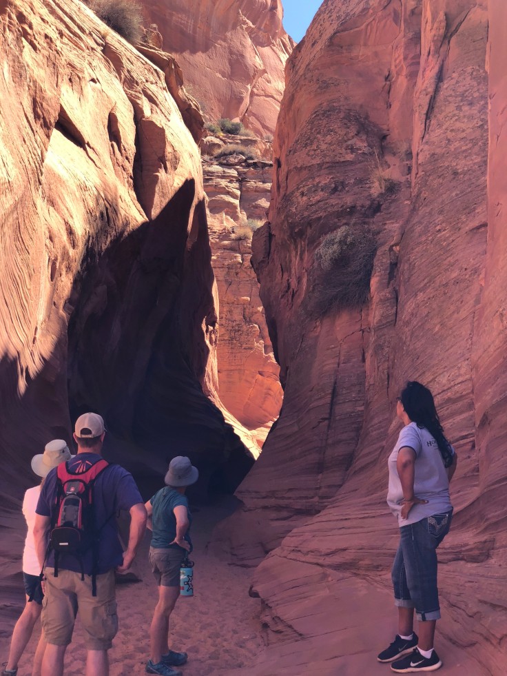
The caravan broke into four groups to take a short trip to see Horseshoe Bend Slot Canyon, on the Navajo Nation Reservation… We were lucky to get the Noon time slot.  We were able to have a leisurely morning…

To get to the Slot canyon, we drove into Page, then rode in a truck outfitted with 15 seats… We were driven along the highway for three miles, then we rode over dirt and rock roads for another six miles…

img_8925img_8920img_8921img_8923img_8924

Once the truck parked, we walked the last 1/2 mile…

img_8926img_8928img_8929

Once we reached the entrance to the slot canyon our guide told us about it… Slot canyons are formed by erosion due to water and wind.  While they are beautiful, they are dangerous if thunderstorms are in the area.  They can fill with raging torrents of water within seconds…

img_8930

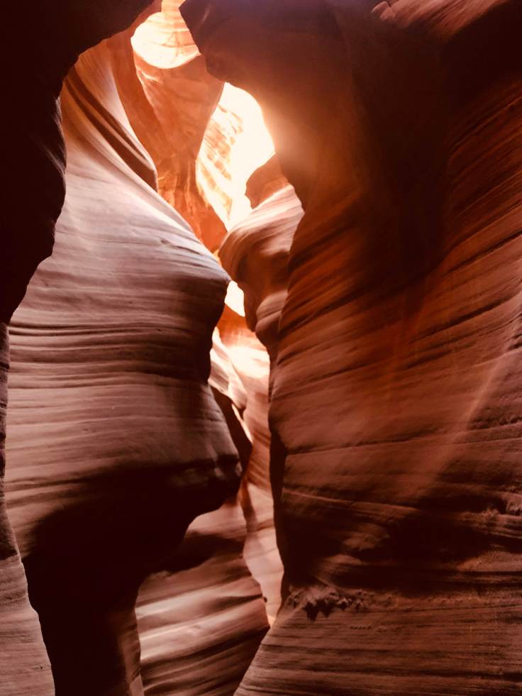
The canyon averages about six feet wide, with many places only about three feet wide.  It is mostly open to the sky, but, because of the narrow width of the canyon, sunlight sometimes does not reach in to the bottom of the canyon…

We walked from one end of the canyon to the other, then back again.  All along the way are spectacular views up, out, around, and through the sandstone walls.  These canyon walls are Navajo Sandstone, and they really are this color red…

img_8989img_8991img_5926img_5929img_8994img_5933img_9014img_9016img_5940img_5942img_9025img_5944img_9030img_9031img_9041

Our driver, and tour guide, was a Navajo women who grew up on this land.  She first saw this slot canyon when she was six years old and the sheep she was tending wandered into the area.  Her grandfather was named Manson, and it was he that traded the land named after their family to the Federal Government for the construction of the Glen Canyon Dam.  In exchange for his land, the Navajo Nation received some much coveted land in Utah.

(The Navajo Nation Reservation is one of the few reservations in the US that is actually on the ancestral land of these particular Indians.  They owe this to  the Spanish explorers, who controlled this entire area, in the 1600s and 1700s.  The Spanish explorers and the subsequent Spanish government kept meticulous records of who owned what.  When the Federal government wanted to put the Navajo Indians onto a reservation, the courts held that this was their ancestral land and that they could stay on it as their reservation… Zuni, Acoma, and Hopi Indians are in a similar situation…)

After our tour we returned to the Villa and had a relaxing evening.  Most Caravaners went out for one thing or another, so the entire campground was quiet…

img_5954img_5951

And an enjoyable time was had by all…

2018-09-26 – WBCCI 2018 Southwest Adventure Caravan – Day 39 – Glen Canyon National Recreation Area

img_5838

Today we took a boat ride around Lake Powell… We chose to sit on the upper deck in the sun all day…

img_8711

Lake Powell is a reservoir on the Colorado River, straddling the border between Utah and Arizona.  Most of Lake Powell, along with Rainbow Bridge National Monument, which we will be seeing today, is located in Utah.  It is a major vacation spot that around two million people visit every year.  It is the second largest man-made reservoir by maximum water capacity in the United States, behind Lake Mead, storing 24,322,000 acre feet of water when full.  However, due to high water withdrawals for human and agricultural consumption, and because of subsequent droughts in the area, Lake Powell is currently larger than Lake Mead in terms of volume of water currently held.  The lake was filled to capacity in the early 1980s and has never been completely full since then.  Today it is about 150′ below maximum capacity, and about 50′ below average levels…

Lake Powell was created by the flooding of Glen Canyon by the Glen Canyon Dam, which also led to the creation of Glen Canyon National Recreation Area.  The reservoir is named for explorer John Wesley Powell, a one-armed American Civil War veteran who, as you already know, explored the river via three wooden boats in 1869.

Lake Powell is over 186 miles long, and averages about 25 miles wide.  There are over 90 side canyons, making the shoreline longer than the entire west coast of the USA.   We will travel up the lake over 50 miles today, then we will go into one of the side canyons, dock, and walk/hike about one mile to see the Rainbow Bridge National Monument…

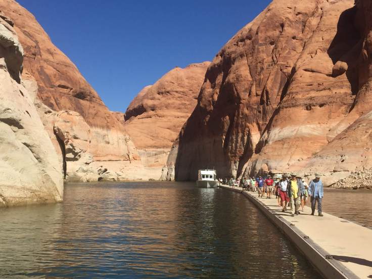
As I mentioned above, the lake is below its historic levels, as evidenced bu the white cliffs seen here.  This “bathtub ring” shows where the water level was in the early 1980s…

img_8724img_8736

Along the way we passed by several marinas, all packed with several millions of dollars of idle boats…

img_8713

Our destination is Rainbow Arch, a natural bridge (an arch formed by water flowing under it…).  This particular bridge is quite sacred to the Navajo people, and its preservation was a major concern during the construction of the Glen Canyon Dam and the resulting Lake Powell.  Even at “full pond”, as they call it, the Rainbow Bridge will remain untouched…

But Rainbow Bridge isn’t the only geologic wonder… We passed by what appear to be frozen, or “petrified” sand dunes.  These are solid rock…

img_8744img_8743

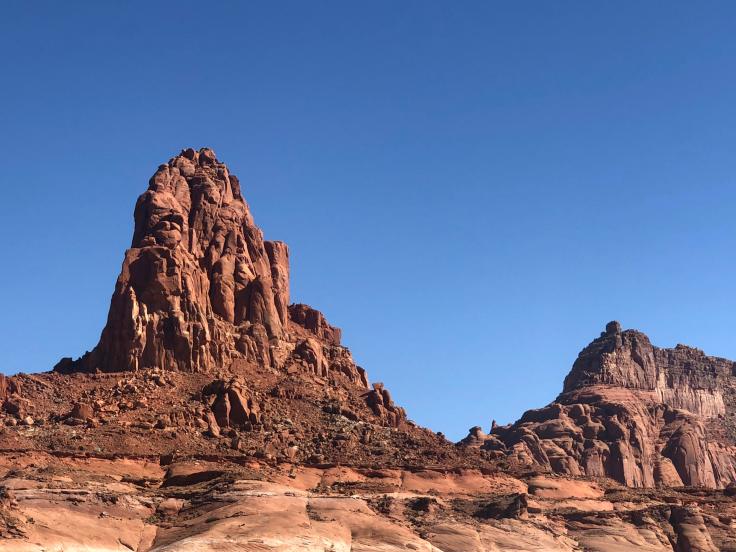
We passed by many buttes…

img_8750img_8758

While it was quite warm on the boat’s upper deck, the sky and water and rocks were beautiful…

img_8768img_8781img_5838img_8791

After traveling about 50 miles we turned into this small side canyon.  There are hundreds of these small side canyons along the lake’s 186 mile length, which makes it an ideal place for boating…

img_8792img_8797

The further we went up the canyon the narrower it became…

img_8811img_8818img_8835

While I’m sure our pilot knew where she was going, it was nice to see a sign that reassured us that we were in the right place…

img_8849img_8851

Narrower and narrower…

img_8857

Finally we spotted the dock…

img_8862

We docked, and set out on the 1 mile hike to the Rainbow Bridge…

img_5862

Finally it appeared…

img_5865img_5867

But we walked on, and even went behind it to see it from behind…

img_5866img_5870img_5874img_5875img_5876img_5878

Whether this was worth spending over five hours on the boat was a topic of discussion amongst the various caravaners…

We returned to the campground along the same route, so if you want to see what we saw, review the pictures above, backwards…

We had a lovely dinner at “Bonkers”, an unfortunately named restaurant in Page, with another caravan couple, then we returned to the campground for another Drivers Meeting…

img_5887

Apparently, our granddaughter, Evelyn, enjoyed her dinner today, as well…

img_8911

And an enjoyable time was had by all…

2018-09-25 – WBCCI 2018 Southwest Adventure Caravan – Day 38 – Glen Canyon National Recreation Area

img_8675

Another busy day on the caravan…

We began with a tour of the Glen Canyon Dam…

Glen Canyon Dam is a concrete arch-gravity dam on the Colorado River, near the town of Page.  The 710-foot high dam was built by the U.S. Bureau of Reclamation (USBR) from 1956 to 1966 and forms Lake Powell, one of the largest man-made reservoirs in the U.S. with a capacity of 27 million acre feet.  The dam is named for Glen Canyon, a series of deep sandstone gorges now flooded by the reservoir; Lake Powell is named for John Wesley Powell, who in 1869 led the first expedition to traverse the Colorado’s Grand Canyon by boat.  You will remember that we saw the Powell Museum in Green River, UT.

Because the dam site was in a remote, rugged area of the Colorado Plateau – more than 30 miles from the closest paved road, U.S. Route 89 – a new road had to be constructed, branching off from US 89 north of Flagstaff, Arizona, and running through the dam site to its terminus at Kanab, Utah.  Because of the isolated location, acquiring the land at the dam and reservoir sites was not particularly difficult, but there were a few disputes with ranchers and miners in the area (many of the Navajo Nation).  Much of the land acquired for the dam was through an exchange with the Navajo, in which the tribe ceded Manson Mesa south of the dam site for a similar-sized chunk of land near Aneth, Utah, which the Navajo had long coveted.  (Tomorrow we will meet descendants of the Navajo man named Manson.  Stay tuned…)

One of the first acts of construction was a suspension footbridge made of chicken wire and metal grates. At the time it was the only way to cross Glen Canyon.  Vehicles had to make a 225-mile journey in order to get from one side of the canyon to the other.  A road link was urgently needed in order to safely accommodate workers and heavy construction equipment.   A steel arch bridge was built; construction began in late 1956, reaching completion on August 11, 1957.  When finished, the steel arch Glen Canyon Bridge was itself a marvel of engineering: at 1,271 feet long and rising 700 feet above the river, it was the highest bridge of its kind in the United States and one of the highest in the world.  The bridge soon became a major tourist attraction.  The March 1959 issue of LIFE reported that “motorists [were] driving miles out of their way just to be thrilled by its dizzying height.”

During the construction of the Glen Canyon Bridge, the USBR also began planning a company town to house the workers.  This resulted in the town of Page, Arizona, named for former Reclamation Commissioner John C. Page.  By 1959, Page had a host of temporary buildings, electricity, and a small school serving workers’ children.  As the city grew, it gathered additional features, including numerous stores, a hospital, and even a jeweler. 

Prior to and during construction, three separate grants were issued by the National Park Service to document and recover artifacts of historical cultures along the river. These went to University of Utah historian C. Gregory Crampton and anthropologist Jesse Jennings, and to the Museum of Northern Arizona.  Crampton subsequently wrote several books and articles on his findings.

We walked atop the dam, viewing the bridge above and the river below…

img_8495

The visitors center perches atop the canyon rim above the dam…

img_8496

Lake Powell behind the dam…

img_5781img_8506

As the giant pipes carry water from the lake to the power plant at the bottom of the dam, the water forms such a turbulent force that the pipes vibrate and shake and would destroy anything rigid that seeks to contain them… Therefore, they covered the pipes with gravel, sand, and finally grass that would give pride to any golf course…

img_8517

From the bottom of the dam we looked up to see the visitors center…

img_8520img_8525

This is the water that seeps through the concrete that makes up the dam – about 1,600 gallons per minute…

img_8522

The power plant – 8 giant turbine generators providing electricity for the surrounding states…

img_8524

We can see Lake Powell stretching over 186 miles up-stream…
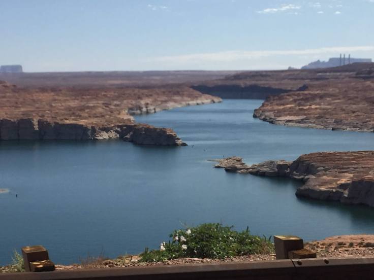
img_5803img_5804

Interesting facts:  See the tunnel entrance in the canyon walls beyond the power plant?

img_8526

The tunnel is two miles long and it extends from the power plant at the river to the rim of the canyon above.  It took two years to build, and it was necessary to get equipment to the dam foundations and to the power plant…

Stay tuned for more information… This afternoon we will travel through this tunnel…

It was an interesting tour, as all dam tours are…

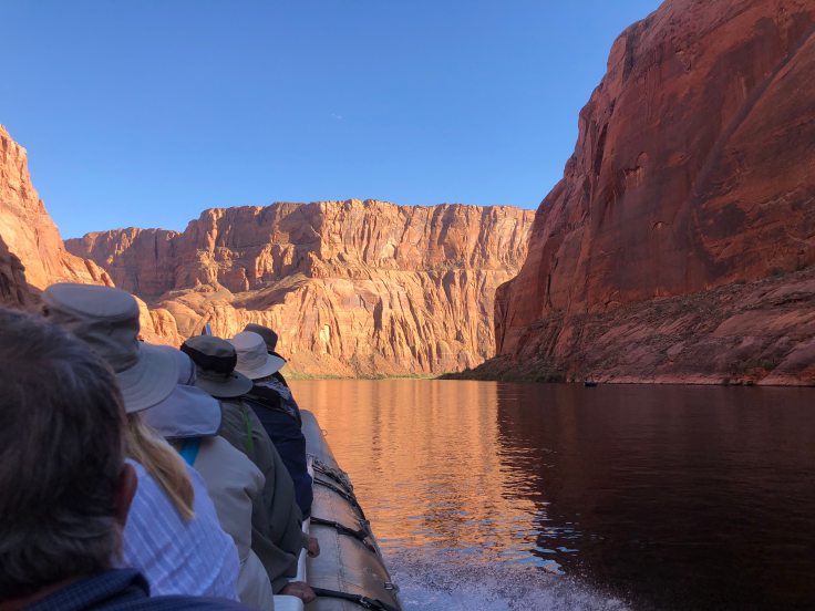
We returned to the Villa in time to turn around and head out for our raft trip on the Colorado River.  We will be starting just below the dam and we will be going down the river about 16 miles to Lee Ferry.  This is a quiet stretch of the river.  Rapids in rivers such as the Colorado are rated from 1-10, with 10 being the biggest.  The “rapids” on this portion of the river are about .3!

We met at the Raft Tour office in Page.  After the Homeland Security check we boarded a bus (salvaged from LA Unified School District in 1959) to ride to the river.  Why a Homeland Security check?  We get to ride in our bus down the two mile long tunnel and park at the foot of the dam.  We were admonished not to take pictures in the tunnel, of the tunnel, or anywhere around the tunnel.  Nor were pictures allowed of the wharf at the foot of the dam.  The bus parked with its door directly adjacent to the ramp down to the dock.  We even had to wear hard hats!  Apparently people on the bridge overhead like to throw things off the bridge!  Who knew?  So we left the bus and boarded the rafts…

We were allowed to take pictures of the river and the bridge overhead…

img_8531img_8533img_8534img_5807

We boarded the rafts and away we went…

img_8537img_8542

The first thing we noticed were these holes in the canyon walls… They are “windows” into the tunnel.  (about 15 feet diameter…) We could follow them along the two miles, as they rose up to the canyon rim… They used these holes for ventilation, and to push the debris out, where it fell to the river below…

img_8545

All along the river we had fabulous views of the canyon walls.  They extend up above the river to a height of about 500 feet at the dam to over 1,000 feet at Lee Ferry.  In contrast, the rim of the Grand Canyon is about one mile, over 5,000 feet, above the river… We took literally hundreds of pictures.  I’ll only show a few…

img_8550img_5813img_8560img_8570img_8564

The “rapids”…

img_8572img_8577img_8576img_8591

Camping is allowed along the river, at about 10-12 sites.  Obviously, you must boat or kayak in, and pitch a tent… Restrooms are provided…

img_8595

Rocks…

img_8601img_8605We stopped at one point to stretch our legs and hike up a short distance to see some petroglyphs…

img_5824img_5822img_5821

We re-boarded the rafts and continued on our way…

img_8638img_5826img_8634

Our pilot, guide, and expert on all things Navajo…

img_8640img_8655img_8656img_8659

There is a fault that runs across the river – these rocks are virtually identical, on opposite sides of the river…

img_8663img_8661img_8665img_8690img_8693img_8697img_8675img_8680img_8687

We arrived at the end of the trip… Our school bus was waiting to take us back to the offices in Page…  The end of our trip, Lee Ferry, is a departure point for 4-7 day white-water rafting trips through the Grand Canyon and beyond… It sounded like fun!

We returned to the Villa quite exhausted.  However, we did have enough energy to spend a few happy hours chatting with another Airstream couple from North Carolina.

And an enjoyable time was had by all…

2018-09-24 – WBCCI 2018 Southwest Adventure Caravan – Day 37 – Driving to Glen Canyon National Recreation Area

img_57751

We had an uneventful drive from Grand Canyon, back to Jacob Lake, and on towards Lake Powell, just outside Page, AZ.

As we left the grand canyon National Park we had a few more glances of the canyon…

img_8461img_5703img_5704

As we neared the exit to the park we saw some wild turkeys…

img_5715img_5716img_5718

More Aspen showing their fall colors…

img_5724img_5710img_5726img_5731

We were soon down in the valley, traveling towards Vermilion Cliffs National Monument…

img_8462img_8465img_5736img_8464

We drove along the Vermilion Cliffs for quite a while.  We came by a sign that said, “Cliff Dwellers”, but all we saw was a motel – The Cliff Dweller Motel.  About one mile further we stopped at a curious sight:

img_8473img_8470img_8475img_5741img_5740img_8466img_8478img_8479img_8482img_8484

There was no information on just what we were seeing here, but it was interesting, authentic or not…

Moving on…

We stopped to take pictures at Navajo Bridge – The Colorado River, again…

img_5746img_5751

Then we passed through Page, AZ, and we drove over the Glen Canyon Bridge.  We will be back here tomorrow to tour the dam…

We caught a few glimpses of Lake Powell as we arrived at the RV Park…

img_5766img_5767img_5771

We checked into the campground and we parked with the other Airstreamers…

This evening we enjoyed a BBQ dinner with the rest of the gang at the campground picnic area…

img_5774img_5772

And an enjoyable time was had by all…

2018-09-23 – WBCCI 2018 Southwest Adventure Caravan – Day 36 – North Rim of the Grand Canyon – First sighting of the Colorado River…

img_8331

Slightly less vigorous day today… We drove, along with another caravaner, to another plateau, surrounded by more cross canyons.  This is in the eastern portion of the park.

We saw a meadow with a watering hole used by the wildlife in the area.  And a 19th century log cabin used by early settlers to store grain and salt for their cattle…

img_8311img_8304img_8305

We stopped at many overlook areas viewing east across and down into the canyon.

img_8314img_8316img_8320img_8324img_8327img_8333img_8340

img_5680

We walked down a canyon to a spring, with water seeping out of the sandstone walls…

img_56471

img_8348img_8350img_5640img_5639img_5638img_5646

The big payoff was Angel’s Window, an arch in the sandstone… (note the people standing atop the arch… )

img_8401img_5661img_5663

The valley below was quite green…

img_5664img_8405img_5666img_8406img_8413img_5667img_8419img_5668img_5669

We also walked atop the arch…

img_8454img_5688img_8432

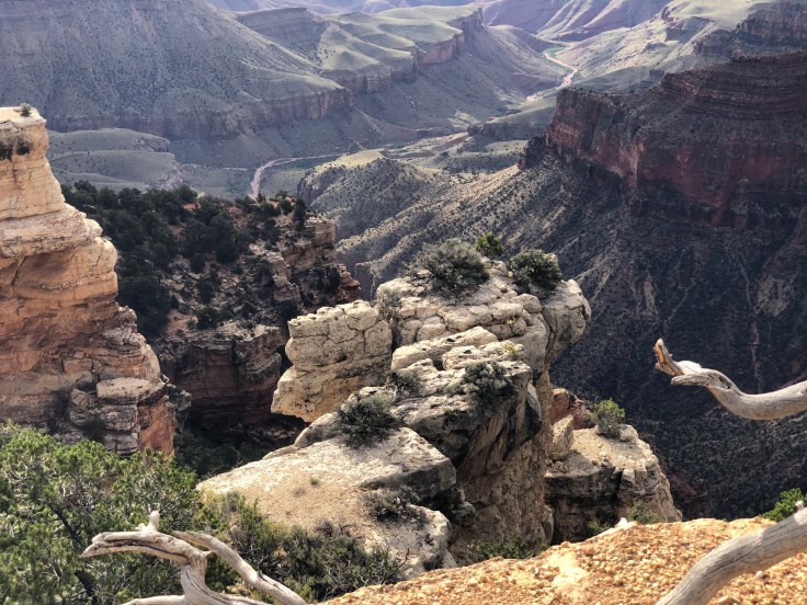
And we went out onto Cape Royal to see the main portion of the Grand Canyon… And we could finally look down into the canyon and see the Colorado River far below – the river is about one mile below the rim of the canyon…

img_5694img_5674

That’s it – about five miles away and about one mile down…

The other views from Cape Royal were also spectacular!  Way better than Uncle Jim’s Trail yesterday…

img_5695img_5692img_5690img_8450img_8449img_8451img_8447img_5684img_5683

We returned to the lodge and enjoyed lunch in the dining room…

img_8456

We walked back to the campground via the Bridle Trail.  We enjoyed happy hours and had a quiet evening in The Villa…

We had our Drivers Meeting to discuss our drive to the Glen Canyon National Recreation Area, home of the Glen Canyon Dam and Lake Powell…

And an enjoyable time was had by all…

2018-09-21 – WBCCI 2018 Southwest Adventure Caravan – Special Note

We will be traveling into the wilderness again today… We will be dry camping at the North Rim of the Grand Canyon, and we will have little electricity and little internet access…

Stay tuned!  You should hear from us again when we are at Lake Powell…


Blog at WordPress.com.

Up ↑