Search

Adventures in the Villa

Category

Dining

2018-09-14 – WBCCI 2018 Southwest Adventure Caravan – Day 27 – Bryce Canyon National Park

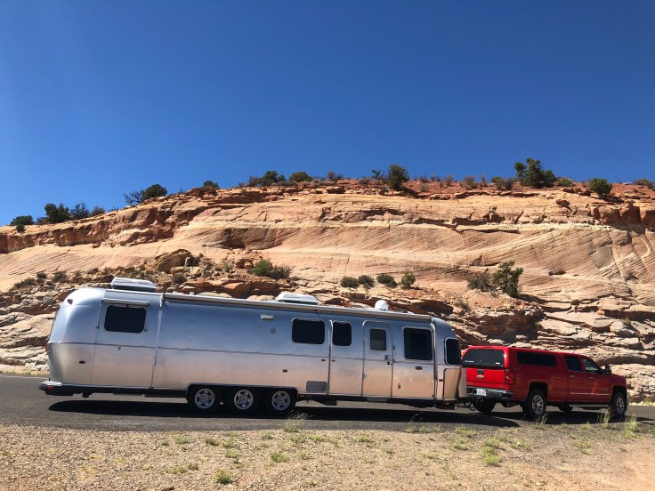
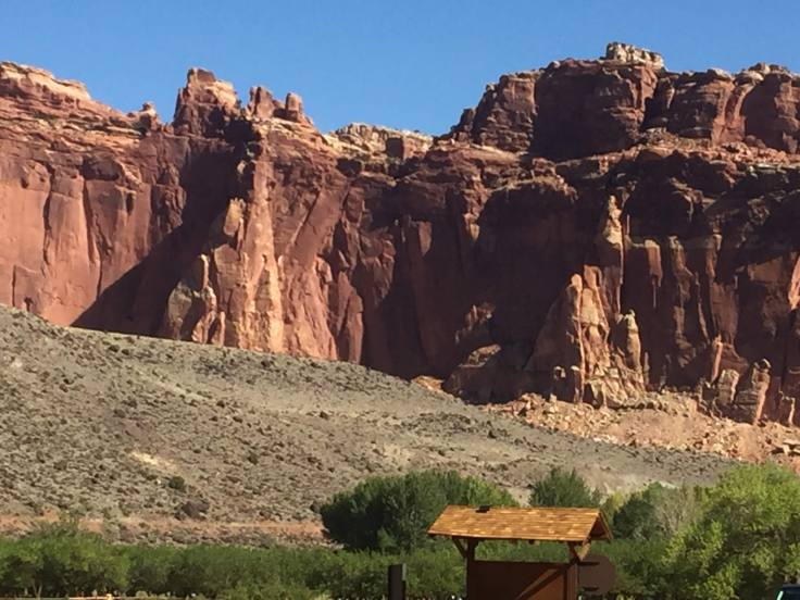
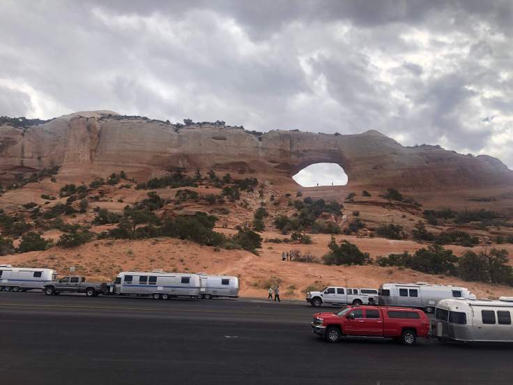
We slept in a bit today, then caught the shuttle into Bryce Canyon National Park…

img_5347

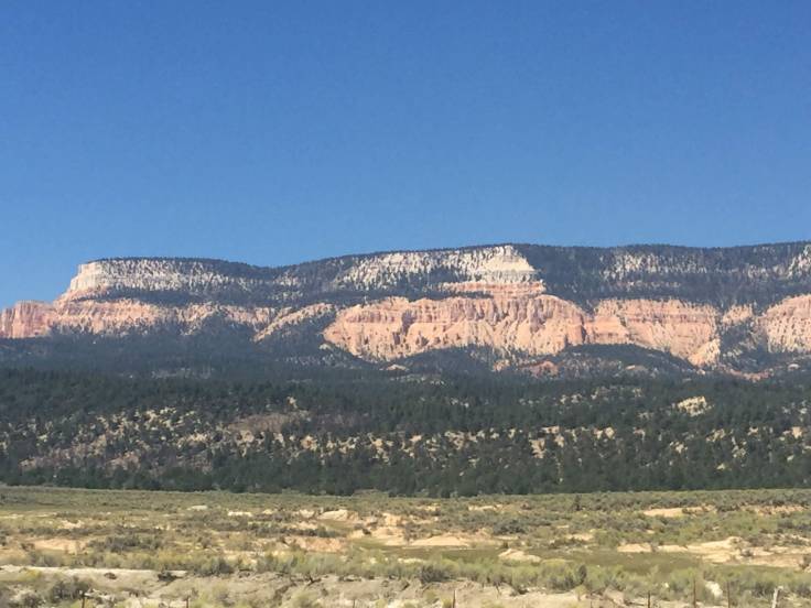
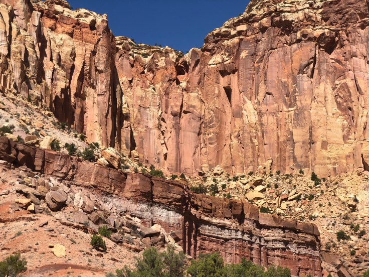
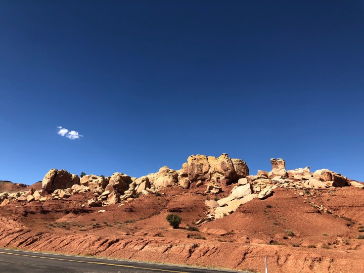
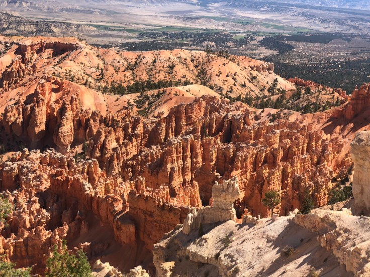
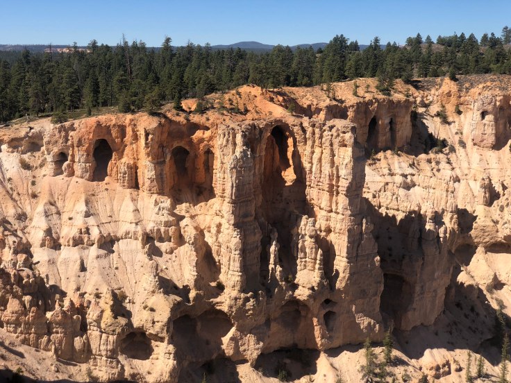
Bryce Canyon National Park  is an national park located in southwestern Utah. The major feature of the park is Bryce Canyon, which despite its name, is not a canyon, but a collection of giant natural amphitheaters along the eastern side of the Paunsaugunt Plateau. Bryce is distinctive due to geological structures called hoodoos, formed by frost weathering and stream erosion of the river and lake bed sedimentary rocks. The red, orange, and white colors of the rocks provide spectacular views for park visitors.  The rim at Bryce varies from 8,000 to 9,000 feet.

The Bryce Canyon area was settled by Mormon pioneers in the 1850s and was named after Ebenezer Bryce, who homesteaded in the area in 1874.  The area around Bryce Canyon was originally designated as a national monument by President Warren G. Harding in 1923 and was redesignated as a national park by Congress in 1928. The park covers 35,835 acres…

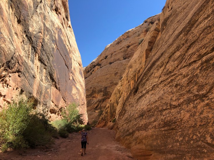
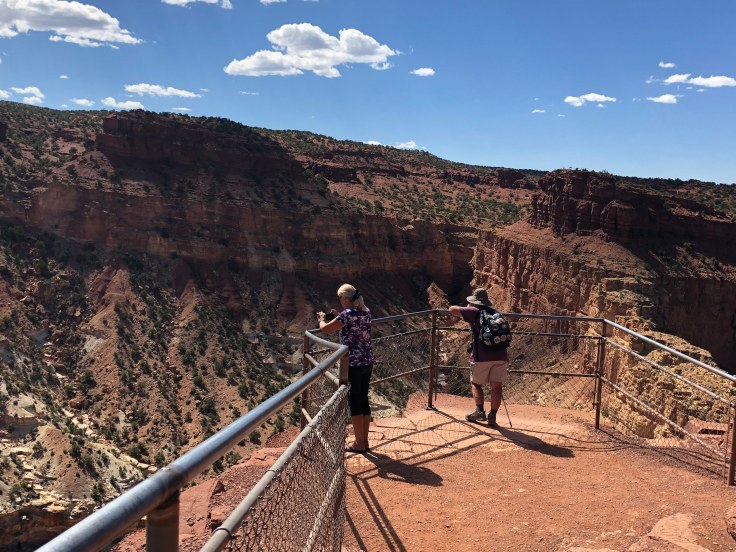
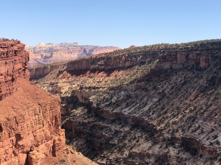
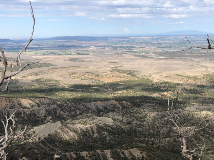
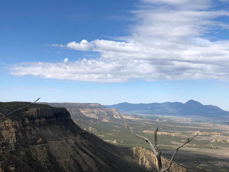
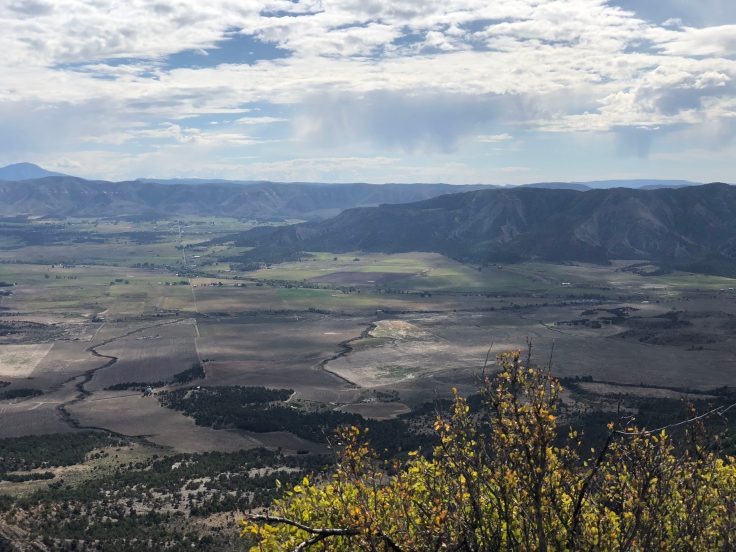
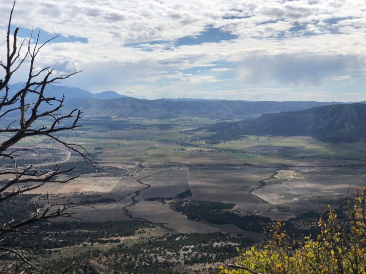
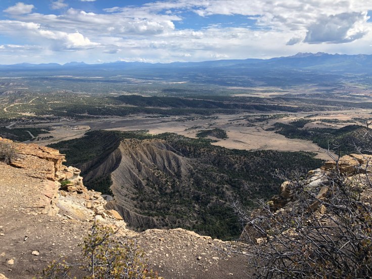
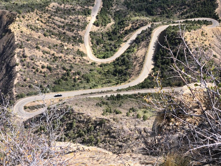
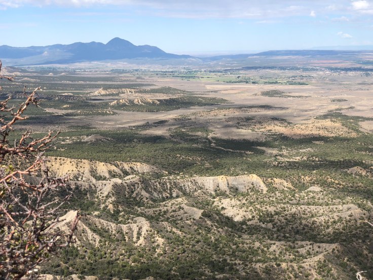
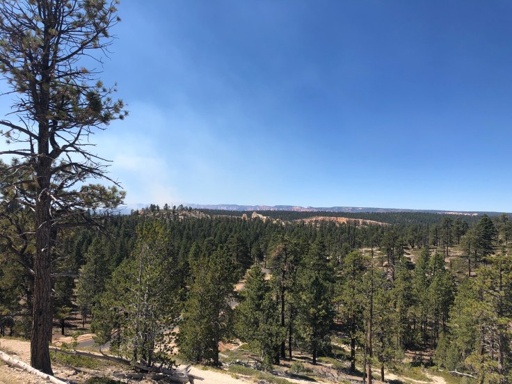
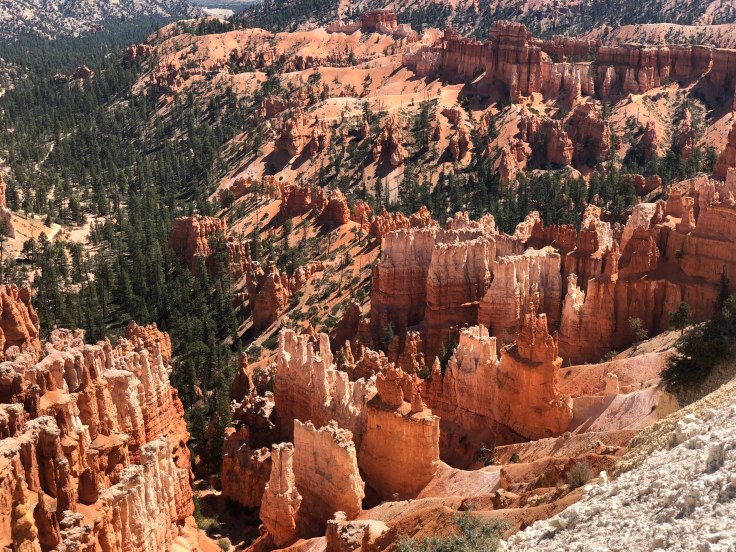
We took the shuttle around the main amphitheater to Bryce Point, elev. 8,300′.  We walked the Rim Trail, overlooking the amphitheater.  Along the way we passed Inspiration Point, Sunset Point, and Sunrise Point, elev. 8,000′.  Along the way were several ups and downs, so we had our fair share of elevation change.

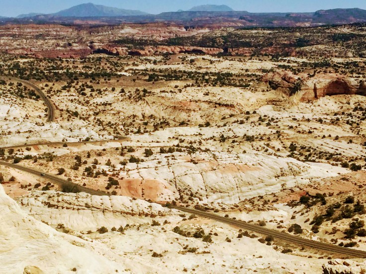
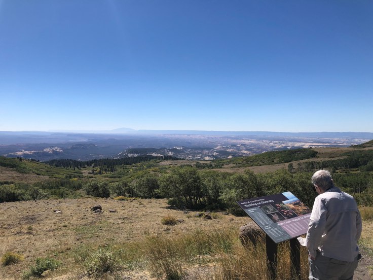
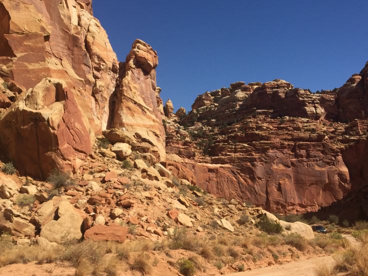
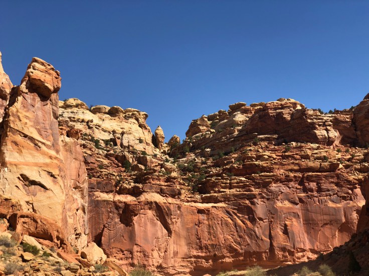
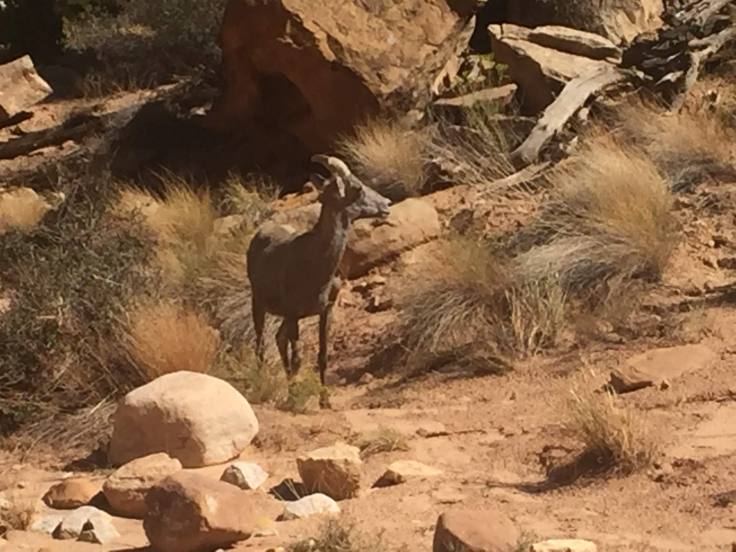
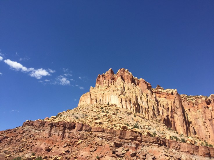
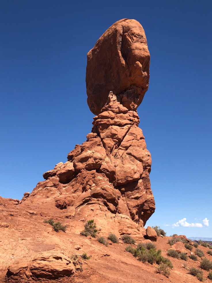
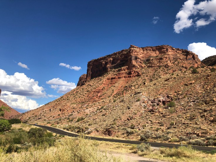
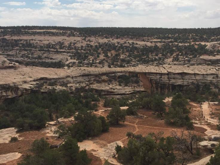
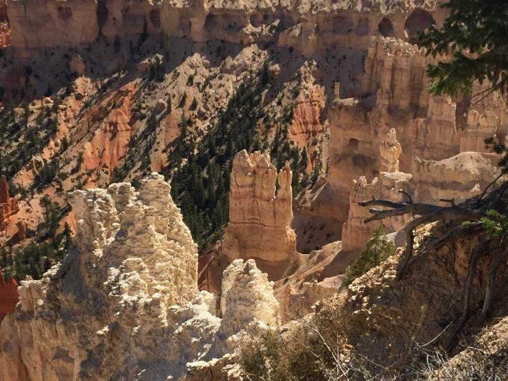
Needless to say, the views were spectacular.  All along the way we saw, well, rocks…

img_7816img_7819img_7820img_7823img_7826img_7830img_7834

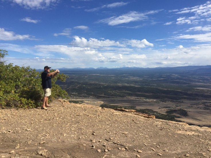
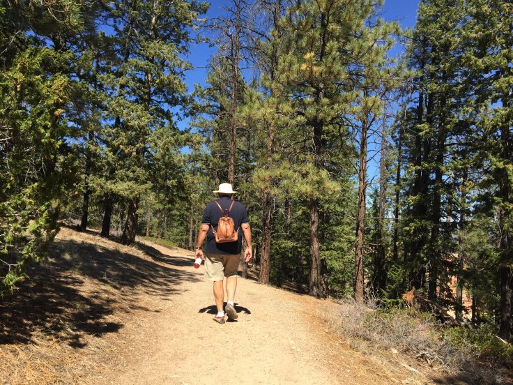
We found a spot to rest from time to time…

img_5289

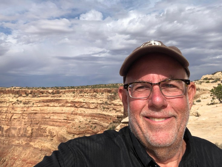
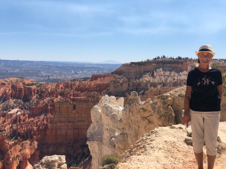
And, in the event we need a picture of me for my funeral, we have this…

img_5295

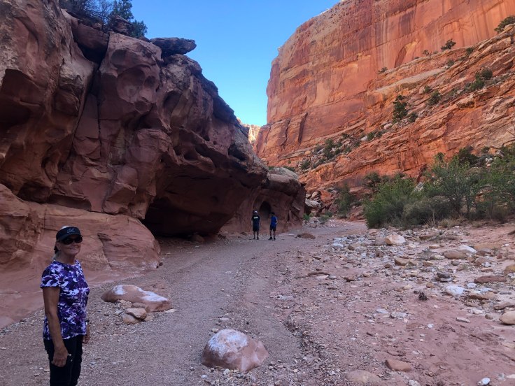
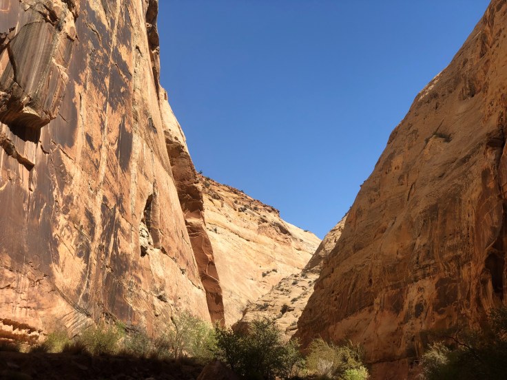
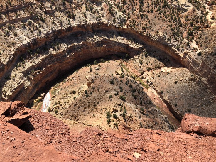
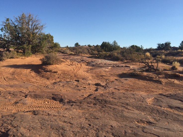
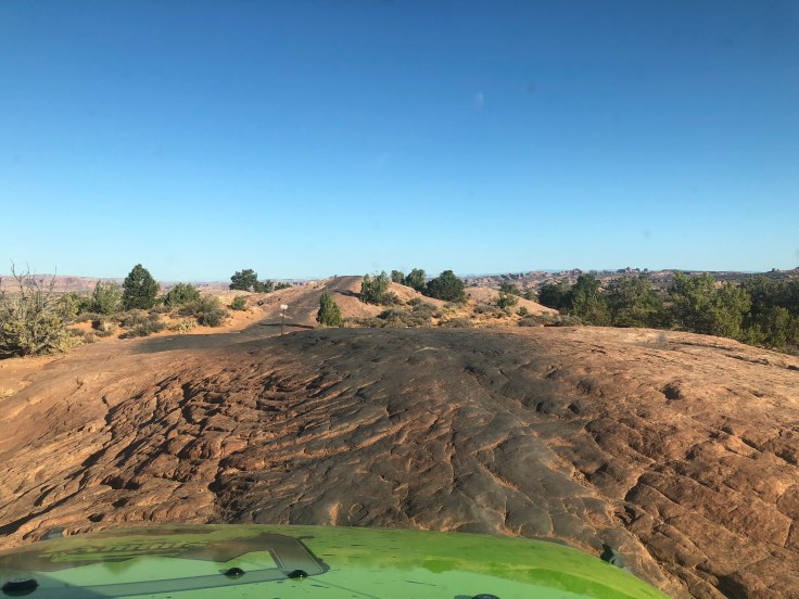
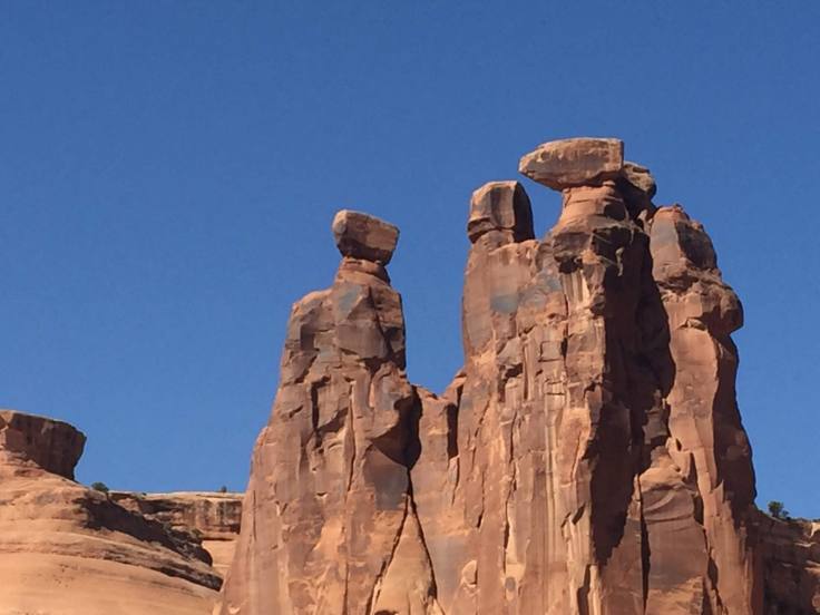
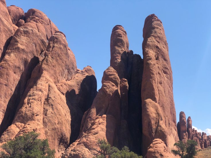
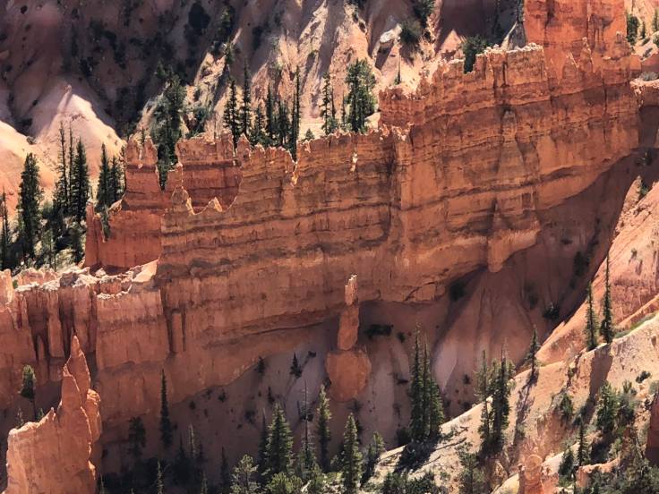
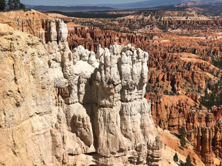
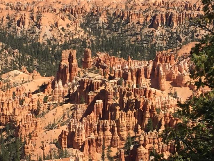
We kept walking and saw amazing things…

img_7896img_7886


img_7885


img_7878img_7879img_7874img_7873

See the hands…

img_7868

See the cathedral with flying buttresses…

img_7866img_7859img_5300img_5296img_7846

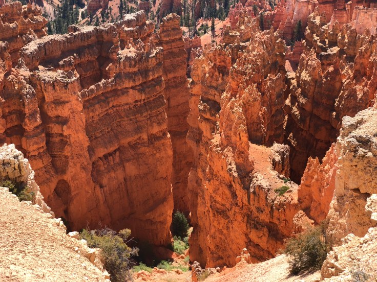
This was the viewpoint at Bryce Point, where we started…

img_7849

Single photos don’t do it justice, so I was forced to use the panorama mode…

img_7845


img_7856

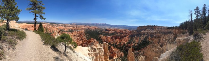
This is where the path is on the ridge, with the amphitheater on one side and forest on the other…

img_7870


img_78961

We arrived at the end of today’s trail…

img_78951

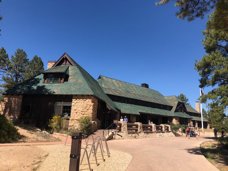
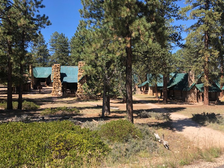
We found our way to the Lodge – typical National Park Lodge, only smaller.

The Bryce Canyon Lodge was built by the Utah Parks Company, a subsidiary of the Union Pacific Railroad, as part of the railroad’s project to develop tourist traffic to Bryce, Zion and the Grand Canyon by providing noteworthy destination hotels at each park.  The Union Pacific was following in the footsteps of other railroads’ efforts to promote the western parks of the United States and Canada.  Architect Gilbert Stanley Underwood was in charge of the design work for the Union Pacific hotels.  Construction at the Bryce Lodge started in 1924 and was completed in the early summer of 1925. The guest wings were added in 1926 and the auditorium in 1927.  Tourists were brought by train to Cedar City, Utah, where they were taken by custom 11 passenger bus-limousines to the various national park lodges.

img_7900

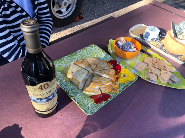
We had a nice lunch to refresh ourselves after the ordeal of our “hike”…

img_7903

After lunch we peaked around the lodge to see what we could see…

img_7901img_7898img_5304img_7897

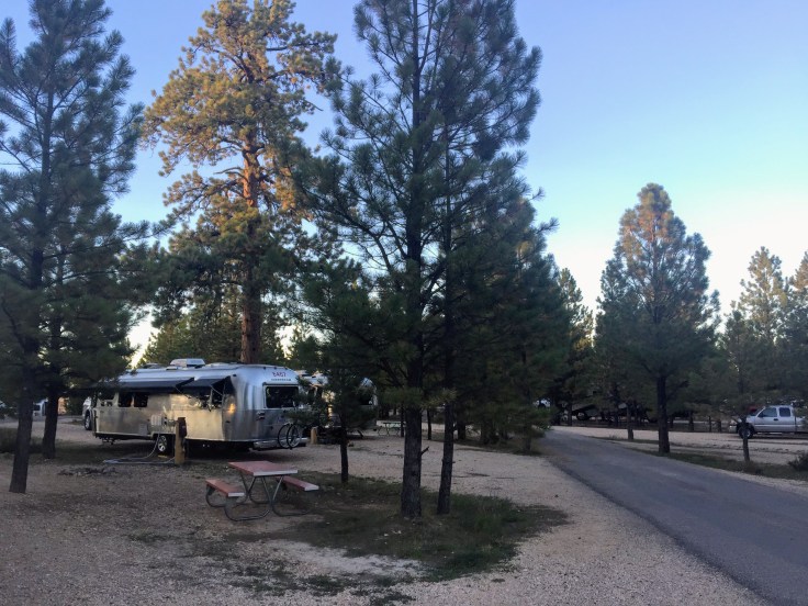
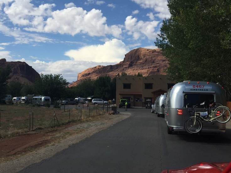
We returned to the RV Park, via the shuttle, and rested up for our evening out.

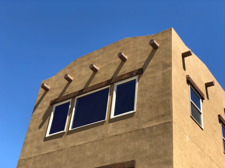
Tonight we go to Ebeneezers Cowboy Barn and Grill, for dinner and a show.  This has been a tradition of the Southwest Caravan for many years.  Remember that Ebeneezer Bryce settled this land, so the name is an homage to him… It is a very large dining room (approximately 300-400 people), not exactly a barn, but certainly as ugly as one…

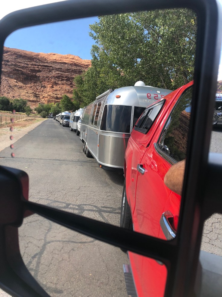
Even though it is less than a mile from the RV park, everyone has to drive their truck… Because, Utah…

img_7906

We waited outside until they opened the doors…

img_7905

We did get a table up front.  I wasn’t sure if this was a good idea, or not…

img_7907

We shared the table with three other Airstream couples…

img_7910

The food was quite good for a mass buffet, and the “band” (three guitar players/singers) was very talented.  They made the show seem very casual and improvised and addressed directly to us, the audience.  However, I would hazard a guess that if we returned tomorrow night we would see the EXACT same casual and improvised show…

We returned to The Villa and turned in…

And an enjoyable time was had by all…

2018-09-13 – WBCCI 2018 Southwest Adventure Caravan – Day 26 – Traveling to Bryce Canyon National Park

Today we travel to Bryce Canyon National Park.  But first, we had duties as assigned… We were “Deparkers”.  This meant that we, along with another couple, were to stand at the exit to the RV park, and, as each Airstream rig pulled out, we were to check to see that their mirrors, hitch, lights, vents, etc. were in proper order for safe travels… It took about one hour for 25 Airstreams to depart.  We then finished hitching up and headed on our way…

We drove along the “Highway Through Time”, so named for its geologic formations… We stopped along the way, at about elevation 9,300 ft., and viewed the scenery…

img_7809img_5276img_5279img_7808img_52751img_5274img_5272img_7801img_5270

The Aspens are starting to turn into fall colors…

img_5265

After about two hours we were at Bryce Canyon City.  The town seems to consist of two motels, several restaurants, a “Barn and Grill” dinner show place (more on this tomorrow…), a state-run liquor store, a post office, a giant gift shop, and a gas station, all apparently owned by the same family…

We were shown to our campsite by the “Parkers”, who had arrived early…

img_7812img_52811

We walked to the bus/shuttle stop and signed up for a bus tour on Sunday and learned about the shuttle service offered through the park…

We enjoyed happy hours with other caravaners from New Jersey…

img_7811

Tomorrow we begin to explore Bryce…

And an enjoyable time was had by all…

2018-09-11 – WBCCI 2018 Southwest Adventure Caravan – Day 24 – Capitol Reef National Park

The morning dawned beautifully in Torrey…

img_7705

We had breakfast at the Capitol Reef Cafe, as part of the caravan fees that we had paid… We enjoy patronizing local businesses…

img_7708

Our touring today takes us through Capitol Reef National Park.  The caravan provided a CD to play as we drove through the park, explaining what we were seeing (rocks) and allowing us to stop from time to time to walk/hike to see things not visible from the road…

img_7713

Capitol Reef National Park is approximately 60 miles long on its north–south axis but an average of just 6 miles wide.  It was initially designated a national monument on August 2, 1937, by President Franklin D. Roosevelt in order to protect the area’s colorful canyons, ridges, buttes, and monoliths; however, it was not until 1950 that the area officially opened to the public.  Road access was improved in 1962, and in 1971 it was named a National Park.  It is one of the least visited and uncrowded National Parks, although it was relatively busy today.

One major feature of the park is the nearly 100 mi long up-thrust formation called the Waterpocket Fold, a huge ridge of up-lifted rock.  The park was named for whitish Navajo Sandstone cliffs with dome formations—similar to the white domes often placed on capitol buildings…

We followed the road, seeing the sights, and finally proceeded down a two mile long gravel road called the Grand Wash to see the rocks up close and personal…

img_7715img_5212

We parked and walked about a mile into the canyon.  There are signs everywhere to stay out of the canyon if rain is expected, since flash floods are common.  Fortunately for us, the sky was clear and blue…

img_7716img_7719img_7723img_5215img_7728img_7727

We returned to the truck and continued along, following the CD, until we arrived at the Capitol Gorge trail, another walk/hike into the canyon…

img_5219img_7739

We found this “window” in the rocks – this will eventually expand into an arch…

img_7741

We saw several goats along the way…

img_5232

The canyon gets very narrow and is quite intimidating…

img_7763img_7772img_7770

As we returned back through the canyon we found some petroglyphs…

img_5241

We returned to another leg of the CD tour.  This one led to marvelous views, both up and down…

img_5246img_7778img_7780img_5248img_52502img_5251img_7788

This is another “meander”, similar to what we saw in Goosenecks State Park…

img_5253img_7790img_7791img_52551img_7793img_7794img_7795

Back at the RV park we had the last of the Fandangos, so, technically, we have met everyone n the caravan… We still have a ways to go to really remember everyone’s name…

And then we were treated to a lovely twighlight…

img_52581

And an enjoyable time was had by all…

2018-09-07 – WBCCI 2018 Southwest Adventure Caravan – Day 20 – A Jeep ride and Arches National Park

This morning we went for a little ride in a Jeep.  Not just any Jeep…

img_7663

This Jeep Wrangler Rubicon has about $200,000 worth of aftermarket parts and other enhancements.  While a standard Jeep can handle inclines of 35 degrees, this one can handle 70 degrees!   (This is another one of our caravaners who took the Jeep ride…)

We headed up the adjacent hills to the east…

img_5005

It was a beautiful day…

We were on “slickrocks”, which are really slippery when wet, but actually slightly sticky when dry.  We did what they called “crawling” – engage the extreme low four wheel drive gear and let the Jeep “crawl” over these rocks.  With the extreme independent suspension and shocks with the anti-tipping mechanism we crawled up the mountainside over rocks that would tip over an ordinary Jeep…

img_5010img_7389img_7388img_7390img_7392img_7394img_7396

Up the steep rocks and down the other side…

img_7399img_7400img_7406img_7407img_7408img_7410img_7411

Pictures don’t do it justice… But it really steep.  We went up and down over 4′ rock ledges…

img_5014img_7424img_7425img_7426img_7431img_7432img_7456img_7457img_7458img_7460img_7461img_7462img_7463img_7464img_7465

(This is another of our caravaners who took the Jeep ride…)

img_7664

img_7466img_7467

None of this was really dangerous because, while the rocks were steep, they weren’t really tall… The extreme Jeep maneuvers go up rocks 200 and 300 feet high… We didn’t do any of that.  We did go fast, after the boulders were past… It was riding on a roller coaster going around the curves in the path…

So we survived and returned to the RV Park.  The rest of the day we spent in Arches National Park…

img_7517img_7518img_5035img_7524

img_7529

I know… More rocks… These are really fun rocks.  The arches are a short walk from the road.  Lynda climbed up into one and appears to be having an enjoyable time…

img_5054img_7540

These narrow rocks are called fins – fins are what will eventually form arches if the conditions are right… We walked among the fins on the softest, finest, powdery sand I had ever seen…

img_7570img_7571img_7574img_5071img_7575img_5082

We spent all day in Arches NP, but we did have to return to Moab to go to dinner.  The Sunset Grill is in the former house of a uranium miner who got fabulously rich in the rush to find and extract uranium in the 1950s.  The house has a commanding view of the Moab valley, including our RV Park…

img_7581img_7583img_7582

And an enjoyable time was had by all…

2018-09-06 – WBCCI 2018 Southwest Adventure Caravan – Day 19 – Traveling from Bluff to Moab…

We packed up and pulled out of the campground in Bluff; we are heading north to Moab, Utah.  Along the way we see typical Utah sights…

img_4974

We stopped at Wilson’s Arch…  Wilson’s Arch was named after Joe Wilson, a local pioneer who had a cabin nearby in Dry Valley. This formation is known as Entrada Sandstone. Over time superficial cracks, joints, and folds of these layers were saturated with water. Ice formed in the fissures, melted under extreme desert heat, and winds cleaned out the loose particles. A series of free-standing fins remained. Wind and water attacked these fins until, in some, cementing material gave way and chunks of rock tumbled out. 

img_7356img_7359

We pulled into The RV Park in Moab behind a few other Airstreams…

img_4980

…and ahead of a few others…

img_7362

The Portal RV park is quite nice; they even have RV sites that they have sold to seasonal residents, and some of them have vacation homes built on them… We parked in the “low rent” area…

img_4984

The offfice even has fake vigas… ’nuff said…

img_7365

The view across the highway is great… I guess every town in Utah looks like this…

img_7366

We’re all checked in…

img_7367

This evening we have a dinner together about 15 miles up a canyon bisected by the Colorado River…

We saw rafters enjoying the late afternoon sun…

img_7368img_7369

We saw amazing sights along the river…

img_7370img_7371img_7372img_7374img_7375img_7376

The Resort and Winery where we were to have dinner is a very nice modern place…

img_4986img_4989img_4990img_4991

We did a little wine tasting, and bought a nice Utah Syrah to have with dinner… Dinner was in a pavilion facing the river; we had our choice of burgers, hot dogs, or chicken… It was a lovely setting…

img_4993

img_4994

We returned to The Villa in time to catch the reflection of the setting sun…

img_7380

And an enjoyable time was had by all…

2018-09-05 – WBCCI 2018 Southwest Adventure Caravan – Day 18 – Monument Valley

Monument Valley (Navajo: Tsé Biiʼ Ndzisgaii, meaning valley of the rocks) is a region of the Colorado Plateau characterized by a cluster of vast sandstone buttes, the largest reaching 1,000 ft above the valley floor.  It is located on the Arizona–Utah border , near the Four Corners area. The valley lies within the territory of the Navajo Nation Reservation.

We traveled today with Jay and Elna, Caravan Leaders, to Gouldings, in Monument Valley.  Harry Goulding established a trading post here in the 1920s, which has grown to include a Lodge, Restaurant, RV Park, and of course, a Gift Shop…

img_7233img_7230img_7234

In the 1930s, in an effort to generate income for the Indians, Harry contacted Hollywood movie folk and arranged for the studios to shoot movies in Monument Valley.  There is a stage set of a cabin supposedly used by John Wayne in John Ford’s production of “She Wore a Yellow Ribbon”…

img_7236img_7235

Even this fake cabin had authentic construction…

img_7237

Other buildings at Gouldings are not so lovely…

img_7238

Monument Valley has been featured in many movies and TV shows since the 1930s. In the words of media critic Keith Phipps, “its five square miles have defined what decades of moviegoers think of when they imagine the American West.”

And it is stunning…

img_7257

We saw the right mitten (above) and the left mitten (below)

img_7347

We saw the castle…

img_7355

And we saw some arches… (Arches differ from Bridges in that arches are formed by erosion by wind and the freeze-thaw cycle, while bridges have (or have had) flowing water beneath them, and the primary method of erosion was from this water…)

img_4969

We were all herded into three touring trucks to see the sights…

img_7330

img_7273img_7262

After some driving along rutted, gravel roads, and seeing marvelous sites, we arrived at John Ford’s Point.  John Ford like to ride his horse around here while shooting movies…  (This is not John Ford…)

img_7276

At one of our stops we saw authentic hogans, homes of the Navajo.  About 30 families live in these traditional homes deep in the valley, using traditional methods of living, with no running water or electricity.  They don’t even have cable TV!  These hogans that we saw were for display purposes and for demonstrations…

img_4958img_4960

This is a sweat lodge…

img_7311

These hogans had beautifully constructed wood roofs to support the earthen exterior covering…

img_7310img_7312

We saw more impressive structures…

img_7290img_7282img_7298img_7314

Then we reached the arches…

img_7316img_7320img_4966img_49691img_4970

This place is very awe-inspiring.  Everywhere you look you see these marvelous structures…

We returned to Gouldings, had a nice lunch in the restaurant there, and then headed back to The Villa… We had a Drivers Meeting to discuss the route of our travels tomorrow, then we had dinner and a quiet evening in The Villa…

And an enjoyable time was had by all…


And an enjoyable time was had by all…

2018-09-04 – WBCCI 2018 Southwest Adventure Caravan – Day 17 – Goosenecks State Park, Muley Point, Moki Dugway, and Natural Bridges National Park

An exciting day exploring Southern Utah in a pickup caravan… We carpooled, but there were still 15 trucks in a row…

img_7229

Our first stop was Goosenecks State Park, overlooking a deep meander of the San Juan River. The park is located near the southern border of the state, a short distance from Mexican Hat, Utah.

A “meander” or restrained meander, is a river that cuts its way through the many layers of various types of stone to form features such as this…


img_7140

What is fascinating to me is how this happened… This river wasn’t just flowing along the top of a mesa and over time carved its way down.  No, the water was always flowing at this level, meandering along a wide, flat plain.  It was the plain that was pushed up by volcanic pressures, and the river and gravity fought back, carving the many layers of stone.

img_7139img_48761img_4877

The river is about 1,000 feet below the mesa at this point…

From here, we headed to the Moki Dugway, which is the access road to Muley Point.  In contrast to Goosenecks, where the river was 1,000 feet below us, Muley Point is 1,000 feet above us, and the Moki Dugway is the way to get up the “mountain”.  (Many of the caravaners are from places like Florida or Texas, so they are not familiar with real mountains…)  Along the way we saw more impressive sights…

img_7141img_7143img_4883

This is Muley Point, at the end of the mesa on the left…

img_7148

The Muki Dugway was the access road carved into the side of the plateau to be used for access to uranium mines many years ago.  Some found it frightening (there are no guardrails, it is very narrow and steep, and it is a gravel road…).

img_7156img_7161

I thought that car down this steep embankment might have been one of the caravaners from last year, but I was informed that it was not…

img_7167

As we arrived at the top we were treated to more fabulous views…

img_7171

I even took a picture!

img_4889img_7177img_7178img_7185

And a selfie…

img_7192

Our next stop today was at Natural Bridges National Park… where we saw natural bridges…

img_7200img_4909

Bridges have (or have had) flowing water beneath them, and the primary method of erosion was from this water…  On the other hand, arches differ from bridges in that arches are formed by erosion by wind and the freeze-thaw cycle.  We’ll see arches tomorrow…

img_7204img_7205img_4912img_4913

After a long day touring, we returned to The Villa.  We went to the Steakhouse adjacent to the campground and had steak for dinner (Porterhouse for 2…).  The restaurant was 90% caravaners – I’m sure the proprietor was happy we were staying next door…

We returned once again to The Villa to relax with a little TV.  I sat in my Eames chair as I usually do.  But what the chair did was not usual…

img_7206

Yes, the entire back collapsed off the base… I’ll have to stand up the rest of the trip… We loaded the pieces into the truck; we’ll have to take it to be repaired when we return.

So this evening an enjoyable time was not had by me…


2018-09-02 – WBCCI 2018 Southwest Adventure Caravan – Day 15 – Mesa Verde National Park

The gray skies blew away so we decided to go on another hike.  This time we started out just adjacent to the campground.  The route was called Point Lookout Trail, and it is 2.0 miles round trip, and we will climb up, then down, 400 vertical feet…

img_7079img_7081img_7083img_7087img_7088img_7089img_7090img_7091img_7093

This is the entrance road we drove to get to the campground yesteday…

img_7099img_4845img_7101img_4846img_7107img_7112img_4849img_7113img_7114

It was fun to watch the Airstreams getting small and smaller… But we were finally done and back to The Villa.

This evening we had a joint dinner at a nearby pavilion.

And an enjoyable time was had by all…

2018-08-30 – WBCCI 2018 Southwest Adventure Caravan – Day 12 – Durango, CO

Quiet day in Durango… Blogging, laundry, walking around the RV Park… This is about as exciting as it gets…

We rode into town in the late afternoon with another caravan couple.  They wanted to walk the town a bit and we wanted to try out an olde timey saloon.

We went to the Strater Hotel, founded 1887.  We were told that in the early days one of their draws was their fresh food – rare in mining communities.  This was accomplished by raising cows and chickens in the lot behind the hotel…

img_6882

The saloon was great – all ugly Victorian decor (I know – that’s redundant…).  But the waitress was great and the drinks were good.  We even tried an appetizer of smoked dates wrapped in bacon with a drizzle of honey… Marvelous!  Just what we wanted.

img_6884

At the appointed hour we joined the other caravaners for dinner in the hotel – this was the real reason we chose this place.

img_6885

The food was good, the wine was acceptable and the service was great… This hotel has been in the same family for over four generations.  However, the fifth generation has decided they no longer want to be in the hotel business, so the hotel is for sale…  It will be the end of an era…

So, as is my tradition on short days, I will include some pictures of our perfect and great Grandchildren…

This is Evelyn, 6 1/2 months old…

img_5255

This is Roisin – what you can see of her, learning to hang around…

img_52501

And this is Roisin again, 5 1/2 years old, reading to Evelyn whilst Mom puts the boys to bed…

img_6886

And the boys:

img_5281

George is almost 3 and Ian is 4 1/2… First day at the new preschool…!

And an enjoyable time was had by all…


Blog at WordPress.com.

Up ↑