Search

Adventures in the Villa

Category

National Parks

2018-09-02 – WBCCI 2018 Southwest Adventure Caravan – Day 15 – Mesa Verde National Park

The gray skies blew away so we decided to go on another hike.  This time we started out just adjacent to the campground.  The route was called Point Lookout Trail, and it is 2.0 miles round trip, and we will climb up, then down, 400 vertical feet…

img_7079img_7081img_7083img_7087img_7088img_7089img_7090img_7091img_7093

This is the entrance road we drove to get to the campground yesteday…

img_7099img_4845img_7101img_4846img_7107img_7112img_4849img_7113img_7114

It was fun to watch the Airstreams getting small and smaller… But we were finally done and back to The Villa.

This evening we had a joint dinner at a nearby pavilion.

And an enjoyable time was had by all…

2018-09-01 – WBCCI 2018 Southwest Adventure Caravan – Day 14 – Mesa Verde National Park

Today we spent more time exploring Mesa Verde… We started at the Chapin Mesa Museum, adjacent to the park headquarters.  The museum had the usual exhibits about the flora and fauna of the park, plus some history and archaeological data.  And a Gift Shop…  Most interesting were miniature dioramas, or models, of the typical pueblo life during the various periods of occupancy, from 650 to 1300.  These beautiful models were built by the CCC (Civilian Conservation Corps) during the 1930s…

What interested me more were the buildings at the museum and the park headquarters.  The scale and massing was lovely, and the buildings were clustered as if they composed a small village… They were built with volcanic stone blocks, left un-plastered…

img_6997img_7001img_7002img_7003img_7039img_7040img_7041img_7042img_7043

img_7046

Did you notice the vigas?  They are done very well.  And they are real!

img_6999

They are not simply stuck onto the exterior as decoration.  They form the structure for the floor or roof above, and they extend through the wall as part of the structural connection.  Another thing: they are Juniper.  Juniper is naturally rot and disease-resistant.  While the vigas in the park buildings are 85-90 years old, the vigas in the Pueblo are 500 years old, and very few of them show any evidence of rot…

Except for these…

img_7047

img_7038img_6998

Still, not bad for 85-90 years.  Today’s tract houses in Santa Fe use Douglas Fir or Southern Pine for their fake vigas, and they show rot beginning in year one…!

After the museum we set out on a “hike”  We are not generally hikers – we are walkers.  This was a well-marked trail.  It descends into Spruce Canyon, and goes down, and down, and down… About 586 vertical feet.  The loop is almost 3 miles.  But we were up to it.  Being in the canyon is a little surreal, seeing the bushes, trees, rocks, and other feats of nature…

img_7013img_4806img_7014img_7016img_4808img_7018img_7020img_4811img_7022img_7024img_7026img_7027img_7028img_7031img_7033img_7034img_7036

We did discover this gruesome evidence of wildlife…

img_7030

Of course, after we walked down we had to walk up again.  While the descent was gradual, the ascent was very short and steep… And we made it!

img_7037

Walking back to the truck we heard thunder all the way.  But there was no rain…

We again admired some of the park buildings… This is the original 1930s restroom building:

img_70441

Nice proportions, authentic wood lintel, posts, and capitals, excellent stonework…

Next door they built a new restroom building containing facilities accessible to the disabled…

img_70451

Nice proportions, excellent stonework… Nicely proportioned lintels, posts and capitals, but note:  They are steel!  Clearly, this building pays homage to the historical architecture, but it uses modern materials when duplicating the historic materials would compromise the integrity of a modern building.  Well done, Architect, whoever you are…!

As we approached our next destination in the truck it started to rain… We stopped at Park Point, the highest point in the park, at 8,572 feet elevation.  This is about 700 feet above the campground…

img_4819

It was lightly raining, but we couldn’t help but notice this white gravel on the ground.  Upon closer inspection, we discovered it was hail!

img_7054img_4826

Views are amazing, in all directions…

img_7059

We could see all the way to Utah, Arizona, and New Mexico, plus, of course, Colorado…

img_4828img_7062

This is “The Sleeping Ute”, a mountaintop in Utah that is supposed to resemble a sleeping Indian…

img_7063img_7066img_7069

This is “Knife Edge mountain, which is our next stop…

img_7070img_7072img_4831

Our next view overlook is called “Knife Edge”…

img_7074img_7075img_4833

So we then headed back to The Villa… And we were in for a surprise:  It had hailed at the campground, too!

img_7076img_4834img_4837

The hail was small – no damage to The Villa.  It lasted about an hour on the ground…  Later that evening we had another “Fandango” to meet other caravaners.  We were hosts, so we had 8 people inside the Villa…

And an enjoyable time was had by all…

2018-08-31 – WBCCI 2018 Southwest Adventure Caravan – Day 13 – Traveling to Mesa Verde National Park

We pulled out of Durango and drove to Mesa Verde National Park, so designated in 1906, one of the very first fourteen National Parks, back before Park Service was created in 1917;  Mesa Verde was designated to “preserve the works of man,” the first national park of its kind.  The other first National Parks were all created to preserve natural wonders…

It was a short drive – only 35 miles – but that is the horizontal distance.  We also climbed up over 1,000 feet vertically, as the campground was at the top of this mesa…! (Not the top of the rock, just to the mesa behind it…

img_4729img_4730img_6887

We are “dry camping” here – no water, sewer, or electrical hook-ups.  Thus, there was a plethora of solar panels and generators present around all the Airstreams…

We had little set-up to do, and we soon set out for a 5 hour bus tour of the Mesa Verde Park.

We saw some splendid scenery – the bus tour drove us around the mesa-top and we saw many archaeological remains.  Native peoples – the Ancients, or Indians, or Puebloans (pick your terms – I’ll call them Indians, as the locals prefer to be called…) – settled in this area about AD650 and continued to live here until the early 1300s, when they all moved, over about a 20 year period, to Taos, Sante Fe, and the other 17 Pueblos in New Mexico along the Rio Grande River.  No one knows for sure why they left, but the obvious reason was to find more fertile land with a reliable water source.

We saw several various structures used by the Indians across the centuries… And I have thousands of photos to prove it…

img_6902img_4739img_4741img_6910img_6926img_6932

We saw some cliff dwellings from a distance.  But the pay-off for the day was seeing the Cliff Palace, the largest, and best preserved, of the cliff dwellings.

img_6936img_6935

On December 18th, 1888, two cowboys, Richard Wetherill and his brother-in-law Charlie Mason, were riding across the mesa top looking for stray cattle. At the edge of the pinyon and juniper forest they came upon a vast canyon.  It looked like this…

img_6952

Today, it has been restored and reassembled where possible.  Basically, they put back up the blocks that had fallen, and they stabilized the ruins.

We assembled for the tour at a platform that offered a closer view…

img_6950img_6947img_6948

We were able to get even closer by descending from the mesa about 150 vertical feet into the canyon, climbing down stone steps built by the National Park Service.  (Indians used ladders and hand- and foot-holds and climbed up the face of the canyon…)

img_6953img_6954img_6955img_6956

Once we were at the level of the pueblo, we heard a ranger talk about the history and give us archaeological information.  There are 150 rooms, including 19 kivas, or subterranean dwellings with religious significance.  The 150 rooms extend back into the cliff over 90 feet…

img_6959

We proceeded to walk along the base and see the pueblo up close…

img_6969img_6968img_4785img_4794img_4796img_4799

Yes – even here there are vigas… more on the vigas tomorrow…

img_6974

After our final ranger talk, we had to get back up to the mesa again, up 150 feet!  We started out on steps, then had to climb three ladders…

img_6981img_6980img_6982img_6984img_6986img_6989

Finally we reached the top…

img_6990img_6992

Back at the Villa, we had some visitors…

img_4801img_4802img_4803img_4804

We returned to the campground, had dinner, and went to bed before it got dark, so we didn’t have to use out batteries… (This dry camping is relatively new to us…)

And an enjoyable time was had by all…

A pause in the Blog… August 31, 2018


We are headed off into the wilderness of Mesa Verde and Southern Utah National Parks… We will have limited internet access for the next several days, so you will not be hearing from us for a while…

Stay tuned!

Phil and Lynda…

2017-10-05 Westbound; California, here we come…

We left Junipers RV Park in Lakeview, OR and soon we reached the promised land:

2017-10-05 California 01

We are happy to be back in California; we left California on June 10…

Today we are heading into the Lassen National Forest and Burney Falls State Park.  We’ve wanted to see Burney Falls since we first heard about it in 2006.  Today is the day!

We had an uneventful drive south along the eastern border of California, not far from Nevada.

We reached Burney Falls State Park about noon.  The falls are not far from the Visitors Center; we soon had a peak at them as we started down the canyon:

2017-10-05 California 02 Burney Falls 01

The path takes us over the stream above the falls; interestingly, the stream flows mostly underground until about 3/4 mile upstream, where some of its water pops to the surface.  (More on this later…)

We crossed the bridge and walked through the woods, hearing the falls and occasionally getting a glimpse of them.  Along the way we had nice views of the stream.

2017-10-05 California 02 Burney Falls 022017-10-05 California 02 Burney Falls 032017-10-05 California 02 Burney Falls 042017-10-05 California 02 Burney Falls 052017-10-05 California 02 Burney Falls 062017-10-05 California 02 Burney Falls 07

Finally we were able to get a full view of the falls:

2017-10-05 California 02 Burney Falls 08

As we drew closer we noticed the interesting shape and location of the falls and the water:

2017-10-05 California 02 Burney Falls 092017-10-05 California 02 Burney Falls 10

Notice how the water is flowing not only over the top of the rocks, but from within the rocks as well!

The underground stream stays underground even as it comes to the surface 3/4 mile upstream, and it is this underground water that flows out of the layer of porous and fragmented rocks that are lodged between the harder basalt rock.  Here is the sign which explained the phenomenon:

2017-10-05 California 02 Burney Falls 11

2017-10-05 California 02 Burney Falls 12

We admired the blue color of the pool at the base of the falls; there were even men casting here:

2017-10-05 California 02 Burney Falls 13

(No fish in sight…)

We like walking to see waterfalls, as you may have noticed… We hope these are not our last…

We headed out of the State Park and drove about 25 miles to our campground for the night: Rancheria RV Park in Hat City:

2017-10-05 California 03 Rancheria 012017-10-05 California 03 Rancheria 02

Happy Hours ensued and an enjoyable time was had by all…


2017-09-17 Westbound; Mt. Rushmore, Crazy Horse, Needles, Wildlife, and Pigtail Bridges…

Today is the day for Mt. Rushmore!

2017-09-17 Black Hills 21 Mt Rushmore 03

We began the day with a temperature of 34 degrees at the campground.  However, the day warmed up nicely…

We set off to see Mt. Rushmore – the Presidential Memorial.  We got more than we bargained for!

We drove towards Mt. Rushmore via the Needles Highway.  We saw (and drove through) spectacular rock formations:

2017-09-17 Black Hills 07 Needles

2017-09-17 Black Hills 06 Needles

And when I say “drove through”, I mean through tunnels:

2017-09-17 Black Hills 05 Needles Tunnel 1

2017-09-17 Black Hills 05 Needles Tunnel 2

2017-09-17 Black Hills 05 Needles Tunnel 4

Tiny tunnels!  No Villas allowed on these roads!

2017-09-17 Black Hills 07 Needles Tunnel 1

2017-09-17 Black Hills 07 Needles Tunnel 2

There were a few viewpoints along the way that offered distant views of the monument:

2017-09-17 Black Hills 21 Mt Rushmore 05

2017-09-17 Black Hills 11 Pigtail Tunnel 08

Mount Rushmore National Memorial is a sculpture carved into the granite face of Mount Rushmore, a batholith in the Black Hills in Keystone, South Dakota. Sculptor Gutzon Borglum created the sculpture’s design and oversaw the project’s execution from 1927 to 1941 with the help of his son, Lincoln Borglum, and Chief Carver Luigi del Bianco. Mount Rushmore features 60-foot tall sculptures of the heads of four United States presidents: George Washington (1732–1799), Thomas Jefferson (1743–1826), Theodore Roosevelt (1858–1919), and Abraham Lincoln (1809–1865).  The memorial park covers over 1,278 acres and is 5,725 feet above sea level.

South Dakota historian Doane Robinson is credited with conceiving the idea of carving the likenesses of famous people into the Black Hills region of South Dakota in order to promote tourism in the region.  Robinson’s initial idea was to sculpt the Needles; however, Gutzon Borglum rejected the Needles because of the poor quality of the granite and strong opposition from Native American groups.  They settled on Mount Rushmore, which also has the advantage of facing southeast for maximum sun exposure.  Borglum decided the sculpture should have broad appeal and chose the four presidents because of their roles in preserving the Republic and expanding its territory.

Construction on the memorial began in 1927, and the presidents’ faces were completed between 1934 and 1939. Upon Gutzon Borglum’s death in March 1941, his son Lincoln Borglum took over as leader of the construction project.  Each president was originally to be depicted from head to waist.  Lack of funding forced construction to end in late October 1941.

Mount Rushmore has become an iconic symbol of the United States, and it has appeared in works of fiction, as well as being discussed or depicted in other popular works.  It attracts over two million visitors annually.  (I think they were all here today… see below…)

After Needles we found the Ironwood Highway.  It is famous for the Pigtail Bridges – wooden (logs) bridges that spiral the road upwards to meet a tunnel, then offer spectacular views after you drive through the tunnels:

2017-09-17 Black Hills 11 Pigtail Tunnel 01

2017-09-17 Black Hills 11 Pigtail Tunnel 02

2017-09-17 Black Hills 11 Pigtail Tunnel 05

2017-09-17 Black Hills 11 Pigtail Tunnel 06

And then the payoff at the end of the tunnel:

2017-09-17 Black Hills 11 Pigtail Tunnel 07

It is quite the dramatic scene!

We drove on to the memorial itself.  Then we waited for over an hour, in a mile long traffic jamb of cars trying to get into the parking structure.  (PS to the National Park Service:  You need to get this figured out!  I would hate to be here in the summer when the park is busy!)

We opted not to park; we did have some fine views of the monument:

2017-09-17 Black Hills 21 Mt Rushmore 04

2017-09-17 Black Hills 21 Mt Rushmore 01

2017-09-17 Black Hills 21 Mt Rushmore 02

When we finally were able to drive around the traffic jam we saw something that I had not known about:  Washington’s profile:

2017-09-17 Black Hills 21 Mt Rushmore 15

This was not intentional on the part of the sculptor; he originally had Jefferson placed here, but after they had done some preliminary rough blasting, they found that the rock was not suitable; they blasted off the preliminary work, and this remained.

Just for fun:

2017-09-17 Black Hills 21 Mt Rushmore 15a

Also, if you look closely, you can see some people climbing on the monument***:

2017-09-17 North_by_Northwest_movie_trailer_screenshot_(28)

After seeing the monument we took a break and met my cousin and his wife (Chuck and Joan Canaan) for lunch; they live here in Rapid City, SD:

2017-09-17 Black Hills 99 Canaan

Then, back to the Black Hills we went.  This time to see its counterpoint, the Crazy Horse Memorial:

2017-09-17 Black Hills 41 Crazy Horse

The Crazy Horse Memorial is a mountain monument under construction on privately held land in the Black Hills, in South Dakota. It will depict the Oglala Lakota warrior, Crazy Horse, riding a horse and pointing into the distance.

The memorial was commissioned by Henry Standing Bear, a Lakota elder, to be sculpted by Korczak Ziolkowski.  It is operated by the Crazy Horse Memorial Foundation, a nonprofit organization.

The memorial master plan includes the mountain carving monument, an Indian Museum of North America, and a Native American Cultural Center.  The monument is being carved out of Thunderhead Mountain, on land considered sacred by some Oglala Lakota, between Custer and Hill City, roughly 17 miles from Mount Rushmore.  The sculpture’s final dimensions are planned to be 641 feet wide and 563 feet high.  The head of Crazy Horse will be 87 feet high; by comparison, the heads of the four U.S. Presidents at Mount Rushmore are each 60 feet high.

The monument has been in progress since 1948 and is far from completion.  In fact, it appears that nothing has been done in years.  If it is ever completed, it may become the world’s largest sculpture.  I say, If…

At the base of the mountain is a huge complex containing western native american art, memorabilia, and trinkets, basically a giant gift shop.  The sculptor died in 1982, and his wife died in 2014.  Their 10 children have taken over the foundation.

Friends had told us this is a not-to-be-missed opportunity.  We thought the whole thing was a giant waste of time.  It appears to me that if they had spent half as much effort on completing the memorial as they did on building a giant gift shop for selling trinkets, they would have made more progress.  At this point it appears that it will never be finished…

So, after our disappointment at the Crazy Horse Memorial, we headed into Custer State Park, and drove the Wildlife Loop.  We saw beautiful outcroppings and wildlife…

Deer:

2017-09-17 Black Hills 08 Needles Deer 01

2017-09-17 Black Hills 08 Needles Deer 02

Bison:

2017-09-17 Black Hills 31 Custer Wildlife 04 Bison

2017-09-17 Black Hills 31 Custer Wildlife 09 Bison

2017-09-17 Black Hills 31 Custer Wildlife 08 Bison

2017-09-17 Black Hills 31 Custer Wildlife 07 Bison

2017-09-17 Black Hills 31 Custer Wildlife 06 Bison

2017-09-17 Black Hills 31 Custer Wildlife 05 Bison

Wild Donkeys:

2017-09-17 Black Hills 32 Custer Wildlife 02 Donkey

2017-09-17 Black Hills 32 Custer Wildlife 01 Donkey

They were very friendly:

2017-09-17 Black Hills 32 Custer Wildlife 03 Donkey

And rock outcroppings:

2017-09-17 Black Hills 31 Custer Wildlife 03a

2017-09-17 Black Hills 31 Custer Wildlife 03

2017-09-17 Black Hills 31 Custer Wildlife 02

2017-09-17 Black Hills 31 Custer Wildlife 01

We finally returned to the Villa, exhausted.  Happy hours ensued and an enjoyable time was had by all…


*** The monument was famously used as the location of the climactic chase scene in Alfred Hitchcock‘s 1959 movie North by Northwest.


2017-08-09 Nor by Nor’east Caravan – North and East coasts of Cape Breton Island

This was a free day to explore Cape Breton on our own.

2017-08-09 Cape Breton Seaside 21

Specifically, we were going to explore the Cabot Trail, a highway and scenic roadway that forms a loop around the northern tip of the island, passing along and through the scenic Cape Breton Highlands.  It is named after the explorer John Cabot who supposedly landed in Atlantic Canada in 1497, although most historians agree his landfall likely took place in Newfoundland. Construction of the initial route was completed in 1932.

The northern section of the Cabot Trail passes through Cape Breton Highlands National Park.  The western and eastern sections follow the rugged coastline, providing spectacular views of the ocean.  The southwestern section passes through the Margaree River valley before passing along Bras d’Or Lake.

We headed north from the campground.  We traveled through beautiful, seemingly empty countryside.  After about 30 miles or so we came to the Larch Wood Enterprises, Inc. factory and showroom:

2017-08-09 Cape Breton Seaside 23

They produce beautiful cutting boards and other wood products.  After hearing their story and seeing their work, we had to buy just one…

2017-08-08 Cape Breton - Larch Wood

Moving on, we continued north, and traveled along the beautiful shoreline…

2017-08-09 Cape Breton Seaside 27

2017-08-09 Cape Breton Seaside 26

2017-08-09 Cape Breton Seaside 25

At another stop, we found a rocky bluff:

2017-08-09 Cape Breton Seaside 16

2017-08-09 Cape Breton Seaside 15

These folks were sitting on the furthest rock; now they are trying to figure out how to get back up:

2017-08-09 Cape Breton Seaside 14

After this much beauty we had to stop for lunch; we were in the town of Cheticamp; we stopped at the Happy Clam:

2017-08-09 Cape Breton Seaside 13

Driving back south we had more vistas of the rugged coast and grassy knolls:

2017-08-09 Cape Breton Seaside 19

2017-08-09 Cape Breton Seaside 22

We stopped to inspect the beach a little closer; the weather was warm and sunny, and Lynda declares that the water is relatively warm:

2017-08-09 Cape Breton Seaside 06

2017-08-09 Cape Breton Seaside 05

2017-08-09 Cape Breton Seaside 08

We stopped in the town of Inverness (to get some espresso to keep us awake after lunch…); we walked from the town down to the water; again, we are astounded at the open space surrounding such beautiful oceanfront property:

2017-08-09 Cape Breton Seaside 12

There was a nice boardwalk to protect the fragile dunes, grasses, and wildflowers:

2017-08-09 Cape Breton Seaside 11

2017-08-09 Cape Breton Seaside 09

2017-08-09 Cape Breton Seaside 03

There was even an oceanfront golf course:

2017-08-09 Cape Breton Seaside 01

Walking along the golf course we came to some houses that looked strikingly similar to Shobac and the “Sliding Down House” we saw south of Halifax:

2017-08-09 Cape Breton Houses 02

It turned out that they were quite different; we also discovered that they part of a condominium development of vacation homes as part of the golf course and country club:

2017-08-09 Cape Breton Houses 01

2017-08-09 Cape Breton Houses 03

2017-08-09 Cape Breton Houses 04

Of course, not all the houses in the neighborhood are this nice:

2017-08-09 Cape Breton Houses 05

Our final destination of the day was a tour and tasting at the Glenora Distillery:

2017-08-09 Distillery 01

They produce a single malt whisky which would be called Scotch if it were produced in Scotland.  They make their whisky using traditional methods and only three ingredients: barley, yeast, and water.  They claim it is the quality of the water on the property that produces the fine quality whisky.

As we waited for the tour we wandered over to the on-site inn and pub, and enjoyed another ceilidg.  These things are everywhere – they take their Gaelic music seriously here…

I was looking forward to finding a great whisky at a reasonable price.  I was disappointed on both counts…

We returned to the Villa in time for happy hours:

2017-08-07 Baddeck Happy Hours

That evening, all the caravanners gathered in the Rec Room for an ice cream social. An enjoyable time was had by all…


2017-07-28 Nor by Nor’east Caravan – Leaving Campobello Island; Two border crossings, and into New Brunswick

We began our travels off the island by crossing the FDR bridge, towards Maine.  As we waited at Customs, we admired the lovely views:


2017-07-28 Campobello - 2

2017-07-28 Campobello - 1

It took quite some time to get through Customs back into the USA.  First of all, this is a tiny station, normally only serving this tiny island; also, because 25 Airstreams began streaming across the bridge starting at about 9:00… Each trailer was inspected – we had not seen this in our three previous border crossings; apparently they are looking for either animals or people – they opened all the larger cupboards and closets. They also checked the refrigerator, probably for fresh meat or produce.  In any case, they let us back into the USA and we were on our way.

We drove generally north, to the Canadian border, and went through Canadian Customs; similar to our last experience, they seemed mostly concerned with things that we might be bringing into Canada and leaving there.  Again, I refrained from mentioning the contents of our holding tanks, which we intended to empty at the first opportunity…

Moncton, New Brunswick, is a relatively large town; its claim to fame is that it is the largest city near the Hopewell Rocks, the best place to experience the extreme tides of the Bay of Fundy. (More on this tomorrow…)

So we settled into Campers City RV Resort in Moncton, NB, and readied ourselves for the coming days:

2017-07-28 Moncton.JPG

First order of business was to go to Costco and restock the wine and liquor cabinet, since the Canadian Government frowns greatly upon bringing vast quantities of wine and liquor into Canada from the USA.  Also, I live on 5-8 bottles per day of Kirkland Vita-Rain water (fake vitamin water that has even fewer vitamins than real Vitamin Water…).  And we needed plain Kirkland water for coffee and such.  Plus, my daily diet consists mainly of Pure Protein Bars, available only at Costco.

The Costco was only 1.2 miles away; we gleefully set out for our shopping spree.

WORST COSTCO EVER!

First of all, it was backwards… But I could deal with that. But:  NO WATER!  How can Costco NOT have 2-3 aisles of water?  This Costco had NO WATER. No plain water; no sparkling wter; no Gator-Ade; no Vita Rain water.  Nothing!  Next insult?  NO ALCOHOL!!!  No Makers Mark, no wine, nothing. Apparently the Canadian Government thinks only the Canadian Government is capable of selling wine and liquor…

Fortunately for me, we did find my protein bars, so we stocked up on them; we are spending the next 5 weeks in Canada: who knows when we will be able to buy them again…?

In any case, we returned to the campground woebegone and wretched. Our spirits picked up a bit as we set about to arrange happy hour: table clothes on the picnic table, chairs, food, wine, etc.  All set; then:  RAIN!  Giant Rain!  Pouring Rain!  We had checked with Steve Jobs and he had promised: NO RAIN!

We scrambled about, and pulled what we could inside.  And we waited. As they say in these foreign parts, “If you don’t like the weather, wait 10 minutes…”. So, after 10 minutes the rain stopped, and we restarted… Happy hours ensued, and an enjoyable time was had by all…


As is our custom, here are our GREAT grandchildren…

Erin, Roisin, and George, looking on…

IMG_6942


Ian, and his dad, Kevin:

IMG_6946


2017-07-27 Nor by Nor’east Caravan – Campobello Island – FDR and Eleanor…

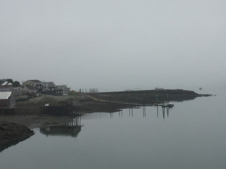
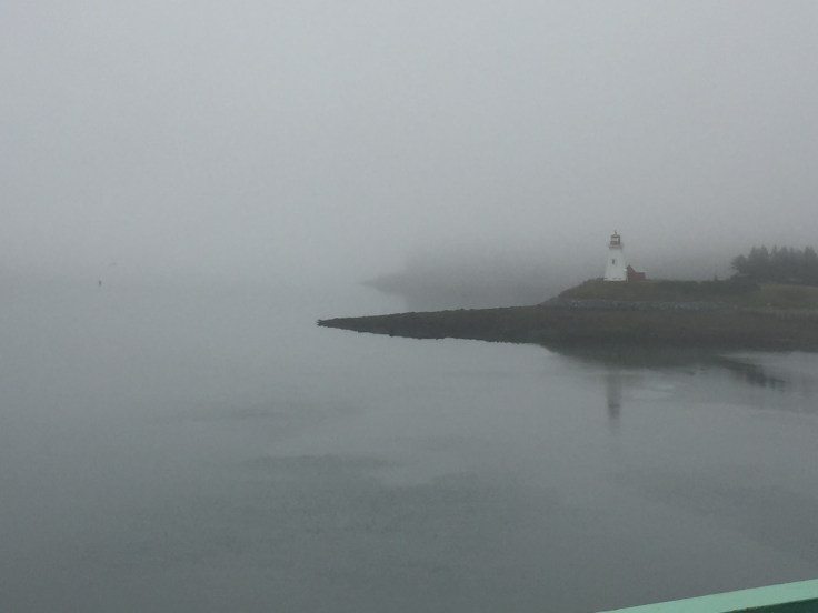
We began our day in the rain.  It was very overcast and foggy.  We drove to the lighthouse:

2017-07-27 Campobello - Quoddy LH 2

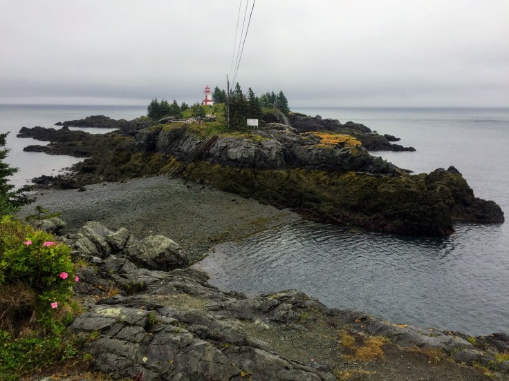
The lighthouse is on the northernmost tip of the island, and it is only accessible at low tide; at high tide it becomes its own island. Tides here are about 18′-20′, this being within the Bay of Fundy. (More on that in a few days…)

2017-07-27 Campobello - Quoddy LH 3

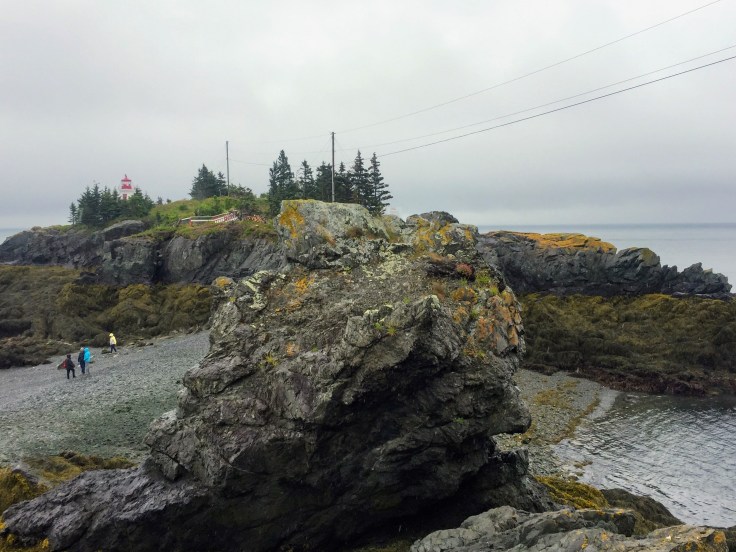
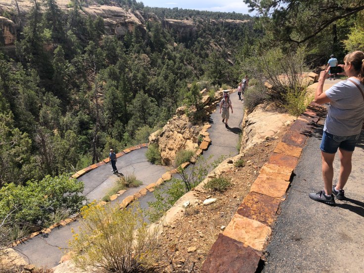
First you have to climb down steep steps to the “beach”, which, at high tide, is the ocean floor…) Then you have to walk across the rocks and seaweed and climb up steep steps on the opposite side to access the lighthouse.

2017-07-27 Campobello - Quoddy LH 1

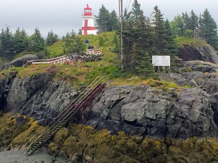
We’ve seen lighthouses before, and several people had already slipped and fallen by the time we arrived, so we stayed on the safe upper path…

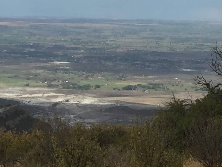
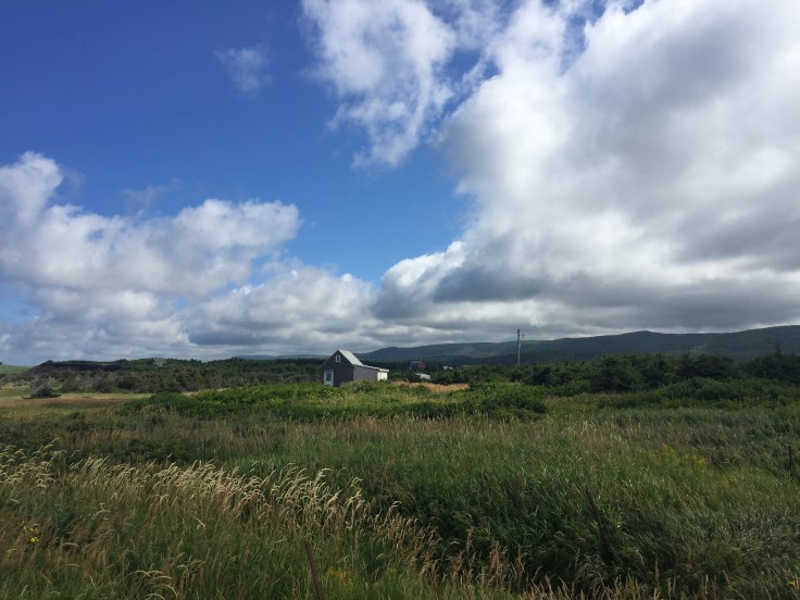
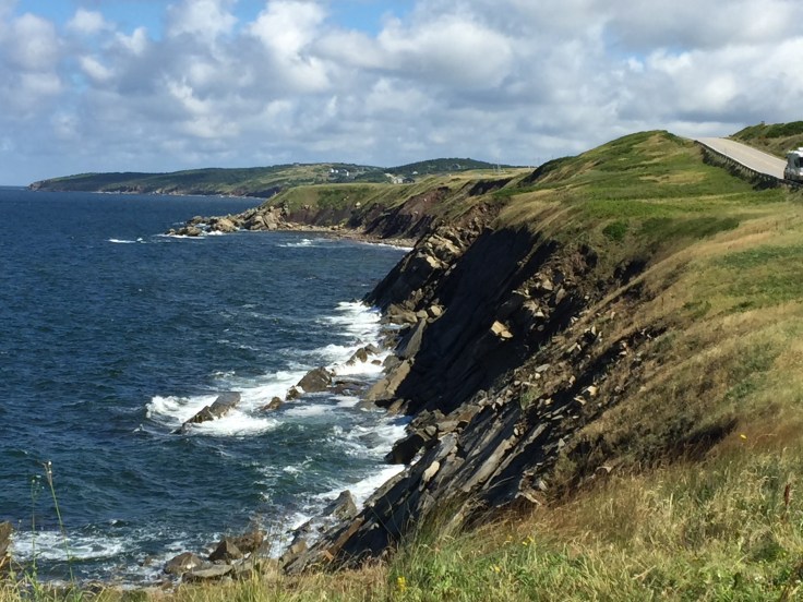
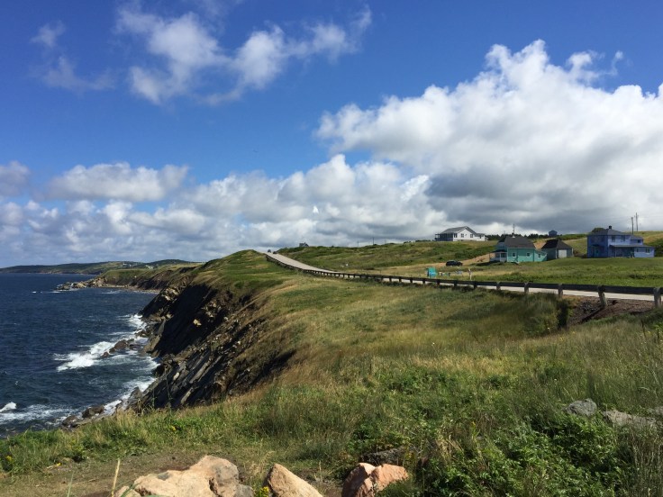
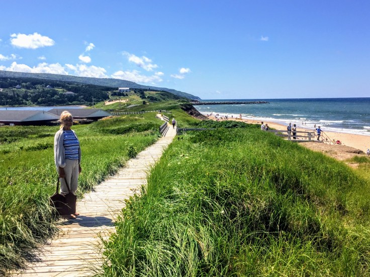
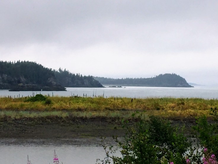
After enjoying the view of the lighthouse we drove through the rest of the northern part of the island. This area is very sparsely populated, and the scenery was beautiful.

2017-07-27 Campobello 03

2017-07-27 Campobello 02

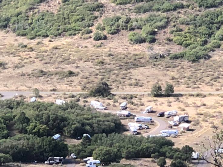
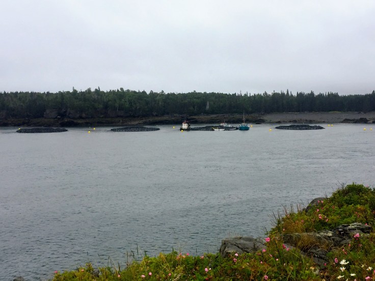
These small “islands” are actually salmon farms:

2017-07-27 Campobello 01


We then headed to the main attraction of the day: Franklin and Eleanor Roosevelt’s “cottage” here on the island…

2017-07-27 Campobello - FDR 01

Franklin Roosevelt spent many enjoyable vacations at his summer home on Campobello Island in New Brunswick’s Bay of Fundy.

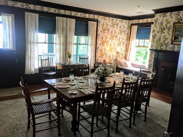
FDR’s “cottage” has been preserved, and is almost exactly as it was in 1920, the summer before Franklin was stricken with polio. We were able to tour the first and second floors of the 34-room memorabilia filled cottage. Guides were stationed throughout the home to offer interpretation and answer questions about the house, its historic furnishings, and the family.  Interestingly, a ramp installed a few years ago provides easy access to the first floor, although FDR never added a ramp to accommodate his wheelchair… (But, then again, he had “people”…)

The “cottage” was built in 1897 for Mrs. Hartman Kuhn, of Boston.  It is next door to the cottage of FDR’s parents, where he summered as a child.  Mrs. Kuhn developed a fondness for Eleanor when Franklin and Eleanor summered at his mother’s cottage next door. A provision in Mrs. Kuhn’s will offered her cottage to FDR’s mother, Sara, for $5,000.00.  Sara purchased the furnished cottage and 5 acres of land in 1909, and gave the cottage to Franklin and Eleanor.  The growing family spent summers in the cottage from 1909 to 1921.  FDR altered the design of the house in 1915, when he added a new wing to provide additional space for his growing family.

2017-07-27 Campobello - FDR 21


2017-07-27 Campobello - FDR 22

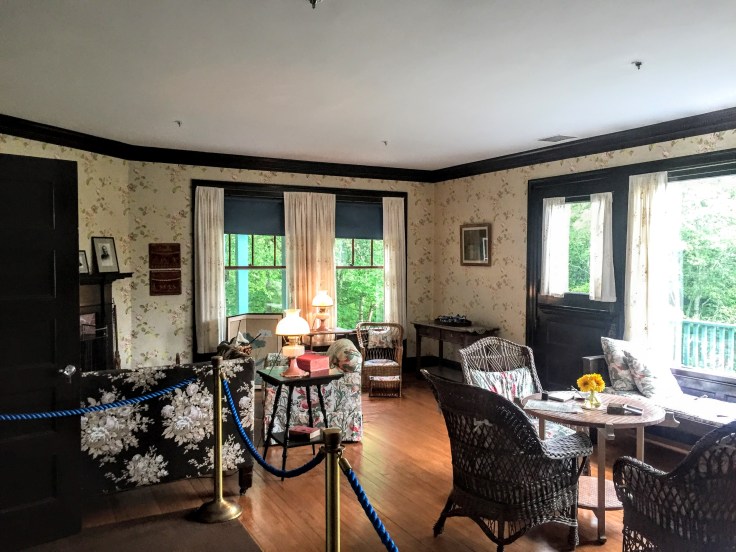
FDR’s cottage exhibits design principles of the Arts and Crafts movement, and also elements of early Dutch-American Colonial architecture.  Considerations in the design of summer homes of the era were comfort, orientation to a scenic view and to the sun, and a “picturesque charm” so valued by the Arts and Crafts Movement.

I’m told that the cottage contains 34 rooms, 18 of which are bedrooms and 6 of which are bathrooms, although I didn’t count them.  The third floor, which we didn’t see, contained guest rooms and servants’ rooms, and, I assume, 3 bathrooms… There was even a bedroom on the second floor for Louis Howe, FDR’s political adviser…

The Kitchen:

2017-07-27 Campobello - FDR 26


The Servants Dining, in the Kitchen:

2017-07-27 Campobello - FDR 23


The Laundry:

2017-07-27 Campobello - FDR 25


The Master Bedroom:

2017-07-27 Campobello - FDR 24

The cottage was considered quite modern for its time, but had neither electricity nor telephone.  Kerosene lamps and candles provided light.  Seven fireplaces and kitchen coal and wood-fired stoves provided heat.  It even had hot and cold running water for bathing, cooking, and cleaning.  (Many cottages on the island had neither kerosene lamps nor running water… these people prided themselves as being “rustic”, but they also had servants to feed the fireplaces, light the candles, cook the meals, haul the water, and empty the chamber pots…)    The water came from storage tanks on the third floor of the cottage.  The storage tanks were fed by gravity from a tank atop a nearby windmill. Drinking water came in large bottles by horse and cart, from a spring called Barrel Well.

Every summer, the Roosevelts brought a nurse and a governess to tutor and instruct the children, and several servants to run the cottage.  Campobello residents were hired to help with the daily chores.

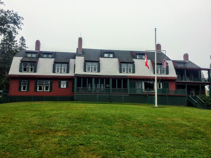
The rear of the house (note the screened porch):

2017-07-27 Campobello - FDR 02


The view from the house:

2017-07-27 Campobello - FDR 03


The rear of the house from the water’s edge, at the dock:


2017-07-27 Campobello - FDR 04


Lynda standing on the dock:

2017-07-27 Campobello - FDR 10


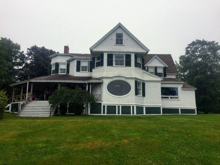
In addition to the Roosevelt cottage we were able to see the Hubbard Cottage… It sits adjacent to FDR’s cottage, on the other side of where FDR’s mother cottage was:

2017-07-27 Campobello - Hubbard 1

(They are working on replacing some siding; thus, the cherry-picker…)

Only the first floor was available to tour, but there were grand rooms to see:

2017-07-27 Campobello - Hubbard 3

2017-07-27 Campobello - Hubbard 4

2017-07-27 Campobello - Hubbard 5


And a grand porch:

2017-07-27 Campobello - Hubbard 2


The rear of the house:

2017-07-27 Campobello - Hubbard 6


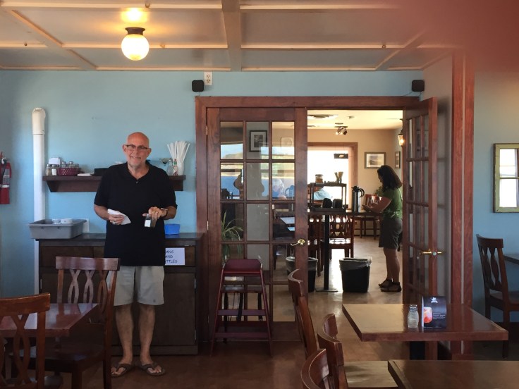
We spent the middle of the day at Josie’s porch, a local coffee-house and general community hang-out.  But they had good internet access, so we spent some quality time catching up on important things…

Later that afternoon we had “Tea with Eleanor”. We assembled at the Wells-Shober house; we were led into parlors and dining room where the 49 of us sat and enjoyed tea and cookies. Two docents spoke for about 45 minutes on the life and times of Eleanor Roosevelt.  She had a tough life growing up, losing her parents at an early age and attending boarding schools in England and other parts of Europe.  It was interesting to hear all this; she never sought the limelight, and hated politics, but she did what she knew was right. After FDR was struck down by polio, it was she who went out and gave speeches to keep FDR in the public eye. After FDR’s death she continued to champion women’s rights and civil rights. During WWII she traveled the world, meeting military personnel in hospitals. She wrote personal letters to the families of everyone she met; sometimes she wrote 12-14 hours per day for months on end to give these families some sense of comfort.

She last returned to Campobello Island in 1962 for the dedication of the FDR bridge from Maine onto the island.

The Wells-Shober Cottage:

2017-07-27 Campobello - Tea 01


Waiting to be taken in:

2017-07-27 Campobello - Tea 02


Hilarity ensues as we try to find our places:

2017-07-27 Campobello - Tea 03


The docents, telling their stories:  (The short one is a 10th generation islander…)

2017-07-27 Campobello - Tea 04


After the tea, the ladies of the caravan assembled for a group picture, as is the caravan’s tradition…

2017-07-27 Campobello - Tea 05


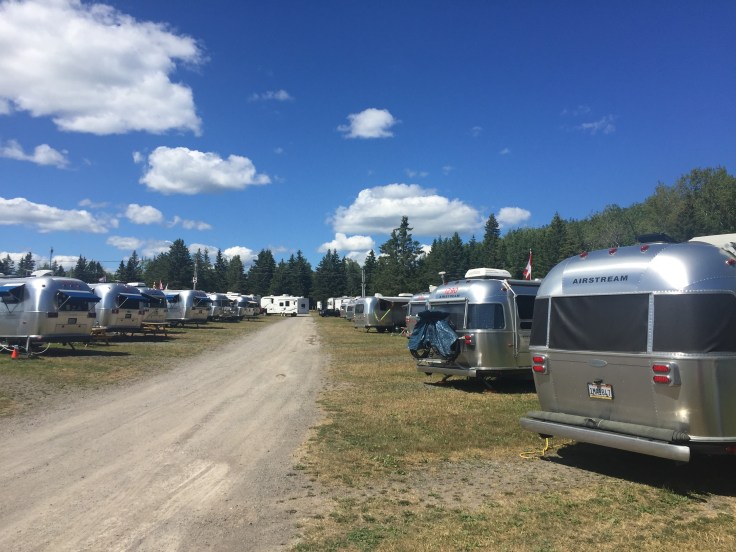
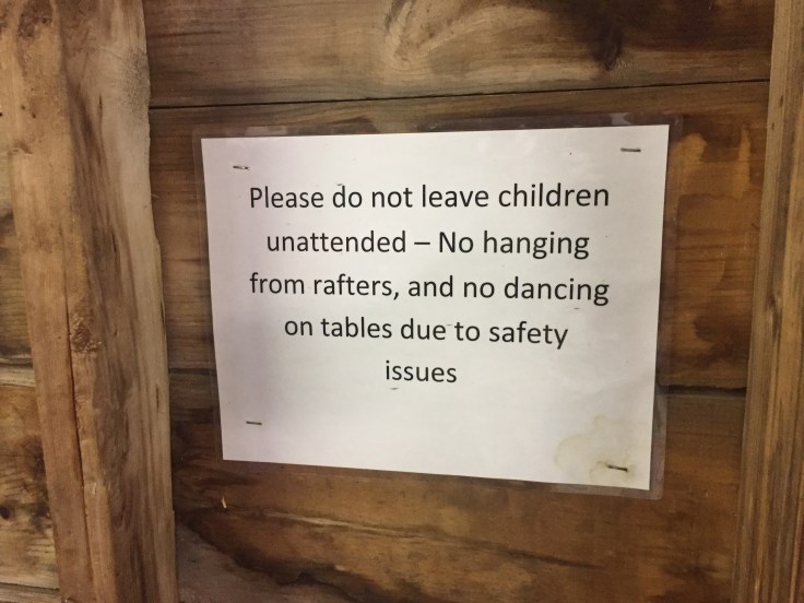
After tea we returned to the campground and readied ourselves for another travel day. We had a “Drivers’ Meeting” to discuss timing and routing.  We met in the campground recreation room; apparently they’ve been having good times, based on this sign…

2017-07-27 Campobello - Sign

As always, an enjoyable time was had by all…


Blog at WordPress.com.

Up ↑