Search

Adventures in the Villa

Category

National Parks

2017-07-26 Nor by Nor’east Caravan – Travel day to Campobello

Today is our last day in Maine. We are moving once again, this time into New Brunswick, Canada, specifically to Campobello Island, the summer home of Franklin Delano Roosevelt.

2017-07-26 Campobello 02


We left the campground in Trenton about 10:00 am, and headed north on highway 1, a small, 2-lane road that leads further and further away from civilization. Finally, after about 2 ½ hours we turned east and drove through the town of Lubec, which claims to be the easternmost city in the USA. Who am I to argue?

We went through customs, with our experience being similar to crossing the border in Niagara Falls, which we did back on June 24.   Once onto the island we found our campground and settled in.

Campobello Island is located at the entrance to Passamaquoddy Bay, adjacent to the entrance to Cobscook Bay, and within the Bay of Fundy. The island has no road connection to the rest of Canada; the bridge we drove over connects it to Lubec, in Maine. Reaching mainland Canada by car without crossing an international border is possible only during the summer season and requires two separate ferry trips, the first to nearby Deer Island, then from Deer Island to L’Etete.

Measuring 8.7 miles long and about 3.1 miles wide, it has an area of 15.3 sq miles; the island’s permanent population in 2011 was 925.

Campobello has always relied heavily on fishing as the mainstay of the island economy; however, the Passamaquoddy Bay region’s potential for tourism was discovered during the 1880s at about the same time as The Algonquin resort was built at nearby St. Andrews and the resort communities of Bar Harbor and Newport were beginning to develop. Campobello Island became home to a similar, although much smaller and more exclusive, development following the acquisition of some island properties by several private American investors. A luxurious resort hotel was built and the island became a popular summer colony for wealthy Canadians and Americans, many of whom built grand estates there.

Included in this group were Sara Delano and her husband James Roosevelt Sr. from New York City. Sara Delano had a number of Delano cousins living in Maine, and Campobello offered a beautiful summer retreat where their family members could easily visit.  From 1883 onward, the Roosevelt family made Campobello Island their summer home.  Their son Franklin D. Roosevelt would spend his summers on Campobello at the family home from the age of one until, as an adult, he “acquired” his own property — a 34-room “cottage” — which he used as a summer retreat until 1939.  It is next door to Sara and James Roosevelt cottage.  You might wonder why he chose to live next door to his mother?  Simple:  She bought the house and gave it to him.

It was at Campobello, in August 1921, that the future president fell ill and was diagnosed with polio, which resulted in his total and permanent paralysis from the waist down. Roosevelt did strive to regain use of his legs but never again stood or walked unassisted.

During the 20th century, the island’s prosperity from its wealthy visitors declined with the change in lifestyles brought on by a new mobility afforded by automobiles, airplanes, and air conditioning in large inland cities. Nonetheless, for President Roosevelt, the tranquility was exactly what he and his family cherished, and the property remained in their hands until 1952 when it was sold by Elliott Roosevelt (Franklin and Eleanor’s fourth child). Elliott decided to sell the house after his mother, Eleanor, had sold it to him. Elliott sold it to Victor Hammer and his brother Armand Hammer of Boston and they owned it up until 1963. However, they said Eleanor was always welcome to come whenever she pleased, and her last visit was in 1962 to attend the opening of the Franklin Delano Roosevelt Bridge connecting Campobello Island to Lubec, Maine. In 1962 the brothers tried to sell it but got no takers; (The were asking $50,000 for it, fully furnished with all the Roosevelt furniture…) they subsequently donated the cottage to the U.S. and Canadian governments in 1963 as an international park. The Roosevelt Campobello International Park is the only one of its kind because it is run by both the Canadian and American governments, the park being located in Canadian territory. The park is now equally staffed by both Americans and Canadians.

In 1960, motion-picture producer Dore Schary and director Vincent J. Donehue made the film Sunrise at Campobello, based on Schary’s Tony Award winning Broadway play of the same name. Starring Ralph Bellamy as Franklin D. Roosevelt, the film covers the years 1921 to 1924 at Campobello Island and events leading up to Roosevelt’s nomination as the Democratic Party’s candidate for president.

So now you know more about Campobello than most Americans do.  (If people DO know about Roosevelt’s time here, they are always surprised to find out that it is in Canada…)

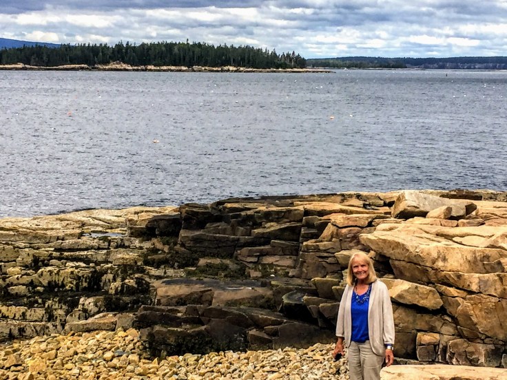
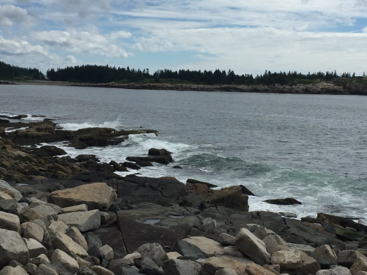
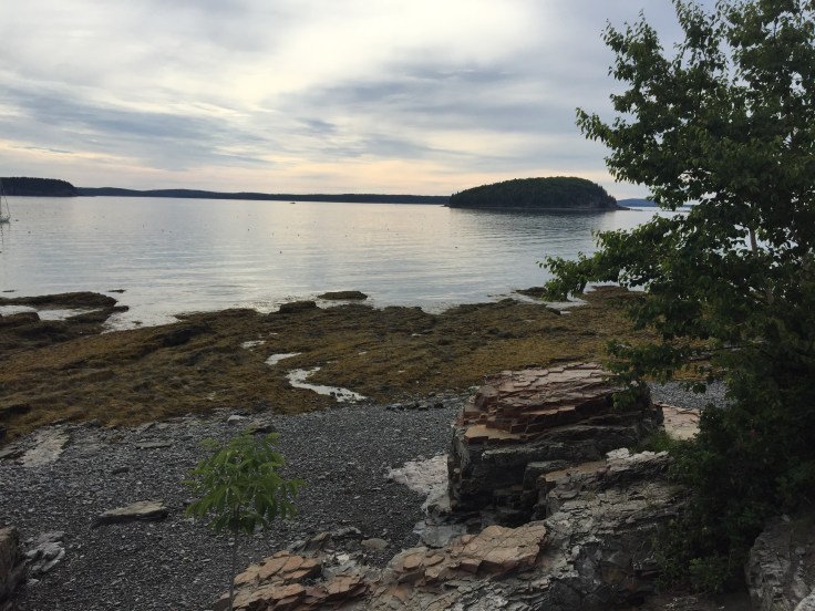
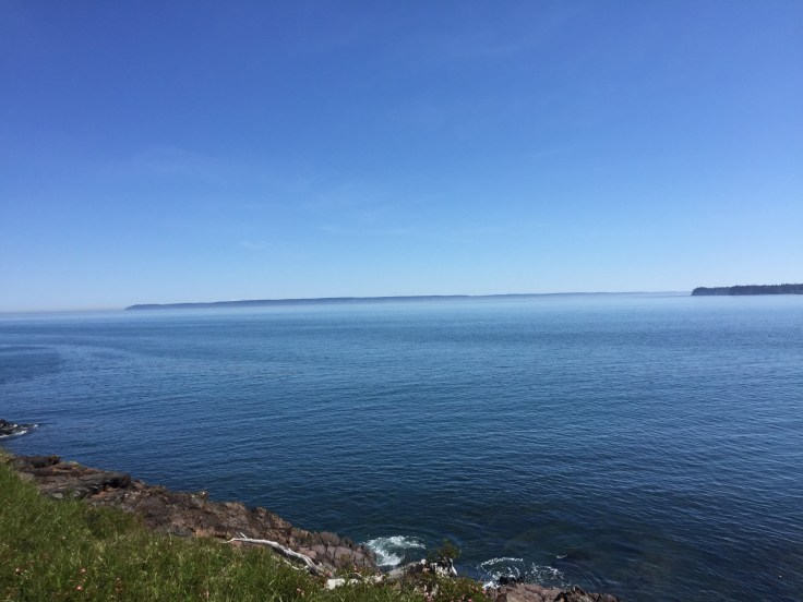
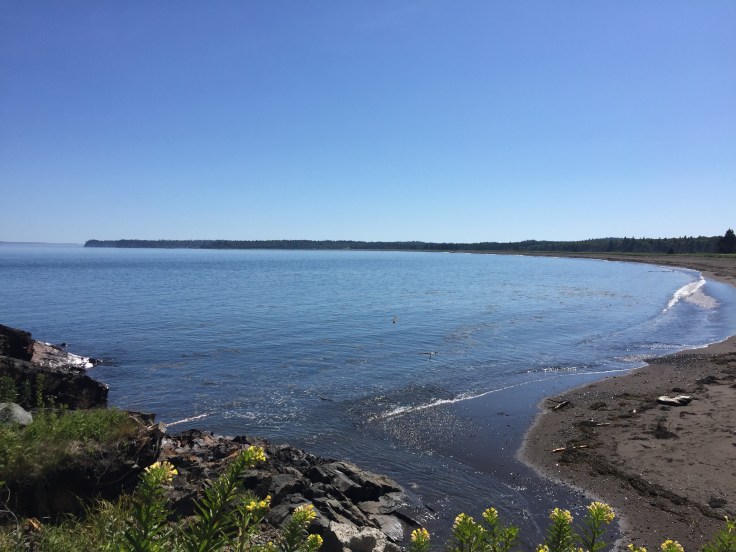
We went for a walk and found a nearby beach on the bay.  The land mass you see in the background is Grand Manat Island; Nova Scotia is beyond that, across the widest part of the Bay of Fundy…


2017-07-26 Campobello 05


2017-07-26 Campobello 03

2017-07-26 Campobello 04


2017-07-26 Campobello 01


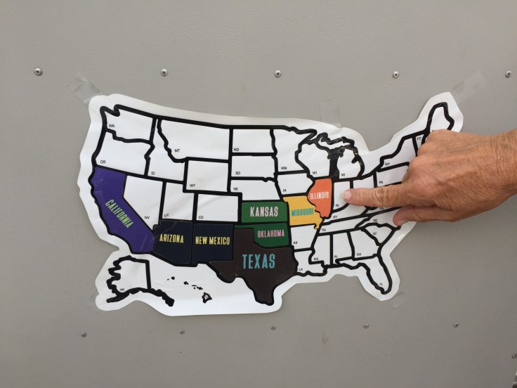
Some folks have asked for a better picture of the Squarestream on this caravan; here it is:

2017-07-26 Campobello - Squarestream

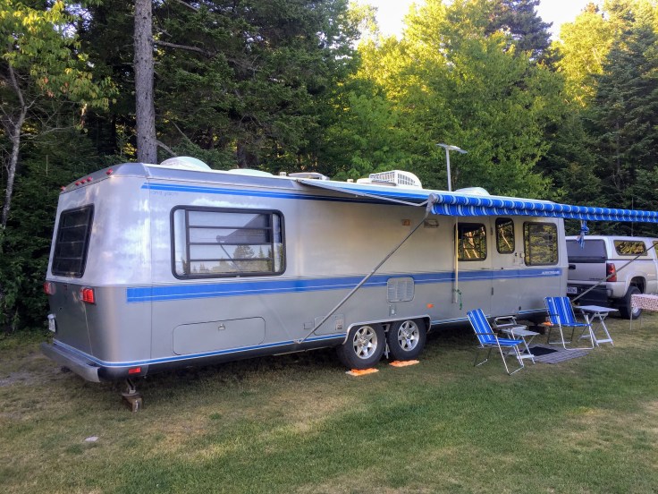
This is a 1989 32′ Airstream Land Yacht. It is aluminum skinned, but instead of rivets they used high-strength epoxy to attach the skins to the frames. It resulted in a much more rigid unit. However, they were not popular with the traditionalists, so the series was dropped a few years later.

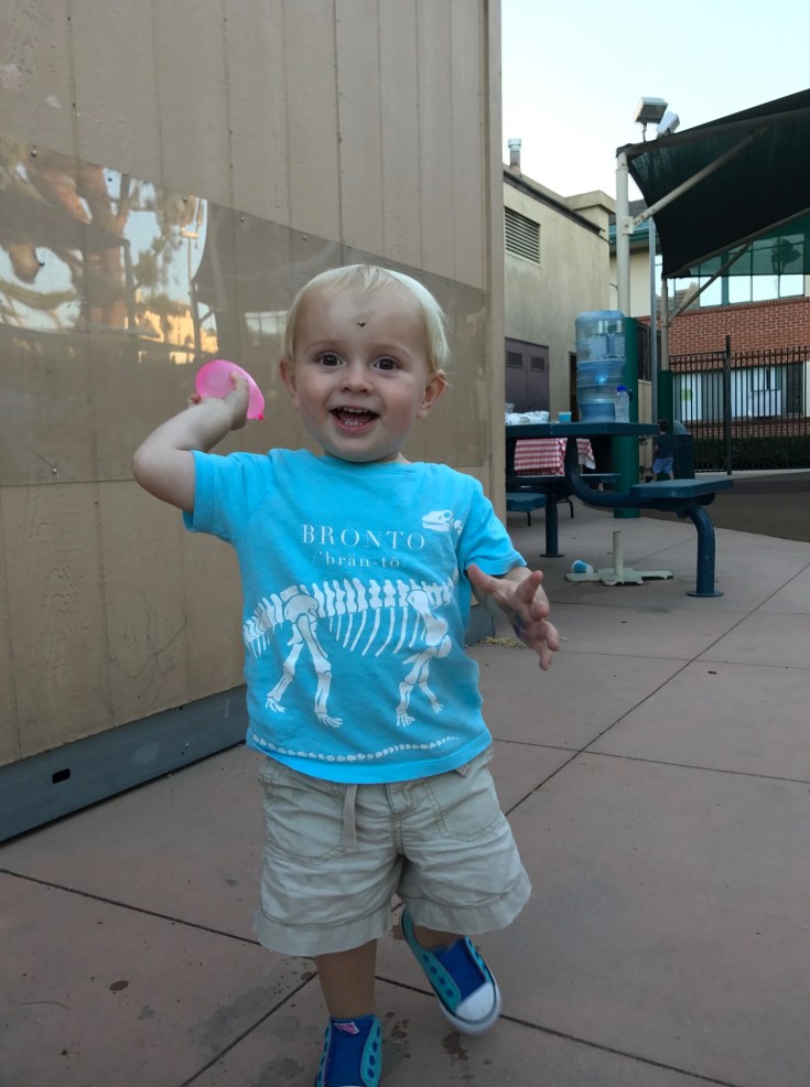
And, as is our custom, here are pictures of our grandchildren, as they learn all about water balloons……

2017-07-26 George

2017-07-26 Ian and Roisin

2017-07-25 Nor by Nor’east Caravan – Maine – Scoodic Peninsula and Seal Cove Auto Museum;

Our adventure at Acadia continued for another day. This time we headed out to the Scoodic Peninsula.

2017-07-25 Acadia Scoodic 13

This place is on the mainland, across the bay from Mt. Desert Island, to the east.  It is about a one hour drive, because you have to drive way north and east before you can begin the drive down the peninsula.  Much of the peninsula is also part of Acadia NP, but there are other towns – many are working lobster towns.  But it was another beautiful drive, very remote and quiet.  We found many great views and quiet towns and harbors.

2017-07-25 Acadia Scoodic 12

2017-07-25 Acadia Scoodic 10

In Winter Harbor we stopped in at their Farmers’ Market and bought blueberry scones for a special breakfast treat (tomorrow):

2017-07-25 Scoodic - Winter Harbor Farmers Market 02

2017-07-25 Scoodic - Winter Harbor Farmers Market 01


There is a sculpture in the bay at Winter Harbor of a stylized whale tail; we saw it at low tide, and later as the tide was coming in:2017-07-25 Scoodic - Winter Harbor Whale Tail Sculpture 01

2017-07-25 Scoodic - Winter Harbor Whale Tail Sculpture 02

We saw Winter Harbor, Prospect Harbor, and Gouldsboro…  And plenty of rocky shoreline:

2017-07-25 Acadia Scoodic 11

2017-07-25 Acadia Scoodic 09

2017-07-25 Acadia Scoodic 07

2017-07-25 Acadia Scoodic 07


When it was time for lunch, we stopped it at Smokey’s BBQ and Lobster. Texas BBQ here in Maine!  But, we are in Maine, so we had fish and chips instead…

2017-07-25 Smokeys BBQ and Lobster

Our afternoon destination was Seal Cove Automobile Museum, back on Mt. Desert Island.  The museum’s collection is the legacy of Richard Paine, a local resident whose passion for cars and their related history led to his buying and selling many collectible cars throughout his life. Upon his death the collection was culled by selling off duplicate cars to create an endowment to keep the cars that tell the story of the beginning of the automobile age.

The collection features some of the earliest automobiles and motorcycles, as well as clothing and accessories, from 1895 through the early 1920s. The cars represent the stories about invention and innovation, art, design, women’s rights, and social and economic changes that came about through the automobile.  Inventors were experimenting with steam, electricity, and gas-powered engines.  There were no standards – anything that might work was tried.

The current exhibit, Auto Wars: Then & Now, explores the debate a century ago over whether or not to allow cars on Mount Desert Island.  The exhibit is presented in a “choose your own adventure” style, allowing YOU to decide whether you would have been for or against cars on the island.  In a nutshell, the wealthy summer residents, who considered their lifestyle to be “rustic”, were opposed to cars on MDI. The locals, who needed the convenience of easy transportation, were in favor. For many years those opposing cars won out, but finally, in 1916, cars were allowed, and this decision forever changed the nature of MDI.

Two cars were of particular interest to me:  A 1934 Ford, with a body custom made in Germany, and custom fitted to a 1934 Ford chassis. It was the design of Edsel Ford, and it was his personal car at his summer cottage on the island.  It became a prototype for the Continental which was released shortly thereafter.

2017-07-25 Seal Cove Auto Museum 22

2017-07-25 Seal Cove Auto Museum 21

Also, while not an old or rare car, I liked seeing the 1991 Mercedes SEL; it belonged to Laurance Rockefeller, and it was the car that he kept at his summer cottage year ‘round.

2017-07-25 Seal Cove Auto Museum 11

2017-07-25 Seal Cove Auto Museum 12

If you recall from an earlier blog post, David Rockefeller also had his favorite summer cottage car, a 1956 Continental, which we saw at Kykuit in Pocantico Hill, New York:

2017-07-01 Kykuit 65

After enjoying the exhibits in the museum we headed back to the Villa. Tonight the caravanners enjoy a BBQ – hamburgers and all the usual sides; we began by finishing off the leftover cheese and wine from Monday’s party… And an enjoyable time was had by all…

2017-07-25 Trenton - BBQ


2017-07-24 Nor by Nor’east Caravan – Maine – Bar Harbor, Acadia National Park, Seal Harbor, Northeast Harbor, and Lobster!

Mt. Desert Island is quite a beautiful place, with rocky shores and quiet harbors.

2017-07-24 Acadia NP 01

Like Newport, RI, Mt. Desert Island was a favorite place for the very wealthy to have summer cottages.  However, rather than being sophisticated and elegant, filled with grand, showy homes, like Newport, MDI was known for its quiet, rustic ways.  Homes, while huge, and filled with servants, were simple, wood houses, with fireplaces and always set back into the wilderness.  Some of the houses from the late 19th century survive, but many were torn down by the 1950s because they were obsolete and too rustic for modern living.  The descendants of the original families who had homes here (Fords, Rockefellers, Astors, Vanderbilts) still have homes here, and many come for the summer season; but the houses are not as visible – they are mostly hidden in the woods…

The heart of social life, for those who participated, was (and is) the town of Bar Harbor. Many elegant hotels line the waterfront. Many of the families, though, stayed away from the town – they preferred to be in the woods, and along the sea, living the simple life – swimming, sailing, and taking long carriage rides along the carriage roads (mostly built by John D. Rockefeller). In fact, most of the land making up Acadia National Park was donated by the Rockefeller family.

We had been warned about the terrible traffic both in Bar Harbor, and in Acadia; we also were warned about road construction in the area.  So, armed with good maps we set off at 7:00 am (along with Larry and Kathy Warrren) to get an early start on the day.  We easily found the “good” road, and we easily found parking in Bar Harbor.  We strolled down empty streets; the only people out this early are folks heading for the whale watching boats. We were soon at our destination – Sunrise Café.  We enjoyed a nice quiet breakfast in this tiny place, then we walked along the Shore Path. The path runs right along the water’s edge, and it extends from the edge of town for about 1 ½ miles. We then could walk back along quiet residential streets. It was a great way to start the day.

2017-07-24 Bar Harbor 11

2017-07-24 Bar Harbor 12

Once back to the car we headed up Cadillac Mountain, the tallest “mountain” along the Atlantic coast – about 1,500 feet elevation. (In California we call these “hills”…)  From here you can see all the islands surrounding the main island of Mt. Desert Island.  The views are stunning!


2017-07-24 Acadia NP 05


2017-07-24 Acadia NP 04

2017-07-24 Acadia NP 03


As the park began getting busy we headed to the quieter side of the island, where many of the original wealthy families had their summer cottages.  We stopped in Seal Harbor, a beautiful place, and amazingly quiet.  The town of Seal Harbor consists of a church, an empty store building, a coffee house, and a bookstore.  And, of course, a real estate office.  There are three or four houses along the water’s edge, and many more in the hills.  All the houses are simple, neat, and unassuming.  There is a tiny Yacht Club perched on the side of the hill overlooking the harbor.

2017-07-24 Bar Harbor 15

2017-07-24 Seal Harbor 01

2017-07-24 Seal Harbor 02

Someone even built a very nice new vacation house right at the harbor’s edge:

2017-07-24 Seal Harbor 03

The next town is Northeast Harbor, a bustling place, filled with many art galleries. The harbor is much larger, and ferries run regularly between the harbor and two of the larger islands just off shore: Great Cranberry Island and Little Cranberry Island.  Many houses dot the streets of the town and the surrounding hills. People who live in Seal Harbor must come here to shop and eat.

2017-07-24 Bar Harbor 13


By now we were ready for lunch. We had been tipped off to another fabulous lobster pound, Trenton Bridge Lobster Pound. Only it was much more of a restaurant than a lobster shack. They served wine and offered napkins, eating utensils, and tools for eating the lobster.  Lobsters were great, but it was not as much fun as a real lobster pound…

We decided to call it a day and head back to the Villa. Tonight we had GAM #5, and we are hosting.  As we arrived at the RV Park it started to rain.  And it continued to rain.  Cold rain.  Maine rain.  We decided to have our GAM inside The Villa – all 10 of us.  It was cozy. But it was much nicer than sitting in the pavilion out in the cold.  We had great snacks and there was free flowing wine as we got to know another set of new friends. An enjoyable time was had by all…


2017-06-16 Missouri, and Eero Saarinen

Before I get to today’s activities, a thought struck me regarding Frank Lloyd Wright and Laura Ingalls Wilder:  They were both born in 1867; she died in 1957 and he died in 1959. They were contemporaries in time, yet I can’t think of two more different people who lived two very different lives… They were born in the age of horse and buggy and covered wagons; they lived to experience trains, planes, and automobiles. She was modest, a simple homebody, and quite introspective; he was arrogant, a home wrecker, and a master designer of our built environment… A very interesting contrast that just appeared on our trip on two adjacent days…

Now, back to our travels:

This morning we walked to Mansfield, and found a delightful little cafe where we had coffee and Belgian waffles. (Ma and Pa’s Diner had terrible Yelp reviews…) Then we packed up and headed the Villa towards St. Louis.

We did our best to avoid the Interstate, because we could. However, whilst driving the back roads of Missouri, it started to rain. Not just any rain, but a true cloud burst like I have never seen. We drove for about 45 minutes with the windshield wipers at full speed, travelling maybe at 30 mph because we could not see any further ahead.  There was thunder and lightning (luckily, no hail – Airstreams hate hail like Superman hates kryptonite…).  Then, suddenly, within a 5 minute time-span, the rain stopped, the road was dry, the sky was blue, the sun was shining, and a guy passed us by in a top-down convertible… I’m just glad we had that vent cover fixed!

We proceeded to St. Louis, then immediately crossed the Mississippi river into Illinois to camp at an RV park behind a casino in East St. Louis. It was 94 degrees and very humid, not a breath of air moving. We plugged into shore power, turned on both AC units, and headed back to St. Louis. There was a convenient light rail train service right at the casino, and we soon were walking the streets of St. Louis.

2017-06-16 Map Illinois

We had two goals to accomplish in St. Louis:  BBQ for dinner, and a ride the top of the Jefferson Memorial Arch, designed by Eero Saarinen. (Eero Saarinen died in 1961, so he did not live to see the arch completed.) But remember the name…

We headed towards the Jefferson Memorial. It was started in 1935; they cleared 40 acres of riverfront property to make way for the Arch. The Arch was completed in 1965, and tours to the top began in 1967.  We found that most of the tickets for the day had been sold out, but we were able to get tickets for the 8:35 pm tour.  This left us plenty of time for our BBQ dinner.

BBQ, as most of you know, is a generic term that literally has no meaning. Saying “I am eating BBQ” is like saying , “I’m eating soup” or “I’m eating meat”.  What kind of soup? Cream based or broth based?  Or, what kind of meat? Braised, grilled, or roasted?  All meaningless without many more descriptors.  Having endured living in Texas for some time, there is exactly one thing I love from Texas and that is their style of BBQ. But I am always happy to try others.  St. Louis BBQ refers not to their sauces or type of cooking – you can find both slow smoked and fast grilled BBQ in St. Louis, with a variety of sauces – sweet, vinegar-based, tomato based – whatever you want.  What is unique about St. Louis BBQ is the way they cut their ribs:  According to Wikipedia, “St. Louis-style spare ribs are cut in a particular way with the sternum bone, cartilage and rib tips removed so that a well-formed, rectangular-shaped rack is created for presentation.”

There are 2 local places that seem to have their fans – Pappy’s and Bogarts. We opted for Pappy’s, because it was a nicer walk through the city to get there… always a determining factor in our lives…

2017-06-16 St Louis - Dinner at Pappys

It was terrible.

OK. On to the arch…

2017-06-16 St Louis - Gateway Arch 12

The Arch is officially called the Jefferson National Expansion Memorial, to commemorate Jefferson’s Louisiana Purchase and the massive migration west by the pioneers in the late 19th century as the Federal government literally gave away hundreds of thousands of acres of land. It is probably the largest planned migration of people in the history of the world, and it totally reshaped the USA.

The shape of the arch is what engineers call an inverted catenary arch. It is the shape that a loose chain takes when suspended between 2 points, just up-side-down.  This shape can be calculated using integrated calculus, and it is also the the graph of 100% tension and zero compression, since a chain, while strong in tension, can withstand absolutely no compression. And that is the limit of my knowledge of structural theory, strength of materials, and calculus…

The arch is 630 feet wide, and 630 feet tall. (The Washington Memorial in Washington, DC, is 555′ tall, and would fit under the arch…) The shape of the cross section is an equilateral triangle. As the triangular form ascends to the top of the arch it gets smaller, creating very interesting perspectives…

2017-06-16 St Louis - Gateway Arch 042017-06-16 St Louis - Gateway Arch 022017-06-16 St Louis - Gateway Arch 062017-06-16 St Louis - Gateway Arch 012017-06-16 St Louis - Gateway Arch 112017-06-16 St Louis - Gateway Arch 17

The designers knew people would want to ascend to the top, so a complicated tramway system was custom designed to carry 40 people at a time. There are two trams, one in each leg, and the viewing space holds about 100 people… The trams consist of 8 cars each, holding 5 people each. The cars are tiny, cramped compartments, less than 6 feet tall, with a door about 2 feet wide and less than 5 feet tall. As the tram ascends along the curved path of the arch, the tram cars must articulate, a bit like a Ferris wheel, except not in a smooth manner. As the cars ascend they tilt (forward or backward), then abruptly snap back into a vertical position.

It was TERRIFYING!

Once at the top, you can see forever. Since we were there just after sunset, our views are all at night…

2017-06-16 St Louis - Gateway Arch 31


The old courthouse, where the Dred Scott trial was held


2017-06-16 St Louis - Gateway Arch 35

Illinois across the Mississippi River – our RV park is back there somewhere…


2017-06-16 St Louis - Gateway Arch 34

Busch Stadium, home of the St. Louis Cardinals…

After our terrifying experience (for some reason, Lynda didn’t find it terrifying at all…), we returned home back to the Villa. We have a long drive tomorrow across Illinois and into Indiana…


Blog at WordPress.com.

Up ↑